Filters: Tags: habitat model (X)
24 results (70ms)|
Filters
Date Range
Extensions Types
Contacts
Categories Tag Types Tag Schemes |

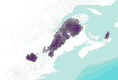
This dataset depicts Lynx (Lynx canadensis) habitat in the Northern Appalachians predicted using the spatially explicit population model PATCH under the population cycling only in Gaspe (core area) plus trapping scenario (B2; Carroll 2007). This dataset represents one of several scenarios testing the interacting effects of population cycling, trapping, territory size, and climate change on lynx populations. Static habitat suitability models for lynx were fed through PATCH to predict source and sink habitat areas across the landscape. The static models for lynx were created based on a logistic regression model of reported lynx locations against the proportion of the landscape in deciduous forest cover and annual...
Prioritizing habitat for surveys of an uncommon mammal: a modeling approach applied to pygmy rabbits
Determining occurrence and distribution is an essential 1st step in conservation planning for rare species. Spatial habitat models can be used to increase efficiency of field surveys and to improve understanding about factors influencing animal distributions. We used a modeling approach to identify and prioritize potential habitat for survey efforts for an uncommon mammal, the pygmy rabbit (Brachylagus idahoensis), for which detailed habitat data are limited. A base map of potential habitat in Idaho was defined using vegetation type and soil depth data. Documented locations (n = 164) were used to evaluate additional habitat variables to prioritize the potential habitat for surveys. We conducted field surveys to...
Categories: Publication;
Types: Citation,
Journal Citation;
Tags: Brachylagus idahoensis,
Geographic Information System (GIS),
Idaho,
Journal of Mammalogy,
habitat model,

This dataset depicts Lynx (Lynx canadensis) habitat in the Northern Appalachians predicted using the spatially explicit population model PATCH under the population cycling only in Gaspe (core area) plus 36 square kilometer territory size (compared to 90 square kilometer territory) scenario (B136; Carroll 2007). This dataset represents one of several scenarios testing the interacting effects of population cycling, trapping, territory size, and climate change on lynx populations. Static habitat suitability models for lynx were fed through PATCH to predict source and sink habitat areas across the landscape. The static models for lynx were created based on a logistic regression model of reported lynx locations against...

Acanthomintha ilicifolia Habitat Suitability in 2050 (RF_PCM_2050): predictive modelling using Random Forest (RF) with PCM climate model (from the Department of Energyâs Parallel Climate Model). Higher values indicate higher habitat suitability. Note that map represents a potential scenario only, based on underlying assumptions regarding future conditions.
Tags: habitat model
This collection of maps shows relative habitat quality for a suite of species that use riparian overstory habitats. Component layers include: tree patch size, presence and complexity of riparian understory, and abundance of tamarisk. Associated layers such as river channels at high flow and bottomland reaches are included for reference.
Categories: Data,
Map;
Types: ArcGIS REST Map Service,
ArcGIS Service Definition,
Downloadable,
Map Service;
Tags: Canyonlands National Park,
Colorado River,
Grand County, Utah,
Riparian Overstory,
San Juan County, Utah,
This dataset depicts Lynx (Lynx canadensis) habitat in the Northern Appalachians predicted using the spatially explicit population model PATCH under the no population cycling plus trapping plus 36 square kilometer territory size (compared to 90 square kilometer territory) scenario (A236; Carroll 2007). This dataset represents one of several scenarios testing the interacting effects of population cycling, trapping, territory size, and climate change on lynx populations. Static habitat suitability models for lynx were fed through PATCH to predict source and sink habitat areas across the landscape. The static models for lynx were created based on a logistic regression model of reported lynx locations against the proportion...
This dataset contains the predicted distributions of 445 terrestrial vertebrate species in Wyoming, created in a GIS modeling process using species habitat assocation rules in combination with species geographic range. Because of the large size of this dataset, it is distributed in two ways (complete, statewide), and tiled into 56 1:100,000-scale quadrangles units which are small enough to be utilized in the PC Arc/Info or ArcView environment.
Categories: Data;
Types: Downloadable;
Tags: Gap Analysis,
Wyoming,
biota,
elevation model,
environment,

This dataset depicts Lynx (Lynx canadensis) habitat in the Northern Appalachians predicted using the spatially explicit population model PATCH under the population cycling only in Gaspe (core area) scenario (B1; Carroll 2007). This dataset represents one of several scenarios testing the interacting effects of population cycling, trapping, territory size, and climate change on lynx populations. Static habitat suitability models for lynx were fed through PATCH to predict source and sink habitat areas across the landscape. The static models for lynx were created based on a logistic regression model of reported lynx locations against the proportion of the landscape in deciduous forest cover and annual snowfall. Demographic...

This dataset shows simulated fisher territory occupancy for a study area the southern Sierra Nevada range from the Extreme Fire Regime plus No Treatment scenario (Scheller and others 2008). Simulations were conducted using the spatially dynamic population model PATCH coupled to the forest succession and disturbance model LANDIS-II. Fisher occupancy is represented as the average number of females per 860 hectare hexagon. Habitat quality was derived from LANDIS-II simulated vegetation dynamics and was used to drive spatially-explicit demographic dynamics in PATCH> The baseline fire regime is derived from the previous 20 years of fire data. The extreme fire regime is a purely hypothetical fire regime intended to produce...
A barrier island habitat prediction model was used to forecast barrier island habitats (for example, beach, dune, intertidal marsh, and woody vegetation) for Dauphin Island, Alabama, based on potential island configurations associated with a variety of restoration measures and varying future conditions of storminess and sea-levels. In this study, we loosely coupled a habitat model framework with decadal hydrodynamic geomorphic model outputs to forecast habitats for 2 potential future conditions related to storminess (that is, "medium" storminess and "high" storminess based on storm climatology data) and 4 sea-level scenarios (that is, a "low" increase in sea level 0.3 m by around 2030 and 2050 and 1.0 m by around...
This individual species distribution is derived from a GIS modeling process using species habitat association rules in combination with species geographic range. There are a total of 445 individual terrestrial vertebrate species distributions generated for Wyoming by the Wyoming Gap Analysis project.
Categories: Data;
Types: Downloadable,
Map Service,
OGC WFS Layer,
OGC WMS Layer,
Shapefile;
Tags: Gap Analysis,
Wyoming,
animal,
biotic,
elevation model,
A barrier island habitat prediction model was used to forecast barrier island habitats (for example, beach, dune, intertidal marsh, and woody vegetation) for Dauphin Island, Alabama, based on potential island configurations associated with a variety of restoration measures and varying future conditions of storminess and sea level (Enwright and others, 2020). This USGS data release contains five habitat model predictions from the aforementioned modeling effort. These include: (1) the contemporary period (that is, 2015); (2) with action Year 0 (that is, hypothetically, predicted habitat coverage in 2128 based on our sea-level change rate); (3) with action Year 10 (that is, predicted habitat coverage after ten years...

This dataset depicts Lynx (Lynx canadensis) habitat in the Northern Appalachians predicted using the spatially explicit population model PATCH under the population cycling only in Gaspe (core area) plus climate change scenario (FB1; Carroll 2007). This dataset represents one of several scenarios testing the interacting effects of population cycling, trapping, territory size, and climate change on lynx populations. Static habitat suitability models for lynx were fed through PATCH to predict source and sink habitat areas across the landscape. The static models for lynx were created based on a logistic regression model of reported lynx locations against the proportion of the landscape in deciduous forest cover and...

Acanthomintha ilicifolia Habitat Suitability in 2050: predictive modelling using Maxent (Max) with PCM climate model (from the Department of Energyâs Parallel Climate Model). Higher values indicate higher habitat suitability. Note that map represents a potential scenario only, based on underlying assumptions regarding future conditions.
Tags: habitat model

Acanthomintha ilicifolia Habitat Suitability in 2050 (Max_GFDL_2050): predictive modelling using Maxent (Max) with GFDL climate model (from the National Oceanic and Atmospheric Associationâs Geophysical Fluid Dynamic Laboratoryâs CM.2 model). Higher values indicate higher habitat suitability. Note that map represents a potential scenario only, based on underlying assumptions regarding future conditions.
Tags: habitat model
The following vegetation map units were combined and recoded to 1 if they occurred on slopes less than or equal to 10%: Apacherian-Chihuahuan Semi-Desert Grassland and Steppe, Chihuahuan Loamy Plains Desert Grasslands, Apacherian-Chihuahuan Mesquite Upland Scrub, Chihuahuan Creosotebush Desert Scrub, and Agriculture. The extents of the map units were limited to HUC boundaries that included historic locations of black-tailed prairie dog towns and/or expert opinion. In some cases, there were HUCs that did not have evidence of historic towns, but were considered to contain sufficient habitat types to include within the model. In other cases, there was limited habitat and the boundaries of the HUC were clipped to include...

This dataset shows simulated fisher territory occupancy for a study area the southern Sierra Nevada range from the Baseline Fire Regime plus No Treatment scenario (Scheller and others 2008). Simulations were conducted using the spatially dynamic population model PATCH coupled to the forest succession and disturbance model LANDIS-II. Fisher occupancy is represented as the average number of females per 860 hectare hexagon. Habitat quality was derived from LANDIS-II simulated vegetation dynamics and was used to drive spatially-explicit demographic dynamics in PATCH> The baseline fire regime is derived from the previous 20 years of fire data. The extreme fire regime is a purely hypothetical fire regime intended to produce...

Acanthomintha ilicifolia Habitat Suitability in 2050 (RF_GFDL_2050): predictive modelling using Random Forest (RF) with GFDL climate model (from the National Oceanic and Atmospheric Associationâs Geophysical Fluid Dynamic Laboratoryâs CM.2 model). Higher values indicate higher habitat suitability. Note that map represents a potential scenario only, based on underlying assumptions regarding future conditions.
Tags: habitat model
This U.S. Geological Survey data release includes bare-earth digital elevation models (DEMs) that were produced by removing elevation bias in vegetated areas from structure-from-motion (SfM) data products for two sites on Dauphin Island, Alabama. These data were collected in the late fall of 2018 and spring of 2019. In addition to the bare-earth DEMs, this data release also includes vegetation masks, examples of model uncertainty, training data, prediction data, and validation data associated with this effort.

This dataset depicts Lynx (Lynx canadensis) habitat in the Northern Appalachians predicted using the spatially explicit population model PATCH under the population cycling plus 36 square kilometer territory size (compared to 90 square kilometer territory) scenario (B1; Carroll 2007). This dataset represents one of several scenarios testing the interacting effects of population cycling, trapping, territory size, and climate change on lynx populations. Static habitat suitability models for lynx were fed through PATCH to predict source and sink habitat areas across the landscape. The static models for lynx were created based on a logistic regression model of reported lynx locations against the proportion of the landscape...
|

|
