Filters: Tags: historical (X) > partyWithName: U.S. Geological Survey (X)
5 results (77ms)|
Filters
Date Range
Extensions Types Contacts
Categories Tag Types
|

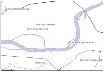
USGS developed The National Map (TNM) Gazetteer as the Federal and national standard (ANSI INCITS 446-2008) for geographic nomenclature based on the Geographic Names Information System (GNIS). The National Map Gazetteer contains information about physical and cultural geographic features, geographic areas, and locational entities that are generally recognizable and locatable by name (have achieved some landmark status) and are of interest to any level of government or to the public for any purpose that would lead to the representation of the feature in printed or electronic maps and/or geographic information systems. The dataset includes features of all types in the United States, its associated areas, and Antarctica,...
This project used species distribution modeling, population genetics, and geospatial analysis of historical vs. modern vertebrate populations to identify climate change refugia and population connectivity across the Sierra Nevada. It is hypothesized that climate change refugia will increase persistence and stability of populations and, as a result, maintain higher genetic diversity. This work helps managers assess the need to include connectivity and refugia in climate change adaptation strategies. Results help Sierra Nevada land managers allocate limited resources, aid future scenario assessment at landscape scales, and develop a performance measure for assessing resilience.
Categories: Data,
Project;
Tags: 2011,
2013,
CA,
California Landscape Conservation Cooperative,
Conservation Design,
U.S. Geological Survey, Department of the Interior - The annual Geographic Names acquisition plan is to collect geographic name data over the United States and its territories through the Board on Geographic Names processes. The U.S. Board on Geographic Names is a Federal body created in 1890 and established in its present form by Public Law in 1947 to maintain uniform geographic name usage throughout the Federal Government. The Board comprises representatives of Federal agencies concerned with geographic information, population, ecology, and management of public lands. Sharing its responsibilities with the Secretary of the Interior, the Board promulgates official geographic feature names with locative attributes...
Types: Citation;
Tags: BGN,
Board on Geographic Names,
Cultural Resources Theme,
GNIS,
Geographic Names,
USGS developed The National Map (TNM) Gazetteer as the Federal and national standard (ANSI INCITS 446-2008) for geographic nomenclature based on the Geographic Names Information System (GNIS). The National Map Gazetteer contains information about physical and cultural geographic features, geographic areas, and locational entities that are generally recognizable and locatable by name (have achieved some landmark status) and are of interest to any level of government or to the public for any purpose that would lead to the representation of the feature in printed or electronic maps and/or geographic information systems. The dataset includes features of all types in the United States, its associated areas, and Antarctica,...
Categories: Data;
Types: ArcGIS REST Map Service,
Map Service,
OGC WFS Layer,
OGC WMS Layer;
Tags: BGN,
Cultural Resources,
GNIS,
Geographic Names,
NGP-TNM,
U.S. Geological Survey, Department of the Interior - The annual Geographic Names acquisition plan is to collect geographic name data over the United States and its territories through the Board on Geographic Names processes. The U.S. Board on Geographic Names is a Federal body created in 1890 and established in its present form by Public Law in 1947 to maintain uniform geographic name usage throughout the Federal Government. The Board comprises representatives of Federal agencies concerned with geographic information, population, ecology, and management of public lands. Sharing its responsibilities with the Secretary of the Interior, the Board promulgates official geographic feature names with locative attributes...
|

|
