Filters
Date Range
Types
Contacts
Categories
Tag Types
Tag Schemes
|

Magma Copper Co.'s plant and concentrator.
Categories: Data;
Tags: 1940s,
Alta Group,
Amalgamated Au, Ag And,
Apex,
Arizona, All tags...
Broken Hill,
Copper, Sulfide,
Dataset,
Hub,
Irene Claim,
Magma Group,
Magma King Mining Co. Property,
Patented Claim Ms 340,
Patented Claims Ms 2930A,
Patented Claims Ms 3144,
Patented Claims Ms 350,
Patented Claims Ms 4152,
Pinal,
Pioneer metallic mineral dist.,
Pomeroy,
Queen,
Silver Queen,
Superior - 7.5 Min,
Superior physiographic area,
T1S R12E Sec 35 ALL,
United States,
buildings,
geoscientificInformation,
image collections,
milling and smelting,
mining,
photographic prints, Fewer tags

ADMMR map collection: Magma, Preliminart Drawing for Waste Ore Chute and Waste Ore Bin; 36 x 27 in.
Categories: Data;
Tags: 1980s,
Alta Group,
Amalgamated Au, Ag And,
Apex,
Arizona, All tags...
Broken Hill,
Calcium, Limestone,
Copper, Oxide,
Copper, Sulfide,
Dataset,
Gold, Lode,
Hub,
Irene Claim,
Iron, Pyrite,
Magma Group,
Magma King Mining Co. Property,
Magma Mine,
Manganese,
Patented Claim Ms 340,
Patented Claims Ms 2930A,
Patented Claims Ms 3144,
Patented Claims Ms 350,
Patented Claims Ms 4152,
Pinal County,
Pioneer metallic mineral dist.,
Pomeroy,
Queen,
Silver,
Silver Queen,
Stone, Decortive,
Superior - 7.5 Min,
Superior area physiographic area,
T1S R12E Sec 35 ALL,
United States,
Zinc,
diagrams,
geoscientificInformation,
mining and quarrying,
mining equipment, Fewer tags

A postcard of the horseshoe curve on the Globe - Phoenix highway.
Categories: Data;
Tags: 1930s,
Alta Group,
Amalgamated Au, Ag And,
Apex,
Arizona, All tags...
Broken Hill,
Copper, Sulfide,
Dataset,
Hub,
Irene Claim,
Magma Group,
Magma King Mining Co. Property,
Patented Claim Ms 340,
Patented Claims Ms 2930A,
Patented Claims Ms 3144,
Patented Claims Ms 350,
Patented Claims Ms 4152,
Pinal,
Pioneer metallic mineral dist.,
Pomeroy,
Queen,
Silver Queen,
Superior - 7.5 Min,
Superior physiographic area,
T1S R12E Sec 35 ALL,
United States,
geoscientificInformation,
image collections,
landscape photographs,
photographic prints, Fewer tags

A view of Superior, Arizona with the Van Dyke mine on a hill.
Categories: Data;
Tags: 1980s,
Alta Group,
Amalgamated Au, Ag And,
Apex,
Arizona, All tags...
Broken Hill,
Copper, Sulfide,
Dataset,
Hub,
Irene Claim,
Magma Group,
Magma King Mining Co. Property,
Patented Claim Ms 340,
Patented Claims Ms 2930A,
Patented Claims Ms 3144,
Patented Claims Ms 350,
Patented Claims Ms 4152,
Pinal,
Pioneer metallic mineral dist.,
Pomeroy,
Queen,
Silver Queen,
Superior - 7.5 Min,
Superior physiographic area,
T1S R12E Sec 35 ALL,
United States,
buildings,
cities and towns,
geoscientificInformation,
image collections,
mining,
photographic prints, Fewer tags

The town of Superior with the mine stacks and dumps in the background.
Categories: Data;
Tags: 1940s,
Alta Group,
Amalgamated Au, Ag And,
Apex,
Arizona, All tags...
Broken Hill,
Copper, Sulfide,
Dataset,
Hub,
Irene Claim,
Magma Group,
Magma King Mining Co. Property,
Patented Claim Ms 340,
Patented Claims Ms 2930A,
Patented Claims Ms 3144,
Patented Claims Ms 350,
Patented Claims Ms 4152,
Pinal,
Pioneer metallic mineral dist.,
Pomeroy,
Queen,
Silver Queen,
Superior - 7.5 Min,
Superior physiographic area,
T1S R12E Sec 35 ALL,
United States,
buildings,
cities and towns,
dumps and tailings,
geoscientificInformation,
image collections,
milling and smelting,
mining,
photographic prints, Fewer tags

A group of touring geolgist in front of the chiller building at the Magma mine.
Categories: Data;
Tags: 1990s,
Alta Group,
Amalgamated Au, Ag And,
Apex,
Arizona, All tags...
Broken Hill,
Copper, Sulfide,
Dataset,
Hub,
Irene Claim,
Magma Group,
Magma King Mining Co. Property,
Patented Claim Ms 340,
Patented Claims Ms 2930A,
Patented Claims Ms 3144,
Patented Claims Ms 350,
Patented Claims Ms 4152,
Pinal,
Pioneer metallic mineral dist.,
Pomeroy,
Queen,
Silver Queen,
Superior - 7.5 Min,
Superior physiographic area,
T1S R12E Sec 35 ALL,
United States,
adults,
buildings,
geoscientificInformation,
image collections,
mining,
photographic prints, Fewer tags

A view from Superior, Arizona of the Van Dyke mine.
Categories: Data;
Tags: 1980s,
Alta Group,
Amalgamated Au, Ag And,
Apex,
Arizona, All tags...
Broken Hill,
Copper, Sulfide,
Dataset,
Hub,
Irene Claim,
Magma Group,
Magma King Mining Co. Property,
Patented Claim Ms 340,
Patented Claims Ms 2930A,
Patented Claims Ms 3144,
Patented Claims Ms 350,
Patented Claims Ms 4152,
Pinal,
Pioneer metallic mineral dist.,
Pomeroy,
Queen,
Silver Queen,
Superior - 7.5 Min,
Superior physiographic area,
T1S R12E Sec 35 ALL,
United States,
automobiles,
buildings,
cities and towns,
geoscientificInformation,
image collections,
mining,
photographic prints, Fewer tags

Corrosion of cyclone mesh after dewatering that section of the Magma mine.
Categories: Data;
Tags: 1990s,
Alta Group,
Amalgamated Au, Ag And,
Apex,
Arizona, All tags...
Broken Hill,
Copper, Sulfide,
Dataset,
Hub,
Irene Claim,
Magma Group,
Magma King Mining Co. Property,
Patented Claim Ms 340,
Patented Claims Ms 2930A,
Patented Claims Ms 3144,
Patented Claims Ms 350,
Patented Claims Ms 4152,
Pinal,
Pioneer metallic mineral dist.,
Pomeroy,
Queen,
Silver Queen,
Superior - 7.5 Min,
Superior physiographic area,
T1S R12E Sec 35 ALL,
United States,
geoscientificInformation,
image collections,
mine drainage,
mining,
photographic prints,
shafts and adits, Fewer tags

A distant view of the Superior mine, with the mountains in the background.
Categories: Data;
Tags: 1940s,
Alta Group,
Amalgamated Au, Ag And,
Apex,
Arizona, All tags...
Broken Hill,
Copper, Sulfide,
Dataset,
Hub,
Irene Claim,
Magma Group,
Magma King Mining Co. Property,
Patented Claim Ms 340,
Patented Claims Ms 2930A,
Patented Claims Ms 3144,
Patented Claims Ms 350,
Patented Claims Ms 4152,
Pinal,
Pioneer metallic mineral dist.,
Pomeroy,
Queen,
Silver Queen,
Superior - 7.5 Min,
Superior physiographic area,
T1S R12E Sec 35 ALL,
United States,
geoscientificInformation,
image collections,
landscape photographs,
mining,
photographic prints, Fewer tags

ADMMR map collection: Magma, No. 9 Shaft Waste Chute and Bin; 36 x 27 in.
Categories: Data;
Tags: 1980s,
Alta Group,
Amalgamated Au, Ag And,
Apex,
Arizona, All tags...
Broken Hill,
Calcium, Limestone,
Copper, Oxide,
Copper, Sulfide,
Dataset,
Gold, Lode,
Hub,
Irene Claim,
Iron, Pyrite,
Magma Group,
Magma King Mining Co. Property,
Magma Mine,
Manganese,
Patented Claim Ms 340,
Patented Claims Ms 2930A,
Patented Claims Ms 3144,
Patented Claims Ms 350,
Patented Claims Ms 4152,
Pinal County,
Pioneer metallic mineral dist.,
Pomeroy,
Queen,
Silver,
Silver Queen,
Stone, Decortive,
Superior - 7.5 Min,
Superior area physiographic area,
T1S R12E Sec 35 ALL,
United States,
Zinc,
diagrams,
geoscientificInformation,
mining and quarrying,
mining equipment, Fewer tags
This data set contains imagery from the National Agriculture Imagery Program (NAIP). The NAIP program is administered by USDA FSA and has been established to support two main FSA strategic goals centered on agricultural production. These are increase stewardship of America's natural resources while enhancing the environment, and to ensure commodities are procured and distributed effectively and efficiently to increase food security. The NAIP program supports these goals by acquiring and providing ortho imagery that has been collected during the agricultural growing season in the U.S. The NAIP ortho imagery is tailored to meet FSA requirements and is a fundamental tool used to support FSA farm and conservation programs....
Types: Citation;
Tags: 3.75 x 3.75 minute,
3410227,
48369,
Aerial Compliance,
Compliance, All tags...
Digital Ortho rectified Image,
Downloadable Data,
HUB,
HUB, SW,
JPEG 2000,
JPEG2000,
NAIP,
Ortho Rectification,
Orthoimagery,
PARMER CO TX FSA,
Parmer,
Quarter Quadrangle,
TX,
TX369,
USDA National Agriculture Imagery Program (NAIP),
farming,
imageryBaseMapsEarthCover, Fewer tags

The main street in Superior, Arizona in the 1940s showing buisnesses and cars on the street.
Categories: Data;
Tags: 1940s,
Alta Group,
Amalgamated Au, Ag And,
Apex,
Arizona, All tags...
Broken Hill,
Copper, Sulfide,
Dataset,
Hub,
Irene Claim,
Magma Group,
Magma King Mining Co. Property,
Patented Claim Ms 340,
Patented Claims Ms 2930A,
Patented Claims Ms 3144,
Patented Claims Ms 350,
Patented Claims Ms 4152,
Pinal,
Pioneer metallic mineral dist.,
Pomeroy,
Queen,
Silver Queen,
Superior - 7.5 Min,
Superior physiographic area,
T1S R12E Sec 35 ALL,
United States,
automobiles,
buildings,
cities and towns,
geoscientificInformation,
image collections,
mining, Fewer tags

ADMMR map collection: Magma, No. 9 Mine Site Waste Dump Facility; 36 x 27 in.
Categories: Data;
Tags: 1980s,
Alta Group,
Amalgamated Au, Ag And,
Apex,
Arizona, All tags...
Broken Hill,
Calcium, Limestone,
Copper, Oxide,
Copper, Sulfide,
Dataset,
Gold, Lode,
Hub,
Irene Claim,
Iron, Pyrite,
Magma Group,
Magma King Mining Co. Property,
Magma Mine,
Manganese,
Patented Claim Ms 340,
Patented Claims Ms 2930A,
Patented Claims Ms 3144,
Patented Claims Ms 350,
Patented Claims Ms 4152,
Pinal County,
Pioneer metallic mineral dist.,
Pomeroy,
Queen,
Silver,
Silver Queen,
Stone, Decortive,
Superior - 7.5 Min,
Superior area physiographic area,
T1S R12E Sec 35 ALL,
United States,
Zinc,
diagrams,
geoscientificInformation,
mining and quarrying,
mining equipment, Fewer tags
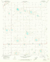
USGS Historical Quadrangle in GeoPDF.
Tags: 7.5 x 7.5 minute,
Downloadable Data,
GeoPDF,
GeoTIFF,
Historical Topographic Maps, All tags...
Historical Topographic Maps 7.5 x 7.5 Minute Map Series,
Hub,
Map,
TX,
imageryBaseMapsEarthCover, Fewer tags

New wooden blocking brought in to work on the dewatered sections of the Magma mine.
Categories: Data;
Tags: 1990s,
Alta Group,
Amalgamated Au, Ag And,
Apex,
Arizona, All tags...
Broken Hill,
Copper, Sulfide,
Dataset,
Hub,
Irene Claim,
Magma Group,
Magma King Mining Co. Property,
Patented Claim Ms 340,
Patented Claims Ms 2930A,
Patented Claims Ms 3144,
Patented Claims Ms 350,
Patented Claims Ms 4152,
Pinal,
Pioneer metallic mineral dist.,
Pomeroy,
Queen,
Silver Queen,
Superior - 7.5 Min,
Superior physiographic area,
T1S R12E Sec 35 ALL,
United States,
geoscientificInformation,
image collections,
mine drainage,
mining,
photographic prints,
shafts and adits,
underground views, Fewer tags

Corrosion in a pipe and on the roof of an adit at the Magma mine.
Categories: Data;
Tags: 1990s,
Alta Group,
Amalgamated Au, Ag And,
Apex,
Arizona, All tags...
Broken Hill,
Copper, Sulfide,
Dataset,
Hub,
Irene Claim,
Magma Group,
Magma King Mining Co. Property,
Patented Claim Ms 340,
Patented Claims Ms 2930A,
Patented Claims Ms 3144,
Patented Claims Ms 350,
Patented Claims Ms 4152,
Pinal,
Pioneer metallic mineral dist.,
Pomeroy,
Queen,
Silver Queen,
Superior - 7.5 Min,
Superior physiographic area,
T1S R12E Sec 35 ALL,
United States,
geoscientificInformation,
image collections,
mining,
photographic prints,
shafts and adits,
underground views, Fewer tags

A residence in Superior, Arizona in the 1940s.
Categories: Data;
Tags: 1940s,
Alta Group,
Amalgamated Au, Ag And,
Apex,
Arizona, All tags...
Broken Hill,
Copper, Sulfide,
Dataset,
Hub,
Irene Claim,
Magma Group,
Magma King Mining Co. Property,
Patented Claim Ms 340,
Patented Claims Ms 2930A,
Patented Claims Ms 3144,
Patented Claims Ms 350,
Patented Claims Ms 4152,
Pinal,
Pioneer metallic mineral dist.,
Pomeroy,
Queen,
Silver Queen,
Superior - 7.5 Min,
Superior physiographic area,
T1S R12E Sec 35 ALL,
United States,
buildings,
cities and towns,
geoscientificInformation,
housing,
image collections,
mining,
photographic prints, Fewer tags

The # 9 headframe at the Magma mine.
Categories: Data;
Tags: 1990s,
Alta Group,
Amalgamated Au, Ag And,
Apex,
Arizona, All tags...
Broken Hill,
Copper, Sulfide,
Dataset,
Hub,
Irene Claim,
Magma Group,
Magma King Mining Co. Property,
Patented Claim Ms 340,
Patented Claims Ms 2930A,
Patented Claims Ms 3144,
Patented Claims Ms 350,
Patented Claims Ms 4152,
Pinal,
Pioneer metallic mineral dist.,
Pomeroy,
Queen,
Silver Queen,
Superior - 7.5 Min,
Superior physiographic area,
T1S R12E Sec 35 ALL,
United States,
geoscientificInformation,
headframes,
image collections,
mining,
photographic prints, Fewer tags

Underground at the Magma mine showing new timbers and blocking brought in to use on the dewatered sections of the mine. A locomotive is on the tracks.
Categories: Data;
Tags: 1990s,
Alta Group,
Amalgamated Au, Ag And,
Apex,
Arizona, All tags...
Broken Hill,
Copper, Sulfide,
Dataset,
Hub,
Irene Claim,
Magma Group,
Magma King Mining Co. Property,
Patented Claim Ms 340,
Patented Claims Ms 2930A,
Patented Claims Ms 3144,
Patented Claims Ms 350,
Patented Claims Ms 4152,
Pinal,
Pioneer metallic mineral dist.,
Pomeroy,
Queen,
Silver Queen,
Superior - 7.5 Min,
Superior physiographic area,
T1S R12E Sec 35 ALL,
United States,
geoscientificInformation,
image collections,
mine drainage,
mining,
photographic prints,
railroads,
shafts and adits,
underground views, Fewer tags
This data set contains imagery from the National Agriculture Imagery Program (NAIP). The NAIP program is administered by USDA FSA and has been established to support two main FSA strategic goals centered on agricultural production. These are increase stewardship of America's natural resources while enhancing the environment, and to ensure commodities are procured and distributed effectively and efficiently to increase food security. The NAIP program supports these goals by acquiring and providing ortho imagery that has been collected during the agricultural growing season in the U.S. The NAIP ortho imagery is tailored to meet FSA requirements and is a fundamental tool used to support FSA farm and conservation programs....
Types: Citation;
Tags: 3.75 x 3.75 minute,
3410227,
48369,
Aerial Compliance,
Compliance, All tags...
Digital Ortho rectified Image,
Downloadable Data,
HUB,
HUB, NW,
JPEG 2000,
JPEG2000,
NAIP,
Ortho Rectification,
Orthoimagery,
PARMER CO TX FSA,
Parmer,
Quarter Quadrangle,
TX,
TX369,
USDA National Agriculture Imagery Program (NAIP),
farming,
imageryBaseMapsEarthCover, Fewer tags
|
|

