Filters: Tags: land cover (X) > partyWithName: Conservation Biology Institute (X)
138 results (87ms)|
Filters
|

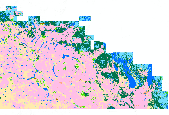
This dataset portrays land cover for north-central Alaska, part of NLCD superzone 15. To reduce file size, Alaska was divided into ten zones, which can be found in the NLCD 2001 gallery . For more infomation on NLCD superzones, including a map, refer to http://www.mrlc.gov/nlcd_multizone_map.php . From NLCD: The National Land Cover Database 2001 was produced through a cooperative project conducted by the Multi-Resolution Land Characteristics (MRLC) Consortium. The MRLC Consortium is a partnership of federal agencies (www.mrlc.gov), consisting of the U.S. Geological Survey (USGS), the National Oceanic and Atmospheric Administration (NOAA), the U.S. Environmental Protection Agency (EPA), the U.S. Department of Agriculture...
This dataset contains generalized landcover data for the Prairie Farm Rehabilitation Administration (PFRA) determined agricultural extent of Manitoba and Saskatchewan. This dataset was subset into two shapefiles. The other half of this dataset covers PFRA agricultural areas of Alberta and British Columbia. The Landcover Generalization process was undertaken to solve rendering problems of the original vectorized landcover data due to its unwieldy/overwhelming size. LANDSAT 7 imagery used in the process was collected during the WGTPP. This landcover imagery has a 30 meter resolution and is stored in over 1,100 vectorized 1:50,000 map sheet tiles. The data requires over seven gigabytes of disc space. If the user wishes...
This dataset portrays percent tree canopy coverage for NLCD mapping superzone twelve (south), covering parts of Louisiana, Mississippi, Alabama, Florida, and Arkansas . Refer to http://www.mrlc.gov/nlcd_multizone_map.php for a map of the superzones. From NLCD: The National Land Cover Database 2001 was produced through a cooperative project conducted by the Multi-Resolution Land Characteristics (MRLC) Consortium. The MRLC Consortium is a partnership of federal agencies (www.mrlc.gov), consisting of the U.S. Geological Survey (USGS), the National Oceanic and Atmospheric Administration (NOAA), the U.S. Environmental Protection Agency (EPA), the U.S. Department of Agriculture (USDA), the U.S. Forest Service (USFS),...

This dataset portrays land cover for Puerto Rico, which is NLCD mapping superzone seventeen. Refer to http://www.mrlc.gov/nlcd_multizone_map.php for a map of the superzones. From NLCD: The National Land Cover Database 2001 was produced through a cooperative project conducted by the Multi-Resolution Land Characteristics (MRLC) Consortium. The MRLC Consortium is a partnership of federal agencies (www.mrlc.gov), consisting of the U.S. Geological Survey (USGS), the National Oceanic and Atmospheric Administration (NOAA), the U.S. Environmental Protection Agency (EPA), the U.S. Department of Agriculture (USDA), the U.S. Forest Service (USFS), the National Park Service (NPS), the U.S. Fish and Wildlife Service (FWS),...

This dataset portrays land cover for NLCD mapping superzone five, covering most of Arizona, a large portion of western New Mexico, and very small portions of Utah, Colorado, and Texas. Refer to http://www.mrlc.gov/nlcd_multizone_map.php for a map of the super-zones. From NLCD: The National Land Cover Database 2001 was produced through a cooperative project conducted by the Multi-Resolution Land Characteristics (MRLC) Consortium. The MRLC Consortium is a partnership of federal agencies (www.mrlc.gov), consisting of the U.S. Geological Survey (USGS), the National Oceanic and Atmospheric Administration (NOAA), the U.S. Environmental Protection Agency (EPA), the U.S. Department of Agriculture (USDA), the U.S. Forest...
Tags: land cover,
nlcd

This dataset portrays percent imperviousness surface area for NLCD mapping superzone four, covering most of Utah and Colorado, and parts of Wyoming, Montana, Idaho, Nevada, Arizona, and New Mexico. Refer to http://www.mrlc.gov/nlcd_multizone_map.php for a map of the super-zones. From NLCD: The National Land Cover Database 2001 was produced through a cooperative project conducted by the Multi-Resolution Land Characteristics (MRLC) Consortium. The MRLC Consortium is a partnership of federal agencies (www.mrlc.gov), consisting of the U.S. Geological Survey (USGS), the National Oceanic and Atmospheric Administration (NOAA), the U.S. Environmental Protection Agency (EPA), the U.S. Department of Agriculture (USDA),...
Tags: impervious,
land cover
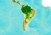
This dataset is an extract from the GlobCover 2009 land cover map, covering Central and South America. The GlobCover 2009 land cover map is derived by an automatic and regionally-tuned classification of a time series of global MERIS (MEdium Resolution Imaging Spectrometer) FR mosaics for the year 2009. The global land cover map counts 22 land cover classes defined with the United Nations (UN) Land Cover Classification System (LCCS). For more information on the GlobCover project, see http://ionia1.esrin.esa.int/ Note on display: class 210: Water Bodies is set to "transparent" to improve display in the Data Basin map. Within the extract's extent, no data were removed from the original dataset.
MC1 is a widely used dynamic global vegetation model (DGVM) that has been used to simulate potential vegetation shifts in California and Alaska, all of North America, and over the entire globe under various climate change scenarios. However, past simulations were run at a scale that is too coarse (e.g., 10km x 10km for the California simulations) for use by local resource managers, such as those in Yosemite National Park ( see Data Basin feature on Yosemite results ). More recently, the model has been implemented at a finer resolution (800m x 800m) of greater utility to National Park staff. MC1 is a model that simulates vegetation types, ecosystem fluxes of carbon, nitrogen, and water, as well as wildfire occurrence...
Types: Map Service,
OGC WFS Layer,
OGC WMS Layer,
OGC WMS Service;
Tags: GIS,
climate,
fire,
land cover,
map,

This map layer is extracted from a grid map of North America including the Caribbean and most of Mexico. The map layer is an excerpt from a global assessment of forest fragmentation (Riitters et al., 2000). Each pixel value represents an index of forest fragmentation for the surrounding 81 sq. km. The map layer was created by applying spatial algorithms to a 1 sq. km. resolution map of global land cover (Loveland and Belward 1997) known as NAIGBP1_2L, obtained from the USGS Center for EROS Distributed Active Archive Center (DAAC) as part of the Global Land Cover Characteristics database (GLCC)(Loveland et al. 1991, 1999). One of six categories of fragmentation was identified for each forested pixel in North...

NLCD 1992, NLCD 2001, and NLCD 2006 are National Land Cover Database classification schemes based primarily on Landsat data along with ancillary data sources, such as topography, census and agricultural statistics, soil characteristics, wetlands, and other land cover maps. NLCD 1992 is a 21-class land cover classification scheme that has been applied consistently across the conterminous U.S. at a spatial resolution of 30 meters. NLCD 2001 is a 16-class land cover classification scheme that also has been applied to the conterminous U.S. at a spatial resolution of 30 meters, and includes Alaska, Hawaii, and Puerto Rico. NLCD 2006 quantifies land cover change for the conterminous U.S. between the years 2001 to 2006....

Abstract: This dataset portrays 28 forest type groups across the contiguous United States. These data were derived from MODIS composite images from the 2002 and 2003 growing seasons in combination with nearly 100 other geospatial data layers, including elevation, slope, aspect, ecoregions, and PRISM climate data. The dataset was developed as a collaborative effort between the USFS Forest Inventory and Analysis and Forest Health Monitoring programs and the USFS Remote Sensing Applications Center. Â Purpose: The purpose of this dataset is to portray broad distribution patterns of forest cover in the United States and provide input to national scale modeling projects. The data should not be displayed at scales smaller...

This dataset portrays land cover for NLCD mapping superzone thirteen, which covers all of Maine, Vermont, New Hampshire, Massachusetts, Rhode Island, Connecticut, New York, New Jersey, Delaware, and Maryland, and parts of Pennsylvania, Virginia, West Virginia, and North Carolina. Refer to http://www.mrlc.gov/nlcd_multizone_map.php for a map of the superzones. From NLCD: The National Land Cover Database 2001 was produced through a cooperative project conducted by the Multi-Resolution Land Characteristics (MRLC) Consortium. The MRLC Consortium is a partnership of federal agencies (www.mrlc.gov), consisting of the U.S. Geological Survey (USGS), the National Oceanic and Atmospheric Administration (NOAA), the U.S....
This dataset portrays percent imperviousness surface area for NLCD mapping superzone thirteen, which covers all of Maine, Vermont, New Hampshire, Massachusetts, Rhode Island, Connecticut, New York, New Jersey, Delaware, and Maryland, and parts of Pennsylvania, Virginia, West Virginia, and North Carolina. Refer to http://www.mrlc.gov/nlcd_multizone_map.php for a map of the super-zones. From NLCD: The National Land Cover Database 2001 was produced through a cooperative project conducted by the Multi-Resolution Land Characteristics (MRLC) Consortium. The MRLC Consortium is a partnership of federal agencies (www.mrlc.gov), consisting of the U.S. Geological Survey (USGS), the National Oceanic and Atmospheric Administration...

This dataset contains generalized landcover data for the Prairie Farm Rehabilitation Administration (PFRA) agricultural extent of Alberta and British Columbia. This dataset was subset into two shapefiles. The other half of this dataset covers PFRA agricultural areas of Manitoba and Saskatchewan. The Landcover Generalization process was undertaken to solve rendering problems of the original vectorized landcover data due to its unwieldy/overwhelming size. LANDSAT 7 imagery used in the process was collected during the WGTPP. This landcover imagery has a 30 meter resolution and is stored in over 1,100 vectorized 1:50,000 map sheet tiles. The data requires over seven gigabytes of disc space. If the user wishes to view...

SYNMAP is a new joint I-km global land cover product with improved characteristics for land cover parameterization of the carbon cycle models that reduces land cover uncertainties in carbon budget calculations. The overall advantage of the SYNMAP legend is that all classes are properly defined in terms of plant functional type mixtures, which can be remotely sensed and include the definitions of leaf type and longevity for each class with a tree component. SYNMAP is currently used for parameterization in a European model intercomparison initiative of three global vegetation models: BIOME-BGC, LPJ, and ORCHIDEE. Corroboration of SYNMAP against GLCC, GLC2000 and MODIS land cover products reveals improved agreement...

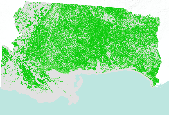
Zone 1 (covering a portion of southwestern Texas) of the contiguous U.S. land cover dataset, NLCD 2006, released 2/16/2011. The full dataset is divided into 25 zones, which can all be found in the NLCD 2006 gallery. The National Land Cover Database products are created through a cooperative project conducted by the Multi-Resolution Land Characteristics (MRLC) Consortium. The MRLC Consortium is a partnership of federal agencies (www.mrlc.gov), consisting of the U.S. Geological Survey (USGS), the National Oceanic and Atmospheric Administration (NOAA), the U.S. Environmental Protection Agency (EPA), the U.S. Department of Agriculture (USDA), the U.S. Forest Service (USFS), the National Park Service (NPS), the U.S....

This dataset portrays land cover for southwestern Alaska, part of NLCD superzone 15. To reduce file size, Alaska was divided into ten zones, which can be found in the NLCD 2001 gallery . For more infomation on NLCD superzones, including a map, refer to http://www.mrlc.gov/nlcd_multizone_map.php . From NLCD: The National Land Cover Database 2001 was produced through a cooperative project conducted by the Multi-Resolution Land Characteristics (MRLC) Consortium. The MRLC Consortium is a partnership of federal agencies (www.mrlc.gov), consisting of the U.S. Geological Survey (USGS), the National Oceanic and Atmospheric Administration (NOAA), the U.S. Environmental Protection Agency (EPA), the U.S. Department of Agriculture...

Zone 9 (covering parts of Louisiana, Arkansas, Missouri, Illinois, Indiana, Kentucky, Tennessee, Mississippi, Alabama, and Georgia) of the contiguous U.S. land cover dataset, NLCD 2006, released 2/16/2011. The full dataset is divided into 25 zones, which can all be found in the NLCD 2006 gallery. The National Land Cover Database products are created through a cooperative project conducted by the Multi-Resolution Land Characteristics (MRLC) Consortium. The MRLC Consortium is a partnership of federal agencies (www.mrlc.gov), consisting of the U.S. Geological Survey (USGS), the National Oceanic and Atmospheric Administration (NOAA), the U.S. Environmental Protection Agency (EPA), the U.S. Department of Agriculture...

Zone 8 (covering parts of Texas, Oklahoma, Kansas, Missouri, Arkansas, and Louisiana) of the contiguous U.S. land cover dataset, NLCD 2006, released 2/16/2011. The full dataset is divided into 25 zones, which can all be found in the NLCD 2006 gallery. The National Land Cover Database products are created through a cooperative project conducted by the Multi-Resolution Land Characteristics (MRLC) Consortium. The MRLC Consortium is a partnership of federal agencies (www.mrlc.gov), consisting of the U.S. Geological Survey (USGS), the National Oceanic and Atmospheric Administration (NOAA), the U.S. Environmental Protection Agency (EPA), the U.S. Department of Agriculture (USDA), the U.S. Forest Service (USFS), the...

This dataset portrays percent imperviousness surface area for NLCD mapping superzone twelve, which covers most of Mississippi and Alabama, and parts of Louisiana, Florida, Georgia, Tennessee, Arkansas, and Missouri. Refer to http://www.mrlc.gov/nlcd_multizone_map.php for a map of the super-zones. From NLCD: The National Land Cover Database 2001 was produced through a cooperative project conducted by the Multi-Resolution Land Characteristics (MRLC) Consortium. The MRLC Consortium is a partnership of federal agencies (www.mrlc.gov), consisting of the U.S. Geological Survey (USGS), the National Oceanic and Atmospheric Administration (NOAA), the U.S. Environmental Protection Agency (EPA), the U.S. Department of Agriculture...
|

|
