Filters
Date Range
Extensions
Types
Contacts
Categories
Tag Types
Tag Schemes
|
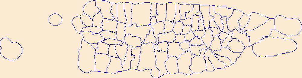
Geospatial data is comprised of government boundaries.
Tags: Adjuntas,
Aguada,
Aguadilla,
Aguas Buenas,
Aibonito, All tags...
Arecibo,
Arroyo,
Añasco,
Barceloneta,
Barranquitas,
Bayamón,
Boundaries,
Cabo Rojo,
Caguas,
Camuy,
Canóvanas,
Carolina,
Cataño,
Cayey,
Ceiba,
Ciales,
Cidra,
Coamo,
Comerío,
Corozal,
County or Equivalent,
Culebra,
Dorado,
Downloadable Data,
Fajardo,
Florida,
GeoPackage,
Guayama,
Guayanilla,
Guaynabo,
Gurabo,
Guánica,
Hatillo,
Hormigueros,
Humacao,
Incorporated Place,
Isabela,
Jayuya,
Juana Díaz,
Juncos,
Jurisdictional,
Lajas,
Lares,
Las Marías,
Las Piedras,
Loíza,
Luquillo,
Manatí,
Maricao,
Maunabo,
Mayagüez,
Minor Civil Division,
Moca,
Morovis,
Naguabo,
Naranjito,
National Boundary Dataset (NBD),
National Boundary Dataset (NBD),
Native American Area,
Open Geospatial Consortium GeoPackage 1.2,
Orocovis,
PLSS First Division,
PLSS Special Survey,
PLSS Township,
PR,
Patillas,
Peñuelas,
Ponce,
Public Land Survey System,
Puerto Rico,
Quebradillas,
Reserve,
Rincón,
Río Grande,
Sabana Grande,
Salinas,
San Germán,
San Juan,
San Lorenzo,
San Sebastián,
Santa Isabel,
State,
State,
State or Territory,
Toa Alta,
Toa Baja,
Trujillo Alto,
U.S. National Grid,
US,
Unincorporated Place,
United States,
Utuado,
Vega Alta,
Vega Baja,
Vieques,
Villalba,
Yabucoa,
Yauco,
boundaries,
boundary,
cadastral surveys,
geographic names,
land ownership,
land use maps,
legal land descriptions,
political and administrative boundaries,
zoning maps, Fewer tags

Geospatial data is comprised of government boundaries.
Types: Citation;
Tags: Barbour,
Berkeley,
Boone,
Boundaries,
Braxton, All tags...
Brooke,
Cabell,
Calhoun,
Clay,
County or Equivalent,
Doddridge,
Downloadable Data,
Esri File GeoDatabase 10,
Fayette,
FileGDB,
Gilmer,
Grant,
Greenbrier,
Hampshire,
Hancock,
Hardy,
Harrison,
Incorporated Place,
Jackson,
Jefferson,
Jurisdictional,
Kanawha,
Lewis,
Lincoln,
Logan,
Marion,
Marshall,
Mason,
McDowell,
Mercer,
Mineral,
Mingo,
Minor Civil Division,
Monongalia,
Monroe,
Morgan,
National Boundary Dataset (NBD),
National Boundary Dataset (NBD),
Native American Area,
Nicholas,
Ohio,
PLSS First Division,
PLSS Special Survey,
PLSS Township,
Pendleton,
Pleasants,
Pocahontas,
Preston,
Public Land Survey System,
Putnam,
Raleigh,
Randolph,
Reserve,
Ritchie,
Roane,
State,
State,
State or Territory,
Summers,
Taylor,
Tucker,
Tyler,
U.S. National Grid,
US,
Unincorporated Place,
United States,
Upshur,
WV,
Wayne,
Webster,
West Virginia,
Wetzel,
Wirt,
Wood,
Wyoming,
boundaries,
boundary,
cadastral surveys,
geographic names,
land ownership,
land use maps,
legal land descriptions,
political and administrative boundaries,
zoning maps, Fewer tags
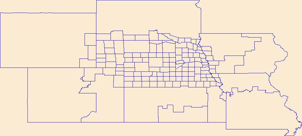
Geospatial data is comprised of government boundaries.
Tags: Adams,
Antelope,
Arthur,
Banner,
Blaine, All tags...
Boone,
Boundaries,
Box Butte,
Boyd,
Brown,
Buffalo,
Burt,
Butler,
Cass,
Cedar,
Chase,
Cherry,
Cheyenne,
Clay,
Colfax,
County or Equivalent,
Cuming,
Custer,
Dakota,
Dawes,
Dawson,
Deuel,
Dixon,
Dodge,
Douglas,
Downloadable Data,
Dundy,
Esri Shapefile nan,
Fillmore,
Franklin,
Frontier,
Furnas,
Gage,
Garden,
Garfield,
Gosper,
Grant,
Greeley,
Hall,
Hamilton,
Harlan,
Hayes,
Hitchcock,
Holt,
Hooker,
Howard,
Incorporated Place,
Jefferson,
Johnson,
Jurisdictional,
Kearney,
Keith,
Keya Paha,
Kimball,
Knox,
Lancaster,
Lincoln,
Logan,
Loup,
Madison,
McPherson,
Merrick,
Minor Civil Division,
Morrill,
NE,
Nance,
National Boundary Dataset (NBD),
National Boundary Dataset (NBD),
Native American Area,
Nebraska,
Nemaha,
Nuckolls,
Otoe,
PLSS First Division,
PLSS Special Survey,
PLSS Township,
Pawnee,
Perkins,
Phelps,
Pierce,
Platte,
Polk,
Public Land Survey System,
Red Willow,
Reserve,
Richardson,
Rock,
Saline,
Sarpy,
Saunders,
Scotts Bluff,
Seward,
Shapefile,
Sheridan,
Sherman,
Sioux,
Stanton,
State,
State,
State or Territory,
Thayer,
Thomas,
Thurston,
U.S. National Grid,
US,
Unincorporated Place,
United States,
Valley,
Washington,
Wayne,
Webster,
Wheeler,
York,
boundaries,
boundary,
cadastral surveys,
geographic names,
land ownership,
land use maps,
legal land descriptions,
political and administrative boundaries,
zoning maps, Fewer tags
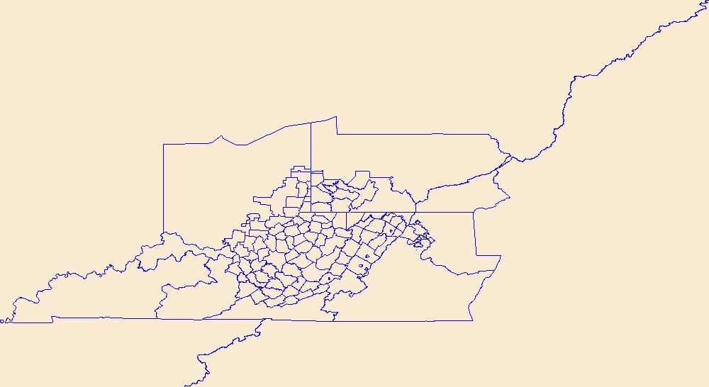
Geospatial data is comprised of government boundaries.
Tags: Barbour,
Berkeley,
Boone,
Boundaries,
Braxton, All tags...
Brooke,
Cabell,
Calhoun,
Clay,
County or Equivalent,
Doddridge,
Downloadable Data,
Fayette,
GeoPackage,
Gilmer,
Grant,
Greenbrier,
Hampshire,
Hancock,
Hardy,
Harrison,
Incorporated Place,
Jackson,
Jefferson,
Jurisdictional,
Kanawha,
Lewis,
Lincoln,
Logan,
Marion,
Marshall,
Mason,
McDowell,
Mercer,
Mineral,
Mingo,
Minor Civil Division,
Monongalia,
Monroe,
Morgan,
National Boundary Dataset (NBD),
National Boundary Dataset (NBD),
Native American Area,
Nicholas,
Ohio,
Open Geospatial Consortium GeoPackage 1.2,
PLSS First Division,
PLSS Special Survey,
PLSS Township,
Pendleton,
Pleasants,
Pocahontas,
Preston,
Public Land Survey System,
Putnam,
Raleigh,
Randolph,
Reserve,
Ritchie,
Roane,
State,
State,
State or Territory,
Summers,
Taylor,
Tucker,
Tyler,
U.S. National Grid,
US,
Unincorporated Place,
United States,
Upshur,
WV,
Wayne,
Webster,
West Virginia,
Wetzel,
Wirt,
Wood,
Wyoming,
boundaries,
boundary,
cadastral surveys,
geographic names,
land ownership,
land use maps,
legal land descriptions,
political and administrative boundaries,
zoning maps, Fewer tags

Geospatial data is comprised of government boundaries.
Tags: Boundaries,
County or Equivalent,
Downloadable Data,
Esri Shapefile nan,
Incorporated Place, All tags...
Jurisdictional,
Minor Civil Division,
National Boundary Dataset (NBD),
National Boundary Dataset (NBD),
Native American Area,
PLSS First Division,
PLSS Special Survey,
PLSS Township,
Public Land Survey System,
Reserve,
Shapefile,
St. Croix,
St. John,
St. Thomas,
State,
State,
State or Territory,
U.S. National Grid,
US,
Unincorporated Place,
United States,
VI,
Virgin Islands,
boundaries,
boundary,
cadastral surveys,
geographic names,
land ownership,
land use maps,
legal land descriptions,
political and administrative boundaries,
zoning maps, Fewer tags
Geospatial data is comprised of government boundaries.
Types: Citation;
Tags: Boundaries,
Bristol,
County or Equivalent,
Downloadable Data,
Esri File GeoDatabase 10, All tags...
FileGDB,
Incorporated Place,
Jurisdictional,
Kent,
Minor Civil Division,
National Boundary Dataset (NBD),
National Boundary Dataset (NBD),
Native American Area,
Newport,
PLSS First Division,
PLSS Special Survey,
PLSS Township,
Providence,
Public Land Survey System,
RI,
Reserve,
Rhode Island,
State,
State,
State or Territory,
U.S. National Grid,
US,
Unincorporated Place,
United States,
Washington,
boundaries,
boundary,
cadastral surveys,
geographic names,
land ownership,
land use maps,
legal land descriptions,
political and administrative boundaries,
zoning maps, Fewer tags

Geospatial data is comprised of government boundaries.
Tags: Boundaries,
Bristol,
County or Equivalent,
Downloadable Data,
Esri Shapefile nan, All tags...
Incorporated Place,
Jurisdictional,
Kent,
Minor Civil Division,
National Boundary Dataset (NBD),
National Boundary Dataset (NBD),
Native American Area,
Newport,
PLSS First Division,
PLSS Special Survey,
PLSS Township,
Providence,
Public Land Survey System,
RI,
Reserve,
Rhode Island,
Shapefile,
State,
State,
State or Territory,
U.S. National Grid,
US,
Unincorporated Place,
United States,
Washington,
boundaries,
boundary,
cadastral surveys,
geographic names,
land ownership,
land use maps,
legal land descriptions,
political and administrative boundaries,
zoning maps, Fewer tags

The Protected Areas Database of the United States (PAD-US) is a geodatabase that illustrates and describes public land ownership, management and conservation lands nationally, including voluntarily provided privately protected areas. The lands included in PAD-US are assigned conservation measures that qualify their intent to manage lands for the preservation of biological diversity and to other natural, recreational and cultural uses; managed for these purposes through legal or other effective means. The geodatabase includes: 1) Geographic boundaries of public land ownership and voluntarily provided private conservation lands (e.g., Nature Conservancy Preserves); 2) The combination land owner, land manager, management...
Types: Downloadable;
Tags: BLM,
Biodiversity,
Bureau of Land Management,
CBR 2010,
Central Basin and Range, All tags...
Conservation,
DOI,
GAP Status Code,
Gap Analysis,
Geospatial,
IUCN Category,
Land Manager,
Land Ownership,
Land Stewardship,
Management,
Protected Area,
Protection Status,
REA,
Rapid Ecoregional Assessment,
Special Management Areas,
boundaries, Fewer tags

The Protected Areas Database of the United States (PAD-US) is a geodatabase that illustrates and describes public land ownership, management and conservation lands nationally, including voluntarily provided privately protected areas. The lands included in PAD-US are assigned conservation measures that qualify their intent to manage lands for the preservation of biological diversity and to other natural, recreational and cultural uses; managed for these purposes through legal or other effective means. The geodatabase includes: 1) Geographic boundaries of public land ownership and voluntarily provided private conservation lands (e.g., Nature Conservancy Preserves); 2) The combination land owner, land manager, management...
Types: Downloadable;
Tags: BLM,
Biodiversity,
Bureau of Land Management,
Conservation,
DOI, All tags...
GAP Status Code,
Gap Analysis,
Geospatial,
IUCN Category,
Land Manager,
Land Ownership,
Land Stewardship,
Management,
NGB 2011,
Northern Great Basin,
Protected Area,
Protection Status,
REA,
Rapid Ecoregional Assessment,
boundaries, Fewer tags

This is a coverage of surface and Federal mineral ownership in the Powder River Basin area, Montana and Wyoming. This coverage is the combination of several ARC/INFO coverages and MOSS format files that were collected from the BLM, reformatted as needed, modified, and/or created by the USGS from hard copy BLM 1:100,000-scale surface and mineral management status maps. The Powder River Basin has the largest in-place coal resources of any field in the contiguous U.S. (Keystone, 1997), and produces over one-fourth of the Nation's total coal production (The Mining Record, 1997). In the Powder River Basin, very little of the surface is Federal land, yet almost all of the coal is Federally owned.
Categories: Data,
pre-SM502.8;
Types: Downloadable,
Map Service,
OGC WFS Layer,
OGC WMS Layer,
Shapefile;
Tags: Federal coal ownership,
Federal mineral ownership,
Federal oil and gas ownership,
Federal surface management,
Northern Great Plains, All tags...
Powder River Basin,
Powder River Basin,
USGS Science Data Catalog (SDC),
additional,
eastern Montana,
eastern Wyoming,
economy,
environment,
federallands,
geoscientificInformation,
land ownership,
land status,
land-use planning, Fewer tags

This shapefile contains land status and Federal mineral ownership of the Hanna and Carbon Basins, Wyoming. The polygon shapefile contains two attributes of ownership information for each polygon. One attribute indicates where the surface is State owned, privately owned, or, if Federally owned, which Federal agency manages the land surface. The other attribute indicates which minerals, if any, are owned by the Federal govenment. This coverage is based on land status and Federal mineral ownership data compiled by the U.S. Geological Survey (USGS) and the Wyoming State Bureau of Land Management (BLM) at a scale of 1:24,000. These data were compiled primarily to serve the USGS National Coal Resource Assessment Projects...
Categories: Data,
pre-SM502.8;
Types: Downloadable,
Map Service,
OGC WFS Layer,
OGC WMS Layer,
Shapefile;
Tags: Carbon Basin,
Carbon Basin,
Carbon County,
Coal,
Coal ownership, All tags...
Federal land,
Federal mineral ownership,
Federal surface management,
Ferris coalfield,
Hanna Basin,
Hanna Basin,
Hanna coalfield,
Land ownership,
Minerals,
Northern Rocky Mountains and Great Plains Region,
Ownership,
South Carbon coalfield,
USGS Science Data Catalog (SDC),
Wyoming,
coal,
economy,
environment,
geoscientificInformation,
hannabasincoal,
nca2000,
nrockiescoal, Fewer tags

The USGS Protected Areas Database of the United States (PAD-US) is the nation's inventory of protected areas, including public open space and voluntarily provided, private protected areas, identified as an A-16 National Geospatial Data Asset in the Cadastral Theme (http://www.fgdc.gov/ngda-reports/NGDA_Datasets.html). PAD-US is an ongoing project with several published versions of a spatial database of areas dedicated to the preservation of biological diversity, and other natural, recreational or cultural uses, managed for these purposes through legal or other effective means. The geodatabase maps and describes public open space and other protected areas. Most areas are public lands owned in fee; however, long-term...
Types: Citation;
Tags: Agricultural Research Service,
Alabama (AL),
Alaska (AK),
American Samoa (AS),
Arizona (AZ), All tags...
Arkansas (AR),
Army Corps of Engineers,
Biodiversity,
Bureau of Indian Affairs,
Bureau of Land Management,
Bureau of Reclamation,
Cadastre Theme,
California (CA),
Colorado (CO),
Connecticut (CT),
Conservation,
Delaware (DE),
Department of Defense,
Department of Energy,
Federal Lands,
Federated States of Micronesia (FM),
Florida (FL),
Forest Service,
GAP Status Code,
Gap Analysis,
Georgia (GA),
Governmental Units,
Guam (GU),
Hawaii (HI),
IUCN Category,
Idaho (ID),
Illinois (IL),
Indiana (IN),
Iowa (IA),
Kansas (KS),
Kentucky (KY),
Land Manager,
Land Ownership,
Land Stewardship,
Local Government Lands,
Louisiana (LA),
Maine (ME),
Mariana Islands (MP),
Marshall Islands (MH),
Maryland (MD),
Massachusetts (MA),
Michigan (MI),
Minnesota (MN),
Mississippi (MS),
Missouri (MO),
Montana (MT),
NGDA,
NGDA Portfolio Themes,
NGDA Portfolio Themes,
National Geospatial Data Asset,
National Oceanic and Atmospheric Administration,
National Park Service,
Natural Resources Conservation Service,
Nebraska (NE),
Nevada (NV),
New Hampshire (NH),
New Jersey (NJ),
New Mexico (NM),
New York (NY),
North Carolina (NC),
North Dakota (ND),
Ohio (OH),
Oklahoma (OK),
Oregon (OR),
Outdoor Recreation,
Palau (PW),
Parks,
Pennsylvania (PA),
Private Lands,
Protected Area,
Protection Status,
Public Health,
Public Lands,
Public Open Space,
Puerto Rico (PR),
Rhode Island (RI),
South Carolina (SC),
South Dakota (SD),
State Lands,
Tennessee (TN),
Tennessee Valley Authority,
Texas (TX),
U.S. Fish & Wildlife Service,
U.S. Fish and Wildlife Service,
U.S. Minor Outlying Islands (UM),
United States,
United States,
United States Virgin Islands (VI),
Utah (UT),
Vermont (VT),
Virginia (VA),
Washington (WA),
West Virginia (WV),
Wisconsin (WI),
Wyoming (WY), Fewer tags
Geospatial data is comprised of government boundaries.
Tags: Allen,
Anderson,
Atchison,
Barber,
Barton, All tags...
Boundaries,
Bourbon,
Brown,
Butler,
Chase,
Chautauqua,
Cherokee,
Cheyenne,
Clark,
Clay,
Cloud,
Coffey,
Comanche,
County or Equivalent,
Cowley,
Crawford,
Decatur,
Dickinson,
Doniphan,
Douglas,
Downloadable Data,
Edwards,
Elk,
Ellis,
Ellsworth,
Esri Shapefile nan,
Finney,
Ford,
Franklin,
Geary,
Gove,
Graham,
Grant,
Gray,
Greeley,
Greenwood,
Hamilton,
Harper,
Harvey,
Haskell,
Hodgeman,
Incorporated Place,
Jackson,
Jefferson,
Jewell,
Johnson,
Jurisdictional,
KS,
Kansas,
Kearny,
Kingman,
Kiowa,
Labette,
Lane,
Leavenworth,
Lincoln,
Linn,
Logan,
Lyon,
Marion,
Marshall,
McPherson,
Meade,
Miami,
Minor Civil Division,
Mitchell,
Montgomery,
Morris,
Morton,
National Boundary Dataset (NBD),
National Boundary Dataset (NBD),
Native American Area,
Nemaha,
Neosho,
Ness,
Norton,
Osage,
Osborne,
Ottawa,
PLSS First Division,
PLSS Special Survey,
PLSS Township,
Pawnee,
Phillips,
Pottawatomie,
Pratt,
Public Land Survey System,
Rawlins,
Reno,
Republic,
Reserve,
Rice,
Riley,
Rooks,
Rush,
Russell,
Saline,
Scott,
Sedgwick,
Seward,
Shapefile,
Shawnee,
Sheridan,
Sherman,
Smith,
Stafford,
Stanton,
State,
State,
State or Territory,
Stevens,
Sumner,
Thomas,
Trego,
U.S. National Grid,
US,
Unincorporated Place,
United States,
Wabaunsee,
Wallace,
Washington,
Wichita,
Wilson,
Woodson,
Wyandotte,
boundaries,
boundary,
cadastral surveys,
geographic names,
land ownership,
land use maps,
legal land descriptions,
political and administrative boundaries,
zoning maps, Fewer tags
Geospatial data is comprised of government boundaries.
Tags: Ada,
Adams,
Bannock,
Bear Lake,
Benewah, All tags...
Bingham,
Blaine,
Boise,
Bonner,
Bonneville,
Boundaries,
Boundary,
Butte,
Camas,
Canyon,
Caribou,
Cassia,
Clark,
Clearwater,
County or Equivalent,
Custer,
Downloadable Data,
Elmore,
Esri Shapefile nan,
Franklin,
Fremont,
Gem,
Gooding,
ID,
Idaho,
Idaho,
Incorporated Place,
Jefferson,
Jerome,
Jurisdictional,
Kootenai,
Latah,
Lemhi,
Lewis,
Lincoln,
Madison,
Minidoka,
Minor Civil Division,
National Boundary Dataset (NBD),
National Boundary Dataset (NBD),
Native American Area,
Nez Perce,
Oneida,
Owyhee,
PLSS First Division,
PLSS Special Survey,
PLSS Township,
Payette,
Power,
Public Land Survey System,
Reserve,
Shapefile,
Shoshone,
State,
State,
State or Territory,
Teton,
Twin Falls,
U.S. National Grid,
US,
Unincorporated Place,
United States,
Valley,
Washington,
boundaries,
boundary,
cadastral surveys,
geographic names,
land ownership,
land use maps,
legal land descriptions,
political and administrative boundaries,
zoning maps, Fewer tags

Geospatial data is comprised of government boundaries.
Tags: Boundaries,
County or Equivalent,
Downloadable Data,
Esri Shapefile nan,
HI, All tags...
Hawaii,
Hawaii,
Honolulu,
Incorporated Place,
Jurisdictional,
Kalawao,
Kauai,
Maui,
Minor Civil Division,
National Boundary Dataset (NBD),
National Boundary Dataset (NBD),
Native American Area,
PLSS First Division,
PLSS Special Survey,
PLSS Township,
Public Land Survey System,
Reserve,
Shapefile,
State,
State,
State or Territory,
U.S. National Grid,
US,
Unincorporated Place,
United States,
boundaries,
boundary,
cadastral surveys,
geographic names,
land ownership,
land use maps,
legal land descriptions,
political and administrative boundaries,
zoning maps, Fewer tags
Geospatial data is comprised of government boundaries.
Tags: Acadia,
Allen,
Ascension,
Assumption,
Avoyelles, All tags...
Beauregard,
Bienville,
Bossier,
Boundaries,
Caddo,
Calcasieu,
Caldwell,
Cameron,
Catahoula,
Claiborne,
Concordia,
County or Equivalent,
De Soto,
Downloadable Data,
East Baton Rouge,
East Carroll,
East Feliciana,
Evangeline,
Franklin,
GeoPackage,
Grant,
Iberia,
Iberville,
Incorporated Place,
Jackson,
Jefferson,
Jefferson Davis,
Jurisdictional,
LA,
LaSalle,
Lafayette,
Lafourche,
Lincoln,
Livingston,
Louisiana,
Madison,
Minor Civil Division,
Morehouse,
Natchitoches,
National Boundary Dataset (NBD),
National Boundary Dataset (NBD),
Native American Area,
Open Geospatial Consortium GeoPackage 1.2,
Orleans,
Ouachita,
PLSS First Division,
PLSS Special Survey,
PLSS Township,
Plaquemines,
Pointe Coupee,
Public Land Survey System,
Rapides,
Red River,
Reserve,
Richland,
Sabine,
St. Bernard,
St. Charles,
St. Helena,
St. James,
St. John the Baptist,
St. Landry,
St. Martin,
St. Mary,
St. Tammany,
State,
State,
State or Territory,
Tangipahoa,
Tensas,
Terrebonne,
U.S. National Grid,
US,
Unincorporated Place,
Union,
United States,
Vermilion,
Vernon,
Washington,
Webster,
West Baton Rouge,
West Carroll,
West Feliciana,
Winn,
boundaries,
boundary,
cadastral surveys,
geographic names,
land ownership,
land use maps,
legal land descriptions,
political and administrative boundaries,
zoning maps, Fewer tags
Geospatial data is comprised of government boundaries.
Tags: Adams,
Allen,
Ashland,
Ashtabula,
Athens, All tags...
Auglaize,
Belmont,
Boundaries,
Brown,
Butler,
Carroll,
Champaign,
Clark,
Clermont,
Clinton,
Columbiana,
Coshocton,
County or Equivalent,
Crawford,
Cuyahoga,
Darke,
Defiance,
Delaware,
Downloadable Data,
Erie,
Fairfield,
Fayette,
Franklin,
Fulton,
Gallia,
Geauga,
GeoPackage,
Greene,
Guernsey,
Hamilton,
Hancock,
Hardin,
Harrison,
Henry,
Highland,
Hocking,
Holmes,
Huron,
Incorporated Place,
Jackson,
Jefferson,
Jurisdictional,
Knox,
Lake,
Lawrence,
Licking,
Logan,
Lorain,
Lucas,
Madison,
Mahoning,
Marion,
Medina,
Meigs,
Mercer,
Miami,
Minor Civil Division,
Monroe,
Montgomery,
Morgan,
Morrow,
Muskingum,
National Boundary Dataset (NBD),
National Boundary Dataset (NBD),
Native American Area,
Noble,
OH,
Ohio,
Open Geospatial Consortium GeoPackage 1.2,
Ottawa,
PLSS First Division,
PLSS Special Survey,
PLSS Township,
Paulding,
Perry,
Pickaway,
Pike,
Portage,
Preble,
Public Land Survey System,
Putnam,
Reserve,
Richland,
Ross,
Sandusky,
Scioto,
Seneca,
Shelby,
Stark,
State,
State,
State or Territory,
Summit,
Trumbull,
Tuscarawas,
U.S. National Grid,
US,
Unincorporated Place,
Union,
United States,
Van Wert,
Vinton,
Warren,
Washington,
Wayne,
Williams,
Wood,
Wyandot,
boundaries,
boundary,
cadastral surveys,
geographic names,
land ownership,
land use maps,
legal land descriptions,
political and administrative boundaries,
zoning maps, Fewer tags
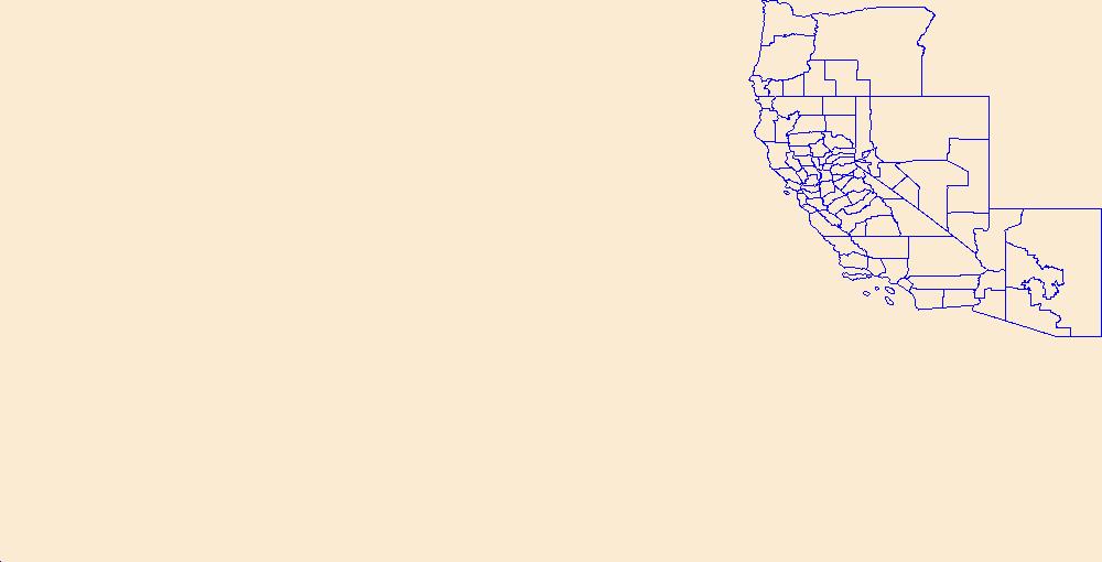
Geospatial data is comprised of government boundaries.
Tags: Alameda,
Alpine,
Amador,
Boundaries,
Butte, All tags...
CA,
Calaveras,
California,
Colusa,
Contra Costa,
County or Equivalent,
Del Norte,
Downloadable Data,
El Dorado,
Fresno,
GeoPackage,
Glenn,
Humboldt,
Imperial,
Incorporated Place,
Inyo,
Jurisdictional,
Kern,
Kings,
Lake,
Lassen,
Los Angeles,
Madera,
Marin,
Mariposa,
Mendocino,
Merced,
Minor Civil Division,
Modoc,
Mono,
Monterey,
Napa,
National Boundary Dataset (NBD),
National Boundary Dataset (NBD),
Native American Area,
Nevada,
Open Geospatial Consortium GeoPackage 1.2,
Orange,
PLSS First Division,
PLSS Special Survey,
PLSS Township,
Placer,
Plumas,
Public Land Survey System,
Reserve,
Riverside,
Sacramento,
San Benito,
San Bernardino,
San Diego,
San Francisco,
San Joaquin,
San Luis Obispo,
San Mateo,
Santa Barbara,
Santa Clara,
Santa Cruz,
Shasta,
Sierra,
Siskiyou,
Solano,
Sonoma,
Stanislaus,
State,
State,
State or Territory,
Sutter,
Tehama,
Trinity,
Tulare,
Tuolumne,
U.S. National Grid,
US,
Unincorporated Place,
United States,
Ventura,
Yolo,
Yuba,
boundaries,
boundary,
cadastral surveys,
geographic names,
land ownership,
land use maps,
legal land descriptions,
political and administrative boundaries,
zoning maps, Fewer tags
|
|

