Filters: Tags: landcover (X) > partyWithName: Conservation Biology Institute (X)
17 results (43ms)|
Filters
Date Range
Tag Schemes |

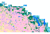
Digital Landcover Dataset for the Southwestern United States - Arizona/New Mexico Plateau eco-region
Multi-season satellite imagery (Landsat ETM+) from 1999-2001 were used in conjunction with digital elevation model (DEM) derived datasets (e.g. elevation, landform, aspect, etc.) to model natural and semi-natural vegetation. The minimum mapping unit for this dataset is approximately 1 acre. Landcover classes are drawn from NatureServe's Ecological System concept, with 109 of the 125 total classes mapped at the system level. For the majority of classes, a decision tree classifier was used to discriminate landcover types, while a minority of classes (e.g. urban classes, sand dunes, burn scars, etc.) were mapped using other techniques. Twenty mapping areas, each characterized by similar ecological and spectral characteristics,...
Tags: landcover,
vegetation cover
This dataset contains generalized landcover data for the Prairie Farm Rehabilitation Administration (PFRA) determined agricultural extent of Manitoba and Saskatchewan. This dataset was subset into two shapefiles. The other half of this dataset covers PFRA agricultural areas of Alberta and British Columbia. The Landcover Generalization process was undertaken to solve rendering problems of the original vectorized landcover data due to its unwieldy/overwhelming size. LANDSAT 7 imagery used in the process was collected during the WGTPP. This landcover imagery has a 30 meter resolution and is stored in over 1,100 vectorized 1:50,000 map sheet tiles. The data requires over seven gigabytes of disc space. If the user wishes...

CDF-FRAP compiled the "best available" land cover data into a single data layer, to support the various analyses required for the 2002 Forest and Range Assessment. Typically the most current and detailed data were collected for various regions of the state or for unique mapping efforts (farmland, wetlands, riparian vegetation). Decision rules were developed that controlled which layers were given priority in areas of overlap. Cross-walks were used to compile the various sources into the common California Wildlife Wabitat Relationships (CWHR) system classification. Data sources had unique scale/resolution, multi-source data provided as 100m GRID. The original 1/2002 data used to support the Asessment is also available...
Tags: landcover,
south coast

CDF-FRAP compiled the "best available" land cover data into a single data layer, to support the various analyses required for the 2002 Forest and Range Assessment. Typically the most current and detailed data were collected for various regions of the state or for unique mapping efforts (farmland, wetlands, riparian vegetation). Decision rules were developed that controlled which layers were given priority in areas of overlap. Cross-walks were used to compile the various sources into the common California Wildlife Wabitat Relationships (CWHR) system classification. Data sources had unique scale/resolution, multi-source data provided as 100m GRID. The original 1/2002 data used to support the Asessment is also available...
Tags: landcover,
sierra nevada

CDF-FRAP compiled the "best available" land cover data into a single data layer, to support the various analyses required for the 2002 Forest and Range Assessment. Typically the most current and detailed data were collected for various regions of the state or for unique mapping efforts (farmland, wetlands, riparian vegetation). Decision rules were developed that controlled which layers were given priority in areas of overlap. Cross-walks were used to compile the various sources into the common California Wildlife Wabitat Relationships (CWHR) system classification. Data sources had unique scale/resolution, multi-source data provided as 100m GRID. The original 1/2002 data used to support the Asessment is also available...

This dataset contains generalized landcover data for the Prairie Farm Rehabilitation Administration (PFRA) agricultural extent of Alberta and British Columbia. This dataset was subset into two shapefiles. The other half of this dataset covers PFRA agricultural areas of Manitoba and Saskatchewan. The Landcover Generalization process was undertaken to solve rendering problems of the original vectorized landcover data due to its unwieldy/overwhelming size. LANDSAT 7 imagery used in the process was collected during the WGTPP. This landcover imagery has a 30 meter resolution and is stored in over 1,100 vectorized 1:50,000 map sheet tiles. The data requires over seven gigabytes of disc space. If the user wishes to view...

CDF-FRAP compiled the "best available" land cover data into a single data layer, to support the various analyses required for the 2002 Forest and Range Assessment. Typically the most current and detailed data were collected for various regions of the state or for unique mapping efforts (farmland, wetlands, riparian vegetation). Decision rules were developed that controlled which layers were given priority in areas of overlap. Cross-walks were used to compile the various sources into the common California Wildlife Wabitat Relationships (CWHR) system classification. Data sources had unique scale/resolution, multi-source data provided as 100m GRID. The original 1/2002 data used to support the Asessment is also available...
Tags: landcover,
san joaquin

CDF-FRAP compiled the "best available" land cover data into a single data layer, to support the various analyses required for the 2002 Forest and Range Assessment. Typically the most current and detailed data were collected for various regions of the state or for unique mapping efforts (farmland, wetlands, riparian vegetation). Decision rules were developed that controlled which layers were given priority in areas of overlap. Cross-walks were used to compile the various sources into the common California Wildlife Wabitat Relationships (CWHR) system classification. Data sources had unique scale/resolution, multi-source data provided as 100m GRID. The original 1/2002 data used to support the Asessment is also available...
Tags: landcover,
north coast

Landuse/cover layer of Papagni river basin, the project area of Foundation for Ecological Security. Prepared by FES from three seasons satellite imageries of IRS 1C, 1998-99. http://www.fes.org.in Downloaded from India Biodiversity Portal on January 17th, 2013.

NatureServe and its natural heritage program members, have completed a working classification of terrestrial ecological systems in the conterminous United States, southern Alaska, and adjacent portions of Mexico and Canada. NatureServe has developed two, inter-related terrestrial classifications, the International Vegetation Classification (IVC), which provides a hierarchical ordering of vegetation around the globe, from broad formations or biomes to fine scale alliances and associations, and the International Terrestrial Ecological Systems Classification, which provides a single, mid-scale level unit suitable for classification and mapping of ecosystems at a scale relevant to many conservation and resource...
Tags: Natureserve,
landcover

CDF-FRAP compiled the "best available" land cover data into a single data layer, to support the various analyses required for the 2002 Forest and Range Assessment. Typically the most current and detailed data were collected for various regions of the state or for unique mapping efforts (farmland, wetlands, riparian vegetation). Decision rules were developed that controlled which layers were given priority in areas of overlap. Cross-walks were used to compile the various sources into the common California Wildlife Wabitat Relationships (CWHR) system classification. Data sources had unique scale/resolution, multi-source data provided as 100m GRID. The original 1/2002 data used to support the Asessment is also available...
Tags: central coast,
landcover

Multi-season satellite imagery (Landsat ETM+) from 1999-2001 were used in conjunction with digital elevation model (DEM) derived datasets (e.g. elevation, landform, aspect, etc.) to model natural and semi-natural vegetation. The minimum mapping unit for this dataset is approximately 1 acre. Landcover classes are drawn from NatureServe's Ecological System concept, with 109 of the 125 total classes mapped at the system level. For the majority of classes, a decision tree classifier was used to discriminate landcover types, while a minority of classes (e.g. urban classes, sand dunes, burn scars, etc.) were mapped using other techniques. Twenty mapping areas, each characterized by similar ecological and spectral characteristics,...
Tags: landcover,
vegetation cover

CDF-FRAP compiled the "best available" land cover data into a single data layer, to support the various analyses required for the 2002 Forest and Range Assessment. Typically the most current and detailed data were collected for various regions of the state or for unique mapping efforts (farmland, wetlands, riparian vegetation). Decision rules were developed that controlled which layers were given priority in areas of overlap. Cross-walks were used to compile the various sources into the common California Wildlife Wabitat Relationships (CWHR) system classification. Data sources had unique scale/resolution, multi-source data provided as 100m GRID. The original 1/2002 data used to support the Asessment is also available...
Tags: landcover,
sacramento

Multi-season satellite imagery (Landsat ETM+) from 1999-2001 were used in conjunction with digital elevation model (DEM) derived datasets (e.g. elevation, landform, aspect, etc.) to model natural and semi-natural vegetation. The minimum mapping unit for this dataset is approximately 1 acre. Landcover classes are drawn from NatureServe's Ecological System concept, with 109 of the 125 total classes mapped at the system level. For the majority of classes, a decision tree classifier was used to discriminate landcover types, while a minority of classes (e.g. urban classes, sand dunes, burn scars, etc.) were mapped using other techniques. Twenty mapping areas, each characterized by similar ecological and spectral characteristics,...
Tags: landcover,
vegetation cover

CDF-FRAP compiled the "best available" land cover data into a single data layer, to support the various analyses required for the 2002 Forest and Range Assessment. Typically the most current and detailed data were collected for various regions of the state or for unique mapping efforts (farmland, wetlands, riparian vegetation). Decision rules were developed that controlled which layers were given priority in areas of overlap. Cross-walks were used to compile the various sources into the common California Wildlife Wabitat Relationships (CWHR) system classification. Data sources had unique scale/resolution, multi-source data provided as 100m GRID. The original 1/2002 data used to support the Asessment is also available...

CDF-FRAP compiled the "best available" land cover data into a single data layer, to support the various analyses required for the 2002 Forest and Range Assessment. Typically the most current and detailed data were collected for various regions of the state or for unique mapping efforts (farmland, wetlands, riparian vegetation). Decision rules were developed that controlled which layers were given priority in areas of overlap. Cross-walks were used to compile the various sources into the common California Wildlife Wabitat Relationships (CWHR) system classification. Data sources had unique scale/resolution, multi-source data provided as 100m GRID. The original 1/2002 data used to support the Asessment is also available...

CDF-FRAP compiled the "best available" land cover data into a single data layer, to support the various analyses required for the 2002 Forest and Range Assessment. Typically the most current and detailed data were collected for various regions of the state or for unique mapping efforts (farmland, wetlands, riparian vegetation). Decision rules were developed that controlled which layers were given priority in areas of overlap. Cross-walks were used to compile the various sources into the common California Wildlife Wabitat Relationships (CWHR) system classification. Data sources had unique scale/resolution, multi-source data provided as 100m GRID. The original 1/2002 data used to support the Assessment is also available...
|

|
