Filters: Tags: lithology (X)
74 results (60ms)|
Filters
Date Range
Extensions Types
Contacts
Categories Tag Types
|

These digital maps are a reformulation of previously published maps, primarily maps of states. The reformulation gives all the maps the same structure and format, allowing them to be combined into regional maps. The associated data tables have information about age and lithology of the map units, also in a standard format.
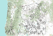
These digital maps are a reformulation of previously published maps, primarily maps of states. The reformulation gives all the maps the same structure and format, allowing them to be combined into regional maps. The associated data tables have information about age and lithology of the map units, also in a standard format.
Problem The New York City Department of Environmental Protection (NYCDEP) has asked the U.S. Geological Survey (USGS) to assist in two major studies: 1) delineation of the source(s) of shallow groundwater and the extent that the Delaware Aqueduct is contributing to local flooding issues, and 2) delineation of the structural, geologic, and hydrologic conditions along proposed tunnel construction paths using advanced surface and borehole geophysical methods. The NYCDEP needs to determine the source of groundwater and surface water and their possible relation to leakage from the Delaware Aqueduct in upstate New York. The Delaware Aqueduct, which supplies a significant portion of New York City's water supply, has...
Categories: Data,
Project;
Types: Downloadable,
Map Service,
OGC WFS Layer,
OGC WMS Layer,
Shapefile;
Tags: Borehole Geophysics,
Cooperative Water Program,
Delaware Aqueduct,
GW or SW,
GW or SW,
This data release codifies and attributes explanatory factors that could potentially impact groundwater quality at 142 groundwater sites (wells or developed springs) used for domestic water supply and 310 groundwater sites used for public water supply in the northern Sierra Nevada foothills. Water quality from domestic groundwater sites was assessed as part of the California State Water Resources Control Board’s Groundwater Ambient Monitoring and Assessment (GAMA) program in 2015-2017. Domestic groundwater sites from two of the U.S. Geological Survey’s Priority Basin Project Shallow Aquifer Assessment study units are attributed here: The Yuba-Bear Watersheds (YBW) study unit (sampled in 2015-2016) and the American-Cosumnes-Mokelumne...
The U.S. Geological Survey (USGS) entered into a cooperative study with the California Department of Water Resources and the Ramona Band of Cahuilla to characterize the hydrogeology of the Cahuilla Valley and Terwilliger Valley groundwater basins and surrounding water-bearing units, with the ultimate goal of developing a calibrated integrated hydrologic model to manage the groundwater supplies on a sustainable basis. A three-dimensional geologic framework model (GFM) was developed to quantify the structural geometry and distribution of water-bearing units in the groundwater basins, using borehole lithology and hydraulic information, geologic maps, and gravity-derived depth-to-basement information. This dataset includes...
Categories: Data;
Tags: Anza Valley,
Geologic framework,
Hydrology,
Lithology,
USGS Science Data Catalog (SDC),
The Missouri Geological Survey (MGS) mineral resource file collection is a one-of-a-kind collection, dating to the early 1900s, that contains unique geologic information not recorded elsewhere. Due to the historic nature of the collection the data it contains would be impossible to replicate today. These data are invaluable to present day geologic research, field and mine-related projects as well as engineering and construction projects. The files not only contain irreplaceable physical geologic information, but document the evolving geologic interpretations and nomenclature during a dynamic time in the science of geology. The files are scanned and have a subject inventory. The scans are available from the MGS in...
Variability in sediment properties with depth and the thickness of individual sedimentary layers are critical determinants of seabed acoustic response. The New England Mud Patch (NEMP), located south of Cape Cod, is an unusual feature on the U.S. Continental Shelf in that it is composed of fine-grained sediment layers containing a relatively-homogeneous mix of sand, silt, and clay-sized particles bounded by more typical sandy shelf sediments. The unique characteristics and nature of this deposit is due to a derivation of sediments that have been transported to, and deposited in, a basal bowl-shaped depression since the last glacial maximum. Ninety-two piston, vibra-, and gravity cores with a maximum length of 8.2...
This part of the data release contains the geospatial data collected by the USGS during the Pecos River salinity assessment. The data includes a feature class of the study area boundary and the Pecos River Basin boundary, the picks that were used to develop the depth to the base of the 16 geologic units, a feature class of springs, seeps and sinkholes compiled in the study area, a feature class of the USGS streamflow-gaging stations locations in the study area, a feature class of the locations of the saltwater disposal wells in the study area, and a feature class of areas of interest with respect to salinity. These digital data accompany Houston, N.A., Thomas, J.V., Ging, P.B., Teeple, A.P., Pedraza, D.E., and...
Types: Map Service,
OGC WFS Layer,
OGC WMS Layer,
OGC WMS Service;
Tags: Andrews County,
Avalon Lake,
Black River,
Blue Hole,
Brantley Lake,

These digital maps are a reformulation of previously published maps, primarily maps of states. The reformulation gives all the maps the same structure and format, allowing them to be combined into regional maps. The associated data tables have information about age and lithology of the map units, also in a standard format.

These digital maps are a reformulation of previously published maps, primarily maps of states. The reformulation gives all the maps the same structure and format, allowing them to be combined into regional maps. The associated data tables have information about age and lithology of the map units, also in a standard format.
Borehole log number, State Well Number, location, construction information, and any wells tests performed on select wells from the Anza basin, Anza, CA. Also includes a lithologic data for a sub-set of borehole logs identified based on best coverage and representation of data within the study area.
Categories: Data;
Tags: Anza Valley,
Stratigraphy,
USGS Science Data Catalog (SDC),
Water Resources,
lithology,
In 2022, Cold Steel Mechanical, contracted by the Idaho Department of Water Resources (IDWR), drilled and constructed twelve wells in Raft River Valley, Idaho. The wells were drilled using compressed air, dual rotary methods and were fully cased to completed depths. The U.S. Geological Survey (USGS) collected groundwater level and select geophysical data at each well between November 15th and 18th, 2022. Geophysical data were collected using Century™ multi-parameter logging probes and select logs are displayed in well log figures. Select geophysical logs include natural gamma, neutron, gamma-gamma density, specific conductance, and temperature. Geophysical data shown in well log figures were collected using the...
Categories: Data;
Types: Map Service,
OGC WFS Layer,
OGC WMS Layer,
OGC WMS Service;
Tags: 420522113191101,
420842113112201,
421329113205701,
421625113252901,
421818113050301,
The geology data set for this map includes arcs, polygons, and labels that outline and describe the general geologic age and type of bedrock of Iran. The geologic provinces data set includes arcs, polygons, and labels of geologic and petroleum provinces interpreted and designated by R.M. Pollastro from a number of literature and map resources to assist in the assessment of oil and gas resources for the USGS World Energy Project. The oil and gas field centerpoints data set is a point coverage that marks the approximate centerpoints of oil and gas fields in Iran. Political boundaries are provided to show the general location of country and/or other reference 'political' boundaries.
In response to the need and an intergovernmental commission for a high resolution and data-derived global ecosystem map, land surface elements of global ecological pattern were characterized in an ecophysiographic stratification of the planet. The stratification produced 3,923 terrestrial ecological land units (ELUs) at a base resolution of 250 meters. The ELUs were derived from data on land surface features in a three step approach. The first step involved acquiring or developing four global raster datalayers representing the primary components of ecosystem structure: bioclimate, landform, lithology, and land cover. These datasets generally represent the most accurate, current, globally comprehensive, and finest...
|

|
