Filters: Tags: mud (X)
233 results (49ms)|
Filters
Date Range
Types Contacts Categories Tag Types Tag Schemes |
This data set contains imagery from the National Agriculture Imagery Program (NAIP). The NAIP program is administered by USDA FSA and has been established to support two main FSA strategic goals centered on agricultural production. These are increase stewardship of America's natural resources while enhancing the environment, and to ensure commodities are procured and distributed effectively and efficiently to increase food security. The NAIP program supports these goals by acquiring and providing ortho imagery that has been collected during the agricultural growing season in the U.S. The NAIP ortho imagery is tailored to meet FSA requirements and is a fundamental tool used to support FSA farm and conservation programs....
This data set contains imagery from the National Agriculture Imagery Program (NAIP). The NAIP program is administered by USDA FSA and has been established to support two main FSA strategic goals centered on agricultural production. These are increase stewardship of America's natural resources while enhancing the environment, and to ensure commodities are procured and distributed effectively and efficiently to increase food security. The NAIP program supports these goals by acquiring and providing ortho imagery that has been collected during the agricultural growing season in the U.S. The NAIP ortho imagery is tailored to meet FSA requirements and is a fundamental tool used to support FSA farm and conservation programs....
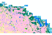
This dataset contains generalized landcover data for the Prairie Farm Rehabilitation Administration (PFRA) determined agricultural extent of Manitoba and Saskatchewan. This dataset was subset into two shapefiles. The other half of this dataset covers PFRA agricultural areas of Alberta and British Columbia. The Landcover Generalization process was undertaken to solve rendering problems of the original vectorized landcover data due to its unwieldy/overwhelming size. LANDSAT 7 imagery used in the process was collected during the WGTPP. This landcover imagery has a 30 meter resolution and is stored in over 1,100 vectorized 1:50,000 map sheet tiles. The data requires over seven gigabytes of disc space. If the user wishes...
Core Research Center, cutting AZ00008, from well operated by COLO OIL & GAS CORaw Properties from download, web scrape, MapServer, and Macrostrat API{"Lib Num": "AZ00008", "API Num": "5030510006", "Operator": "COLO OIL & GAS CO", "Well Name": "2 CORE HOLE", "Field": "EXPLORATORY", "State": "AK", "County": "YAKUTAT", "Thin Sec": "F", "Analysis": "T", "Latitude": "59.3712735223", "Longitude": "-139.3729762603", "coordinates_geohash": "bfscu2pwwr89", "Source": "FROM STATE RECORDS", "Min": "50", "Max": "5690", "Security Flag": null, "crc_collection_name": "cutting", "sb_parent_id": "4f4e49d8e4b07f02db5df2d2", "intervals": [{"Formation": null, "Age": null, "Min Depth": null, "Max Depth": null}], "crcwc_url": "https://my.usgs.gov/crcwc/cutting/report/157",...
Categories: Physical Item;
Tags: Quaternary,
Unconsolidated surficial deposits, undivided,
mud,
sand
Core Research Center, cutting DZ01387, from well operated by PETR INCRaw Properties from download, web scrape, MapServer, and Macrostrat API{"Lib Num": "DZ01387", "API Num": "4304720064", "Operator": "PETR INC", "Well Name": "1 SHELL-STATE", "Field": "NATURAL BUTTES ", "State": "UT", "County": "UINTAH", "Thin Sec": "F", "Analysis": "F", "Latitude": "40.08488", "Longitude": "-109.61726", "coordinates_geohash": "9x4h195pkenx", "Source": "FROM STATE RECORDS", "Min": "300", "Max": "5615", "Security Flag": null, "crc_collection_name": "cutting", "sb_parent_id": "4f4e49d8e4b07f02db5df2d2", "intervals": [{"Formation": null, "Age": null, "Min Depth": null, "Max Depth": null}], "crcwc_url": "https://my.usgs.gov/crcwc/cutting/report/31840",...
Core Research Center, cutting DZ12152, from well operated by TEXACO INCRaw Properties from download, web scrape, MapServer, and Macrostrat API{"Lib Num": "DZ12152", "API Num": "4304716199", "Operator": "TEXACO INC", "Well Name": "1 GOVT-F S PRICE", "Field": null, "State": "UT", "County": "UINTAH", "Thin Sec": "F", "Analysis": "F", "Latitude": "40.21842", "Longitude": "-109.20676", "coordinates_geohash": "9x4kfcw160cs", "Source": "FROM STATE RECORDS", "Min": "0", "Max": "5865", "Security Flag": null, "crc_collection_name": "cutting", "sb_parent_id": "4f4e49d8e4b07f02db5df2d2", "intervals": [{"Formation": null, "Age": null, "Min Depth": null, "Max Depth": null}], "crcwc_url": "https://my.usgs.gov/crcwc/cutting/report/35032",...
Core Research Center, cutting DZ16088, from well operated by CHEVRON OILRaw Properties from download, web scrape, MapServer, and Macrostrat API{"Lib Num": "DZ16088", "API Num": "4301330359", "Operator": "CHEVRON OIL", "Well Name": "1-15-B1 HELEN G GOLTHARP", "Field": null, "State": "UT", "County": "DUCHESNE", "Thin Sec": "F", "Analysis": "F", "Latitude": "40.31219", "Longitude": "-109.98514", "coordinates_geohash": "9x1v34x782zs", "Source": "FROM STATE RECORDS", "Min": "5000", "Max": "12500", "Security Flag": null, "crc_collection_name": "cutting", "sb_parent_id": "4f4e49d8e4b07f02db5df2d2", "intervals": [{"Formation": null, "Age": null, "Min Depth": null, "Max Depth": null}], "crcwc_url": "https://my.usgs.gov/crcwc/cutting/report/41401",...
Core Research Center, cutting CZ16408, from well operated by NATURAL GAS CORP. OF CARaw Properties from download, web scrape, MapServer, and Macrostrat API{"Lib Num": "CZ16408", "API Num": "4903722146", "Operator": "NATURAL GAS CORP. OF CA", "Well Name": "3-8 CHEROKEE HILL FED.", "Field": "WC", "State": "WY", "County": "SWEETWATER", "Thin Sec": "F", "Analysis": "F", "Latitude": "41.72116", "Longitude": "-107.6799", "coordinates_geohash": "9x7mmejgk7zj", "Source": "FROM STATE RECORDS", "Min": "5060", "Max": "11550", "Security Flag": null, "crc_collection_name": "cutting", "sb_parent_id": "4f4e49d8e4b07f02db5df2d2", "intervals": [{"Formation": null, "Age": null, "Min Depth": null, "Max Depth": null}], "crcwc_url":...
Core Research Center, cutting CZ14323, from well operated by CHEVRON USARaw Properties from download, web scrape, MapServer, and Macrostrat API{"Lib Num": "CZ14323", "API Num": "4904120231", "Operator": "CHEVRON USA", "Well Name": "24-30B PAINTER RESERVOIR", "Field": "PAINTER RESERVOIR", "State": "WY", "County": "UINTA", "Thin Sec": "F", "Analysis": "F", "Latitude": "41.33076", "Longitude": "-110.88115", "coordinates_geohash": "9x35hu4c1un4", "Source": "FROM STATE RECORDS", "Min": "840", "Max": "11250", "Security Flag": null, "crc_collection_name": "cutting", "sb_parent_id": "4f4e49d8e4b07f02db5df2d2", "intervals": [{"Formation": null, "Age": null, "Min Depth": null, "Max Depth": null}], "crcwc_url": "https://my.usgs.gov/crcwc/cutting/report/25854",...
Categories: Physical Item;
Tags: Upper part of the Wasatch Formation,
Wasatch Formation,
claystone,
conglomerate,
diamictite,
Core Research Center, cutting CZ15294, from well operated by CHEVRON USARaw Properties from download, web scrape, MapServer, and Macrostrat API{"Lib Num": "CZ15294", "API Num": "4904120276", "Operator": "CHEVRON USA", "Well Name": "23-6A PAINTER RESERVOIR", "Field": "PAINTER RESERVOIR", "State": "WY", "County": "UINTA", "Thin Sec": "F", "Analysis": "F", "Latitude": "41.30574", "Longitude": "-110.88356", "coordinates_geohash": "9x34uz3p3u10", "Source": "FROM STATE RECORDS", "Min": "1950", "Max": "12400", "Security Flag": null, "crc_collection_name": "cutting", "sb_parent_id": "4f4e49d8e4b07f02db5df2d2", "intervals": [{"Formation": null, "Age": null, "Min Depth": null, "Max Depth": null}], "crcwc_url": "https://my.usgs.gov/crcwc/cutting/report/27224",...
Categories: Physical Item;
Tags: Upper part of the Wasatch Formation,
Wasatch Formation,
claystone,
conglomerate,
diamictite,
Core Research Center, cutting CZ16490, from well operated by CHEVRON USARaw Properties from download, web scrape, MapServer, and Macrostrat API{"Lib Num": "CZ16490", "API Num": "4904120486", "Operator": "CHEVRON USA", "Well Name": "24-5A PAINTER RESERVOIR", "Field": "PAINTER RESERVOIR EAST", "State": "WY", "County": "UINTA", "Thin Sec": "F", "Analysis": "F", "Latitude": "41.30205", "Longitude": "-110.86093", "coordinates_geohash": "9x34vqc9ch5j", "Source": "FROM STATE RECORDS", "Min": "2520", "Max": "12750", "Security Flag": null, "crc_collection_name": "cutting", "sb_parent_id": "4f4e49d8e4b07f02db5df2d2", "intervals": [{"Formation": null, "Age": null, "Min Depth": null, "Max Depth": null}], "crcwc_url": "https://my.usgs.gov/crcwc/cutting/report/29665",...
Categories: Physical Item;
Tags: Upper part of the Wasatch Formation,
Wasatch Formation,
claystone,
conglomerate,
diamictite,
Core Research Center, core R382, from well operated by MALLON GEORGERaw Properties from download, web scrape, MapServer, and Macrostrat API{"Lib Num": "R382", "API Num": "4901520131", "Operator": "MALLON GEORGE", "Well Name": "30-16 HUNTER FEDERAL", "Field": "TORRINGTON", "State": "WY", "County": "GOSHEN", "Type": "SLABBED", "Photos": "T", "Thin Sec": "F", "Analysis": "T", "Latitude": "42.01934", "Longitude": "-104.23069", "coordinates_geohash": "9xmzh1ms2usq", "Source": "FROM STATE RECORDS", "Security Flag": "NO SPECIAL RESTRICTIONS", "crc_collection_name": "core", "sb_parent_id": "4f4e49dae4b07f02db5e0486", "intervals": [{"Formation": "DAKOTA J", "Age": "CRET", "Min Depth": "6890", "Max Depth": "6917"}], "crcwc_url":...
Core Research Center, cutting DZ03513, from well operated by CARTER OILRaw Properties from download, web scrape, MapServer, and Macrostrat API{"Lib Num": "DZ03513", "API Num": "4304715553", "Operator": "CARTER OIL", "Well Name": "1 RICHTMANN-FEDERAL", "Field": null, "State": "UT", "County": "UINTAH", "Thin Sec": "F", "Analysis": "F", "Latitude": "40.23393", "Longitude": "-109.34708", "coordinates_geohash": "9x4hzsrgsk5t", "Source": "FROM STATE RECORDS", "Min": "880", "Max": "5270", "Security Flag": null, "crc_collection_name": "cutting", "sb_parent_id": "4f4e49d8e4b07f02db5df2d2", "intervals": [{"Formation": null, "Age": null, "Min Depth": null, "Max Depth": null}], "crcwc_url": "https://my.usgs.gov/crcwc/cutting/report/33334",...
Core Research Center, cutting FC00953, from well operated by SHELL OILRaw Properties from download, web scrape, MapServer, and Macrostrat API{"Lib Num": "FC00953", "API Num": "4302711038", "Operator": "SHELL OIL", "Well Name": "1 SUNSET CANYON", "Field": null, "State": "UT", "County": "MILLARD", "Thin Sec": "F", "Analysis": "F", "Latitude": "38.87777", "Longitude": "-112.30381", "coordinates_geohash": "9wbjhmqz7t9g", "Source": "FROM STATE RECORDS", "Min": "40", "Max": "8962", "Security Flag": null, "crc_collection_name": "cutting", "sb_parent_id": "4f4e49d8e4b07f02db5df2d2", "intervals": [{"Formation": null, "Age": null, "Min Depth": null, "Max Depth": null}], "crcwc_url": "https://my.usgs.gov/crcwc/cutting/report/49685",...
Core Research Center, cutting CZ13271, from well operated by CHEVRON USARaw Properties from download, web scrape, MapServer, and Macrostrat API{"Lib Num": "CZ13271", "API Num": "4904120147", "Operator": "CHEVRON USA", "Well Name": "42-1D PAINTER RESERVOIR UNIT", "Field": "PAINTER RESERVOIR", "State": "WY", "County": "UINTA", "Thin Sec": "F", "Analysis": "F", "Latitude": "41.30978", "Longitude": "-110.89171", "coordinates_geohash": "9x35h85ngv5u", "Source": "FROM STATE RECORDS", "Min": "1500", "Max": "10450", "Security Flag": null, "crc_collection_name": "cutting", "sb_parent_id": "4f4e49d8e4b07f02db5df2d2", "intervals": [{"Formation": null, "Age": null, "Min Depth": null, "Max Depth": null}], "crcwc_url": "https://my.usgs.gov/crcwc/cutting/report/26373",...
Categories: Physical Item;
Tags: Upper part of the Wasatch Formation,
Wasatch Formation,
claystone,
conglomerate,
diamictite,
Core Research Center, cutting CZ13752, from well operated by PACIFIC TRANSMISSIONRaw Properties from download, web scrape, MapServer, and Macrostrat API{"Lib Num": "CZ13752", "API Num": "4903721361", "Operator": "PACIFIC TRANSMISSION", "Well Name": "1-8 FEDERAL", "Field": "WC", "State": "WY", "County": "SWEETWATER", "Thin Sec": "F", "Analysis": "F", "Latitude": "41.89589", "Longitude": "-107.82869", "coordinates_geohash": "9x7q66ct1rvn", "Source": "FROM STATE RECORDS", "Min": "1500", "Max": "13525", "Security Flag": null, "crc_collection_name": "cutting", "sb_parent_id": "4f4e49d8e4b07f02db5df2d2", "intervals": [{"Formation": null, "Age": null, "Min Depth": null, "Max Depth": null}], "crcwc_url": "https://my.usgs.gov/crcwc/cutting/report/25964",...
Core Research Center, cutting DZ18598, from well operated by GULF OILRaw Properties from download, web scrape, MapServer, and Macrostrat API{"Lib Num": "DZ18598", "API Num": "4304731066", "Operator": "GULF OIL", "Well Name": "2-20-3B COSTAS-FEDERAL", "Field": null, "State": "UT", "County": "UINTAH", "Thin Sec": "F", "Analysis": "F", "Latitude": "40.10673", "Longitude": "-109.57037", "coordinates_geohash": "9x4h4tjq9k67", "Source": "FROM STATE RECORDS", "Min": "65", "Max": "5320", "Security Flag": null, "crc_collection_name": "cutting", "sb_parent_id": "4f4e49d8e4b07f02db5df2d2", "intervals": [{"Formation": null, "Age": null, "Min Depth": null, "Max Depth": null}], "crcwc_url": "https://my.usgs.gov/crcwc/cutting/report/43307",...
Core Research Center, cutting DZ18236, from well operated by GULF OILRaw Properties from download, web scrape, MapServer, and Macrostrat API{"Lib Num": "DZ18236", "API Num": "4304730824", "Operator": "GULF OIL", "Well Name": "1-35 WONSITS VALLEY", "Field": null, "State": "UT", "County": "UINTAH", "Thin Sec": "F", "Analysis": "F", "Latitude": "40.11378", "Longitude": "-109.55108", "coordinates_geohash": "9x4h5n7rdyd4", "Source": "FROM STATE RECORDS", "Min": "80", "Max": "5390", "Security Flag": null, "crc_collection_name": "cutting", "sb_parent_id": "4f4e49d8e4b07f02db5df2d2", "intervals": [{"Formation": null, "Age": null, "Min Depth": null, "Max Depth": null}], "crcwc_url": "https://my.usgs.gov/crcwc/cutting/report/39763",...
Core Research Center, cutting DZ13688, from well operated by CHEVRON OIL CORaw Properties from download, web scrape, MapServer, and Macrostrat API{"Lib Num": "DZ13688", "API Num": "4304715308", "Operator": "CHEVRON OIL CO", "Well Name": "208 RED WASH UNIT-(32-22C)", "Field": null, "State": "UT", "County": "UINTAH", "Thin Sec": "F", "Analysis": "F", "Latitude": "40.1968", "Longitude": "-109.19715", "coordinates_geohash": "9x4kejt53fx7", "Source": "FROM STATE RECORDS", "Min": "2400", "Max": "5420", "Security Flag": null, "crc_collection_name": "cutting", "sb_parent_id": "4f4e49d8e4b07f02db5df2d2", "intervals": [{"Formation": null, "Age": null, "Min Depth": null, "Max Depth": null}], "crcwc_url": "https://my.usgs.gov/crcwc/cutting/report/38784",...
Core Research Center, cutting DZ18429, from well operated by ENERGY RESERVES GROUPRaw Properties from download, web scrape, MapServer, and Macrostrat API{"Lib Num": "DZ18429", "API Num": "4304730939", "Operator": "ENERGY RESERVES GROUP", "Well Name": "18 USA BROADHURST", "Field": null, "State": "UT", "County": "UINTAH", "Thin Sec": "F", "Analysis": "F", "Latitude": "40.22967", "Longitude": "-109.32923", "coordinates_geohash": "9x4kb5sfu613", "Source": "FROM STATE RECORDS", "Min": "2000", "Max": "5420", "Security Flag": null, "crc_collection_name": "cutting", "sb_parent_id": "4f4e49d8e4b07f02db5df2d2", "intervals": [{"Formation": null, "Age": null, "Min Depth": null, "Max Depth": null}], "crcwc_url": "https://my.usgs.gov/crcwc/cutting/report/42725",...
|

|
