Filters: Tags: national (X)
129 results (7ms)|
Filters
|

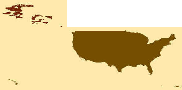
This map layer consists of federally owned or administered lands of the United States, Puerto Rico, and the U.S. Virgin Islands. For the most part, only areas of 320 acres or more are included; some smaller areas deemed to be important or significant are also included. There may be private inholdings within the boundaries of Federal lands in this map layer. Some established Federal lands which are larger than 320 acres are not included in this map layer, because their boundaries were not available from the owning or administering agency.

This map layer shows Indian lands of the United States. For the most part, only areas of 320 acres or more are included; some smaller areas deemed to be important or significant are also included. Federally-administered lands within a reservation are included for continuity; these may or may not be considered part of the reservation and are simply described with their feature type and the administrating Federal agency. Some established Indian lands which are larger than 320 acres are not included in this map layer because their boundaries were not available from the owning or administering agency.

The Geographic Names Information System (GNIS) is the Federal standard for geographic nomenclature. The U.S. Geological Survey developed the GNIS for the U.S. Board on Geographic Names, a Federal inter-agency body chartered by public law to maintain uniform feature name usage throughout the Government and to promulgate standard names to the public. The GNIS is the official repository of domestic geographic names data; the official vehicle for geographic names use by all departments of the Federal Government; and the source for applying geographic names to Federal electronic and printed products of all types.
Conclusions:Report synthesizes scientific, planning, and policy-related aspects on the importance of land conservation in areas producing water for potable uses, including watersheds and aquifers. One critical finding indicated that if there is more forest cover in a watershed, water treatment costs are lower.Thresholds/Learnings:For every 10% increase in forest cover in the source area, treatment and chemical costs decreased by about 20%, up to about 60% forest cover. Treatment costs level off when forest cover is between 70-100%.
Categories: Publication;
Types: Citation;
Tags: Land use configuration,
Natural cover amount,
United States,
forest cover,
multiple,
In 1998, the Florida Fish and Wildlife Conservation Commission's (FWC) Fisheries Independent Monitoring (FIM) program began a long-term monitoring effort of key reef fish populations in the Florida Keys National Marine Sanctuary. This effort was aimed at evaluating the relative abundance, size structure, and habitat utilization of specific reef fish species that are targeted by commercial and recreational fisheries.; Smith, S.G., et al. 2011, Multispecies survey design for assessing reef-fish stocks, spatially explicit management performance, and ecosystem condition. Fisheries Research 109(2011)25-41; Brandt, M.E., et. al. 2009, A Cooperative Multi-agency Reef Fish Monitoring Protocol for the Florida Keys Coral...
Categories: Data;
Types: NetCDF OPeNDAP Service;
Tags: Florida Keys National Marine Sanctuaries Reef Fish Monitoring,
array,
array-data,
basis,
basisOfRecord,
In an earlier article the author has argued that the turbulent history of nuclear power in Britain and the USA stems from the technology itself, and has little to do with the very different institutional arrangements made for the new technology in the two countries. Nuclear plant has various features which make its planning extraordinarily difficult. Its long lead time, large unit size, capital intensity and dependence on complex infrastructure combine to ensure that mistakes are likely to be made in planning the technology and that what mistakes do occur are expensive. This article aims to expand on the earlier one in two ways; by looking at the apparent success of the French nuclear programme which seems to run...
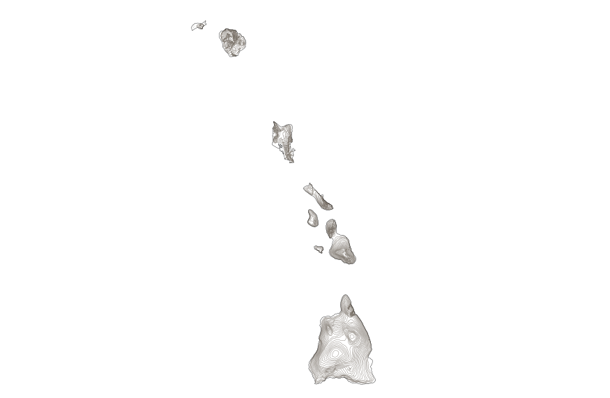
This map layer shows elevation contour lines for Hawaii. The map layer was derived from the 100-meter resolution elevation data set which is published by the National Atlas of the United States, and is in the same Albers Equal-area Conic projection as that source data set. Contour intervals match the steps used in the National Atlas Color-Sliced Elevation data sets. Contours were adjusted so that they are in the proper relationship to National Atlas 1:1,000,000-scale lakes, reservoirs, and wide (double-line) streams.
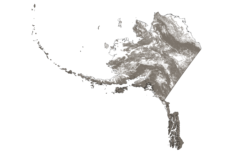
This map layer shows elevation contour lines for Alaska. The map layer was derived from the 100-meter resolution elevation data set which is published by the National Atlas of the United States, and is in the same Albers Equal-area Conic projection as that source data set. Contour intervals match the steps used in the National Atlas Color-Sliced Elevation data sets. Contours were adjusted so that they are in the proper relationship to National Atlas 1:1,000,000-scale lakes, reservoirs, and wide (double-line) streams.

Environmental Sensitivity Index (ESI) maps are an integral component in oil-spill contingency planning and assessment. They serve as a source of information in the event of an oil spill incident. ESI maps are a product of the Hazardous Materials Response Division of the Office of Response and Restoration (OR&R;). ESI maps contain three types of information: shoreline habitats (classified according to their sensitivity to oiling), human-use resources, and sensitive biological resources.
These data depict the National Hydrography Dataset Plus Version 2.1 (NHDPlusV2.1) flowline representation of the National Wild and Scenic Rivers System throughout the conterminous United States as of 2018. U.S. Forest Service geospatial data on National Wild and Scenic River segments (USFS WSR Segment) from 3/1/2016 were joined to the NHDPlusV2.1 to create the Wild and Scenic Rivers 2018 Linked to the NHDPlusV2.1 (wsr_nhdpv2.1) data. To ensure these data correctly represented the NHDPlusV2.1 flowline delineation of the National Wild and Scenic Rivers System, each wsr_nhdpv2.1 river segment was examined against the USFS WSR Segment data to check for duplication and/or omission of Wild and Scenic River segments. Spatial...
Categories: Data;
Types: Map Service,
OGC WFS Layer,
OGC WMS Layer,
OGC WMS Service;
Tags: Alabama,
Arizona,
Arkansas,
California,
Colorado,
In 1998, the Florida Fish and Wildlife Conservation Commission's (FWC) Fisheries Independent Monitoring (FIM) program began a long-term monitoring effort of key reef fish populations in the Florida Keys National Marine Sanctuary. This effort was aimed at evaluating the relative abundance, size structure, and habitat utilization of specific reef fish species that are targeted by commercial and recreational fisheries.; Smith, S.G., et al. 2011, Multispecies survey design for assessing reef-fish stocks, spatially explicit management performance, and ecosystem condition. Fisheries Research 109(2011)25-41; Brandt, M.E., et. al. 2009, A Cooperative Multi-agency Reef Fish Monitoring Protocol for the Florida Keys Coral...
Categories: Data;
Types: NetCDF OPeNDAP Service;
Tags: Florida Keys National Marine Sanctuaries Reef Fish Monitoring,
array,
array-data,
basis,
basisOfRecord,
These vector contour lines are derived from the 3D Elevation Program using automated and semi-automated processes. They were created to support 1:24,000-scale CONUS and Hawaii, 1:25,000-scale Alaska, and 1:20,000-scale Puerto Rico / US Virgin Island topographic map products, but are also published in this GIS vector format. Contour intervals are assigned by 7.5-minute quadrangle, so this vector dataset is not visually seamless across quadrangle boundaries. The vector lines have elevation attributes (in feet above mean sea level on NAVD88), but this dataset does not carry line symbols or annotation.
Layers of geospatial data include roads, airports, trails, and railroads.
The Sevilleta LTER supports a long-term, integrated, interdisciplinary research program addressing key hypotheses on pattern and process in aridland ecosystems. Sevilleta LTER research includes studies in desert grassland and shrubland communities, and riparian and mountain forests emphasizing pulse driven processes in space and time. Key drivers (e.g., climate, fire, water, resource availability) govern dynamics in each landscape component. Our focus on how biotic and abiotic drivers affect spatial and temporal dynamics of aridland ecosystems allows us to conduct long-term research that addresses important basic theories and yet has significant relevance to regional, national and international priorities. The...
Types: Map Service,
OGC WFS Layer,
OGC WMS Layer,
OGC WMS Service;
Tags: Chihuahuan Desert,
English,
GIS,
Madrean,
New Mexico,
The LANDFIRE Program developed a rich suite of consistent spatial data sets for the entire United States. These spatial data sets were designed for very large landscape, regional and national applications. Two of these spatial layers are particularly unique and interesting, Departure and Uncharacteristic Vegetation. Departure is a metric that indicates how different the current composition and structure of vegetation is from estimated historical conditions. This metric is identical to Fire Regime Condition Class (FRCC) in LANDFIRE (V1.0), and is generally called FRCC in the fire literature (link to FRCC in LANDFIRE). A departure value is computed for each unique historical vegetation type (called Biophysical...
Types: Map Service,
OGC WFS Layer,
OGC WMS Layer,
OGC WMS Service;
Tags: English,
GIS,
US,
fire,
invasive,
LandScope America—a collaborative project of NatureServe and the National Geographic Society—is a new online resource for the land-protection community and the public. By bringing together maps, data, photos, and stories about America’s natural places and open spaces, our goal is to inform and inspire conservation of our lands and waters.
Types: Map Service,
OGC WFS Layer,
OGC WMS Layer,
OGC WMS Service;
Tags: Chihuahuan Desert,
English,
GIS,
Mojave Desert,
Sonoran Desert,
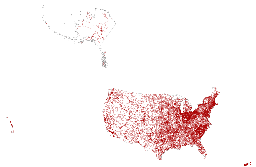
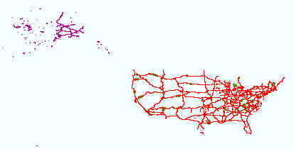
This map layer portrays the major roads in the United States, Puerto Rico, and the U.S. Virgin Islands. The file was produced by joining the individual State roads layers from the National Highway Planning Network (NHPN), Geographic Data Technology (GDT) Dynamap, and TIGER/Line files. This is a revised version of the July 2012 map layer.
This feature class includes monitoring data collected nationally to understand the status, condition, and trend of resources on BLM lands. Data are collected in accordance with the BLM Assessment, Inventory, and Monitoring (AIM) Strategy. The AIM Strategy specifies a probabilistic sampling design, standard core indicators and methods, electronic data capture and management, and integration with remote sensing. Attributes include the BLM aquatic core indicators: pH, conductivity, temperature, pool depth, length, frequency, streambed particles sizes, bank stability and cover, floodplain connectivity, large woody debris, macroinvertebrate biological integrity, ocular estimates of vegetative type, cover, and structure...
In 1998, the Florida Fish and Wildlife Conservation Commission's (FWC) Fisheries Independent Monitoring (FIM) program began a long-term monitoring effort of key reef fish populations in the Florida Keys National Marine Sanctuary. This effort was aimed at evaluating the relative abundance, size structure, and habitat utilization of specific reef fish species that are targeted by commercial and recreational fisheries.; Smith, S.G., et al. 2011, Multispecies survey design for assessing reef-fish stocks, spatially explicit management performance, and ecosystem condition. Fisheries Research 109(2011)25-41; Brandt, M.E., et. al. 2009, A Cooperative Multi-agency Reef Fish Monitoring Protocol for the Florida Keys Coral...
Categories: Data;
Types: NetCDF OPeNDAP Service;
Tags: Florida Keys National Marine Sanctuaries Reef Fish Monitoring,
array,
array-data,
basis,
basisOfRecord,
|

|
