Filters: Tags: necessity (X)
13 results (32ms)|
Filters
Date Range
Extensions Types Contacts
Categories Tag Types Tag Schemes |
This data set contains imagery from the National Agriculture Imagery Program (NAIP). The NAIP program is administered by USDA FSA and has been established to support two main FSA strategic goals centered on agricultural production. These are increase stewardship of America's natural resources while enhancing the environment, and to ensure commodities are procured and distributed effectively and efficiently to increase food security. The NAIP program supports these goals by acquiring and providing ortho imagery that has been collected during the agricultural growing season in the U.S. The NAIP ortho imagery is tailored to meet FSA requirements and is a fundamental tool used to support FSA farm and conservation programs....
The subject of ecological indicators is both complex and technical. Indicators are low signal/noise read-outs from systems reflecting deeply embedded processes. Informal, single factor indicators reflect superficial properties. Complex systems require formal, multifactorial measures. Conceptual basis, importance and bandwidth of variables, reliability and statistical properties, data and skill requirements, data quality and archiving, robustness under technology change, and cost/benefit issues are factors in indicator design. Network models enable formalism to be brought to the indicator problem. Networks are oriented in time-forward and reverse directions, giving rise to environs. Output environs span network flows...
Categories: Publication;
Types: Citation;
Tags: China,
DEA,
Environmental,
coal-fired,
disposability,
This data set contains imagery from the National Agriculture Imagery Program (NAIP). The NAIP program is administered by USDA FSA and has been established to support two main FSA strategic goals centered on agricultural production. These are increase stewardship of America's natural resources while enhancing the environment, and to ensure commodities are procured and distributed effectively and efficiently to increase food security. The NAIP program supports these goals by acquiring and providing ortho imagery that has been collected during the agricultural growing season in the U.S. The NAIP ortho imagery is tailored to meet FSA requirements and is a fundamental tool used to support FSA farm and conservation programs....
The uptake of nitrous oxide (N2O) occurs at the surface of the earth both in terrestrial and aquatic systems. This uptake is usually neglected in N2O budget studies. In this article, we discuss the likeliness of N2O uptake in different systems. These systems include soils as well as groundwater systems, riparian zones and surface waters. We address the possible consequences of ignoring surface sinks for N2O in global budgets as well as in national emission inventories. Our estimated surface sink is relatively small compared to the estimates of the present-day global emissions. Neglecting a possible surface sink of N2O may, therefore, not have major consequences for atmospheric budget studies on the global scale....
Categories: Publication;
Types: Citation;
Tags: China,
DEA,
Environmental,
coal-fired,
disposability,
What might be the energy demand and energy mix to reconcile the world’s pursuit of welfare and happiness with the necessity to preserve the integrity of the biosphere?
The uptake of nitrous oxide (N2O) occurs at the surface of the earth both in terrestrial and aquatic systems. This uptake is usually neglected in N2O budget studies. In this article, we discuss the likeliness of N2O uptake in different systems. These systems include soils as well as groundwater systems, riparian zones and surface waters. We address the possible consequences of ignoring surface sinks for N2O in global budgets as well as in national emission inventories. Our estimated surface sink is relatively small compared to the estimates of the present-day global emissions. Neglecting a possible surface sink of N2O may, therefore, not have major consequences for atmospheric budget studies on the global scale....
Categories: Publication;
Types: Citation;
Tags: China,
DEA,
Environmental,
coal-fired,
disposability,
Hydrates in nature have been known for a long time. In the last couple of decades the possibility of commercial utilization of natural hydrates has arisen as an alternative energy source. This paper asks 21 questions that, in the author’s opinion, need to be addressed and answered correctly before one can be confident one understands the scope of the problem one is facing in attempting to address the role of natural hydrates, both commercially and geologically.
Categories: Publication;
Types: Citation;
Tags: China,
DEA,
Environmental,
coal-fired,
disposability,
This data set contains imagery from the National Agriculture Imagery Program (NAIP). The NAIP program is administered by USDA FSA and has been established to support two main FSA strategic goals centered on agricultural production. These are increase stewardship of America's natural resources while enhancing the environment, and to ensure commodities are procured and distributed effectively and efficiently to increase food security. The NAIP program supports these goals by acquiring and providing ortho imagery that has been collected during the agricultural growing season in the U.S. The NAIP ortho imagery is tailored to meet FSA requirements and is a fundamental tool used to support FSA farm and conservation programs....
The uptake of nitrous oxide (N2O) occurs at the surface of the earth both in terrestrial and aquatic systems. This uptake is usually neglected in N2O budget studies. In this article, we discuss the likeliness of N2O uptake in different systems. These systems include soils as well as groundwater systems, riparian zones and surface waters. We address the possible consequences of ignoring surface sinks for N2O in global budgets as well as in national emission inventories. Our estimated surface sink is relatively small compared to the estimates of the present-day global emissions. Neglecting a possible surface sink of N2O may, therefore, not have major consequences for atmospheric budget studies on the global scale....
Categories: Publication;
Types: Citation;
Tags: China,
DEA,
Environmental,
coal-fired,
disposability,
Hydrates in nature have been known for a long time. In the last couple of decades the possibility of commercial utilization of natural hydrates has arisen as an alternative energy source. This paper asks 21 questions that, in the author’s opinion, need to be addressed and answered correctly before one can be confident one understands the scope of the problem one is facing in attempting to address the role of natural hydrates, both commercially and geologically.
Categories: Publication;
Types: Citation;
Tags: China,
DEA,
Environmental,
coal-fired,
disposability,
The uptake of nitrous oxide (N2O) occurs at the surface of the earth both in terrestrial and aquatic systems. This uptake is usually neglected in N2O budget studies. In this article, we discuss the likeliness of N2O uptake in different systems. These systems include soils as well as groundwater systems, riparian zones and surface waters. We address the possible consequences of ignoring surface sinks for N2O in global budgets as well as in national emission inventories. Our estimated surface sink is relatively small compared to the estimates of the present-day global emissions. Neglecting a possible surface sink of N2O may, therefore, not have major consequences for atmospheric budget studies on the global scale....
Categories: Publication;
Types: Citation;
Tags: China,
DEA,
Environmental,
coal-fired,
disposability,
This data set contains imagery from the National Agriculture Imagery Program (NAIP). The NAIP program is administered by USDA FSA and has been established to support two main FSA strategic goals centered on agricultural production. These are increase stewardship of America's natural resources while enhancing the environment, and to ensure commodities are procured and distributed effectively and efficiently to increase food security. The NAIP program supports these goals by acquiring and providing ortho imagery that has been collected during the agricultural growing season in the U.S. The NAIP ortho imagery is tailored to meet FSA requirements and is a fundamental tool used to support FSA farm and conservation programs....
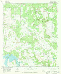
USGS Historical Quadrangle in GeoPDF.
|

|
