Filters: Tags: newfoundland (X)
34 results (52ms)|
Filters
Date Range
Extensions Types
Contacts
Categories Tag Types
|
This data set contains imagery from the National Agriculture Imagery Program (NAIP). The NAIP program is administered by USDA FSA and has been established to support two main FSA strategic goals centered on agricultural production. These are, increase stewardship of America's natural resources while enhancing the environment, and to ensure commodities are procured and distributed effectively and efficiently to increase food security. The NAIP program supports these goals by acquiring and providing ortho imagery that has been collected during the agricultural growing season in the U.S. The NAIP ortho imagery is tailored to meet FSA requirements and is a fundamental tool used to support FSA farm and conservation programs....
This data set contains imagery from the National Agriculture Imagery Program (NAIP). The NAIP program is administered by USDA FSA and has been established to support two main FSA strategic goals centered on agricultural production. These are, increase stewardship of America's natural resources while enhancing the environment, and to ensure commodities are procured and distributed effectively and efficiently to increase food security. The NAIP program supports these goals by acquiring and providing ortho imagery that has been collected during the agricultural growing season in the U.S. The NAIP ortho imagery is tailored to meet FSA requirements and is a fundamental tool used to support FSA farm and conservation programs....
This data set contains imagery from the National Agriculture Imagery Program (NAIP). The NAIP program is administered by USDA FSA and has been established to support two main FSA strategic goals centered on agricultural production. These are, increase stewardship of America's natural resources while enhancing the environment, and to ensure commodities are procured and distributed effectively and efficiently to increase food security. The NAIP program supports these goals by acquiring and providing ortho imagery that has been collected during the agricultural growing season in the U.S. The NAIP ortho imagery is tailored to meet FSA requirements and is a fundamental tool used to support FSA farm and conservation programs....
Falls on Manuel's Brook. Conception Bay, Newfoundland. Panorama. 1888.
Categories: Image;
Types: Map Service,
OGC WFS Layer,
OGC WMS Layer,
OGC WMS Service;
Tags: Newfoundland,
Photographers,
Walcott, C.D. Collection,
panorama,
photo print

The NRN product is distributed in the form of thirteen provincial or territorial datasets and consists of two linear entities (Road Segment and Ferry Connection Segment) and three punctual entities (Junction, Blocked Passage, Toll Point) with which is associated a series of descriptive attributes such as, among others: First House Number, Last House Number, Street Name Body, Place Name, Functional Road Class, Pavement Status, Number Of Lanes, Structure Type, Route Number, Route Name, and Exit Number. This dataset contains road segment vectors within Newfoundland and Labrador province. The development of the NRN was realized by means of individual meetings and national workshops with interested data providers from...
This data set contains imagery from the National Agriculture Imagery Program (NAIP). The NAIP program is administered by USDA FSA and has been established to support two main FSA strategic goals centered on agricultural production. These are, increase stewardship of America's natural resources while enhancing the environment, and to ensure commodities are procured and distributed effectively and efficiently to increase food security. The NAIP program supports these goals by acquiring and providing ortho imagery that has been collected during the agricultural growing season in the U.S. The NAIP ortho imagery is tailored to meet FSA requirements and is a fundamental tool used to support FSA farm and conservation programs....
Overview This directory was developed to provide discovery information for anyone looking for publicly accessible repositories that house geological materials in the U.S. and Canada. In addition, this resource is intended to be a tool to facilitate a community of practice. The need for the directory was identified during planning for and follow-up from a drill core repository webinar series in Spring 2020 for public repository curators and staff in the U.S. and Canada hosted by the Minnesota Geological Survey and the Minnesota Department of Natural Resources. Additional supporting sponsors included the U.S. Geological Survey National Geological and Geophysical Data Preservation Program and the Association of American...
Categories: Data;
Types: Downloadable,
Map Service,
OGC WFS Layer,
OGC WMS Layer,
Shapefile;
Tags: Alabama,
Alaska,
Alberta,
Arkansas,
British Columbia,
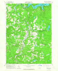
USGS Historical Quadrangle in GeoPDF.
Conception Bay, Newfoundland. Panorama. 1888.
Categories: Image;
Types: Map Service,
OGC WFS Layer,
OGC WMS Layer,
OGC WMS Service;
Tags: Newfoundland,
Photographers,
Walcott, C.D. Collection,
photo print
This data set contains imagery from the National Agriculture Imagery Program (NAIP). The NAIP program is administered by USDA FSA and has been established to support two main FSA strategic goals centered on agricultural production. These are, increase stewardship of America's natural resources while enhancing the environment, and to ensure commodities are procured and distributed effectively and efficiently to increase food security. The NAIP program supports these goals by acquiring and providing ortho imagery that has been collected during the agricultural growing season in the U.S. The NAIP ortho imagery is tailored to meet FSA requirements and is a fundamental tool used to support FSA farm and conservation programs....
Conception Bay, Newfoundland. Panorama. 1888.
USGS Historical Quadrangle in GeoPDF.
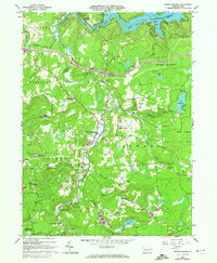
USGS Historical Quadrangle in GeoPDF.
THIS IS A HISTORICAL RECORD. As of December 17, 2021, the BISON application will no longer be available online and has been replaced by https://www.gbif.us. The BISON APIs are still available at https://bison.usgs.gov/#api and the Integrated Publishing Toolkit is still available at https://bison.usgs.gov/ipt. The USGS Biodiversity Information Serving Our Nation (BISON) project is an online all-species mapping information system consisting of a large collection of species occurrence datasets (e.g., plants and animals) found in the United States, U.S. Territories, U.S. marine Exclusive Economic Zones (EEZ), and Canada, with relevant geospatial layers. Species occurrences are records of organisms at a particular...
Currie roofing-slate quarries, Smith Sound, Trinity Bay. Newfoundland, Canada. 1899.
Categories: Image;
Tags: Canada,
Mills, Mines, Quarries,
Newfoundland,
Photographers,
Walcott, C.D. Collection,

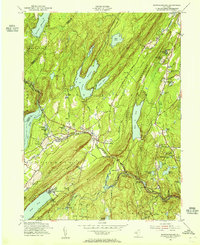
USGS Historical Quadrangle in GeoPDF.
Currie roofing-slate quarries, Smith Sound, Trinity Bay. Newfoundland, Canada. 1899.
This data set contains imagery from the National Agriculture Imagery Program (NAIP). The NAIP program is administered by USDA FSA and has been established to support two main FSA strategic goals centered on agricultural production. These are, increase stewardship of America's natural resources while enhancing the environment, and to ensure commodities are procured and distributed effectively and efficiently to increase food security. The NAIP program supports these goals by acquiring and providing ortho imagery that has been collected during the agricultural growing season in the U.S. The NAIP ortho imagery is tailored to meet FSA requirements and is a fundamental tool used to support FSA farm and conservation programs....
USGS Historical Quadrangle in GeoPDF.

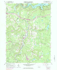
USGS Historical Quadrangle in GeoPDF.
|

|
