Filters: Tags: northwest forest plan (X)
10 results (19ms)|
Filters
Date Range
Extensions Types
Contacts
Categories Tag Types
|

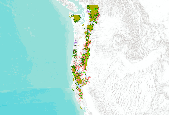
Map showing management direction (land use allocations) and land designations (wilderness, ACEC's, etc) on BLM and Forest Service managed lands.
Natural resource managers are confronted with the pressing challenge to develop conservation plans that address complex ecological and societal needs against the backdrop of a rapidly changing climate. Climate change vulnerability assessments (CCVAs) provide valuable information that helps guide management and conservation actions in this regard. An essential component to CCVAs is understanding adaptive capacity, or the ability of a species to cope with or adjust to climate change. However, adaptive capacity is the least understood and evaluated component of CCVAs. This is largely due to a fundamental need for guidance on how to assess adaptive capacity and incorporate this information into conservation planning...
Categories: Project;
Types: Map Service,
OGC WFS Layer,
OGC WMS Layer,
OGC WMS Service;
Tags: 2019,
Birds,
Birds,
CASC,
Data Visualization & Tools,

This dataset represents areas in Oregon (USA) with potential high suitability for northern spotted owls. This dataset is not intended to accurately characterize high-quality northern spotted owl habitat, but instead serves as a means of distilling the more complex information depicted in the northern spotted owl habitat suitability layers published by the Northwest Forest Plan (NFP) - Interagency Regional Monitoring Program (Lint 2005) used to create this dataset. The Conservation Biology Institute (CBI) developed this layer through a series of post-processing steps. Areas of high suitability (90-100%) were identified in the NFP habitat suitability layer. These areas were then filtered and smoothed using a 125 meter...
Northwest Forest Plan (NWFP) Physiographic provinces for the Western Oregon Plan Revision (WOPR) project.BLM: (Bureau of Land Management) WOPR: (Western Oregon Plan Revision) LUP: (Land Use Planning) PRMP: (Proposed Resource Management Plan) PHYPRO: (Physiographic Provinces) NWFP: (Northwest Forest Plan)
This theme shows the Key Watersheds that are located on BLM lands and adjacent Forest Service Lands, as identified during the Forest Ecosystem Management Assessment effort (Northwest Forest Plan - Record of Decision 1994). The initial mapping done in 1994 was a very generalized representation and was done prior to the development of the interagency standard 5th and 6th field watershed boundaries. The line work has been made coincident with the 5th and 6th field watershed lines where the Key Watershed Boundaries clearly intended to use a watershed as the boundary. District personnel have reviewed these edits to conform to the 5th and 6th field boundaries and have incorporated other edits to follow operationally identifiable...
Categories: Data;
Types: Downloadable,
Map Service,
OGC WFS Layer,
OGC WMS Layer,
Shapefile;
Tags: Conservation Priority Area,
Effects of changes in hydrologic regimes on anadromous fish,
Effects of hydrologic regime shifts on rivers, streams, and riparian corridors,
Forest Service Land,
Key Watersheds,
The rasters 22 classes of forest vegetation from potential forest (value 1) through large multistory conifer (value 22) plus water, barren lands, etc. at 25 meter resolution. Source data was Interagency Vegetation Mapping Project (IVMP) coverages for quadratic mean diameter (QMD), stand structure, and conifer vegetation from Landsat TM ca. 1996. Accuracy Assessment not valid for land areas smaller than physiographic province. Mapped by the Regional Interagency Effectiveness Monitoring Program, NW Forest Plan, R6/PNW in 2005. LANDSAT TM ca. 1996; IVMP quadratic mean diameter, species, canopy structure
Categories: Data;
Types: Downloadable,
Map Service,
OGC WFS Layer,
OGC WMS Layer,
Shapefile;
Tags: Effects of change in air temperature and precipitation on Forests,
Forest Service,
Land Cover,
Late Successional,
NPLCC,
NWFP-20 - Northwest Forest Plan Effectiveness Monitoring (20-Year Report)Estimated completion June 2015This project is a continuation of research completed for the 15-year Report for NWFP Effectiveness Monitoring. We are continuing to develop and refine modeling techniques and data, to provide improved multi-date GNN maps of forest vegetation and older forest. Key improvements to GNN modeling to be implemented in this project are: (1) addition of more inventory plots, with yearly matching of plots to LandTrendr imagery for model development; (2) incorporation of measures of disturbance history, derived from LandTrendr algorithms, as spatial predictors; (3) improved GNN outlier analysis using TimeSync; and (4) additional...
Categories: Data;
Types: Downloadable,
Map Service,
OGC WFS Layer,
OGC WMS Layer,
Shapefile;
Tags: BLM,
Bureau of Land Management,
CA,
CLAMS,
CMONster,
The Aquatic and Riparian Effectiveness Monitoring Plan (AREMP) characterizes the ecological condition of watersheds and aquatic ecosystems to answer the core question: “Are the Northwest Forest Plan (NWFP) and the BLM Western Oregon Resource Management Plans maintaining and restoring the conditions of aquatic and riparian ecosystems on federal lands in the Forest Plan area?” AREMP determines the status and trend of inchannel and upslope-riparian watershed condition for sixth-field watersheds (HUC12) within the NWFP area. Upslope and riparian condition are based on mapped data (e.g. road density, vegetation) for all watersheds with ≥5% federal ownership. Inchannel condition is based on stream data (e.g. substrate,...

This dataset represents projected survey and manage species probability of occupancy for the climate of 2011-2040, averaged from the occurrence probabilities of 130 survey and manage species. The survey and manage species are rare localized species of concern under the Northwest Forest plan, consisting of 75 species of fungi, 21 species of lichen, 10 species of bryophytes, 8 species of vascular plants, 12 species of mollusks, 2 species of amphibians, one mammal, and one bird. Climate data were drawn from three representative climate projections: lowest warming (GCM GISS_ER with IPCC storyline B1), moderate warming (GCM ECHAM5 SRES with storyline A2), and highest warming (GCM IPSL_CM4 with storyline A2). In Carroll...
This dataset depicts the land allocations created by the Northwest Forest Plan Record of Decision (NwFP). It includes land allocations identified in the Northwest Forest Plan. This is an interagency product and should be regarded as the main dataset for these land allocations. The Northwest Forest Plan encompasses 24 million acres of federal land managed by the Forest Service, Bureau of Land Management, and National Park Service in western Washington, Oregon, and northwest California within the range of the northern spotted owl. The Plan's objectives are threefold: * Protecting and enhancing habitat for mature and old-growth forests and related species. * Restoring and maintaining the ecological integrity of watersheds...
|

|
