Filters: Tags: norway (X)
55 results (46ms)|
Filters
Date Range
Extensions Types Contacts
Categories Tag Types
|
This data set contains imagery from the National Agriculture Imagery Program (NAIP). The NAIP program is administered by USDA FSA and has been established to support two main FSA strategic goals centered on agricultural production. These are, increase stewardship of America's natural resources while enhancing the environment, and to ensure commodities are procured and distributed effectively and efficiently to increase food security. The NAIP program supports these goals by acquiring and providing ortho imagery that has been collected during the agricultural growing season in the U.S. The NAIP ortho imagery is tailored to meet FSA requirements and is a fundamental tool used to support FSA farm and conservation programs....

Boreal rain forests of Norway. This layer was created by hand digitizing an image provided by Holien Håkon who recieved it from Geir Gaarder. The layer was created for the book: DellaSala, DA editor. 2010. Temperate and Boreal Rainforests of the World. Island Press, Washington DC. 336 pp. http://www.islandpress.org/dellasala/
Tags: boreal rain forest,
norway
The Critical Minerals in Archived Mine Samples Database (CMDB) contains chemistry and geologic information for historic ore and ore-related rock samples from mineral deposits in the United States. In addition, the database contains samples from archetypal deposits from 27 other countries in North America, South America, Asia, Africa and Europe. Samples were obtained from archived ore collections under the U.S. Geological Survey's project titled "Quick Assessment of Rare and Critical Metals in Ore Deposits: A National Assessment" (2008 to 2013) in an effort to begin an assessment of the Nations' previously mined ore deposits for critical minerals. Mineralized and altered rock samples were provided by the Colorado...
Categories: Data;
Types: ArcGIS REST Map Service,
ArcGIS Service Definition,
Downloadable,
Map Service,
OGC WFS Layer,
OGC WMS Layer,
Shapefile;
Tags: Alaska,
Argentina,
Arizona,
Arkansas,
Australia,
This coverage includes arcs, polygons and polygon labels that describe U.S. Geological Survey defined geologic provinces of Europe including Turkey. (Albania, Andorra, Austria, Belgium, Bosnia and Herzegovina, Bulgaria, Croatia, Cyprus, Czech Republic, Denmark, Finland, France, Germany, Greece, Hungary, Iceland, Ireland, Italy, Liechtenstein, Luxembourg, The Former Yugoslav Republic of Macedonia, Malta, Monaco, Netherlands, Norway, Poland, Portugal, Romania, San Marino, Serbia and Montenegro, Slovakia, Slovenia, Spain, Sweden, Switzerland, Turkey, United Kingdom and Vatican City.) Each province has a set of geologic characteristics distinguishing it from surrounding provinces. These characteristics may include the...
Categories: Data,
pre-SM502.8;
Types: Downloadable,
Map Service,
OGC WFS Layer,
OGC WMS Layer,
Shapefile;
Tags: AL,
AN,
AU,
Adana/Sivas, Province 2079,
Adriatic Basin, Province 4058,
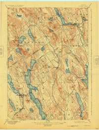
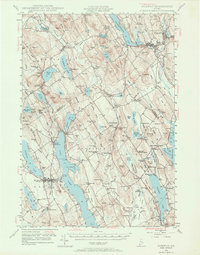
USGS Historical Quadrangle in GeoPDF.

USGS Historical Quadrangle in GeoPDF.
USGS Historical Quadrangle in GeoPDF.

Uncertain and isolated areas of Boreal rain forests of Norway. This layer was created by hand digitizing an image provided by Holien Håkon who recieved it from Geir Gaarder. The layer was created for the book: DellaSala, DA editor. 2010. Temperate and Boreal Rainforests of the World. Island Press, Washington DC. 336 pp. http://www.islandpress.org/dellasala/
Tags: boreal rain forest,
norway
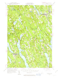
USGS Historical Quadrangle in GeoPDF.
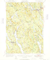
USGS Historical Quadrangle in GeoPDF.

USGS Historical Quadrangle in GeoPDF.
USGS Historical Quadrangle in GeoPDF.
This dataset provides demographic information for the Svalbard population of pink-footed geese from 1991 to 2018. Any use of trade, firm, or product names is for descriptive purposes only and does not imply endorsement by the U.S. Government.
This coverage includes arcs, polygons, and polygon labels that describe the generalized geologic age of surface outcrops of bedrock of Svalbard. It also includes shorelines.

GTOPO30 is a global digital elevation model (DEM) resulting from a collaborative effort led by the staff at the U.S. Geological Survey's EROS Data Center in Sioux Falls, South Dakota. The name GTOPO30 is derived from the fact that elevations in GTOPO30 are regularly spaced at 30-arc seconds (approximately 1 kilometer). GTOPO30 was developed to meet the needs of the geospatial data user community for regional and continental scale topographic data. This release represents the completion of global coverage of 30-arc second elevation data that have been available from the EROS Data Center beginning in 1993. Several areas have been updated and the entire global data set has been repackaged, so these data supersede...
In 1990 a sovereign wealth fund was founded in Norway in which the country invests surpluses from oil and gas industry sales. The fund is designed to secure the state's ability to act in a post-petroleum era. At the end of the 1990's the voice of Norwegian civil society insisted that the sovereign wealth fund should not only ensure intergenerational justice, but should also contribute to the implementation of values and norms of the present country. At the end of 2004 the parliament finally agreed upon ethical regulations for the investment of the sovereign wealth fund. Now the second largest sovereign wealth fund in the world only invests in businesses that adhere to those ethical regulations. In the present paper,...
Categories: Publication;
Types: Citation;
Tags: Case study,
Climate protection policy,
Diffusion of policy innovations,
Ethical investment,
Norway,
This database is the result of an extensive literature search aimed at identifying documents relevant to the emerging field of dam removal science. In total the database contains 296 citations that contain empirical monitoring information associated with 207 different dam removals across the United States and abroad. Data includes publications through 2020 and supplemented with the U.S. Army Corps of Engineers National Inventory of Dams database, U.S. Geological Survey National Water Information System and aerial photos to estimate locations when coordinates were not provided. Publications were located using the Web of Science, Google Scholar, and Clearinghouse for Dam Removal Information.
Categories: Data;
Types: Map Service,
OGC WFS Layer,
OGC WMS Layer,
OGC WMS Service;
Tags: Australia,
Austria,
Canada,
Connectivity,
Dam Removal,
USGS Historical Quadrangle in GeoPDF.
This data set contains imagery from the National Agriculture Imagery Program (NAIP). The NAIP program is administered by USDA FSA and has been established to support two main FSA strategic goals centered on agricultural production. These are, increase stewardship of America's natural resources while enhancing the environment, and to ensure commodities are procured and distributed effectively and efficiently to increase food security. The NAIP program supports these goals by acquiring and providing ortho imagery that has been collected during the agricultural growing season in the U.S. The NAIP ortho imagery is tailored to meet FSA requirements and is a fundamental tool used to support FSA farm and conservation programs....
This data set contains imagery from the National Agriculture Imagery Program (NAIP). The NAIP program is administered by USDA FSA and has been established to support two main FSA strategic goals centered on agricultural production. These are, increase stewardship of America's natural resources while enhancing the environment, and to ensure commodities are procured and distributed effectively and efficiently to increase food security. The NAIP program supports these goals by acquiring and providing ortho imagery that has been collected during the agricultural growing season in the U.S. The NAIP ortho imagery is tailored to meet FSA requirements and is a fundamental tool used to support FSA farm and conservation programs....
|

|
