Filters: Tags: np lcc (X) > partyWithName: Conservation Biology Institute (X)
72 results (9ms)|
Filters
|
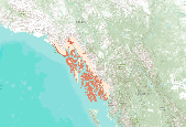
This dataset represents the soil pH from SSURGO and STATSGO soil descriptions for soil map units in the state of southern Alaska that lie within the North Pacific Landscape Conservation Cooperative.

This dataset represents the soil temperature regimes from SSURGO and STATSGO soil descriptions for soil map units in the state of southern Alaska (b) that lie within the North Pacific Landscape Conservation Cooperative. Definition.—“Soil temperature” is the mean monthly soil temperature at the specified depth (the average of the daily high and daily low temperature for the month). Significance.—Soil temperature is important to many biological and physical processes that occur in the soil. Plant germination and growth are closely related to soil temperature. Cold soil temperatures effectively create a thermal pan in the soil. Roots cannot uptake moisture or nutrients below the threshold temperatures specific to...

This dataset respresents the soils with high volcanic content (pumice or volcanic glass) in the North Pacific Landscape Conservation Cooperative.
This dataset represents the soil water storage capacity (AWS in mm at 0.25 m depth) from SSURGO and STATSGO soil descriptions for soil map units in the state of southern Alaska that lie within the North Pacific Landscape Conservation Cooperative. Available Water Storage 0-25 cm - Weighted Average (centimeters). Available water storage (AWS). The volume of water that the soil, to a depth of 25 centimeters, can store that is available to plants. It is reported as the weighted average of all components in the map unit, and is expressed as centimeters of water. AWS is calculated from AWC (available water capacity) which is commonly estimated as the difference between the water contents at 1/10 or 1/3 bar (field capacity)...

This dataset represents the soil water storage capacity (AWS in mm at 0.5 m depth) from SSURGO and STATSGO soil descriptions for soil map units in the state of southern Alaska that lie within the North Pacific Landscape Conservation Cooperative. Available Water Storage 0-50 cm - Weighted Average (centimeters). Available water storage (AWS). The volume of water that the soil, to a depth of 50 centimeters, can store that is available to plants. It is reported as the weighted average of all components in the map unit, and is expressed as centimeters of water. AWS is calculated from AWC (available water capacity) which is commonly estimated as the difference between the water contents at 1/10 or 1/3 bar (field capacity)...
This dataset represents the soil texture from SSURGO and STATSGO soil descriptions for soil map units in the state of western Oregon that lie within the North Pacific Landscape Conservation Cooperative. Soil texture is the mineral particle size distribution of soil particles within a soil horizon. This dataset also documents rock fragments and organic matter that may contribute to water infiltration, storage and relocation within the surface horizons of the soil profile. For reference, see NRCS soil texture triangle: http://soils.usda.gov/technical/aids/investigations/texture/
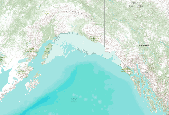
This dataset represents the soil order from SSURGO and STATSGO soil descriptions for soil map units in the state of southern Alaska (b) that lie within the North Pacific Landscape Conservation Cooperative.

This dataset represents the soil water storage capacity (AWS in mm at 0.5 m depth) from SSURGO and STATSGO soil descriptions for soil map units in the state of northern California that lie within the North Pacific Landscape Conservation Cooperative. Available Water Storage 0-50 cm - Weighted Average (centimeters). Available water storage (AWS). The volume of water that the soil, to a depth of 50 centimeters, can store that is available to plants. It is reported as the weighted average of all components in the map unit, and is expressed as centimeters of water. AWS is calculated from AWC (available water capacity) which is commonly estimated as the difference between the water contents at 1/10 or 1/3 bar (field...

This dataset respresents the soils with high iron content in the North Pacific Landscape Conservation Cooperative.

This dataset represents the soils with high smectite (high activity clays) concentrations content in the North Pacific Landscape Conservation Cooperative.

This dataset represents the soil order from SSURGO and STATSGO soil descriptions for soil map units in the state of western Oregon that lie within the North Pacific Landscape Conservation Cooperative.

This dataset represents the soil order from SSURGO and STATSGO soil descriptions for soil map units in the state of southern Alaska (b) that lie within the North Pacific Landscape Conservation Cooperative.

This dataset represents the soil temperature regimes from SSURGO and STATSGO soil descriptions for soil map units in the state of northern California that lie within the North Pacific Landscape Conservation Cooperative. Definition.—“Soil temperature” is the mean monthly soil temperature at the specified depth (the average of the daily high and daily low temperature for the month). Significance.—Soil temperature is important to many biological and physical processes that occur in the soil. Plant germination and growth are closely related to soil temperature. Cold soil temperatures effectively create a thermal pan in the soil. Roots cannot uptake moisture or nutrients below the threshold temperatures specific to...
This dataset represents the soil texture from SSURGO and STATSGO soil descriptions for soil map units in the state of northern California that lie within the North Pacific Landscape Conservation Cooperative. Soil texture is the mineral particle size distribution of soil particles within a soil horizon. This dataset also documents rock fragments and organic matter that may contribute to water infiltration, storage and relocation within the surface horizons of the soil profile. For reference, see NRCS soil texture triangle: http://soils.usda.gov/technical/aids/investigations/texture/
This dataset represents the soil texture from SSURGO and STATSGO soil descriptions for soil map units in the state of western Washington that lie within the North Pacific Landscape Conservation Cooperative. Soil texture is the mineral particle size distribution of soil particles within a soil horizon. This dataset also documents rock fragments and organic matter that may contribute to water infiltration, storage and relocation within the surface horizons of the soil profile. For reference, see NRCS soil texture triangle: http://soils.usda.gov/technical/aids/investigations/texture/

This dataset represents the soil water storage capacity (AWS in mm at 0.25 m depth) from SSURGO and STATSGO soil descriptions for soil map units in the state of southern Alaska that lie within the North Pacific Landscape Conservation Cooperative. Available Water Storage 0-25 cm - Weighted Average (centimeters). Available water storage (AWS). The volume of water that the soil, to a depth of 25 centimeters, can store that is available to plants. It is reported as the weighted average of all components in the map unit, and is expressed as centimeters of water. AWS is calculated from AWC (available water capacity) which is commonly estimated as the difference between the water contents at 1/10 or 1/3 bar (field capacity)...

This dataset represents the soil texture from SSURGO and STATSGO soil descriptions for soil map units in the state of southern Alaska that lie within the North Pacific Landscape Conservation Cooperative. Soil texture is the mineral particle size distribution of soil particles within a soil horizon. This dataset also documents rock fragments and organic matter that may contribute to water infiltration, storage and relocation within the surface horizons of the soil profile. For reference, see NRCS soil texture triangle: http://soils.usda.gov/technical/aids/investigations/texture/

The Soil Landscapes of Canada are a series of GIS coverages that show the major characteristics of soil and land for the whole country. SLCs were compiled at a scale of 1:1 million, and information is organized according to a uniform national set of soil and landscape criteria based on permanent natural attributes. The SLCs are based on existing soil survey maps which have been recompiled at 1:1 million scale. Each area (or polygon) on the map is described by a standard set of attributes. The full array of attributes that describe a distinct type of soil and its associated landscape, such as surface form, slope, water table depth, permafrost and lakes, is called a soil landscape. SLC polygons may contain one or...

This dataset represents the soil water storage capacity (AWS in mm at 0.25 m depth) from SSURGO and STATSGO soil descriptions for soil map units in the state of northern California that lie within the North Pacific Landscape Conservation Cooperative. Available Water Storage 0-25 cm - Weighted Average (centimeters). Available water storage (AWS). The volume of water that the soil, to a depth of 25 centimeters, can store that is available to plants. It is reported as the weighted average of all components in the map unit, and is expressed as centimeters of water. AWS is calculated from AWC (available water capacity) which is commonly estimated as the difference between the water contents at 1/10 or 1/3 bar (field...

This dataset respresents the soils with high organic content in the North Pacific Landscape Conservation Cooperative.
|

|
