Filters
Date Range
Extensions
Types
Contacts
Categories
Tag Types
Tag Schemes
|
This project represents a collaboration between individuals at the U.S. Geological Survey’s (USGS) Wetland and Aquatic Research Center, the Northern Gulf of Mexico Sentinel Site Cooperative, and the U.S. Fish and Wildlife Service (USFWS) to produce customized two-pager information sheets for 54 federal coastal refuges, parks, and reserves across the northern Gulf of Mexico (i.e., sea-level rise sensitive federally-managed lands within Texas, Louisiana, Alabama, Mississippi, and Florida). The project team included Bogdan Chivoiu (Cherokee Nation Technologies at USGS), Michael Osland (USGS), Renee Collini (Northern Gulf of Mexico Sentinel Site Cooperative), Sara Martin (Northern Gulf of Mexico Sentinel Site Cooperative),...
Tags: Alabama,
Estuarine Coastal,
Estuarine Coastal Intertidal,
Florida,
Gulf of Mexico, All tags...
Louisiana,
Mississippi,
Sea-Level Rise and Coasts,
Southeast CASC,
Texas,
Water, Coasts and Ice,
parks, Fewer tags

Publicly accessible open spaces provide valuable opportunities for people to exercise, play, socialize, and build community. People are more likely to use public open spaces that are close (ideally within walking distance) to their homes, and larger open spaces often provide more amenities. To assess the potential benefit of creating new open space in the southeast US, we identified areas without access to open space within a certain distance category (in this case, 3 miles). Then, for each 30-meter pixel in the study area, we then totaled the number of people within 3 miles who do not currently have access to open space within that distance. This represents the number of people who would benefit from new open space...
Categories: Data;
Tags: Alabama,
Arkansas,
Data Visualization & Tools,
Data and Information Sharing,
Florida, All tags...
Georgia,
Louisiana,
Mississippi,
Missouri,
North Carolina,
Science Tools for Managers,
South Carolina,
Southeast CASC,
Tennessee,
Virginia,
parks,
recreation, Fewer tags

Spatial analysis and statistical summaries of the Protected Areas Database of the United States (PAD-US) provide land managers and decision makers with a general assessment of management intent for biodiversity protection, natural resource management, and recreation access across the nation. This data release presents results from statistical summaries of the PAD-US 2.1 protection status for various land unit boundaries (Protected Areas Database of the United States (PAD-US) 2.1 Summary Statistics by GAP Status Code) as well as summaries of public access status (Protected Areas Database of the United States (PAD-US) 2.1 Summary Statistics by Public Access Category), provided in Microsoft Excel readable workbooks,...
Tags: Agricultural Research Service,
Alabama (AL),
Alaska (AK),
American Samoa (AS),
Arizona (AZ), All tags...
Arkansas (AR),
Army Corps of Engineers,
Biodiversity,
Bureau of Land Management,
Bureau of Reclamation,
Cadastre Theme,
California (CA),
Colorado (CO),
Connecticut (CT),
Conservation,
Delaware (DE),
Department of Defense,
Department of Energy,
Federal Lands,
Federated States of Micronesia (FM),
Florida (FL),
Forest Service,
GAP Status Code,
Gap Analysis,
Geography,
Georgia (GA),
Governmental Units,
Guam (GU),
Hawaii (HI),
IUCN Category,
Idaho (ID),
Illinois (IL),
Indiana (IN),
Iowa (IA),
Kansas (KS),
Kentucky (KY),
Land Manager,
Land Ownership,
Land Stewardship,
Land-Use Change,
Local Government Lands,
Louisiana (LA),
Maine (ME),
Mariana Islands (MP),
Marshall Islands (MH),
Maryland (MD),
Massachusetts (MA),
Michigan (MI),
Minnesota (MN),
Mississippi (MS),
Missouri (MO),
Montana (MT),
NGDA,
NGDA Portfolio Themes,
National Geospatial Data Asset,
National Oceanic and Atmospheric Administration,
National Park Service,
Natural Resources Conservation Service,
Nebraska (NE),
Nevada (NV),
New Hampshire (NH),
New Jersey (NJ),
New Mexico (NM),
New York (NY),
North Carolina (NC),
North Dakota (ND),
Ohio (OH),
Oklahoma (OK),
Oregon (OR),
Outdoor Recreation,
Palau (PW),
Parks,
Pennsylvania (PA),
Private Lands,
Protected Area,
Protection Status,
Public Health,
Public Lands,
Public Open Space,
Puerto Rico (PR),
Rhode Island (RI),
South Carolina (SC),
South Dakota (SD),
State Lands,
Tennessee (TN),
Tennessee Valley Authority,
Texas (TX),
U.S. Fish and Wildlife Service,
U.S. Minor Outlying Islands (UM),
USGS Science Data Catalog (SDC),
United States,
United States,
United States Virgin Islands (VI),
Utah (UT),
Vermont (VT),
Virginia (VA),
Washington (WA),
West Virginia (WV),
Wisconsin (WI),
Wyoming (WY), Fewer tags
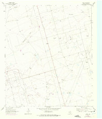
USGS Historical Quadrangle in GeoPDF.
Tags: 7.5 x 7.5 minute,
Downloadable Data,
GeoPDF,
GeoTIFF,
Historical Topographic Maps, All tags...
Historical Topographic Maps 7.5 x 7.5 Minute Map Series,
Map,
Parks,
TX,
imageryBaseMapsEarthCover, Fewer tags

The USGS Protected Areas Database of the United States (PAD-US) is the nation's inventory of protected areas, including public open space and voluntarily provided, private protected areas, identified as an A-16 National Geospatial Data Asset in the Cadastral Theme (http://www.fgdc.gov/ngda-reports/NGDA_Datasets.html). PAD-US is an ongoing project with several published versions of a spatial database of areas dedicated to the preservation of biological diversity, and other natural, recreational or cultural uses, managed for these purposes through legal or other effective means. The geodatabase maps and describes public open space and other protected areas. Most areas are public lands owned in fee; however, long-term...
Types: Citation;
Tags: Agricultural Research Service,
Alabama (AL),
Alaska (AK),
American Samoa (AS),
Arizona (AZ), All tags...
Arkansas (AR),
Army Corps of Engineers,
Biodiversity,
Bureau of Indian Affairs,
Bureau of Land Management,
Bureau of Reclamation,
Cadastre Theme,
California (CA),
Colorado (CO),
Connecticut (CT),
Conservation,
Delaware (DE),
Department of Defense,
Department of Energy,
Federal Lands,
Federated States of Micronesia (FM),
Florida (FL),
Forest Service,
GAP Status Code,
Gap Analysis,
Georgia (GA),
Governmental Units,
Guam (GU),
Hawaii (HI),
IUCN Category,
Idaho (ID),
Illinois (IL),
Indiana (IN),
Iowa (IA),
Kansas (KS),
Kentucky (KY),
Land Manager,
Land Ownership,
Land Stewardship,
Local Government Lands,
Louisiana (LA),
Maine (ME),
Mariana Islands (MP),
Marshall Islands (MH),
Maryland (MD),
Massachusetts (MA),
Michigan (MI),
Minnesota (MN),
Mississippi (MS),
Missouri (MO),
Montana (MT),
NGDA,
NGDA Portfolio Themes,
NGDA Portfolio Themes,
National Geospatial Data Asset,
National Oceanic and Atmospheric Administration,
National Park Service,
Natural Resources Conservation Service,
Nebraska (NE),
Nevada (NV),
New Hampshire (NH),
New Jersey (NJ),
New Mexico (NM),
New York (NY),
North Carolina (NC),
North Dakota (ND),
Ohio (OH),
Oklahoma (OK),
Oregon (OR),
Outdoor Recreation,
Palau (PW),
Parks,
Pennsylvania (PA),
Private Lands,
Protected Area,
Protection Status,
Public Health,
Public Lands,
Public Open Space,
Puerto Rico (PR),
Rhode Island (RI),
South Carolina (SC),
South Dakota (SD),
State Lands,
Tennessee (TN),
Tennessee Valley Authority,
Texas (TX),
U.S. Fish & Wildlife Service,
U.S. Fish and Wildlife Service,
U.S. Minor Outlying Islands (UM),
United States,
United States,
United States Virgin Islands (VI),
Utah (UT),
Vermont (VT),
Virginia (VA),
Washington (WA),
West Virginia (WV),
Wisconsin (WI),
Wyoming (WY), Fewer tags
Protected lands within the Mississippi River Basin (MRB).The USGS Protected Areas Database of the United States (PAD-US) is the nation's inventory of protected areas, including public open space and voluntarily provided, private protected areas, identified as an A-16 National Geospatial Data Asset in the Cadastral Theme (http://www.fgdc.gov/ngda-reports/NGDA_Datasets.html). PAD-US is an ongoing project with several published versions of a spatial database of areas dedicated to the preservation of biological diversity, and other natural, recreational or cultural uses, managed for these purposes through legal or other effective means. The geodatabase maps and describes public open space and other protected areas....
Categories: Data;
Types: Citation,
Downloadable,
Map Service,
OGC WFS Layer,
OGC WMS Layer,
Shapefile;
Tags: Agricultural Research Service,
Alabama (AL),
Alaska (AK),
American Samoa (AS),
Arizona (AZ), All tags...
Arkansas (AR),
Army Corps of Engineers,
Biodiversity,
Bureau of Indian Affairs,
Bureau of Land Management,
Bureau of Reclamation,
Cadastre Theme,
California (CA),
Colorado (CO),
Connecticut (CT),
Conservation,
Delaware (DE),
Department of Defense,
Department of Energy,
Federal Lands,
Federated States of Micronesia (FM),
Florida (FL),
Forest Service,
GAP Status Code,
Gap Analysis,
Georgia (GA),
Governmental Units,
Guam (GU),
Hawaii (HI),
IUCN Category,
Idaho (ID),
Illinois (IL),
Indiana (IN),
Iowa (IA),
Kansas (KS),
Kentucky (KY),
Land Manager,
Land Ownership,
Land Stewardship,
Local Government Lands,
Louisiana (LA),
Maine (ME),
Mariana Islands (MP),
Marshall Islands (MH),
Maryland (MD),
Massachusetts (MA),
Michigan (MI),
Minnesota (MN),
Mississippi (MS),
Missouri (MO),
Montana (MT),
NGDA,
NGDA Portfolio Themes,
National Geospatial Data Asset,
National Oceanic and Atmospheric Administration,
National Park Service,
Natural Resources Conservation Service,
Nebraska (NE),
Nevada (NV),
New Hampshire (NH),
New Jersey (NJ),
New Mexico (NM),
New York (NY),
North Carolina (NC),
North Dakota (ND),
Ohio (OH),
Oklahoma (OK),
Oregon (OR),
Outdoor Recreation,
Palau (PW),
Parks,
Pennsylvania (PA),
Private Lands,
Protected Area,
Protection Status,
Public Health,
Public Lands,
Public Open Space,
Puerto Rico (PR),
Rhode Island (RI),
South Carolina (SC),
South Dakota (SD),
State Lands,
Tennessee (TN),
Tennessee Valley Authority,
Texas (TX),
U.S. Fish & Wildlife Service,
U.S. Fish and Wildlife Service,
U.S. Minor Outlying Islands (UM),
United States,
United States,
United States Virgin Islands (VI),
Utah (UT),
Vermont (VT),
Virginia (VA),
Washington (WA),
West Virginia (WV),
Wisconsin (WI),
Wyoming (WY),
health,
planningCadastre, Fewer tags

The USGS Protected Areas Database of the United States (PAD-US) is the nation's inventory of protected areas, including public land and voluntarily provided private protected areas, identified as an A-16 National Geospatial Data Asset in the Cadastre Theme ( https://ngda-cadastre-geoplatform.hub.arcgis.com/ ). The PAD-US is an ongoing project with several published versions of a spatial database including areas dedicated to the preservation of biological diversity, and other natural (including extraction), recreational, or cultural uses, managed for these purposes through legal or other effective means. The database was originally designed to support biodiversity assessments; however, its scope expanded in recent...
Tags: Agricultural Research Service,
Alabama (AL),
Alaska (AK),
American Samoa (AS),
Arizona (AZ), All tags...
Arkansas (AR),
Army Corps of Engineers,
Biodiversity,
Bureau of Land Management,
Bureau of Reclamation,
California (CA),
Colorado (CO),
Connecticut (CT),
Conservation,
Delaware (DE),
Department of Defense,
Department of Energy,
Federal Lands,
Florida (FL),
Forest Service,
GAP Status Code,
Gap Analysis,
Geography,
Georgia (GA),
Governmental Units,
Guam (GU),
Hawaii (HI),
IUCN Category,
Idaho (ID),
Illinois (IL),
Indiana (IN),
Iowa (IA),
Kansas (KS),
Kentucky (KY),
Land Manager,
Land Ownership,
Land Stewardship,
Land Use Change,
Land Use and Land Cover,
Local Government Lands,
Louisiana (LA),
Maine (ME),
Mariana Islands (MP),
Maryland (MD),
Massachusetts (MA),
Michigan (MI),
Minnesota (MN),
Mississippi (MS),
Missouri (MO),
Montana (MT),
National Oceanic and Atmospheric Administration,
National Park Service,
Natural Resources Conservation Service,
Nebraska (NE),
Nevada (NV),
New Hampshire (NH),
New Jersey (NJ),
New Mexico (NM),
New York (NY),
North Carolina (NC),
North Dakota (ND),
Ohio (OH),
Oklahoma (OK),
Oregon (OR),
Outdoor Recreation,
Parks,
Pennsylvania (PA),
Private Lands,
Protected Area,
Protected Area,
Protection Status,
Public Health,
Public Lands,
Public Open Space,
Puerto Rico (PR),
Rhode Island (RI),
South Carolina (SC),
South Dakota (SD),
State Lands,
Tennessee (TN),
Tennessee Valley Authority,
Texas (TX),
U.S. Fish and Wildlife Service,
U.S. Minor Outlying Islands (UM),
USGS Science Data Catalog (SDC),
United States,
United States,
United States Virgin Islands (VI),
Utah (UT),
Vermont (VT),
Virginia (VA),
Washington (WA),
West Virginia (WV),
Wisconsin (WI),
Wyoming (WY), Fewer tags

Spatial analysis and statistical summaries of the Protected Areas Database of the United States (PAD-US) provide land managers and decision makers with a general assessment of management intent for biodiversity protection, natural resource management, and recreation access across the nation. The PAD-US 4.0 Combined Fee, Designation, Easement feature classes (with Military Lands and Tribal Areas from the Proclamation and Other Planning Boundaries feature classes) were modified to remove overlaps, avoiding overestimation in protected area statistics and to support user needs. A Python scripted process ("PADUS4_0_VectorAnalysis_Script_Python3.zip") associated with this data release prioritized overlapping designations...
Tags: Agricultural Research Service,
Alabama (AL),
Alaska (AK),
American Samoa (AS),
Arizona (AZ), All tags...
Arkansas (AR),
Army Corps of Engineers,
Biodiversity,
Bureau of Land Management,
Bureau of Reclamation,
California (CA),
Census,
Colorado (CO),
Connecticut (CT),
Conservation,
Data Integration,
Delaware (DE),
Department of Defense,
Department of Energy,
Federal Lands,
Florida (FL),
Forest Service,
GAP Status Code,
Gap Analysis,
Geography,
Georgia (GA),
Governmental Units,
Guam (GU),
Hawaii (HI),
IUCN Category,
Idaho (ID),
Illinois (IL),
Indiana (IN),
Iowa (IA),
Kansas (KS),
Kentucky (KY),
Land Manager,
Land Ownership,
Land Stewardship,
Land Use and Land Cover,
Local Government Lands,
Louisiana (LA),
Maine (ME),
Mariana Islands (MP),
Maryland (MD),
Massachusetts (MA),
Michigan (MI),
Minnesota (MN),
Mississippi (MS),
Missouri (MO),
Montana (MT),
NGDA Portfolio Themes,
National Oceanic and Atmospheric Administration,
National Park Service,
Natural Resource Management,
Natural Resources Conservation Service,
Nebraska (NE),
Nevada (NV),
New Hampshire (NH),
New Jersey (NJ),
New Mexico (NM),
New York (NY),
North Carolina (NC),
North Dakota (ND),
Ohio (OH),
Oklahoma (OK),
Oregon (OR),
Outdoor Recreation,
Parks,
Pennsylvania (PA),
Private Lands,
Protected Area,
Protection Status,
Public Access,
Public Health,
Public Lands,
Public Open Space,
Puerto Rico (PR),
Rhode Island (RI),
South Carolina (SC),
South Dakota (SD),
State Lands,
Tennessee (TN),
Tennessee Valley Authority,
Texas (TX),
U.S. Fish and Wildlife Service,
U.S. Minor Outlying Islands (UM),
United States,
United States,
United States Virgin Islands (VI),
Utah (UT),
Vermont (VT),
Veterans Affairs,
Virginia (VA),
Washington (WA),
West Virginia (WV),
Wisconsin (WI),
Wyoming (WY), Fewer tags
This data set contains imagery from the National Agriculture Imagery Program (NAIP). The NAIP program is administered by USDA FSA and has been established to support two main FSA strategic goals centered on agricultural production. These are, increase stewardship of America's natural resources while enhancing the environment, and to ensure commodities are procured and distributed effectively and efficiently to increase food security. The NAIP program supports these goals by acquiring and providing ortho imagery that has been collected during the agricultural growing season in the U.S. The NAIP ortho imagery is tailored to meet FSA requirements and is a fundamental tool used to support FSA farm and conservation programs....
Types: Citation;
Tags: 22099,
3.75 x 3.75 minute,
3009150,
Aerial Compliance,
Compliance, All tags...
Digital Ortho rectified Image,
Downloadable Data,
JPEG2000,
LA,
LA099,
NAIP,
Ortho Rectification,
Orthoimagery,
PARKS,
PARKS, NE,
Quarter Quadrangle,
ST MARTIN PARISH LA FSA,
St. Martin,
USDA National Agriculture Imagery Program (NAIP),
farming, Fewer tags

The dataset contains quantitative polymerase chain reaction data for microbial source tracking markers screened on water samples collected from streams and rivers within and bounding Congaree National Park from samples collected throughout the year from December 2017 through June 2019. The number of samples collected per event ranged from 4-16 over the span of 11 sample events.

The USGS Protected Areas Database of the United States (PAD-US) is the nation's inventory of protected areas, including public open space and voluntarily provided, private protected areas, identified as an A-16 National Geospatial Data Asset in the Cadastral Theme (http://www.fgdc.gov/ngda-reports/NGDA_Datasets.html). PAD-US is an ongoing project with several published versions of a spatial database of areas dedicated to the preservation of biological diversity, and other natural, recreational or cultural uses, managed for these purposes through legal or other effective means. The geodatabase maps and describes public open space and other protected areas. Most areas are public lands owned in fee; however, long-term...
Types: Citation;
Tags: Agricultural Research Service,
Alabama (AL),
Alaska (AK),
American Samoa (AS),
Arizona (AZ), All tags...
Arkansas (AR),
Army Corps of Engineers,
Biodiversity,
Bureau of Indian Affairs,
Bureau of Land Management,
Bureau of Reclamation,
Cadastre Theme,
California (CA),
Colorado (CO),
Connecticut (CT),
Conservation,
Delaware (DE),
Department of Defense,
Department of Energy,
Federal Lands,
Federated States of Micronesia (FM),
Florida (FL),
Forest Service,
GAP Status Code,
Gap Analysis,
Georgia (GA),
Governmental Units,
Guam (GU),
Hawaii (HI),
IUCN Category,
Idaho (ID),
Illinois (IL),
Indiana (IN),
Iowa (IA),
Kansas (KS),
Kentucky (KY),
Land Manager,
Land Ownership,
Land Stewardship,
Local Government Lands,
Louisiana (LA),
Maine (ME),
Mariana Islands (MP),
Marshall Islands (MH),
Maryland (MD),
Massachusetts (MA),
Michigan (MI),
Minnesota (MN),
Mississippi (MS),
Missouri (MO),
Montana (MT),
NGDA,
NGDA Portfolio Themes,
NGDA Portfolio Themes,
National Geospatial Data Asset,
National Oceanic and Atmospheric Administration,
National Park Service,
Natural Resources Conservation Service,
Nebraska (NE),
Nevada (NV),
New Hampshire (NH),
New Jersey (NJ),
New Mexico (NM),
New York (NY),
North Carolina (NC),
North Dakota (ND),
Ohio (OH),
Oklahoma (OK),
Oregon (OR),
Outdoor Recreation,
Palau (PW),
Parks,
Pennsylvania (PA),
Private Lands,
Protected Area,
Protection Status,
Public Health,
Public Lands,
Public Open Space,
Puerto Rico (PR),
Rhode Island (RI),
South Carolina (SC),
South Dakota (SD),
State Lands,
Tennessee (TN),
Tennessee Valley Authority,
Texas (TX),
U.S. Fish & Wildlife Service,
U.S. Fish and Wildlife Service,
U.S. Minor Outlying Islands (UM),
United States,
United States,
United States Virgin Islands (VI),
Utah (UT),
Vermont (VT),
Virginia (VA),
Washington (WA),
West Virginia (WV),
Wisconsin (WI),
Wyoming (WY), Fewer tags
|
|

