Filters: Tags: parks (X)
171 results (71ms)|
Filters
Date Range
Extensions Types Contacts
Categories Tag Types
|
The USGS Protected Areas Database of the United States (PAD-US) is the nation's inventory of protected areas, including public open space and voluntarily provided, private protected areas, identified as an A-16 National Geospatial Data Asset in the Cadastral Theme (http://www.fgdc.gov/ngda-reports/NGDA_Datasets.html). PAD-US is an ongoing project with several published versions of a spatial database of areas dedicated to the preservation of biological diversity, and other natural, recreational or cultural uses, managed for these purposes through legal or other effective means. The geodatabase maps and describes public open space and other protected areas. Most areas are public lands owned in fee; however, long-term...
Types: Citation;
Tags: Agricultural Research Service,
Alabama (AL),
Alaska (AK),
American Samoa (AS),
Arizona (AZ),
NOTE: A more current version of the Protected Areas Database of the United States (PAD-US) is available: PAD-US 2.0 https://doi.org/10.5066/P955KPLE. The USGS Protected Areas Database of the United States (PAD-US) is the nation's inventory of protected areas, including public open space and voluntarily provided, private protected areas, identified as an A-16 National Geospatial Data Asset in the Cadastral Theme (http://www.fgdc.gov/ngda-reports/NGDA_Datasets.html). PAD-US is an ongoing project with several published versions of a spatial database of areas dedicated to the preservation of biological diversity, and other natural, recreational or cultural uses, managed for these purposes through legal or other effective...
Categories: Data;
Types: Citation;
Tags: Agricultural Research Service,
Alabama (AL),
Alaska (AK),
American Samoa (AS),
Arizona (AZ),
Publicly accessible open spaces provide valuable opportunities for people to exercise, play, socialize, and build community. People are more likely to use public open spaces that are close (ideally within walking distance) to their homes, and larger open spaces often provide more amenities. To assess the potential benefit of creating new open space in the southeast US, we identified areas without access to open space within a certain distance category (in this case, 3 miles). Then, for each 30-meter pixel in the study area, we then totaled the number of people within 3 miles who do not currently have access to open space within that distance. This represents the number of people who would benefit from new open space...
Categories: Data;
Tags: Alabama,
Arkansas,
Data Visualization & Tools,
Data and Information Sharing,
Florida,
Daily visitor use in Rocky Mountain National Park has increased substantially since 2014, raising questions about the impact of human waste on water quality in popular areas without latrines. Human urine contributes nitrogen, and the ecological and biogeochemical effects of nitrogen from atmospheric deposition have long been the topic of study in Loch Vale watershed, Rocky Mountain National Park. Nitrogen from atmospheric deposition has been found previously to lead to lake eutrophication and altered algal species assemblages. Our data were collected to evaluate the impacts of visitors to a popular alpine watershed in Rocky Mountain National Park. There are three separate data files: soil sample locations and concentrations...
Categories: Data;
Tags: Ecology,
Environmental Health,
Rocky Mountain National Park,
Soil Sciences,
USGS Science Data Catalog (SDC),
Spatial analysis and statistical summaries of the Protected Areas Database of the United States (PAD-US) provide land managers and decision makers with a general assessment of management intent for biodiversity protection, natural resource management, and outdoor recreation access across the nation. This data release presents results from statistical summaries of the PAD-US 4.0 protection status (by GAP Status Code) and public access status for various land unit boundaries (PAD-US 4.0 Vector Analysis and Summary Statistics). Summary statistics are also available to explore and download from the PAD-US Statistics Dashboard ( https://www.usgs.gov/programs/gap-analysis-project/science/pad-us-statistics ). The vector...
The USGS Protected Areas Database of the United States (PAD-US) is the nation's inventory of protected areas, including public land and voluntarily provided private protected areas, identified as an A-16 National Geospatial Data Asset in the Cadastre Theme ( https://ngda-cadastre-geoplatform.hub.arcgis.com/ ). The PAD-US is an ongoing project with several published versions of a spatial database including areas dedicated to the preservation of biological diversity, and other natural (including extraction), recreational, or cultural uses, managed for these purposes through legal or other effective means. The database was originally designed to support biodiversity assessments; however, its scope expanded in recent...
This data set contains imagery from the National Agriculture Imagery Program (NAIP). The NAIP program is administered by USDA FSA and has been established to support two main FSA strategic goals centered on agricultural production. These are, increase stewardship of America's natural resources while enhancing the environment, and to ensure commodities are procured and distributed effectively and efficiently to increase food security. The NAIP program supports these goals by acquiring and providing ortho imagery that has been collected during the agricultural growing season in the U.S. The NAIP ortho imagery is tailored to meet FSA requirements and is a fundamental tool used to support FSA farm and conservation programs....
This data set contains imagery from the National Agriculture Imagery Program (NAIP). The NAIP program is administered by USDA FSA and has been established to support two main FSA strategic goals centered on agricultural production. These are, increase stewardship of America's natural resources while enhancing the environment, and to ensure commodities are procured and distributed effectively and efficiently to increase food security. The NAIP program supports these goals by acquiring and providing ortho imagery that has been collected during the agricultural growing season in the U.S. The NAIP ortho imagery is tailored to meet FSA requirements and is a fundamental tool used to support FSA farm and conservation programs....
This spatial data set provides information pertaining to the known land use and disturbance history for lands within the March 2018 administrative boundary of the North Unit of Badlands National Park, South Dakota. Land use and disturbance history presented here are not a comprehensive record of all potential land uses and disturbances but rather a record of known and documented land uses and disturbances based on the best available information. Additional land use and disturbance information may exist but due to time and budget constraints may not have been discovered during the research and development of this data set. The information in this data set was gathered through a variety of sources including but not...
This data set contains the Sedge Island Marine Conservation Zone delineated by NJDEP Green Acres Program. The Sedge Island Marine Conservation Zone contains approximately 1,600 acres of highly productive tidal marshes, creeks, ponds, and open water.
Categories: Data;
Types: Downloadable,
Map Service,
OGC WFS Layer,
OGC WMS Layer,
Shapefile;
Tags: New Jersey,
Sedge Island,
environment,
green acres,
marine conservation zone,
The USGS Protected Areas Database of the United States (PAD-US) is the nation's inventory of protected areas, including public open space and voluntarily provided, private protected areas, identified as an A-16 National Geospatial Data Asset in the Cadastral Theme (http://www.fgdc.gov/ngda-reports/NGDA_Datasets.html). PAD-US is an ongoing project with several published versions of a spatial database of areas dedicated to the preservation of biological diversity, and other natural, recreational or cultural uses, managed for these purposes through legal or other effective means. The geodatabase maps and describes public open space and other protected areas. Most areas are public lands owned in fee; however, long-term...
Types: Citation;
Tags: Agricultural Research Service,
Alabama (AL),
Alaska (AK),
American Samoa (AS),
Arizona (AZ),
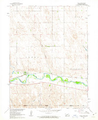
USGS Historical Quadrangle in GeoPDF.

USGS Historical Quadrangle in GeoPDF.
Low-lying public lands along the northern Gulf of Mexico coast are vulnerable to sea-level rise. Coastal planners and resource managers in the region have requested customized information that can be used to concisely communicate local sea-level rise scenarios and identify potential impacts to the missions of management agencies. In this project, researchers worked with the Northern Gulf of Mexico Sentinel Site Cooperative to develop information sheets outlining potential sea-level rise scenarios for the region through 2100 including their potential impact on the missions of federally-managed lands. Researchers drew from existing information on regional and global sea-level rise scenarios to develop customized...
Categories: Publication;
Types: Citation;
Tags: Alabama,
Estuarine Coastal,
Estuarine Coastal Intertidal,
Florida,
Gulf of Mexico,
|

|
