Filters
Date Range
Types
Contacts
Tag Types
Tag Schemes
|

This feature class Describes the spatial location of recreation sites within or in close proximity to an administrative unit. Recreation sites are stored in three feature classes. The feature class Recreation_Site_pt represents recreation sites so small they are displayed as points, Recreation_Site_pl represents recreation sites large enough to be represented by area features, and Recreation_Site_ln represents recreation sites that are represented by lines. Any type of recreation site may be contained in any of the feature classes but any given recreation site must be contained in only one of the three feature classes. Recreation sites are grouped hierarchically. For example, a campground may be composed of many...
Types: Downloadable;
Tags: BLM,
Bureau of Land Management,
DOI,
Geospatial,
REA, All tags...
Rapid Ecoregional Assessment,
Recreation,
Recreation_Site_pt,
SOD 2010,
Sonoran Desert,
boat ramp,
campground,
economy,
fishing,
picnic area,
planningCadastre,
recreation site,
society,
trailhead,
viewing, Fewer tags

This feature class Describes the spatial location of recreation sites within or in close proximity to an administrative unit. Recreation sites are stored in three feature classes. The feature class Recreation_Site_pt represents recreation sites so small they are displayed as points, Recreation_Site_pl represents recreation sites large enough to be represented by area features, and Recreation_Site_ln represents recreation sites that are represented by lines. Any type of recreation site may be contained in any of the feature classes but any given recreation site must be contained in only one of the three feature classes. Recreation sites are grouped hierarchically. For example, a campground may be composed of many...
Types: Downloadable;
Tags: BLM,
Bureau of Land Management,
COP 2010,
Colorado Plateau,
DOI, All tags...
Geospatial,
REA,
Rapid Ecoregional Assessment,
Recreation,
Recreation_Site_pt,
boat ramp,
campground,
economy,
fishing,
picnic area,
recreation site,
society,
trailhead,
viewing, Fewer tags

GIS dataset of the developed recreation sites (points) identified in the Lake Havasu Field Office RMP 2007 along the Colorado River. The dataset includes BLM boat-in campsites, boat ramps, picnic areas, public fishing docks, and public displays (kiosks). Additional recreation sites are in the RecreationSites_polygon.shp dataset. These recreation areas are on BLM lands in Arizona and California within the Lake Havasu Field Office.
Types: Downloadable;
Tags: BLM,
Bureau of Land Management,
DOI,
Geospatial,
Land Use Planning, All tags...
REA,
Rapid Ecoregional Assessment,
Recreation,
Recreation Area,
SOD 2010,
Sonoran Desert,
boat ramp,
boat-in campsite,
economy,
fishing dock,
kiosk,
picnic area,
planningCadastre,
recreation site,
society, Fewer tags

This feature class Describes the spatial location of recreation sites within or in close proximity to an administrative unit. Recreation sites are stored in three feature classes. The feature class Recreation_Site_pt represents recreation sites so small they are displayed as points, Recreation_Site_pl represents recreation sites large enough to be represented by area features, and Recreation_Site_ln represents recreation sites that are represented by lines. Any type of recreation site may be contained in any of the feature classes but any given recreation site must be contained in only one of the three feature classes. Recreation sites are grouped hierarchically. For example, a campground may be composed of many...
Types: Downloadable;
Tags: BLM,
Bureau of Land Management,
DOI,
Geospatial,
REA, All tags...
Rapid Ecoregional Assessment,
Recreation,
Recreation_Site_pt,
SOD 2010,
Sonoran Desert,
boat ramp,
campground,
economy,
fishing,
picnic area,
planningCadastre,
recreation site,
society,
trailhead,
viewing, Fewer tags

This feature class Describes the spatial location of recreation sites within or in close proximity to an administrative unit. Recreation sites are stored in three feature classes. The feature class Recreation_Site_pt represents recreation sites so small they are displayed as points, Recreation_Site_pl represents recreation sites large enough to be represented by area features, and Recreation_Site_ln represents recreation sites that are represented by lines. Any type of recreation site may be contained in any of the feature classes but any given recreation site must be contained in only one of the three feature classes. Recreation sites are grouped hierarchically. For example, a campground may be composed of many...
Types: Downloadable;
Tags: BLM,
Bureau of Land Management,
DOI,
Geospatial,
REA, All tags...
Rapid Ecoregional Assessment,
Recreation,
Recreation_Site_pt,
SOD 2010,
Sonoran Desert,
boat ramp,
campground,
economy,
fishing,
picnic area,
planningCadastre,
recreation site,
society,
trailhead,
viewing, Fewer tags

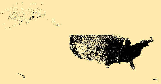
USGS Structures from The National Map (TNM) consists of data to include the name, function, location, and other core information and characteristics of selected manmade facilities across all US states and territories. The types of structures collected are largely determined by the needs of disaster planning and emergency response, and homeland security organizations. Structures currently included are: School, School:Elementary, School:Middle, School:High, College/University, Technical/Trade School, Ambulance Service, Fire Station/EMS Station, Law Enforcement, Prison/Correctional Facility, Post Office, Hospital/Medical Center, Cabin, Campground, Cemetery, Historic Site/Point of Interest, Picnic Area, Trailhead, Vistor/Information...
Types: Citation;
Tags: Ambulance Service,
Cabin,
Campground,
Cemetery,
City / Town Hall, All tags...
College / University,
Court House,
Fire Station / EMS Station,
Headquarters,
Historic Site / Point of Interest,
Hospital / Medical Center,
Law Enforcement,
NGDA,
NGDAID135,
National Geospatial Data Asset,
National Structures Dataset (NSD),
Picnic Area,
Post Office,
Prison / Correctional Facility,
Ranger Station,
Real Property Theme,
School,
School: Elementary,
School: High School,
School: Middle School,
State Capitol,
State Supreme Court,
Technical / Trade School,
Trailhead,
US,
US Capitol,
US Supreme Court,
USGS:db4fb1b6-1282-4e5b-9866-87a68912c5d1,
United States,
Visitor / Information Center,
White House,
structure, Fewer tags

Depicts the center point location of developed recreation areas on the Dixie National Forest
Types: Downloadable;
Tags: BLM,
Bureau of Land Management,
COP 2010,
Campground,
Colorado Plateau, All tags...
DOI,
Developed Recreation,
Equestrian Camping,
Geospatial,
Picnic Area,
REA,
Rapid Ecoregional Assessment,
Recreation,
economy,
society, Fewer tags
|
|