|
|
This data set contains imagery from the National Agriculture Imagery Program (NAIP). The NAIP program is administered by USDA FSA and has been established to support two main FSA strategic goals centered on agricultural production. These are, increase stewardship of America's natural resources while enhancing the environment, and to ensure commodities are procured and distributed effectively and efficiently to increase food security. The NAIP program supports these goals by acquiring and providing ortho imagery that has been collected during the agricultural growing season in the U.S. The NAIP ortho imagery is tailored to meet FSA requirements and is a fundamental tool used to support FSA farm and conservation programs....
Types: Citation;
Tags: 08059,
3.75 x 3.75 minute,
3910538,
Aerial Compliance,
CO, All tags...
CO059,
Compliance,
Digital Ortho rectified Image,
Downloadable Data,
JEFFERSON CO CO FSA,
JPEG2000,
Jefferson,
NAIP,
Ortho Rectification,
Orthoimagery,
PINE,
PINE, NE,
Quarter Quadrangle,
USDA National Agriculture Imagery Program (NAIP),
farming, Fewer tags
This data set contains imagery from the National Agriculture Imagery Program (NAIP). The NAIP program is administered by USDA FSA and has been established to support two main FSA strategic goals centered on agricultural production. These are, increase stewardship of America's natural resources while enhancing the environment, and to ensure commodities are procured and distributed effectively and efficiently to increase food security. The NAIP program supports these goals by acquiring and providing ortho imagery that has been collected during the agricultural growing season in the U.S. The NAIP ortho imagery is tailored to meet FSA requirements and is a fundamental tool used to support FSA farm and conservation programs....
Types: Citation;
Tags: 27115,
3.75 x 3.75 minute,
4509203,
Aerial Compliance,
Compliance, All tags...
Digital Ortho rectified Image,
Downloadable Data,
JPEG2000,
LAKE CLAYTON,
LAKE CLAYTON, NE,
MN,
MN115,
NAIP,
Ortho Rectification,
Orthoimagery,
PINE CO MN FSA,
Pine,
Quarter Quadrangle,
USDA National Agriculture Imagery Program (NAIP),
farming, Fewer tags
This data set contains imagery from the National Agriculture Imagery Program (NAIP). The NAIP program is administered by USDA FSA and has been established to support two main FSA strategic goals centered on agricultural production. These are, increase stewardship of America's natural resources while enhancing the environment, and to ensure commodities are procured and distributed effectively and efficiently to increase food security. The NAIP program supports these goals by acquiring and providing ortho imagery that has been collected during the agricultural growing season in the U.S. The NAIP ortho imagery is tailored to meet FSA requirements and is a fundamental tool used to support FSA farm and conservation programs....
Types: Citation;
Tags: 27115,
3.75 x 3.75 minute,
4509210,
Aerial Compliance,
BASS CREEK, All tags...
BASS CREEK, NW,
Compliance,
Digital Ortho rectified Image,
Downloadable Data,
JPEG2000,
MN,
MN115,
NAIP,
Ortho Rectification,
Orthoimagery,
PINE CO MN FSA,
Pine,
Quarter Quadrangle,
USDA National Agriculture Imagery Program (NAIP),
farming, Fewer tags
This data set contains imagery from the National Agriculture Imagery Program (NAIP). The NAIP program is administered by USDA FSA and has been established to support two main FSA strategic goals centered on agricultural production. These are, increase stewardship of America's natural resources while enhancing the environment, and to ensure commodities are procured and distributed effectively and efficiently to increase food security. The NAIP program supports these goals by acquiring and providing ortho imagery that has been collected during the agricultural growing season in the U.S. The NAIP ortho imagery is tailored to meet FSA requirements and is a fundamental tool used to support FSA farm and conservation programs....
Types: Citation;
Tags: 27115,
3.75 x 3.75 minute,
4509210,
Aerial Compliance,
BASS CREEK, All tags...
BASS CREEK, SW,
Compliance,
Digital Ortho rectified Image,
Downloadable Data,
JPEG2000,
MN,
MN115,
NAIP,
Ortho Rectification,
Orthoimagery,
PINE CO MN FSA,
Pine,
Quarter Quadrangle,
USDA National Agriculture Imagery Program (NAIP),
farming, Fewer tags
This data set contains imagery from the National Agriculture Imagery Program (NAIP). The NAIP program is administered by USDA FSA and has been established to support two main FSA strategic goals centered on agricultural production. These are, increase stewardship of America's natural resources while enhancing the environment, and to ensure commodities are procured and distributed effectively and efficiently to increase food security. The NAIP program supports these goals by acquiring and providing ortho imagery that has been collected during the agricultural growing season in the U.S. The NAIP ortho imagery is tailored to meet FSA requirements and is a fundamental tool used to support FSA farm and conservation programs....
Types: Citation;
Tags: 27115,
3.75 x 3.75 minute,
4509308,
Aerial Compliance,
BROOK PARK, All tags...
BROOK PARK, SW,
Compliance,
Digital Ortho rectified Image,
Downloadable Data,
JPEG2000,
MN,
MN115,
NAIP,
Ortho Rectification,
Orthoimagery,
PINE CO MN FSA,
Pine,
Quarter Quadrangle,
USDA National Agriculture Imagery Program (NAIP),
farming, Fewer tags
This data set contains imagery from the National Agriculture Imagery Program (NAIP). The NAIP program is administered by USDA FSA and has been established to support two main FSA strategic goals centered on agricultural production. These are, increase stewardship of America's natural resources while enhancing the environment, and to ensure commodities are procured and distributed effectively and efficiently to increase food security. The NAIP program supports these goals by acquiring and providing ortho imagery that has been collected during the agricultural growing season in the U.S. The NAIP ortho imagery is tailored to meet FSA requirements and is a fundamental tool used to support FSA farm and conservation programs....
Types: Citation;
Tags: 27115,
3.75 x 3.75 minute,
4509316,
Aerial Compliance,
Compliance, All tags...
Digital Ortho rectified Image,
Downloadable Data,
HENRIETTE,
HENRIETTE, NE,
JPEG2000,
MN,
MN115,
NAIP,
Ortho Rectification,
Orthoimagery,
PINE CO MN FSA,
Pine,
Quarter Quadrangle,
USDA National Agriculture Imagery Program (NAIP),
farming, Fewer tags
This data set contains imagery from the National Agriculture Imagery Program (NAIP). The NAIP program is administered by USDA FSA and has been established to support two main FSA strategic goals centered on agricultural production. These are, increase stewardship of America's natural resources while enhancing the environment, and to ensure commodities are procured and distributed effectively and efficiently to increase food security. The NAIP program supports these goals by acquiring and providing ortho imagery that has been collected during the agricultural growing season in the U.S. The NAIP ortho imagery is tailored to meet FSA requirements and is a fundamental tool used to support FSA farm and conservation programs....
Types: Citation;
Tags: 27115,
3.75 x 3.75 minute,
4509323,
Aerial Compliance,
BRAHAM, All tags...
BRAHAM, NE,
Compliance,
Digital Ortho rectified Image,
Downloadable Data,
JPEG2000,
MN,
MN115,
NAIP,
Ortho Rectification,
Orthoimagery,
PINE CO MN FSA,
Pine,
Quarter Quadrangle,
USDA National Agriculture Imagery Program (NAIP),
farming, Fewer tags
This data set contains imagery from the National Agriculture Imagery Program (NAIP). The NAIP program is administered by USDA FSA and has been established to support two main FSA strategic goals centered on agricultural production. These are, increase stewardship of America's natural resources while enhancing the environment, and to ensure commodities are procured and distributed effectively and efficiently to increase food security. The NAIP program supports these goals by acquiring and providing ortho imagery that has been collected during the agricultural growing season in the U.S. The NAIP ortho imagery is tailored to meet FSA requirements and is a fundamental tool used to support FSA farm and conservation programs....
Types: Citation;
Tags: 27115,
3.75 x 3.75 minute,
4609241,
Aerial Compliance,
Compliance, All tags...
DENHAM,
DENHAM, SW,
Digital Ortho rectified Image,
Downloadable Data,
JPEG2000,
MN,
MN115,
NAIP,
Ortho Rectification,
Orthoimagery,
PINE CO MN FSA,
Pine,
Quarter Quadrangle,
USDA National Agriculture Imagery Program (NAIP),
farming, Fewer tags
This data set contains imagery from the National Agriculture Imagery Program (NAIP). The NAIP program is administered by USDA FSA and has been established to support two main FSA strategic goals centered on agricultural production. These are, increase stewardship of America's natural resources while enhancing the environment, and to ensure commodities are procured and distributed effectively and efficiently to increase food security. The NAIP program supports these goals by acquiring and providing ortho imagery that has been collected during the agricultural growing season in the U.S. The NAIP ortho imagery is tailored to meet FSA requirements and is a fundamental tool used to support FSA farm and conservation programs....
Types: Citation;
Tags: 27115,
3.75 x 3.75 minute,
4609245,
Aerial Compliance,
Compliance, All tags...
Digital Ortho rectified Image,
Downloadable Data,
HOLYOKE SW,
HOLYOKE SW, SE,
JPEG2000,
MN,
MN115,
NAIP,
Ortho Rectification,
Orthoimagery,
PINE CO MN FSA,
Pine,
Quarter Quadrangle,
USDA National Agriculture Imagery Program (NAIP),
farming, Fewer tags
This data set contains imagery from the National Agriculture Imagery Program (NAIP). The NAIP program is administered by USDA FSA and has been established to support two main FSA strategic goals centered on agricultural production. These are, increase stewardship of America's natural resources while enhancing the environment, and to ensure commodities are procured and distributed effectively and efficiently to increase food security. The NAIP program supports these goals by acquiring and providing ortho imagery that has been collected during the agricultural growing season in the U.S. The NAIP ortho imagery is tailored to meet FSA requirements and is a fundamental tool used to support FSA farm and conservation programs....
Types: Citation;
Tags: 27115,
3.75 x 3.75 minute,
4609246,
Aerial Compliance,
BLACK LAKE, All tags...
BLACK LAKE, NE,
Compliance,
Digital Ortho rectified Image,
Downloadable Data,
JPEG2000,
MN,
MN115,
NAIP,
Ortho Rectification,
Orthoimagery,
PINE CO MN FSA,
Pine,
Quarter Quadrangle,
USDA National Agriculture Imagery Program (NAIP),
farming, Fewer tags
This data set contains imagery from the National Agriculture Imagery Program (NAIP). The NAIP program is administered by USDA FSA and has been established to support two main FSA strategic goals centered on agricultural production. These are, increase stewardship of America's natural resources while enhancing the environment, and to ensure commodities are procured and distributed effectively and efficiently to increase food security. The NAIP program supports these goals by acquiring and providing ortho imagery that has been collected during the agricultural growing season in the U.S. The NAIP ortho imagery is tailored to meet FSA requirements and is a fundamental tool used to support FSA farm and conservation programs....
Types: Citation;
Tags: 27115,
3.75 x 3.75 minute,
4609261,
Aerial Compliance,
Compliance, All tags...
DANBURY WEST,
DANBURY WEST, NE,
Digital Ortho rectified Image,
Downloadable Data,
JPEG2000,
MN,
MN115,
NAIP,
Ortho Rectification,
Orthoimagery,
PINE CO MN FSA,
Pine,
Quarter Quadrangle,
USDA National Agriculture Imagery Program (NAIP),
farming, Fewer tags
This data set contains imagery from the National Agriculture Imagery Program (NAIP). The NAIP program is administered by USDA FSA and has been established to support two main FSA strategic goals centered on agricultural production. These are, increase stewardship of America's natural resources while enhancing the environment, and to ensure commodities are procured and distributed effectively and efficiently to increase food security. The NAIP program supports these goals by acquiring and providing ortho imagery that has been collected during the agricultural growing season in the U.S. The NAIP ortho imagery is tailored to meet FSA requirements and is a fundamental tool used to support FSA farm and conservation programs....
Types: Citation;
Tags: 27115,
3.75 x 3.75 minute,
4609262,
Aerial Compliance,
Compliance, All tags...
DANBURY EAST,
DANBURY EAST, NE,
Digital Ortho rectified Image,
Downloadable Data,
JPEG2000,
MN,
MN115,
NAIP,
Ortho Rectification,
Orthoimagery,
PINE CO MN FSA,
Pine,
Quarter Quadrangle,
USDA National Agriculture Imagery Program (NAIP),
farming, Fewer tags
This data set contains imagery from the National Agriculture Imagery Program (NAIP). The NAIP program is administered by USDA FSA and has been established to support two main FSA strategic goals centered on agricultural production. These are, increase stewardship of America's natural resources while enhancing the environment, and to ensure commodities are procured and distributed effectively and efficiently to increase food security. The NAIP program supports these goals by acquiring and providing ortho imagery that has been collected during the agricultural growing season in the U.S. The NAIP ortho imagery is tailored to meet FSA requirements and is a fundamental tool used to support FSA farm and conservation programs....
Types: Citation;
Tags: 27115,
3.75 x 3.75 minute,
4609262,
Aerial Compliance,
Compliance, All tags...
DANBURY EAST,
DANBURY EAST, SW,
Digital Ortho rectified Image,
Downloadable Data,
JPEG2000,
MN,
MN115,
NAIP,
Ortho Rectification,
Orthoimagery,
PINE CO MN FSA,
Pine,
Quarter Quadrangle,
USDA National Agriculture Imagery Program (NAIP),
farming, Fewer tags

This digital range map represents the range of Colorado pinyon pine (Pinus edulis) in western North America. Data from multiple sources, including existing digitized maps, tabular data, personal communications, USDA Forest Service Inventory and Analysis data, and figures from other publications, were synthesized to create a single digital distribution. The distribution was peer reviewed and iteratively revised based on personal observations of regional authorities.
Layered GeoPDF 7.5 Minute Quadrangle Map. Layers of geospatial data include orthoimagery, roads, grids, geographic names, elevation contours, hydrography, and other selected map features.
Tags: 7.5 x 7.5 minute,
Aitkin,
Carlton,
Downloadable Data,
EarthCover, All tags...
GeoPDF,
Imagery and Base Maps,
Map,
Minnesota,
Pine,
Public Land Survey System,
Ronald, MN,
U.S. National Grid,
US,
US Topo,
US Topo Historical,
United States,
boundary,
contour,
geographic names,
hydrography,
imageryBaseMapsEarthCover,
orthoimage,
structures,
topographic,
transportation,
woodland, Fewer tags
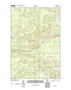
Layered geospatial PDF Map. Layers of geospatial data include orthoimagery, roads, grids, geographic names, elevation contours, hydrography, and other selected map features.
Tags: 7.5 x 7.5 minute,
Carlton,
Downloadable Data,
EarthCover,
GeoPDF, All tags...
Imagery and Base Maps,
Kettle River, MN,
Map,
Minnesota,
Pine,
Public Land Survey System,
U.S. National Grid,
US,
US Topo,
US Topo Historical,
United States,
boundary,
contour,
geographic names,
hydrography,
imageryBaseMapsEarthCover,
orthoimage,
structures,
topographic,
transportation,
woodland, Fewer tags
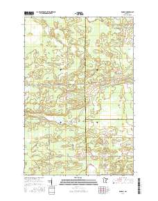
Layered GeoPDF 7.5 Minute Quadrangle Map. Layers of geospatial data include orthoimagery, roads, grids, geographic names, elevation contours, hydrography, and other selected map features.
Tags: 7.5 x 7.5 minute,
Burnett,
Downloadable Data,
EarthCover,
GeoPDF, All tags...
Imagery and Base Maps,
Lake Clayton, MN-WI,
Map,
Minnesota,
Pine,
Public Land Survey System,
U.S. National Grid,
US,
US Topo,
US Topo Historical,
United States,
Wisconsin,
boundary,
contour,
geographic names,
hydrography,
imageryBaseMapsEarthCover,
orthoimage,
structures,
topographic,
transportation,
woodland, Fewer tags
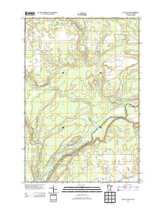
Layered GeoPDF 7.5 Minute Quadrangle Map. Layers of geospatial data include orthoimagery, roads, grids, geographic names, elevation contours, hydrography, and other selected map features.
Tags: 7.5 x 7.5 minute,
Braham, MN,
Chisago,
Downloadable Data,
EarthCover, All tags...
GeoPDF,
Imagery and Base Maps,
Isanti,
Kanabec,
Map,
Minnesota,
Pine,
Public Land Survey System,
U.S. National Grid,
US,
US Topo,
US Topo Historical,
United States,
boundary,
contour,
geographic names,
hydrography,
imageryBaseMapsEarthCover,
orthoimage,
structures,
topographic,
transportation,
woodland, Fewer tags
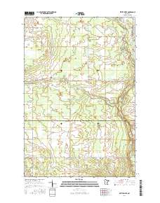
Layered GeoPDF 7.5 Minute Quadrangle Map. Layers of geospatial data include orthoimagery, roads, grids, geographic names, elevation contours, hydrography, and other selected map features.
Tags: 7.5 x 7.5 minute,
Downloadable Data,
EarthCover,
GeoPDF,
Grasston, MN, All tags...
Imagery and Base Maps,
Kanabec,
Map,
Minnesota,
Pine,
Public Land Survey System,
U.S. National Grid,
US,
US Topo,
US Topo Historical,
United States,
boundary,
contour,
geographic names,
hydrography,
imageryBaseMapsEarthCover,
orthoimage,
structures,
topographic,
transportation,
woodland, Fewer tags
|
|

