Filters
Date Range
Types
Contacts
Categories
Tag Types
Tag Schemes
|
This data set contains imagery from the National Agriculture Imagery Program (NAIP). The NAIP program is administered by USDA FSA and has been established to support two main FSA strategic goals centered on agricultural production. These are, increase stewardship of America's natural resources while enhancing the environment, and to ensure commodities are procured and distributed effectively and efficiently to increase food security. The NAIP program supports these goals by acquiring and providing ortho imagery that has been collected during the agricultural growing season in the U.S. The NAIP ortho imagery is tailored to meet FSA requirements and is a fundamental tool used to support FSA farm and conservation programs....
Types: Citation;
Tags: 3.75 x 3.75 minute,
32023,
3811755,
Aerial Compliance,
Compliance, All tags...
Digital Ortho rectified Image,
Downloadable Data,
JPEG2000,
NAIP,
NV,
NV023,
NYE CO NV FSA,
Nye,
Ortho Rectification,
Orthoimagery,
Quarter Quadrangle,
RAYS,
RAYS, SW,
USDA National Agriculture Imagery Program (NAIP),
farming, Fewer tags
This data set contains imagery from the National Agriculture Imagery Program (NAIP). The NAIP program is administered by USDA FSA and has been established to support two main FSA strategic goals centered on agricultural production. These are, increase stewardship of America's natural resources while enhancing the environment, and to ensure commodities are procured and distributed effectively and efficiently to increase food security. The NAIP program supports these goals by acquiring and providing ortho imagery that has been collected during the agricultural growing season in the U.S. The NAIP ortho imagery is tailored to meet FSA requirements and is a fundamental tool used to support FSA farm and conservation programs....
Types: Citation;
Tags: 3.75 x 3.75 minute,
32023,
3811755,
Aerial Compliance,
Compliance, All tags...
Digital Ortho rectified Image,
Downloadable Data,
JPEG2000,
NAIP,
NV,
NV023,
NYE CO NV FSA,
Nye,
Ortho Rectification,
Orthoimagery,
Quarter Quadrangle,
RAYS,
RAYS, SE,
USDA National Agriculture Imagery Program (NAIP),
farming, Fewer tags

In general, ChesMMAP is fishery-independent monitoring survey that uses a large-mesh bottom trawl to sample late juvenile-to-adult fishes in the mainstem of Chesapeake Bay. This program currently provides data on relative abundance, length, weight, sex ratio, maturity, age, and trophic interactions for several important fish species that inhabit the bay seasonally.
Categories: Data;
Types: Citation,
Map Service,
OGC WFS Layer,
OGC WMS Layer,
OGC WMS Service;
Tags: Artrópode,
Chesapeake Bay, USA,
Cifozoa,
Loggerhead,
Loggerhead Sea Turtles, All tags...
Multispecies,
Multispecies Fisheries,
Multispecies Fisheries Research,
Reptiles,
Sea Turtles,
Tortuga-marina caguama,
Turtles,
aigles de mer,
anchois,
anchovies,
anglerfishes,
antozoário,
anémones de mer,
anêmona,
arthropodes,
arthropods,
ascidies,
aulopiforms,
bait shrimp,
balistes,
batrachoidiforms,
baudroies,
blood ark,
blue mussel,
bolacha da praia,
bonnethead sharks,
bony fishes,
brown shrimp,
butterfly rays,
camarón blanco,
camarón blanco norteño,
camarón café,
camarón café norteño,
camarón fijador,
camarón moreno,
camarón pardo,
camarón rosado norteño,
caravela,
cartilaginous fishes,
catfishes,
cazones,
cazones aguijones,
chabots,
channeled whelk,
cheliceriformes,
chiens de mer,
chordates,
cifozoário,
clawed lobsters,
cnidaires,
cnidarians,
cnidario,
cods,
coelenterates,
coelentérés,
colorful sea whip,
condrictes,
corais,
coral,
corals,
coraux,
cordado,
cordés,
cow-nose rays,
cowfishes,
cownose rays,
crabes,
crabes de boue,
crabs,
crayfishes,
crevette gambri,
crevette ligubam de nord,
crevette rodché,
crevette royale grise,
crevettes,
crevettes pénaéïdes,
crustaceans,
crustacés,
crustáceo,
cup animals,
cyprins,
dogfish sharks,
eagle rays,
eastern oyster,
echinoderms,
edible blue mussel,
equinoderma,
equinodermata,
esponja,
estrela do mar,
esturgeons,
esturiones,
filefishes,
flatfishes,
flounders,
flower animals,
gadiforms,
golden shrimp,
gorgônia,
grenadiers,
ground sharks,
hakes,
hammerhead sharks,
harengs,
herrings,
hidra,
hidrozoa,
hidrozoário,
homards,
hooked mussel,
horseshoe crabs,
hound sharks,
houndsharks,
hydraires,
hydralike animals,
hydroids,
hydromedusae,
hydrozoaires,
hydrozoans,
jellyfish,
jellyfishes,
knobbed whelk,
lake lamprey,
lampreas,
lampreys,
lamproie marine,
lamproies,
leatherjackets,
limandes,
lion's mane,
lobsters,
loggerhead sea turtle,
mail-cheeked fishes,
mangeurs d'hommes,
marine turtles,
meduza,
merlus,
meuniers,
minnows,
modern sea turtles,
molluscs,
mollusks,
mollusques,
molusco,
moon jelly,
morues,
mourines,
mud crabs,
mullets,
méduses,
neopterygians,
northern brown shrimp,
northern pink shrimp,
northern quahog,
northern white shrimp,
osteíceto,
ouriço do mar,
paddlefishes,
pastenagues,
pebble crabs,
peixe cartilaginoso,
peixe ósseo,
penaeid shrimps,
penaeoid shrimps,
perch-like fishes,
pink shrimp,
pipefishes,
plies,
poisson épineux,
poissons cartilagineux,
poissons osseux,
poissons plats,
poissons à nageoires rayonnées,
poissons-coffres,
poissons-globes,
poissons-scie,
porifero,
prawns,
puffers,
purple-spined sea urchin,
pólipo,
quelicerado,
queliceriforme,
raies,
raies-papillons,
rascasses,
ray-finned fishes,
rayas,
rayas gavilán,
rayas látigo,
rayas mariposa,
rays,
red shrimp,
redtail shrimp,
reptiles,
requiem sharks,
requins,
requins-marteaux,
right-handed hermit crabs,
rock crabs,
roughneck shrimp,
rubble crabs,
répteis,
salmons,
salps,
sand dollars,
sawfishes,
scoophead sharks,
scorpion fishes,
sculpins,
sea anemones,
sea lamprey,
sea nettle,
sea squirts,
sharks,
short-tailed crabs,
shrimp,
silures,
skates,
smooth dogfishes,
smooth-hounds,
soft corals,
soles,
spider crabs,
spiny dogfishes,
spiny rayed fishes,
sponges,
spoonfishes,
spotted shrimp,
squillid mantis shrimps,
sticklebacks,
stingrays,
sturgeons,
suckers,
swimming crabs,
tamburataca,
terrapins,
thecate hydroids,
tiburones gambuso,
tiburones martillo,
topes,
torpedoes,
tortoises,
tortues,
triggerfishes,
true crabs,
trunkfishes,
tubarão,
tunicates,
urocordado,
vertebrado,
vertebrates,
vertébrés,
whip-tail stingrays,
whiprays,
whiptail stingrays,
whiskery sharks,
white shrimp,
xanthidés,
água viva,
águilas marinas,
échinodermes,
écrevisses,
émissoles,
éponges, Fewer tags
This data set contains imagery from the National Agriculture Imagery Program (NAIP). The NAIP program is administered by USDA FSA and has been established to support two main FSA strategic goals centered on agricultural production. These are, increase stewardship of America's natural resources while enhancing the environment, and to ensure commodities are procured and distributed effectively and efficiently to increase food security. The NAIP program supports these goals by acquiring and providing ortho imagery that has been collected during the agricultural growing season in the U.S. The NAIP ortho imagery is tailored to meet FSA requirements and is a fundamental tool used to support FSA farm and conservation programs....
Types: Citation;
Tags: 3.75 x 3.75 minute,
32023,
3811755,
Aerial Compliance,
Compliance, All tags...
Digital Ortho rectified Image,
Downloadable Data,
JPEG2000,
NAIP,
NV,
NV023,
NYE CO NV FSA,
Nye,
Ortho Rectification,
Orthoimagery,
Quarter Quadrangle,
RAYS,
RAYS, NW,
USDA National Agriculture Imagery Program (NAIP),
farming, Fewer tags
This data set contains imagery from the National Agriculture Imagery Program (NAIP). The NAIP program is administered by USDA FSA and has been established to support two main FSA strategic goals centered on agricultural production. These are, increase stewardship of America's natural resources while enhancing the environment, and to ensure commodities are procured and distributed effectively and efficiently to increase food security. The NAIP program supports these goals by acquiring and providing ortho imagery that has been collected during the agricultural growing season in the U.S. The NAIP ortho imagery is tailored to meet FSA requirements and is a fundamental tool used to support FSA farm and conservation programs....
Types: Citation;
Tags: 3.75 x 3.75 minute,
32023,
3811755,
Aerial Compliance,
Compliance, All tags...
Digital Ortho rectified Image,
Downloadable Data,
JPEG2000,
NAIP,
NV,
NV023,
NYE CO NV FSA,
Nye,
Ortho Rectification,
Orthoimagery,
Quarter Quadrangle,
RAYS,
RAYS, NE,
USDA National Agriculture Imagery Program (NAIP),
farming, Fewer tags

NEAMAP stands for NorthEast Area Monitoring and Assessment Program. NEAMAP was developed to meet the needs of fisheries management and stock assessment activities in the northeastern United States. NEAMAP began in 2006 with a fall pilot survey and in 2008 began conducting both a spring and fall survey. NEAMAP samples from Cape Cod, MA south to Cape Hatteras, NC and targets both juvenile and adult fishes. NEAMAP is an integrated, cooperative state/federal data collection program. Its mission is to facilitate the collection and dissemination of fishery-independent information obtained in the Northeast for use by state and federal fisheries management agencies, the fishing industry (commercial and recreational),...
Categories: Data;
Types: Citation;
Tags: Anelídeo,
Artrópode,
Atlantic hagfish,
Atlantic ridley,
Atlantic ridley sea turtle, All tags...
Atlantic surfclam,
Cifozoa,
Green Sea Turtle,
Green Sea Turtles,
Kemp's Ridley,
Kemp's ridley sea turtle,
Loggerhead,
Loggerhead Sea Turtles,
Mid-Atlantic, USA,
Multispecies,
Multispecies Fisheries,
Multispecies Fisheries Research,
Reptiles,
Ridley Sea Turtles,
Sea Turtles,
Tortuga-marina caguama,
Tortuga-marina verde-del Atlántico,
Turtles,
aigles de mer,
anchois,
anchovies,
anglerfishes,
anguilles,
annelids,
annélides,
antozoário,
anémones de mer,
anêmona,
arachnids,
aracnídeo,
araignées,
aranhas,
arañas,
arthropodes,
arthropods,
arácnidos,
aulopiforms,
bait shrimp,
balistes,
batrachoidiforms,
baudroies,
blue mussel,
bolacha da praia,
bonnethead sharks,
bony fishes,
brown shrimp,
brujas,
butterfly rays,
cabbagehead,
camarón blanco,
camarón blanco norteño,
camarón café,
camarón café norteño,
camarón fijador,
camarón moreno,
camarón pardo,
camarón rosado norteño,
cannonball jelly,
cannonball jellyfish,
caravela,
cartilaginous fishes,
cazones,
cazones aguijones,
chabots,
channeled whelk,
cheliceriformes,
chiens de mer,
chordates,
cifozoário,
clawed lobsters,
cloportes,
cnidaires,
cnidarians,
cnidario,
cods,
coelenterates,
coelentérés,
colorful sea whip,
common green sea turtle,
condrictes,
corais,
coral,
corals,
coraux,
cordado,
cordés,
cow-nose rays,
cowfishes,
cownose rays,
crabes,
crabs,
crayfishes,
crevette gambri,
crevette ligubam de nord,
crevette rodché,
crevette royale grise,
crevettes,
crevettes pénaéïdes,
crustaceans,
crustacés,
crustáceo,
cup animals,
dogfish sharks,
eagle rays,
echinoderms,
edible blue mussel,
eels,
electric rays,
equinoderma,
equinodermata,
esponja,
estrela do mar,
esturgeons,
esturiones,
filefishes,
flatfishes,
flounders,
flower animals,
gadiforms,
golden shrimp,
gorgônia,
grenadiers,
ground sharks,
hagfishes,
hakes,
hammerhead sharks,
harengs,
herrings,
hidra,
hidrozoa,
hidrozoário,
homards,
horseshoe crabs,
hound sharks,
houndsharks,
hydraires,
hydralike animals,
hydroids,
hydromedusae,
hydrozoaires,
hydrozoans,
isopodes,
isopods,
jaquetones,
jellyfish,
jellyfishes,
knobbed whelk,
leatherjackets,
limandes,
lion's mane,
lobsters,
loggerhead sea turtle,
mackerel sharks,
mail-cheeked fishes,
mangeurs d'hommes,
marine turtles,
meduza,
merlus,
minhoca,
modern sea turtles,
molluscs,
mollusks,
mollusques,
molusco,
moon jelly,
morues,
mourines,
mullets,
myxine du nord,
myxines,
méduses,
neopterygians,
northern brown shrimp,
northern pink shrimp,
northern quahog,
northern white shrimp,
ophidiiforms,
osteíceto,
ouriço do mar,
paddlefishes,
pastenagues,
peixe cartilaginoso,
peixe ósseo,
penaeid shrimps,
penaeoid shrimps,
perch-like fishes,
pillbugs,
pink shrimp,
pipefishes,
plies,
poisson épineux,
poissons cartilagineux,
poissons osseux,
poissons plats,
poissons à nageoires rayonnées,
poissons-coffres,
poissons-globes,
poissons-scie,
porbeagles,
porifero,
prawns,
puffers,
purple-spined sea urchin,
pólipo,
quelicerado,
queliceriforme,
raies,
raies-papillons,
rascasses,
ray-finned fishes,
rayas,
rayas gavilán,
rayas látigo,
rayas mariposa,
rays,
red shrimp,
redtail shrimp,
reptiles,
requiem sharks,
requins,
requins-marteaux,
requins-renards,
requins-taupes,
right-handed hermit crabs,
rock crabs,
roughneck shrimp,
répteis,
salmons,
sand dollars,
sanguessuga,
sawfishes,
scoophead sharks,
scorpion fishes,
sculpins,
sea anemones,
sea scallop,
sharks,
short-tailed crabs,
shrimp,
skates,
smooth dogfishes,
smooth-hounds,
soft corals,
soles,
sowbugs,
spider crabs,
spiders,
spiny dogfishes,
spiny rayed fishes,
sponges,
spoonfishes,
spotted shrimp,
squillid mantis shrimps,
sticklebacks,
stingrays,
sturgeons,
swimming crabs,
tamburataca,
terrapins,
thecate hydroids,
thresher sharks,
tiburones gambuso,
tiburones martillo,
tiburones zorro,
topes,
torpedo electric rays,
torpedo rays,
torpedoes,
torpedos,
torpilles,
tortoises,
tortues,
triggerfishes,
true crabs,
trunkfishes,
tubarão,
vertebrado,
vertebrates,
vertébrés,
whip-tail stingrays,
whiprays,
whiptail stingrays,
whiskery sharks,
white sharks,
white shrimp,
água viva,
águilas marinas,
échinodermes,
écrevisses,
émissoles,
éponges, Fewer tags
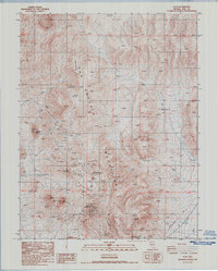
USGS Historical Quadrangle in GeoPDF.
Tags: 7.5 x 7.5 minute,
Downloadable Data,
GeoPDF,
GeoTIFF,
Historical Topographic Maps, All tags...
Historical Topographic Maps 7.5 x 7.5 Minute Map Series,
Map,
NV,
Provisional,
Rays,
imageryBaseMapsEarthCover, Fewer tags
|
|

