Filters: Tags: san joaquin valley (X)
82 results (53ms)|
Filters
Date Range
Extensions Types Contacts
Categories Tag Types Tag Schemes
|

These data were released prior to the October 1, 2016 effective date for the USGS’s policy dictating the review, approval, and release of scientific data as referenced in USGS Survey Manual Chapter 502.8 Fundamental Science Practices: Review and Approval of Scientific Data for Release. This digital dataset defines the spring 1961 water-table altitude for the California's Central Valley. It was used to initiate the water-level altitudes for the upper zones of the transient hydrologic model of the Central Valley flow system. The Central Valley encompasses an approximate 50,000 square-kilometer region of California. The complex hydrologic system of the Central Valley is simulated using the USGS numerical modeling...

These data were released prior to the October 1, 2016 effective date for the USGS’s policy dictating the review, approval, and release of scientific data as referenced in USGS Survey Manual Chapter 502.8 Fundamental Science Practices: Review and Approval of Scientific Data for Release. This digital dataset defines the model grid and altitudes of the top of the 10 model layers and base of the model simulated in the transient hydrologic model of the Central Valley flow system. The Central Valley encompasses an approximate 50,000 square-kilometer region of California. The complex hydrologic system of the Central Valley is simulated using the USGS numerical modeling code MODFLOW-FMP (Schmid and others, 2006), which...

These data were released prior to the October 1, 2016 effective date for the USGS’s policy dictating the review, approval, and release of scientific data as referenced in USGS Survey Manual Chapter 502.8 Fundamental Science Practices: Review and Approval of Scientific Data for Release. This digital dataset contains the surface-water network for the Central Valley Hydrologic Model (CVHM). The Central Valley encompasses an approximate 50,000-square-kilometer region of California. The complex hydrologic system of the Central Valley is simulated using the USGS numerical modeling code MODFLOW-FMP (Schmid and others, 2006). This simulation is referred to here as the CVHM (Faunt, 2009). Utilizing MODFLOW-FMP, the CVHM...
Groundwater-quality data collected between 1993 and 2015 were compiled from the U.S. Geological Survey (USGS) National Water Information System (NWIS) database for 722 wells in the San Joaquin Valley (SJV). Groundwater-quality data retrieved included lab analyses of complete major ion data (calcium, magnesium, sodium, potassium, chloride, sulfate, nitrate, alkalinity, bicarbonate, carbonate, silica, and TDS) for 613 samples, and an additional 109 samples with measured values of specific conductance. Most of these wells were sampled as part of the California Groundwater Ambient Monitoring and Assessment (GAMA) Program Priority Basin Project or the USGS National Water Quality Assessment (NAWQA) Program. In addition...
Categories: Data;
Types: Citation,
Map Service,
OGC WFS Layer,
OGC WMS Layer,
OGC WMS Service;
Tags: Agriculture,
California,
Central Valley,
Environment,
GAMA,
This digital dataset is comprised of two separate data files that contain total dissolved solids, well construction, and well identifying information for 1,131 petroleum wells used to map salinity in and around 31 southern and central California oil fields. Salinity mapping was done for 27 fields located in the southern San Joaquin Valley of Kern County (North Belridge, South Belridge, Canfield Ranch, North Coles Levee, South Coles Levee, Cymric, Edison, Elk Hills, Fruitvale, Greeley, Jasmin, Kern Bluff, Kern Front, Kern River, Lost Hills, Mount Poso, Mountain View, Poso Creek, Rio Bravo, Rosedale, Rosedale Ranch, Round Mountain, San Emidio Nose, Tejon, Ten Section, Wheeler Ridge, and Yowlumne), 3 fields in the...
Categories: Data;
Tags: California,
Central Coastal Basins,
Los Angeles Basin,
San Joaquin Valley,
groundwater,
The U.S. Geological Survey (USGS) in cooperation with the California State Water Resources Control Board collected produced water samples for analysis of volatile organic compounds (VOCs) in the eight California oil fields of Fruitvale, Lost Hills, North Belridge, Orcutt, Placerita, South Belridge, Midway-Sunset, and Buena Vista from 2016 to 2020. Sampled sites included oil wells; injectate from tanks, pipelines, and injection wells where produced water from many wells, after removal of oil, is stored or transported prior to underground injection; integrated produced water from many oil wells collected from pipelines before oil removal; and surface disposal ponds where produced water, after removal of oil, is disposed...
This mapping documents the changes in extent and condition of vernal pool habitat in the Great Valley between 2005 and 2012. "Vernal pool habitat" is defined as vernal pools and the surrounding upland (typically grassland) habitat matrix. The 2005 basemap was created by using double-blind mapping protocol and included 21.4 million acres in and surrounding the Sacramento and San Joaquin valleys (Witham et al 2013). The area included in the 2012 remapping effort focused on the 807,820 acres identified in the 2005 map and areas immediately surrounding the previously mapped polygons. Special attention was paid to areas where habitat was being created through mitigation banking. The result of the 2012 remapping shows...
Categories: Data,
Publication;
Types: ArcGIS REST Map Service,
ArcGIS Service Definition,
Citation,
Downloadable,
Map Service,
OGC WFS Layer,
OGC WMS Layer,
Shapefile;
Tags: California,
Great Valley,
Hogwallows,
Sacramento Valley,
San Joaquin Valley,
Mendenhall and others (1916) published depth-to-water data compiled in 1910 for all known wells in the San Joaquin Valley, California. Data for the 3,429 wells having depth-to-water of greater than zero feet were used to construct an interpolated depth-to-water surface for the entire SJV. This map represents groundwater levels in approximately 1910, prior to extensive development of the groundwater system. A depth-to-water contour map with contour lines of 5, 10, 15, and 25 meters below land surface was then drawn from this raster surface.
Types: Citation,
Map Service,
OGC WFS Layer,
OGC WMS Layer,
OGC WMS Service;
Tags: Agriculture,
ArcGIS,
California,
Central Valley,
Depth-to-Water,
High concentrations of uranium were detected in samples from wells used for domestic drinking water supplies in the San Joaquin Valley. Of 163 domestic wells sampled by the California Groundwater Ambient Monitoring and Assessment Program Priority Basin Project (GAMA-PBP) and the National Water Quality Program (NWQP) in 2008-2015, 26 percent had uranium concentrations greater than the U.S. Environmental Protection Agency maximum contaminant level (EPA MCL) of 30 µg/L, with 13 percent of the wells having uranium concentration between 100 µg/L and 450 µg/L. To evaluate the potential anthropogenic and geologic causes of these anomalously high uranium concentrations, Rosen and others (2019) compiled water quality and...

These data were released prior to the October 1, 2016 effective date for the USGS’s policy dictating the review, approval, and release of scientific data as referenced in USGS Survey Manual Chapter 502.8 Fundamental Science Practices: Review and Approval of Scientific Data for Release. This digital dataset contains the virtual wells used for urban (municipal and industrial use) pumpage for the Central Valley Hydrologic Model (CVHM). The Central Valley encompasses an approximate 50,000 square-kilometer region of California. The complex hydrologic system of the Central Valley is simulated using the U.S. Geological Survey (USGS) numerical modeling code MODFLOW-FMP (Schmid and others, 2006). This application is referred...
This data release contains oil well annular cement and casing damage data from parts of the South Belridge and Lost Hills Oil Fields in western Kern County, California. The study area coincides with where groundwater with less than 10,000 milligrams per liter total dissolved solids and outside an exempt aquifer are located overlying oil-producing zones in these fields. In the study areas, hydraulic fracturing is occurring in mature oil fields where oil and gas development has occurred for approximately a century. The data were compiled from records of the California Department of Conservation, Geologic Energy Management Division (CalGEM). The data compiled include construction information for oil wells, drilling...
Categories: Data;
Tags: California,
Energy Resources,
Geochemistry,
Lost Hills oil field,
San Joaquin Valley,
Saline Soils with at least slightly saline conditions. Based on SSURGO data.
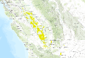
Airborne electromagnetic (AEM) and magnetic survey data were collected during October 2016 over a total distance of 262 line kilometers in the southeastern San Joaquin Valley near Cawelo, California. These data were collected in support of groundwater salinity mapping and hydrogeologic framework development as part of the U.S. Geological Survey California Oil, Gas, and Groundwater program and the California State Water Resources Control Board’s Oil and Gas Regional Monitoring Program. Minimally processed binary AEM data received from SkyTEM ApS were imported into the Aarhus Workbench software (Aarhus Geosoftware, Aarhus, Denmark) and processed. Filters were applied to inclinometer and spatial positioning data to...
Categories: Data;
Types: Map Service,
OGC WFS Layer,
OGC WMS Layer,
OGC WMS Service;
Tags: CAWSC,
California,
California Water Science Center,
Cawelo,
GGGSC,
This Data release presents results for pesticide constituents in 460 samples collected from domestic and public-supply wells in August 2013-May 2018 for the California Groundwater Ambient Monitoring and Assessment Program Priority Basin Project (GAMA-PBP). The samples were analyzed for 225 pesticide constituents on USGS National Water Quality Laboratory analytical schedule 2437. Results from quality-control samples collected with the environmental samples and results from laboratory quality-control samples were used to re-process the data to meet project data-quality objectives. The data release includes the final approved results tabulated by result and by sample, the original and final values for results affected...
Categories: Data;
Tags: California,
Environmental Health,
GAMA Priority Basin Project,
Geochemistry,
Hydrology,

These data were released prior to the October 1, 2016 effective date for the USGS’s policy dictating the review, approval, and release of scientific data as referenced in USGS Survey Manual Chapter 502.8 Fundamental Science Practices: Review and Approval of Scientific Data for Release. This digital dataset defines the model grid, active cells in model layers 2 and 3, and geologic province arrays of the ZONE package used in the transient hydrologic model of the Central Valley flow system. The Central Valley encompasses an approximate 50,000 square-kilometer region of California. The complex hydrologic system of the Central Valley is simulated using the USGS numerical modeling code MODFLOW-FMP (Schmid and others,...

These data were released prior to the October 1, 2016 effective date for the USGS’s policy dictating the review, approval, and release of scientific data as referenced in USGS Survey Manual Chapter 502.8 Fundamental Science Practices: Review and Approval of Scientific Data for Release. This digital dataset contains the monthly precipitation for the Central Valley Hydrologic Model (CVHM). The Central Valley encompasses an approximate 50,000 square-kilometer region of California. The complex hydrologic system of the Central Valley is simulated using the U.S. Geological Survey (USGS) numerical modeling code MODFLOW-FMP (Schmid and others, 2006). This simulation is referred to here as the CVHM (Faunt, 2009). Utilizing...

These data were released prior to the October 1, 2016 effective date for the USGS’s policy dictating the review, approval, and release of scientific data as referenced in USGS Survey Manual Chapter 502.8 Fundamental Science Practices: Review and Approval of Scientific Data for Release. This digital dataset contains the monthly urban (municipal and industrial use) pumpage for the Central Valley Hydrologic Model (CVHM) by Water Balance Subregion (WBS). The Central Valley encompasses an approximate 50,000 square-kilometer region of California. The complex hydrologic system of the Central Valley is simulated using the U.S. Geological Survey(USGS) numerical modeling code MODFLOW-FMP (Schmid and others, 2006). This application...
Airborne electromagnetic (AEM) and magnetic survey data were collected during October 2016 along 1,443 line kilometers in the southwestern San Joaquin Valley near Lost Hills, California. These data were collected in support of groundwater salinity mapping and hydrogeologic framework development as part of the U.S. Geological Survey California Oil, Gas, and Groundwater program and the California State Water Resources Control Board’s Program of Regional Monitoring of Water Quality in Areas of Oil and Gas Production. Minimally processed binary AEM data received from the contractor were imported into the Aarhus Workbench software (Aarhus Geosoftware, Aarhus, Denmark) and processed. Filters were applied to inclinometer...
Categories: Data;
Types: Map Service,
OGC WFS Layer,
OGC WMS Layer,
OGC WMS Service;
Tags: CAWSC,
California,
California Water Science Center,
GGGSC,
Geology, Geophysics, and Geochemistry Science Center,
This data release documents grid cells and modeled groundwater levels for hydrologic characterization of aquifer areas used for public drinking-water supply in California’s Central Valley from 1990 to 2020. Observations of spring groundwater level (median depth to groundwater measured from January through April) were calculated for selected wells from the California Department of Water Resources (DWR) periodic groundwater level measurements dataset (DWR, 2021) that had data for >50% of years from 1990 to 2020. Spring groundwater levels for years without data were imputed by multiple linear regression on the top five most correlated records within the same Central Valley subregion (Sacramento Valley, San Joaquin...

These data were released prior to the October 1, 2016 effective date for the USGS’s policy dictating the review, approval, and release of scientific data as referenced in USGS Survey Manual Chapter 502.8 Fundamental Science Practices: Review and Approval of Scientific Data for Release. This digital dataset contains the locations of, and links to USGS gages on the surface-water network for the Central Valley Hydrologic Model (CVHM). The Central Valley encompasses an approximate 50,000 square-kilometer region of California. The complex hydrologic system of the Central Valley is simulated using the USGS numerical modeling code MODFLOW-FMP (Schmidt and others, 2006b). This simulation is referred to here as the CVHM...
|

|
