Filters: Tags: scenario (X)
317 results (90ms)|
Filters
Date Range
Extensions Types
Contacts
Categories Tag Types
|

The Nature Conservancy (TNC) has derived climate suitability forecasts for most species of trees and shrubs considered to be ecological dominants of terrestrial Californian habitat types. Our plant projections are compiled as decision support tools to help Conservancy project staff, as well as our external partners, develop the necessary plans, priorities and strategies to successfully adapt to uncertain changes in future climate. In the recently completed Southern Sierra Partnership's 2010 Climate-Adapted Conservation Plan for the Southern Sierra Nevada and Tehachapi Mountains, species and habitat forecasts shown here informed the development of a regional conservation design that explicitly incorporates long-term...

The Nature Conservancy (TNC) has derived climate suitability forecasts for most species of trees and shrubs considered to be ecological dominants of terrestrial Californian habitat types. Our plant projections are compiled as decision support tools to help Conservancy project staff, as well as our external partners, develop the necessary plans, priorities and strategies to successfully adapt to uncertain changes in future climate. In the recently completed Southern Sierra Partnership's 2010 Climate-Adapted Conservation Plan for the Southern Sierra Nevada and Tehachapi Mountains, species and habitat forecasts shown here informed the development of a regional conservation design that explicitly incorporates long-term...

The Nature Conservancy (TNC) has derived climate suitability forecasts for most species of trees and shrubs considered to be ecological dominants of terrestrial Californian habitat types. Our plant projections are compiled as decision support tools to help Conservancy project staff, as well as our external partners, develop the necessary plans, priorities and strategies to successfully adapt to uncertain changes in future climate. In the recently completed Southern Sierra Partnership's 2010 Climate-Adapted Conservation Plan for the Southern Sierra Nevada and Tehachapi Mountains, species and habitat forecasts shown here informed the development of a regional conservation design that explicitly incorporates long-term...
The Nature Conservancy (TNC) has derived climate suitability forecasts for most species of trees and shrubs considered to be ecological dominants of terrestrial Californian habitat types. Our plant projections are compiled as decision support tools to help Conservancy project staff, as well as our external partners, develop the necessary plans, priorities and strategies to successfully adapt to uncertain changes in future climate. In the recently completed Southern Sierra Partnership's 2010 Climate-Adapted Conservation Plan for the Southern Sierra Nevada and Tehachapi Mountains, species and habitat forecasts shown here informed the development of a regional conservation design that explicitly incorporates long-term...

The Nature Conservancy (TNC) has derived climate suitability forecasts for most species of trees and shrubs considered to be ecological dominants of terrestrial Californian habitat types. Our plant projections are compiled as decision support tools to help Conservancy project staff, as well as our external partners, develop the necessary plans, priorities and strategies to successfully adapt to uncertain changes in future climate. In the recently completed Southern Sierra Partnership's 2010 Climate-Adapted Conservation Plan for the Southern Sierra Nevada and Tehachapi Mountains, species and habitat forecasts shown here informed the development of a regional conservation design that explicitly incorporates long-term...

The Nature Conservancy (TNC) has derived climate suitability forecasts for most species of trees and shrubs considered to be ecological dominants of terrestrial Californian habitat types. Our plant projections are compiled as decision support tools to help Conservancy project staff, as well as our external partners, develop the necessary plans, priorities and strategies to successfully adapt to uncertain changes in future climate. In the recently completed Southern Sierra Partnership's 2010 Climate-Adapted Conservation Plan for the Southern Sierra Nevada and Tehachapi Mountains, species and habitat forecasts shown here informed the development of a regional conservation design that explicitly incorporates long-term...

The Nature Conservancy (TNC) has derived climate suitability forecasts for most species of trees and shrubs considered to be ecological dominants of terrestrial Californian habitat types. Our plant projections are compiled as decision support tools to help Conservancy project staff, as well as our external partners, develop the necessary plans, priorities and strategies to successfully adapt to uncertain changes in future climate. In the recently completed Southern Sierra Partnership's 2010 Climate-Adapted Conservation Plan for the Southern Sierra Nevada and Tehachapi Mountains, species and habitat forecasts shown here informed the development of a regional conservation design that explicitly incorporates long-term...

The Nature Conservancy (TNC) has derived climate suitability forecasts for most species of trees and shrubs considered to be ecological dominants of terrestrial Californian habitat types. Our plant projections are compiled as decision support tools to help Conservancy project staff, as well as our external partners, develop the necessary plans, priorities and strategies to successfully adapt to uncertain changes in future climate. In the recently completed Southern Sierra Partnership's 2010 Climate-Adapted Conservation Plan for the Southern Sierra Nevada and Tehachapi Mountains, species and habitat forecasts shown here informed the development of a regional conservation design that explicitly incorporates long-term...

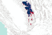
This dataset represents presence of white pine (Pinus strobus) at year 150 (2045) from a single model run of LANDIS-II. The simulation assumed Intergovernmental Panel on Climate Change (IPCC) B2 emissions (moderate) and used the Hadley 3 global circulation model. Restoration harvest rates and intensities were simulated.
Thuis empirical note provides a disaggregated analysis of the causal relationship between fossil fuel consumption and real gross domestic product (GDP) in the US using annual data from 1949 to 2006. The Toda-Yamamoto long-run causality tests reveal the absence of Granger-causality between coal consumption and real GDP; positive undirectional causality from real GDP to natural gas consumption; and positive undirectional causality from petroleum consumption to real GDP.
The Vista tool is used to create a Scenario of the development CAs affecting the North American Warm Desert Riparian Woodland, Shrubland, Mesquite Bosque and Stream CE and applies user-input Landscape Condition Model (LCM) scores to generate ESAs for each of the CEs. The LCM consists of Site Impact scores and impact Distances for each CA category. Site Impact scores are a value between 0 and 1 representing the impact of the CA on the relevant CEs. A score close to 1 indicates negligible or no impact from that CA. A score close to 0 indicates the highest possible impact, e.g. an interstate highway that makes the area in which it occurs completely unsuitable for the CE. Distances are set in meters and extend the impact...
The Vista tool is used to create a Scenario of the fire CAs affecting the Nectivorous Bat Assemblage CE and applies user-input Landscape Condition Model (LCM) scores to generate ESAs for each of the CEs. The LCM consists of Site Impact scores and impact Distances for each CA category. Site Impact scores are a value between 0 and 1 representing the impact of the CA on the relevant CEs. A score close to 1 indicates negligible or no impact from that CA. A score close to 0 indicates the highest possible impact, e.g. an interstate highway that makes the area in which it occurs completely unsuitable for the CE. Distances are set in meters and extend the impact of the CA from the footprint out for the specified distance,...
The Vista tool is used to create a Scenario of the invasives CAs affecting the Desert Bighorn Sheep (Ovis canadensis) CE and applies user-input Landscape Condition Model (LCM) scores to generate ESAs for each of the CEs. The LCM consists of Site Impact scores and impact Distances for each CA category. Site Impact scores are a value between 0 and 1 representing the impact of the CA on the relevant CEs. A score close to 1 indicates negligible or no impact from that CA. A score close to 0 indicates the highest possible impact, e.g. an interstate highway that makes the area in which it occurs completely unsuitable for the CE. Distances are set in meters and extend the impact of the CA from the footprint out for the...
The Vista tool is used to create a Scenario of the CAs affecting the Grassland Bird Assemblage CE and applies user-input Landscape Condition Model (LCM) scores to generate ESAs for each of the CEs. The LCM consists of Site Impact scores and impact Distances for each CA category. Site Impact scores are a value between 0 and 1 representing the impact of the CA on the relevant CEs. A score close to 1 indicates negligible or no impact from that CA. A score close to 0 indicates the highest possible impact, e.g. an interstate highway that makes the area in which it occurs completely unsuitable for the CE. Distances are set in meters and extend the impact of the CA from the footprint out for the specified distance, declining...
The Vista tool is used to create a Scenario of the CAs affecting the Desert Box Turtle (Terrapene ornata subspecies luteola) CE and applies user-input Landscape Condition Model (LCM) scores to generate ESAs for each of the CEs. The LCM consists of Site Impact scores and impact Distances for each CA category. Site Impact scores are a value between 0 and 1 representing the impact of the CA on the relevant CEs. A score close to 1 indicates negligible or no impact from that CA. A score close to 0 indicates the highest possible impact, e.g. an interstate highway that makes the area in which it occurs completely unsuitable for the CE. Distances are set in meters and extend the impact of the CA from the footprint out for...
The Vista tool is used to create a Scenario of the CAs affecting the Desert Bighorn Sheep (Ovis canadensis) CE and applies user-input Landscape Condition Model (LCM) scores to generate ESAs for each of the CEs. The LCM consists of Site Impact scores and impact Distances for each CA category. Site Impact scores are a value between 0 and 1 representing the impact of the CA on the relevant CEs. A score close to 1 indicates negligible or no impact from that CA. A score close to 0 indicates the highest possible impact, e.g. an interstate highway that makes the area in which it occurs completely unsuitable for the CE. Distances are set in meters and extend the impact of the CA from the footprint out for the specified...
The Vista tool is used to create a Scenario of the CAs affecting the Apacherian Chihuahuan Semi-Desert Grassland and Steppe CE and applies user-input Landscape Condition Model (LCM) scores to generate ESAs for each of the CEs. The LCM consists of Site Impact scores and impact Distances for each CA category. Site Impact scores are a value between 0 and 1 representing the impact of the CA on the relevant CEs. A score close to 1 indicates negligible or no impact from that CA. A score close to 0 indicates the highest possible impact, e.g. an interstate highway that makes the area in which it occurs completely unsuitable for the CE. Distances are set in meters and extend the impact of the CA from the footprint out for...
|

|
