Filters: Tags: section (X)
35 results (34ms)|
Filters
Date Range
Extensions (Less) Types (Less)
Contacts (Less)
Categories (Less) Tag Types Tag Schemes |

Bureau of Land management shape file depicting Oil and Gas lease Areas in Utah, USA This data set contains Oil and Gas Leases, derived from Legal Land Descriptions (LLD) contained in the US Bureau of Land Management's LR2000 Database, and geocoded (mapped) using the Public Land Survey System (PLSS)/Geographic Coordinate Data Base (GCDB) derived from the most accurate survey data available through BLM Cadastral Survey workforce, and the Premier Data Services CarteView Software.
The polygon (vector) shapefile represents Public Land Survey System (PLSS) sections, or 1-square mile areas of land, with information about Bureau of Land Management (BLM) land and mineral use authorizations for mining claims. For each section, the number of claims (by type) was determined and a density (by claim type) was calculated. The land areas specified by BLM authorizations vary in size and orientation, and may cross PLSS section boundaries. For spatial consistency, the information was aggregated to the square mile PLSS section boundary. The original source data from BLM Cases Recordation database (LR2000) were specific to the day they were generated (March 6, 2016) and subsequent data pulls will likely be...
Categories: Data;
Types: Citation,
Downloadable,
Map Service,
OGC WFS Layer,
OGC WMS Layer,
Shapefile;
Tags: Idaho,
Mine Claims,
Montana,
Nevada,
Oregon,
In 2015, approximately 10 million acres of Federal lands across six western states were proposed for withdrawal from mineral entry by the Bureau of Land Management (BLM) in order to conserve habitat critical for the greater sage-grouse. As a result, the U.S. Geological Survey (USGS) launched the Sagebrush Mineral-Resource Assessment (SaMiRA) project in late-2015 to provide BLM with an assessment of the locatable minerals and an evaluation of the leaseable and saleable minerals within the proposed withdrawal areas. BLM provided Legacy Rehost 2000 System (LR2000) spatial data to the USGS on March 6, 2016 to help identify areas containing mineral leases and claims. The LR2000 system reports BLM land and mineral-use...
The polygon (vector) shapefiles represent Public Land Survey System (PLSS) sections, or 1-square mile areas of land, with information about Bureau of Land Management (BLM) land and mineral use authorizations for plans of operations and notices. The land areas specified by BLM authorizations vary in size and orientation, and may cross one or more PLSS section boundaries. For spatial consistency, the information was aggregated to the square mile PLSS section boundary. The original source data from BLM Cases Recordation database (LR2000) were specific to the day they were generated (March 6, 2016) and subsequent data pulls will likely be different.
Categories: Data;
Types: Citation,
Downloadable,
Map Service,
OGC WFS Layer,
OGC WMS Layer,
Shapefile;
Tags: Cadastral,
Idaho,
Montana,
Nevada,
Notices,
The polygon (vector) shapefiles represent Public Land Survey System (PLSS) sections, or 1-square mile areas of land, with information about Bureau of Land Management (BLM) land and mineral use authorizations for non-energy solid minerals. The land areas specified by BLM authorizations vary in size and orientation, and may cross one or more PLSS section boundaries. For spatial consistency, the information was aggregated to the square mile PLSS section boundary. The original source data from BLM Cases Recordation database (LR2000) were specific to the day they were generated (March 6, 2016) and subsequent data pulls will likely be different.
Categories: Data;
Types: Citation,
Downloadable,
Map Service,
OGC WFS Layer,
OGC WMS Layer,
Shapefile;
Tags: Cadastral,
Idaho,
Mineral Materials,
Montana,
Nevada,
This geospatially explicit vector-based polygon dataset identifies 85 terrestrial ecological subsection delineations present in Southeast Alaska and the Tongass National Forest. Within each subsection one can expect to find a relatively consistent occurence and distribution of vegetation types. Due to the hydrologically-influenced geomorphology of Southeast Alaska specific key indicators of physiography, lithology, and surface geology were employed to systematically distinguish terrestrial ecosystems.
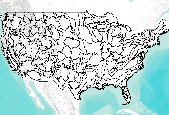
This data set represents ecological sections within the conterminous United States. This data set contains regional geographic delineations for analysis of ecological relationships across ecological units. The U.S. Department of Agriculture (USDA), Forest Service, in participation with numerous individuals of Federal and State agencies and nongovernmental organizations (NGOs), has been developing and refining ecological maps of the United States through the process of peer review and successive approximations since 1976 (Bailey 1976). Ecological mapping and descriptions follow the USDA Forest Service's National Hierarchical Framework of Ecological Units (ECOMAP 1993, Cleland et al. 1997). This 2007 map is the first...
The polygon (vector) shapefiles represent Public Land Survey System (PLSS) sections, or 1-square mile areas of land, with information about Bureau of Land Management (BLM) land and mineral use authorizations for oil and gas. The land areas specified by BLM authorizations vary in size and orientation, and may cross one or more PLSS section boundaries. For spatial consistency, the information was aggregated to the square mile PLSS section boundary. The original source data from BLM Cases Recordation database (LR2000) were specific to the day they were generated (March 6, 2016) and subsequent data pulls will likely be different.
Categories: Data;
Types: Citation,
Downloadable,
Map Service,
OGC WFS Layer,
OGC WMS Layer,
Shapefile;
Tags: Cadastral,
Gas,
Idaho,
Montana,
Nevada,
This digital file is a high-resolution scan or copy of a published geologic map. It was created to archive a geologic map that could be lost to future generations.
Categories: Physical Item;
Tags: Section
The polygon (vector) shapefiles represent claim areas within Public Land Survey System (PLSS) sections aggregated by serial (claim) numbers with information about Bureau of Land Management (BLM) land and mineral use authorizations geothermal. The land areas specified by BLM authorizations vary in size and orientation, and may cross one or more PLSS section boundaries. For spatial consistency, the information was aggregated to the square mile PLSS section boundary and by serial numbers. The original source data from BLM Cases Recordation database (LR2000) were specific to the day they were generated (March 6, 2016) and subsequent data pulls will likely be different.
Categories: Data;
Types: Citation,
Downloadable,
Map Service,
OGC WFS Layer,
OGC WMS Layer,
Shapefile;
Tags: Cadastral,
Geothermal,
Idaho,
Nevada,
Oregon,
The polygon (vector) shapefiles represent claim areas within Public Land Survey System (PLSS) sections aggregated by serial (claim) numbers with information about Bureau of Land Management (BLM) land and mineral use authorizations for coal. The land areas specified by BLM authorizations vary in size and orientation, and may cross one or more PLSS section boundaries. For spatial consistency, the information was aggregated to the square mile PLSS section boundary and by serial numbers. The original source data from BLM Cases Recordation database (LR2000) were specific to the day they were generated (March 6, 2016) and subsequent data pulls will likely be different.
Categories: Data;
Types: Citation,
Downloadable,
Map Service,
OGC WFS Layer,
OGC WMS Layer,
Shapefile;
Tags: Cadastral,
Coal,
PLSS,
Public Land Survey System,
Section,
The polygon (vector) shapefiles represent claim areas within Public Land Survey System (PLSS) sections aggregated by serial (claim) numbers with information about Bureau of Land Management (BLM) land and mineral use authorizations for non-energy solid minerals. The land areas specified by BLM authorizations vary in size and orientation, and may cross one or more PLSS section boundaries. For spatial consistency, the information was aggregated to the square mile PLSS section boundary and by serial numbers. The original source data from BLM Cases Recordation database (LR2000) were specific to the day they were generated (March 6, 2016) and subsequent data pulls will likely be different.
Categories: Data;
Types: Citation,
Downloadable,
Map Service,
OGC WFS Layer,
OGC WMS Layer,
Shapefile;
Tags: Cadastral,
Idaho,
Montana,
Nevada,
Non-energy Solid Minerals,
This data set contains the Public Land Survey System at the QQ level covering much of the western United States. The data is primarily derived from USGS 7.5 - minute topographic maps, with BLM GCDB as a secondary source.
Categories: Data;
Types: Downloadable;
Tags: Greater Green River,
PLSS,
Powder River,
Public Land Survey System,
USA,

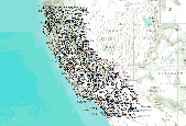
This layer contains polygon features of Ecological Units for the state of California as described by ECOMAP (1993),.. "Ecological types are classified and ecological units are mapped based on associations of those biotic and environmental factors that directly affect or indirectly express energy, moisture, and nutrient gradients which regulate the structure and function of ecosystems. These factors include climate, physiography, water, soils, air, hydrology, and potential natural communities."

This layer contains polygon features of Ecological Units for the state of California as described by ECOMAP (1993),.. "Ecological types are classified and ecological units are mapped based on associations of those biotic and environmental factors that directly affect or indirectly express energy, moisture, and nutrient gradients which regulate the structure and function of ecosystems. These factors include climate, physiography, water, soils, air, hydrology, and potential natural communities."

This dataset depicts Public Land Survey section polygons that contained mining claims on federal land during the period 1976 to 2005, as recorded by the U.S. Bureau of Land Management. This dataset can be used to track changes in the number of mining claims in a particular area over time, or to evaluate relative mining claim pressure between areas at a given point in time.
The polygon (vector) shapefiles represent Public Land Survey System (PLSS) sections, or 1-square mile areas of land, with information about Bureau of Land Management (BLM) land and mineral use authorizations for geothermal. The land areas specified by BLM authorizations vary in size and orientation, and may cross one or more PLSS section boundaries. For spatial consistency, the information was aggregated to the square mile PLSS section boundary. The original source data from BLM Cases Recordation database (LR2000) were specific to the day they were generated (March 6, 2016) and subsequent data pulls will likely be different.
Categories: Data;
Types: Citation,
Downloadable,
Map Service,
OGC WFS Layer,
OGC WMS Layer,
Shapefile;
Tags: Geothermal,
Idaho,
Nevada,
Oregon,
PLSS,

This dataset depicts Public Land Survey section polygons that contained mining claims on federal land during the period 1976 to 2005, as recorded by the U.S. Bureau of Land Management. This dataset can be used to track changes in the number of mining claims in a particular area over time, or to evaluate relative mining claim pressure between areas at a given point in time.
This layer contains polygon features of Ecological Units for the state of California as described by ECOMAP (1993),.. "Ecological types are classified and ecological units are mapped based on associations of those biotic and environmental factors that directly affect or indirectly express energy, moisture, and nutrient gradients which regulate the structure and function of ecosystems. These factors include climate, physiography, water, soils, air, hydrology, and potential natural communities."
This data set contains the Public Land Survey System at the township level covering much of the western United States, derived from USGS 7.5 - minute topographic maps.
Categories: Data;
Types: Downloadable;
Tags: PLSS,
Public Land Survey System,
Wyoming,
boundaries,
land grid,
|

|
