Filters: Tags: shoals (X)
17 results (158ms)|
Filters
Date Range
Extensions Types Contacts
Categories Tag Types
|
This data set contains imagery from the National Agriculture Imagery Program (NAIP). The NAIP program is administered by USDA FSA and has been established to support two main FSA strategic goals centered on agricultural production. These are, increase stewardship of America's natural resources while enhancing the environment, and to ensure commodities are procured and distributed effectively and efficiently to increase food security. The NAIP program supports these goals by acquiring and providing ortho imagery that has been collected during the agricultural growing season in the U.S. The NAIP ortho imagery is tailored to meet FSA requirements and is a fundamental tool used to support FSA farm and conservation programs....
This project evaluates the effects of global climate change and sea level rise on estuarine intertidal habitat in the San Francisco Bay and the Pacific Flyway migratory waterbirds that rely on this habitat. Phase 2 of this project is a continuation of work to evaluate the effects of global climate change and sea level rise (SLR) on intertidal shoals in the San Francisco Bay Estuary and the migratory waterbirds that rely on this critically important resource in the Pacific Flyway. The primary objectives are to: 1) use downscaled global climate change models to translate SLR and climate scenarios into habitat quantity predictions through Delft3D and Dflow-FM (unstructured grid) geomorphic modeling; 2) model the response...
Categories: Data,
Project;
Tags: 2010,
2012,
Applications and Tools,
CA,
California Landscape Conservation Cooperative,

These files were used to construct corridors estimating the extent of new coastal corridors exposed by reduced lake levels. They are included here to show the available horizontal extent of lidar-derived topo-bathymetric data and thus explicitly identify gaps and limitations of predicted corridor extents under various reduced lake level scenarios. In addition, these files provide users with a background layer that depicts the topographic variability of the submerged near-shore lake bed and terrestrial landscape.These files are 5m grid representations of the hydrographic and topographic data collected by the CHARTS system along the coasts of the U.S. sides of Lake Michigan, Lake Huron, Lake St. Clair, Lake Erie,...
Categories: Data,
Map;
Types: Map Service,
OGC WMS Layer;
Tags: Mobile District,
Accountability,
Bathymetry,
CHARTS,
GLRI,
This data set contains imagery from the National Agriculture Imagery Program (NAIP). The NAIP program is administered by USDA FSA and has been established to support two main FSA strategic goals centered on agricultural production. These are increase stewardship of America's natural resources while enhancing the environment, and to ensure commodities are procured and distributed effectively and efficiently to increase food security. The NAIP program supports these goals by acquiring and providing ortho imagery that has been collected during the agricultural growing season in the U.S. The NAIP ortho imagery is tailored to meet FSA requirements and is a fundamental tool used to support FSA farm and conservation programs....
This data set contains imagery from the National Agriculture Imagery Program (NAIP). The NAIP program is administered by USDA FSA and has been established to support two main FSA strategic goals centered on agricultural production. These are increase stewardship of America's natural resources while enhancing the environment, and to ensure commodities are procured and distributed effectively and efficiently to increase food security. The NAIP program supports these goals by acquiring and providing ortho imagery that has been collected during the agricultural growing season in the U.S. The NAIP ortho imagery is tailored to meet FSA requirements and is a fundamental tool used to support FSA farm and conservation programs....
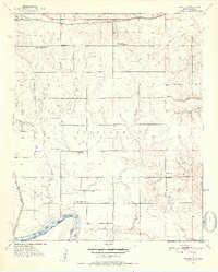
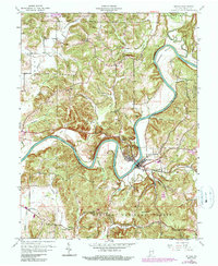
USGS Historical Quadrangle in GeoPDF.
This data set contains imagery from the National Agriculture Imagery Program (NAIP). The NAIP program is administered by USDA FSA and has been established to support two main FSA strategic goals centered on agricultural production. These are, increase stewardship of America's natural resources while enhancing the environment, and to ensure commodities are procured and distributed effectively and efficiently to increase food security. The NAIP program supports these goals by acquiring and providing ortho imagery that has been collected during the agricultural growing season in the U.S. The NAIP ortho imagery is tailored to meet FSA requirements and is a fundamental tool used to support FSA farm and conservation programs....
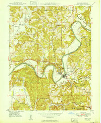
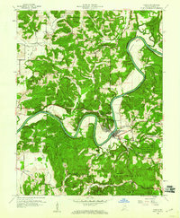
USGS Historical Quadrangle in GeoPDF.
This data set contains imagery from the National Agriculture Imagery Program (NAIP). The NAIP program is administered by USDA FSA and has been established to support two main FSA strategic goals centered on agricultural production. These are increase stewardship of America's natural resources while enhancing the environment, and to ensure commodities are procured and distributed effectively and efficiently to increase food security. The NAIP program supports these goals by acquiring and providing ortho imagery that has been collected during the agricultural growing season in the U.S. The NAIP ortho imagery is tailored to meet FSA requirements and is a fundamental tool used to support FSA farm and conservation programs....
This data set contains imagery from the National Agriculture Imagery Program (NAIP). The NAIP program is administered by USDA FSA and has been established to support two main FSA strategic goals centered on agricultural production. These are increase stewardship of America's natural resources while enhancing the environment, and to ensure commodities are procured and distributed effectively and efficiently to increase food security. The NAIP program supports these goals by acquiring and providing ortho imagery that has been collected during the agricultural growing season in the U.S. The NAIP ortho imagery is tailored to meet FSA requirements and is a fundamental tool used to support FSA farm and conservation programs....
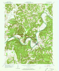
USGS Historical Quadrangle in GeoPDF.
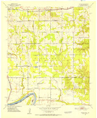
USGS Historical Quadrangle in GeoPDF.
The Wetland Reserve Program (WRP) is a voluntary program administered by the NRCS. It provides technical and financial assistance to private landowners and Tribes to restore, protect, and enhance wetlands in exchange for retiring eligible land from agriculture. For a site to be a wetland eligible for restoration, it must be in a zone with sustained or frequent flooding for a period of 7 consecutive days on average at least once every 2 years (a value termed the 7MQ2). This study calculated the 7MQ2 flows for all the U.S. Geological Survey streamgages within the selected study reaches. These flows were related to the stage discharge tables for each streamgage and a corresponding elevation was determined. By use of...
This data set contains imagery from the National Agriculture Imagery Program (NAIP). The NAIP program is administered by USDA FSA and has been established to support two main FSA strategic goals centered on agricultural production. These are, increase stewardship of America's natural resources while enhancing the environment, and to ensure commodities are procured and distributed effectively and efficiently to increase food security. The NAIP program supports these goals by acquiring and providing ortho imagery that has been collected during the agricultural growing season in the U.S. The NAIP ortho imagery is tailored to meet FSA requirements and is a fundamental tool used to support FSA farm and conservation programs....
This data set contains imagery from the National Agriculture Imagery Program (NAIP). The NAIP program is administered by USDA FSA and has been established to support two main FSA strategic goals centered on agricultural production. These are, increase stewardship of America's natural resources while enhancing the environment, and to ensure commodities are procured and distributed effectively and efficiently to increase food security. The NAIP program supports these goals by acquiring and providing ortho imagery that has been collected during the agricultural growing season in the U.S. The NAIP ortho imagery is tailored to meet FSA requirements and is a fundamental tool used to support FSA farm and conservation programs....
USGS Historical Quadrangle in GeoPDF.
USGS Historical Quadrangle in GeoPDF.
|

|
