Filters: Tags: soil (X)
616 results (13ms)|
Filters
Date Range
Extensions
Types Contacts
Categories Tag Types
|

This dataset represents the soil moisure regimes from SSURGO and STATSTO soil descriptions for soil map units in the state of northern California that lie within the North Pacific Landscape Conservation Cooperative. "The term 'soil moisture regime' refers to the presence or absence either of ground water or of water held at a tension of less than 1500 kPa in the soil or in specific horizons during periods of the year. Water held at a tension of 1500 kPa or more is not available to keep most mesophytic plants alive. The availability of water is also affected by dissolved salts. If a soil is saturated with water that is too salty to be available to most plants, it is considered salty rather than dry. Consequently,...

This set of soils data consists of bulk density, mineral depth, and three layers each of sand, clay, and rock fragment fractions. The soils data were obtained from Kern (2000), using methodology from Kern (1995) with corrected inconsistencies and gap filling from NRCS (1994).

Soil maps for the State Soil Geographic Database (STATSGO) were developed by the NRCS. Detailed county-level soil survey data were generalized into state based coverages and each state edge-matched to form a seamless nation-wide database for soils. The mapping scale for STATSGO is 1:250,000 (with the exception of alaska, which is 1:1,000,000). The level of mapping is designed to be used for broad planning and management covering state, regional, and multi-state areas. STATSGO data are available for the conterminous U.S., Alaska, Hawaii, and Puerto Rico. This data layer was produced by extracting soil temperature attributes from the NRCS - STATSGO data layers for the 11 western states. Map types represent most prevalent...

This set of soils data consists of mineral depth, and three layers each of sand, clay, and rock fragment fractions. The soils data were obtained from Kern (2000), using methodology from Kern (1995) with corrected inconsistencies and gap filling from NRCS (1994).

The Vegetation/Ecosystem Modeling and Analysis Project (VEMAP) was a multi-institutional, international effort that addressed the response of biogeography and biogeochemistry to environmental variability in climate and other drivers in both space and time domains. The objectives of VEMAP were to study the intercomparison of biogeochemistry models and vegetationtype distribution models (biogeography models) and determine their sensitivity to changing climate, elevated atmospheric carbon dioxide concentrations, and other sources of altered forcing. Soil properties were based on a 10-km gridded EPA soil database developed by Kern (1994, 1995). Two soil coverages are provided in the Kern data set: one from the USDA...

The Vegetation/Ecosystem Modeling and Analysis Project (VEMAP) was a multi-institutional, international effort that addressed the response of biogeography and biogeochemistry to environmental variability in climate and other drivers in both space and time domains. The objectives of VEMAP were to study the intercomparison of biogeochemistry models and vegetationtype distribution models (biogeography models) and determine their sensitivity to changing climate, elevated atmospheric carbon dioxide concentrations, and other sources of altered forcing. Soil properties were based on a 10-km gridded EPA soil database developed by Kern (1994, 1995). Two soil coverages are provided in the Kern data set: one from the USDA...

This dataset respresents the soils with high volcanic content (pumice or volcanic glass) in the North Pacific Landscape Conservation Cooperative.
This dataset represents the soil water storage capacity (AWS in mm at 0.25 m depth) from SSURGO and STATSGO soil descriptions for soil map units in the state of southern Alaska that lie within the North Pacific Landscape Conservation Cooperative. Available Water Storage 0-25 cm - Weighted Average (centimeters). Available water storage (AWS). The volume of water that the soil, to a depth of 25 centimeters, can store that is available to plants. It is reported as the weighted average of all components in the map unit, and is expressed as centimeters of water. AWS is calculated from AWC (available water capacity) which is commonly estimated as the difference between the water contents at 1/10 or 1/3 bar (field capacity)...

This dataset represents the soil water storage capacity (AWS in mm at 0.5 m depth) from SSURGO and STATSGO soil descriptions for soil map units in the state of southern Alaska that lie within the North Pacific Landscape Conservation Cooperative. Available Water Storage 0-50 cm - Weighted Average (centimeters). Available water storage (AWS). The volume of water that the soil, to a depth of 50 centimeters, can store that is available to plants. It is reported as the weighted average of all components in the map unit, and is expressed as centimeters of water. AWS is calculated from AWC (available water capacity) which is commonly estimated as the difference between the water contents at 1/10 or 1/3 bar (field capacity)...
Our objective is to improve the scientific understanding of the modes, rates, and mechanisms of carbon stabilization and losses in soils from Alaska, California, and other Western states. We focus on the biophysical and microbial mechanisms that drive carbon gains and losses, and to use our data to improve models of soil carbon cycling. This catalog supports research from several projects focused on soil carbon cycling. It encompasses multiple types of datasets including environmental, ecological, biological, isotopic, mineralogical, genomic, flux, and modeled data from water, vegetation, soil, and atmospheric matrices. The catalog will be available online and to the public. Therefore, publication of data through...
Winter climate change has the potential to have a large impact on coastal wetlands in the southeastern U.S. Warmer winter temperatures and reductions in the intensity of freeze events would likely lead to mangrove forest range expansion and salt marsh displacement in parts of the U.S. Gulf of Mexico and Atlantic coast. The objective of this research was to better understand some of the ecological implications of mangrove forest migration and salt marsh displacement. The potential ecological effects of mangrove migration are diverse ranging from important biotic impacts (e.g., coastal fisheries, land bird migration; colonial nesting wading birds) to ecosystem stability (e.g., response to sea level rise and drought;...
Winter climate change has the potential to have a large impact on coastal wetlands in the southeastern U.S. Warmer winter temperatures and reductions in the intensity of freeze events would likely lead to mangrove forest range expansion and salt marsh displacement in parts of the U.S. Gulf of Mexico and Atlantic coast. The objective of this research was to better understand some of the ecological implications of mangrove forest migration and salt marsh displacement. The potential ecological effects of mangrove migration are diverse ranging from important biotic impacts (e.g., coastal fisheries, land bird migration; colonial nesting wading birds) to ecosystem stability (e.g., response to sea level rise and drought;...

These data were released prior to the October 1, 2016 effective date for the USGS’s policy dictating the review, approval, and release of scientific data as referenced in USGS Survey Manual Chapter 502.8 Fundamental Science Practices: Review and Approval of Scientific Data for Release. The digital data set delineates the outer boundary of each major discharge area evaluated as part of the study. These areas were used to refine estimates of ground-water discharge throughout the Death Valley regional flow system. As delineated, boundaries include all phreatophytic vegetation and moist soil areas within a discharge area. The boundaries were used to focus efforts associated with classifying the different vegetation...

These data were released prior to the October 1, 2016 effective date for the USGS’s policy dictating the review, approval, and release of scientific data as referenced in USGS Survey Manual Chapter 502.8 Fundamental Science Practices: Review and Approval of Scientific Data for Release. This spatial data set was created by the U.S. Geological Survey (USGS) to represent the area of soils with different levels of phosphorus retention potential in the Pacific Northwest region of the United States (Hydro Region 17; Major River Basin 7 (MRB7)) within each incremental watershed delineated in the NHDPlus v2 dataset.
This dataset represents the soil texture from SSURGO and STATSGO soil descriptions for soil map units in the state of western Oregon that lie within the North Pacific Landscape Conservation Cooperative. Soil texture is the mineral particle size distribution of soil particles within a soil horizon. This dataset also documents rock fragments and organic matter that may contribute to water infiltration, storage and relocation within the surface horizons of the soil profile. For reference, see NRCS soil texture triangle: http://soils.usda.gov/technical/aids/investigations/texture/
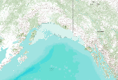
This dataset represents the soil order from SSURGO and STATSGO soil descriptions for soil map units in the state of southern Alaska (b) that lie within the North Pacific Landscape Conservation Cooperative.
This dataset represents the soil pH from SSURGO and STATSGO soil descriptions for soil map units in the state of northern California that lie within the North Pacific Landscape Conservation Cooperative.
What are current conditions for important park natural resources? What are the critical data and knowledge gaps? What are some of the factors that are influencing park resource conditions? Natural Resource Condition Assessments (NRCAs) evaluate and report on the above for a subset of important natural resources in national park units (hereafter, parks). Focal study resources and indicators are selected on a park-by-park basis, guided by use of structured resource assessment and reporting frameworks. Considerations include park resource setting and enabling legislation (what are this park's most important natural resources?) and presently available data and expertise (what can be evaluated at this time?). In addition...
Categories: Data;
Types: ArcGIS REST Map Service,
Map Service,
OGC WFS Layer,
OGC WMS Layer,
OGC WMS Service;
Tags: Chihuahuan Desert,
English,
GIS,
Madrean,
Mojave Desert,
El Espacio Digital Geográfico (ESDIG) de la SEMARNAT, muestra en mapas información sobre las características ambientales y sociales del país en temas como vegetación, uso del suelo, cuerpos de agua, suelos, clima, población, entre otros, así como de los resultados de programas ambientales y sociales dedicados al aprovechamiento, conservación y recuperación de los ecosistemas naturales de México. Los mapas desplegados son extraídos de la base de datos geográfica del SNIARN. La información contenida en ésta base ha sido generada por diferentes áreas de la Semarnat, sus órganos desconcentrados y descentralizados, así como también por el INEGI y diversas dependencias del Gobierno Federal.
Types: Map Service,
OGC WFS Layer,
OGC WMS Layer,
OGC WMS Service;
Tags: GIS,
Mexico,
Spanish,
bird,
climate,
A battery of questions was developed and applied to different stakeholders immersed in knowledge of the condition and the use of grazing of grasslands. One hundred people were surveyed amongst livestock producers (both from private ranches and from communal ejidos), and students and researchers at regional institutions involved in agricultural sciences in different states of Mexico: Coahuila, Durango, San Luis Potosí, and Jalisco. The objective of the survey was to determine aspects of stakeholders’ interpretation of the condition of grasslands in their region under conditions of extensive grazing, such as soil condition, harvest efficiency, vegetation condition, openness to community organizing of grazing, capacity...
Types: Map Service,
OGC WFS Layer,
OGC WMS Layer,
OGC WMS Service;
Tags: Mexico,
Spanish,
cultural,
desertification,
economic,
|

|
