Filters: Tags: trona (X)
22 results (56ms)|
Filters
Date Range
Extensions Types Contacts
Categories Tag Types Tag Schemes |
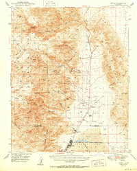
USGS Historical Quadrangle in GeoPDF.

USGS Historical Quadrangle in GeoPDF.
Previous research has shown that the flotation of soluble salt is determined by interfacial water structure, thermal stability, and viscosity. These salts include alkali halide and alkali oxyanion salts. Of particular interest are the carbonate salts such as those associated with the great trona deposit of the Green River basin in Wyoming. In this study, we investigated the adsorption of carbonate and bicarbonate salts at the air–brine interface and correlated the adsorption behavior with water structure. Specifically, the equilibrium and dynamic surface tensions of sodium carbonate and sodium bicarbonate salts have been measured as a function of the salt concentration up to saturation and compared with the model...
Categories: Publication;
Types: Citation,
Journal Citation;
Tags: International Journal of Mineral Processing,
adsorption,
sodium bicarbonate,
sodium carbonate,
surface tension,
Core Research Center, cutting CZ12740, from well operated by MIAMI OIL PRODUCERSRaw Properties from download, web scrape, MapServer, and Macrostrat API{"Lib Num": "CZ12740", "API Num": "4903720427", "Operator": "MIAMI OIL PRODUCERS", "Well Name": "1 GREEN RIVER", "Field": "WC", "State": "WY", "County": "SWEETWATER", "Thin Sec": "F", "Analysis": "F", "Latitude": "41.53011", "Longitude": "-109.42743", "coordinates_geohash": "9x6hmbm6kjd5", "Source": "FROM STATE RECORDS", "Min": "100", "Max": "8150", "Security Flag": null, "crc_collection_name": "cutting", "sb_parent_id": "4f4e49d8e4b07f02db5df2d2", "intervals": [{"Formation": null, "Age": null, "Min Depth": null, "Max Depth": null}], "crcwc_url": "https://my.usgs.gov/crcwc/cutting/report/24326",...
Categories: Physical Item;
Tags: Wilkins Peak Member,
Wilkins Peak Member of Green River Formation,
ash,
halite,
lower Eocene,
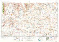
USGS Historical Quadrangle in GeoPDF.
USGS Historical Quadrangle in GeoPDF.
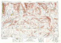
USGS Historical Quadrangle in GeoPDF.
USGS Historical Quadrangle in GeoPDF.

From the US Bureau of Mines map publication, "Availability of Federally Owned Minerals for Exploration and Development in the Western United States". The Bureau of Mines inventoried Federal mineral land in Wyoming and assessed the availability of this land for mineral exploration and development as affected by legal status and agency management practices. To illustrate the impact that various Federal land use decisions have on the mineral industry, the USBM also identified and ranked known mineral deposit areas (KMDAs)-i.e., areas having past or present mineral production and /or known mineral resources- and compared these areas spatially with availability of Federal mineral lands. Most Federal minerals, except...
Categories: Data;
Types: Downloadable;
Tags: Federal Government,
Geology,
Mineral Occurrences,
Wyoming,
economy,

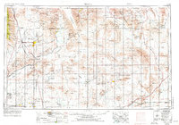
USGS Historical Quadrangle in GeoPDF.

USGS Historical Quadrangle in GeoPDF.
USGS Historical Quadrangle in GeoPDF.
USGS Historical Quadrangle in GeoPDF.
USGS Historical Quadrangle in GeoPDF.

USGS Historical Quadrangle in GeoPDF.
USGS Historical Quadrangle in GeoPDF.
Previous research has shown that the flotation of soluble salt is determined by interfacial water structure, thermal stability, and viscosity. These salts include alkali halide and alkali oxyanion salts. Of particular interest are the carbonate salts such as those associated with the great trona deposit of the Green River basin in Wyoming. In this study, we investigated the adsorption of carbonate and bicarbonate salts at the air?brine interface and correlated the adsorption behavior with water structure. Specifically, the equilibrium and dynamic surface tensions of sodium carbonate and sodium bicarbonate salts have been measured as a function of the salt concentration up to saturation and compared with the model...
Categories: Publication;
Types: Citation,
Journal Citation;
Tags: International Journal of Mineral Processing,
adsorption,
sodium bicarbonate,
sodium carbonate,
surface tension,
Core Research Center, core U858, from well operated by U S ERDARaw Properties from download, web scrape, MapServer, and Macrostrat API{"Lib Num": "U858", "API Num": null, "Operator": "U S ERDA", "Well Name": "4 WHITE MOUNTAIN", "Field": null, "State": "WY", "County": "SWEETWATER", "Type": "SPLIT", "Photos": "F", "Thin Sec": "F", "Analysis": "F", "Latitude": "41.618916", "Longitude": "-109.286765", "coordinates_geohash": "9x6kc07zcb38", "Source": "FROM STATE RECORDS", "Security Flag": "NO SPECIAL RESTRICTIONS", "crc_collection_name": "core", "sb_parent_id": "4f4e49dae4b07f02db5e0486", "intervals": [{"Formation": "GREEN RIVER", "Age": "TERT", "Min Depth": "10", "Max Depth": "170"}], "crcwc_url": "https://my.usgs.gov/crcwc/core/report/16439",...
Categories: Physical Item;
Tags: GREEN RIVER,
TERT,
Wilkins Peak Member,
Wilkins Peak Member of Green River Formation,
ash,

USGS Historical Quadrangle in GeoPDF.

USGS Historical Quadrangle in GeoPDF.
|

|
