Filters: Tags: trout (X)
30 results (110ms)|
Filters
Date Range
Extensions (Less) Types (Less)
Contacts (Less)
Categories (Less) Tag Types
|

Point locations for collections of Michigan fish in the Lake Michigan basin.

This dataset contains small cutthroat trout lakes within Southeast Alaska. These are smaller lakes that do not produce cutthroat trout large enough to reach the 11-inch regional minimum size limit. Each of these lakes has a 9-inch minimum size limit, and bait is prohibited. Regionwide limits of 2 per day and 2 in possession apply. Currently there are seven lakes in Southeast Alaska with the small cutthroat lake designation. Please verify fishing regulations with current Alaska Department of Fish and Game Sport Fishing Regulations at the following link: http://www.adfg.alaska.gov/index.cfm?adfg=fishregulations.se_sportfish
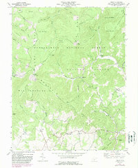
USGS Historical Quadrangle in GeoPDF.
The Western Native Trout Initiative is all about getting projects done that will help improve the abundance of western native trout across a variety of landscapes. WNTI a collaborative effort of 12 western states including Alaska, the National Fish Habitat Action Plan, the U.S. Fish and Wildlife Service, Forest Service, Bureau of Land Management, and many tribal and public or private conservation-minded organizations (view partners). WNTI's goals and objectives include gathering project opportunities, funding, and partners together to make a measurable impact on native trout populations and habitats. WNTI projects are and will be funded by many different entities and partners.
Categories: Data;
Types: ArcGIS REST Map Service,
ArcGIS Service Definition,
Downloadable,
Map Service;
Tags: WNTI,
native trout,
projects,
restoration,
trout,

Species occurrence data were obtained from the Atlas of Spawning and Nursery Areas of Great Lakes Fishes (Goodyear et al. 1982). The atlas contains information on all of the commercially and recreationally important species that use the tributaries, littoral and open-water areas of the Great Lakes as spawning and nursery habitats. Close to 9500 geo-referenced data records (occurrences of fish species) were imported into ArcView GIS. The 139 fish taxa reported in the Atlas had to be grouped into fewer broad categories to produce meaningful distribution maps. We chose three functional classification schemes. Jude and Pappas (1992) used Correspondence Analysis to partition fish species associated with the open...
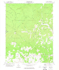
USGS Historical Quadrangle in GeoPDF.

The source of this coverage data set is the fish biodiversity maps created for The Nature Conservancy (TNC) as part of their Hexagon Project. Professor Peter Moyle and his graduate student, Paul Randall, of the Department of Wildlife and Fisheries Conservation Biology at the University of California, Davis were hired to produce range maps for all known fish species that presently occur in California. Each coverage denotes a separate fish species (refer to the species coverage key below). The polygons are estimated to be accurate at a scale of roughly 1:1,000,000.
Field estimates of the abundance of rainbow trout in Washington and British Columbia were collected in concert with environmental DNA samples (eDNA) to evaluate if eDNA copy numbers correlated with abundance of trout. In addition, stream habitat data including channel units (pools, riffles), substrate, large woody debris, among others, were collected at sites.

Species occurrence data were obtained from the Atlas of Spawning and Nursery Areas of Great Lakes Fishes (Goodyear et al. 1982). The atlas contains information on all of the commercially and recreationally important species that use the tributaries, littoral and open-water areas of the Great Lakes as spawning and nursery habitats. Close to 9500 geo-referenced data records (occurrences of fish species) were imported into ArcView GIS. The 139 fish taxa reported in the Atlas had to be grouped into fewer broad categories to produce meaningful distribution maps. We chose three functional classification schemes. Jude and Pappas (1992) used Correspondence Analysis to partition fish species associated with the open...
Recapture data for trout in a stream. Format is appropriate for CJS modelling.
Categories: Data;
Tags: Aquatic Biology,
Ecology,
Northeast CASC,
Rivers, Streams and Lakes,
Survival,
This data set contains imagery from the National Agriculture Imagery Program (NAIP). The NAIP program is administered by USDA FSA and has been established to support two main FSA strategic goals centered on agricultural production. These are increase stewardship of America's natural resources while enhancing the environment, and to ensure commodities are procured and distributed effectively and efficiently to increase food security. The NAIP program supports these goals by acquiring and providing ortho imagery that has been collected during the agricultural growing season in the U.S. The NAIP ortho imagery is tailored to meet FSA requirements and is a fundamental tool used to support FSA farm and conservation programs....
The Alaska Department of Fish and Game's (ADF&G) Anadromous water bodies data is derived from the ADF&G's GIS shape files for the "Catalog of Waters Important for Spawning, Rearing or Migration of Anadromous Fishes" (referred to as the "Catalog") and the "Atlas to the Catalog of Waters Important for Spawning, Rearing or Migration of Anadromous Fishes" (referred to as the "Atlas"). It is produced for general visual reference and to aid users in generating various natural resource analyses and products. The shape files depict the known anadromous fish bearing lakes and streams within Alaska (from the mouth to the known upper extent of species usage). It incorporates data from a variety of sources including:...
Blue ribbon streams in Wyoming. Blue ribbon streams are defined as stream reaches with greater than 600 pounds of trout per stream mile.

The source of this coverage data set is the fish biodiversity maps created for The Nature Conservancy (TNC) as part of their Hexagon Project. Professor Peter Moyle and his graduate student, Paul Randall, of the Department of Wildlife and Fisheries Conservation Biology at the University of California, Davis were hired to produce range maps for all known fish species that presently occur in California. Each coverage denotes a separate fish species (refer to the species coverage key below). The polygons are estimated to be accurate at a scale of roughly 1:1,000,000.
Brown trout, Salmo trutta, exposed to heavy metals (mainly Cd and Zn) for at least 2 years in the Eagle River, Colorado, were examined for liver size and activity of the growth-promoting enzyme, ornithine decarboxylase (ODC) and compared to trout living in an uncontaminated site. Liver-somatic index (LSI) was greater for trout living in the uncontaminated site with the LSI of females being significantly greater than that of males. The LSI for females at the uncontaminated site was greater than that of females at the contaminated site, but males were not different statistically. ODC activity in the livers of both males and females was lower at the contaminated site. However, males and females did not differ with...
Categories: Publication;
Types: Citation,
Journal Citation;
Tags: Cadmium,
Comparative Biochemistry and Physiology,
Copper,
Heavy metals,
Liver,
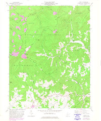
USGS Historical Quadrangle in GeoPDF.

Point locations for collections of Michigan fish in the Lake Michigan basin.
This data set contains imagery from the National Agriculture Imagery Program (NAIP). The NAIP program is administered by USDA FSA and has been established to support two main FSA strategic goals centered on agricultural production. These are increase stewardship of America's natural resources while enhancing the environment, and to ensure commodities are procured and distributed effectively and efficiently to increase food security. The NAIP program supports these goals by acquiring and providing ortho imagery that has been collected during the agricultural growing season in the U.S. The NAIP ortho imagery is tailored to meet FSA requirements and is a fundamental tool used to support FSA farm and conservation programs....
FY2011Thousands of data points have been collected by Oregon Department of Fish and Wildlife and Nevada Division of Wildlife from the 1950s to the present describing the distribution of declining native redband and endangered Lahontan cutthroat trout, and the invasive, nonnative brown and brook trout. USGS analyzed this data to understand the climate-related changes to species distributions and model extinction risk. The results, submittedfor publication, will be used by the State of Oregon as it drafts conservation plans for redband trout and by the Nevada Division of Environmental Protection in drafting water quality criteria to protect and monitor the states coldwater fisheries.
Categories: Data,
Project;
Types: Map Service,
OGC WFS Layer,
OGC WMS Layer,
OGC WMS Service;
Tags: Academics & scientific researchers,
California,
California,
California,
California,
|

|
