Filters: Tags: us forest service (X)
18 results (153ms)|
Filters
Date Range
Extensions Types Contacts
Categories Tag Types Tag Schemes |
All FRCC calculations were done in ArcGIS 9.3.1 with the FRCC Mapping Tool version 2.2.0, using Landfire Biophysical Settings (BpS) and Succession Class (S-Class) layers and the default Landfire Reference Condition table (LFnat_west). All calculations were performed at a 30-meter resolution. Input BpS and S-Class layers were downloaded using the Landfire Data Access Tool version 2.2 (configuration database version 1.27, feature database version 1.02). Three landscape levels were used in all calculations, the 4th, 5th and 6th field HUCs from the "Pacific NW Sixth Field Hucs" GIS layer from Bonneville Power Administration (Subbasins, Watersheds and Subwatersheds, resp.). FRCC Calculation Procedure For each of the...

A map service, available on the www, that depicts the Inventoried Roadless Areas that were used in the Final Environmental Impact Statement (EIS) for the 2001 Roadless Area Conservation Rule. The EIS analysis team used this spatial data to assess the impacts of roadless area alternatives on Forest Service policies, use of the National Forests, and the surrounding environment. It was used for analysis in combination with national characterization layers, such as ambient human population, forest mortality risk to insects and diseases, current land cover types, and others. The data includes the entire lower 48 states and Alaska at a coarse resolution. The public also had a need to know where IRAs were located in their...
A map service on the www depicting the boundary that encompasses a Ranger District. This map service provides display, identification, and analysis tools for determining current boundary information for Forest Service managers, GIS Specialists, and others. Best available source with a target scale of 1:24000 for Continental U.S., Puerto Rico, and Hawaii and 1:63360 for Alaska.
National Forest Inventoried Roadless Areas (IRAs) for Wyoming.
Categories: Data;
Types: Downloadable,
Map Service,
OGC WFS Layer,
OGC WMS Layer,
Shapefile;
Tags: LEAP,
Roadless Areas,
US Forest Service,
Wyoming

Best available source with a target scale of 1:24000 for Continental U.S., Puerto Rico, and Hawaii and 1:63360 for Alaska.
This GIS coverage displays range allotment permit boundaries, which are also analysis areas used for analysis of the 1986 Forest Plan. Many of these allotments are not being grazed by livestock at this time. This dataset does not include interior pasture fences or improvements.
Categories: Data;
Types: Downloadable;
Tags: Federal Government,
Shoshone National Forest,
US Forest Service,
USFS,
Wyoming State,
This GIS coverage displays all five districts of the Shoshone National Forest. The five districts making up the Shoshone National Forest are Clarks Fork, Greybull, Wapiti, Wind River and Washakie. Each District is managed by a district ranger and staff of resource specialists.
Categories: Data;
Types: Downloadable;
Tags: Federal Government,
Shoshone National Forest,
US Forest Service,
USFS,
Wyoming State,
These data display national forest and ranger district boundaries for Region 1, 2 and 4. Note that many private and state-owned parcels lie within the national forest boundaries depicted in these data. Note that these data do not conform entirely with official national forest boundaries: (1) the boundaries included here have been expanded to encompass national forest system lands that lie outside of the official forest boundary and (2) many small and discrete polygons that have no national forest ownership but were (and are) included in the officially designated forest boundary are not included in these data. To obtain actual boundaries use most accurate land management data layer.
Categories: Data;
Types: Downloadable;
Tags: Colorado,
Federal Government,
Forest,
Forest Service,
Idaho,
This GIS coverage displays the exterior boundary of the Shoshone National Forest. These lands are managed by the United States Department of Agriculture, Shoshone National Forest.
Categories: Data;
Types: Downloadable;
Tags: Federal Government,
Shoshone National Forest,
US Forest Service,
USFS,
Wyoming State,

A map service on the www depicting all the National Forest System lands administered by an unit. These areas encompasse private lands, other governmental agency lands, and may contain National Forest System lands within the proclaimed boundaries of another administrative unit. All National Forest System lands fall within one and only one Administrative Forest Area. This map service provides display, identification, and analysis tools for determining current boundary information for Forest Service managers, GIS Specialists, and others. This map service is symbolized with a light green fill and a darker green outline. Labeling for each administrative unit starts at 1:10,000,000. Best available source with a target...
The 2016 Food Storage Order (FSO) boundary layer depicts those areas on Federal lands within the Greater Yellowstone Ecosystem (GYE) where legal requirements pertaining to safe storage, possession, and handling of food and other grizzly bear attractants are implemented. FSOs give Forest Supervisors and National Park Superintendents the authority to close or restrict the use of designated areas under their jurisdiction in order to minimize human/grizzly bear conflicts. As of 2016, FSOs are prescribed on 98% of all Forest and Park Service lands inside the grizzly bear demographic monitoring area of the GYE. FSOs help facilitate connectivity between the Yellowstone grizzly bear and adjacent populations by minimizing...
This GIS coverage displays all of the congressionally designated wilderness areas found within the Shoshone National Forest. Much of the Forest is within designated wilderness areas.
Categories: Data;
Types: Downloadable;
Tags: Federal Government,
Shoshone National Forest,
US Forest Service,
USFS,
Wyoming State,
National Forest Administrative boundaries for Wyoming.
Categories: Data;
Types: Downloadable,
Map Service,
OGC WFS Layer,
OGC WMS Layer,
Shapefile;
Tags: LEAP,
US Forest Service,
USFS,
Wyoming,
national forests
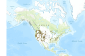
This data set consists of federally owned land polygon features of the United States. The data set was created by extracting federal land polygon features from the individual 1:2,000,000-scale State boundary Digital Line Graph (DLG) files produced by the U.S. Geological Survey. These files were then appended into a single coverage. This is a revised version of the June 1998 data set. There may be private inholdings within the boundaries of Federal Lands in this data set. These data are intended for geographic display and analysis at the national level, and for large regional areas. The data should be displayed and analyzed at scales appropriate for 1:2,000,000-scale data. No responsibility is assumed by the U.S....
Categories: Data;
Types: Downloadable,
Map Service,
OGC WFS Layer,
OGC WMS Layer,
Shapefile;
Tags: Agricultural Research Service,
Bureau of Indian Affairs,
Bureau of Land Management,
Bureau of Reclamation,
Federal lands,

A map service designed to portray US Forest Service Land Status Record System data. The map service is for querying and displaying Land Status Record System information for Lands under Forest Service Management. Using this service in the US Forest Service Map Service Viewer the user will be able to view Land Status Record System layers with various supplied background imagery and layers.
This GIS coverage shows non-national forest ownership within Shoshone National Forest. This dataset does not provide land owner information.
Categories: Data;
Types: Downloadable;
Tags: Federal Government,
Shoshone National Forest,
US Forest Service,
USFS,
Wyoming State,

A map service on the www depicting a compilation of forest insect, disease, and abiotic damage mapped on forested areas in the United States. Data for this map is created from the Annual Insect and Disease Survey (IDS) database. All reported damage areas displayed by damage type are shown within the insect and disease survey areas from 1997 to 2011. Damage areas by damage type displayed within the insect and disease survey areas. The 2011 insect and disease survey is displayed by default.
This GIS coverage displays areas identified as potential roadless areas in the final environmental impact statement, Roadless Area Review and Evaluation (1979).
Categories: Data;
Types: Downloadable;
Tags: Federal Government,
Shoshone National Forest,
US Forest Service,
USFS,
Wyoming State,
|

|
