Filters: Tags: water (X)
979 results (90ms)|
Filters
Contacts
(Less)
|
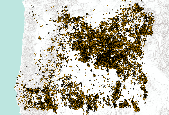
This dataset contains csv files in support of the conclusions published in "Water use demand in Mediterranean California under multiple scenarios of developed and agricultural land use " in the journal PLOS One. We used the USGS's LUCAS model to examine a broad suite of spatially explicit future land use scenarios and their associated county-level water use demand, including the historical (1992-2011) and projected periods (2012-2062) across 40 Monte Carlo simulations.We examined a range of potential water demand futures sampled from a 20-year record of historical (1992-2012) data to develop a suite of potential future land change scenarios from 2012-2062. These scenario simulations include a 1) business-as-usual...
Categories: Data;
Tags: California,
California,
Central Valley,
LUCAS model,
land use and land cover change,
This dataset contains stream-stage data for Santa Cruz River at Tumacácori Downstream Site (SC11). The pressure transducer was mounted to a metal post secured in the stream near the left bank. The data were recorded using non-vented Solinst Levelogger for the period of June 16, 2016 to June 24, 2016. The data were logged continuously at a 15-minute interval and manually downloaded. Data were then corrected with the atmospheric pressure collected from a Solinst Barologger located at SC14. The data was processed and analyzed for erroneous data.
Categories: Data;
Types: Citation;
Tags: DNA,
E. coli,
Escherichia coli,
Stage,
Tumacácori National Historical Park,
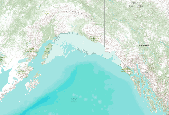
Staff from Alaska Earthquake Center, Geophysical Institute and Alaska Division of Geological & Geophysical Surveys evaluated potential tsunami hazards for the city of Sand Point, on Popof Island in the Shumagin Islands archipelago. We numerically modeled the extent of inundation from tsunami waves generated by local and distant earthquake sources. We considered the results in light of historical observations. The worst-case scenarios are defined by analyzing results of the sensitivity study of the tsunami dynamics with respect to different slip distributions along the Aleutian megathrust. For the Sand Point area, the worst-case scenarios are thought to be thrust earthquakes in the Shumagin Islands region with magnitudes...

Geospatial data that is a derivative land cover product depicting woodland on topographic maps.
An unsaturated-zone transport model was used to examine the transport and fate of metolachlor applied to an agricultural site in Maryland, USA. The study site was instrumented to collect data on soil-water content, soil-water potential, ground water levels, major ions, pesticides, and nutrients from the unsaturated zone during 2002-2004. The data set was enhanced with site-specific information describing weather, soils, and agricultural practices. The Root Zone Water Quality Model was used to simulate physical, chemical, and biological processes occurring in the unsaturated zone. Model calibration to bromide tracer concentrations indicated flow occurred through the soil matrix. Simulated recharge rates were within...
With the continuing increase in world population, and rising standard of living, more and more water will be necessary to satisfy basic human needs. The global picture with regard to water use and availability is very uneven, and the policy options for major sectoral uses -- rural and urban water supply, agricultural requirements and hydro-electric power generation are explored. The social and environmental implications of water development are briefly discussed. Finally, the question of the availability of adequate water to sustain future world population and development to the year 2000 is analysed. It is concluded that the major problem in the area of water-resources development is not one of the Malthusian spectre...
Categories: Publication;
Types: Citation;
Tags: Integrated,
dimensions,
international,
management,
water

Geospatial data that is a derivative land cover product depicting woodland on topographic maps.
This metadata describes water point data for the Oregon Framework Hydrography data and the standard system used to identify the state's surface water. The Water Points (WP) layer is the repository for springs, seeps and other hydrographic features with limited spatial extent (i.e. most easily represented by a point).

Limites des secteurs de la RDC. Le fichier est issu de la digitalisation par UNOCHA et UNDP de l’atlas de l’organisation administrative de la RDC réalisé par le père Léon de Saint Moulin. Lorsque les limites de secteurs sont définies par un cours d’eau, la géométrie a été partagée. La toponymie et la codification ont été validées par l’INS. Boundaries of sectors of the Democratic Republic of Congo (RDC). This dataset is a digitization of UNOCHA and UNDP of the administraive organization atlas for the RDC produced by leon de Saint Moulin. The boundaries of these sectors are defined by waterways, geometry and and subdivisions. The toponomy and codification were validated by the INS.
Aucune base de données ne disposait du positionnement numérique des ports. Les ports fluviaux correspondent à des noeuds des [axe_hydro]. Ils ont été positionnés par comparaison entre le fichier des localités transmis par la MONUC et, soit la carte des ports transmis par la RVF, soit le listing des ports transmis par la SNCC. En l’absence de ville ou de village portant le nom du port, le noeud a été créé en référence au PK transmis par la SNCC ou la RVF. Le positionnement des ports fluviaux a été fait au sein de l’agence UNJLC de Kinshasa en 2006. No database gives a numerical position of ports. The fluvial ports correspond to nodes on the hydrologic axes. They are positioned by comparisons between the local data...
This dataset represents the soil water storage capacity (AWS in mm at 0.25 m depth) from SSURGO and STATSGO soil descriptions for soil map units in the state of southern Alaska that lie within the North Pacific Landscape Conservation Cooperative. Available Water Storage 0-25 cm - Weighted Average (centimeters). Available water storage (AWS). The volume of water that the soil, to a depth of 25 centimeters, can store that is available to plants. It is reported as the weighted average of all components in the map unit, and is expressed as centimeters of water. AWS is calculated from AWC (available water capacity) which is commonly estimated as the difference between the water contents at 1/10 or 1/3 bar (field capacity)...

This dataset represents the soil water storage capacity (AWS in mm at 0.5 m depth) from SSURGO and STATSGO soil descriptions for soil map units in the state of southern Alaska that lie within the North Pacific Landscape Conservation Cooperative. Available Water Storage 0-50 cm - Weighted Average (centimeters). Available water storage (AWS). The volume of water that the soil, to a depth of 50 centimeters, can store that is available to plants. It is reported as the weighted average of all components in the map unit, and is expressed as centimeters of water. AWS is calculated from AWC (available water capacity) which is commonly estimated as the difference between the water contents at 1/10 or 1/3 bar (field capacity)...

Geospatial data that is a derivative land cover product depicting woodland on topographic maps.
Observed water temperatures from 1980-2019 were compiled for 2,332 lakes in the US. These data were used as training, test, and error-estimation data for process-guided deep learning models and the evaluation of process-based models. The data are formatted as a single csv (comma separated values) file with attributes corresponding to the unique combination of lake identifier, time, and depth. Data came from a variety of sources, including the Water Quality Portal, the North Temperate Lakes Long-Term Ecological Research Project, and digitized temperature records from the MN Department of Natural Resources. This dataset is part of a larger data release of lake temperature model inputs and outputs for these same lakes...

Geospatial data that is a derivative land cover product depicting woodland on topographic maps.

Geospatial data that is a derivative land cover product depicting woodland on topographic maps.

Geospatial data that is a derivative land cover product depicting woodland on topographic maps.

Geospatial data that is a derivative land cover product depicting woodland on topographic maps.

Geospatial data that is a derivative land cover product depicting woodland on topographic maps.

Geospatial data that is a derivative land cover product depicting woodland on topographic maps.
|

|
