Filters
Date Range
Types
Contacts
Categories
Tag Types
Tag Schemes
|
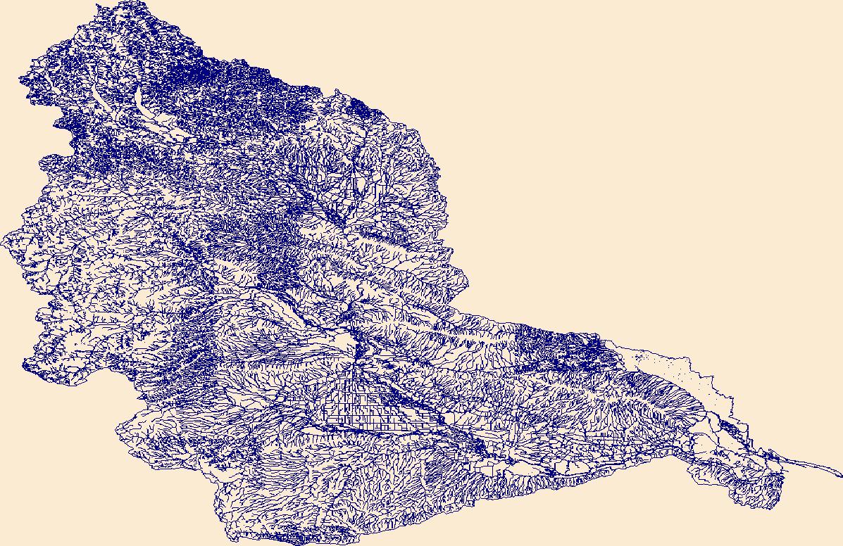
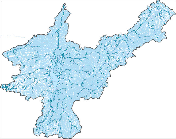
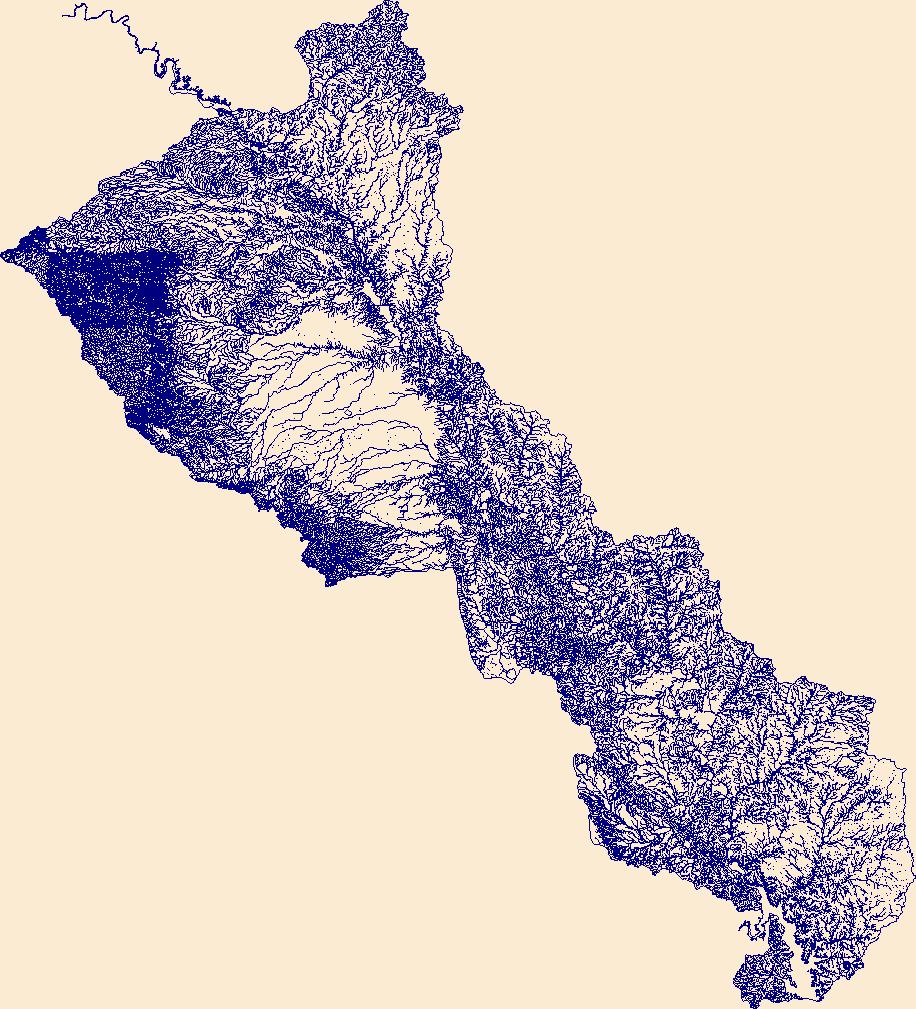
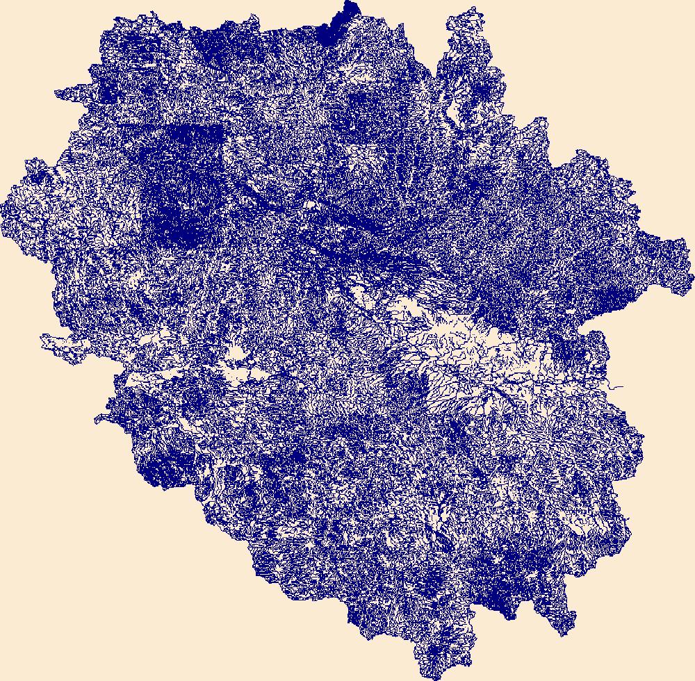
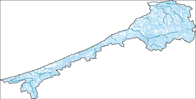
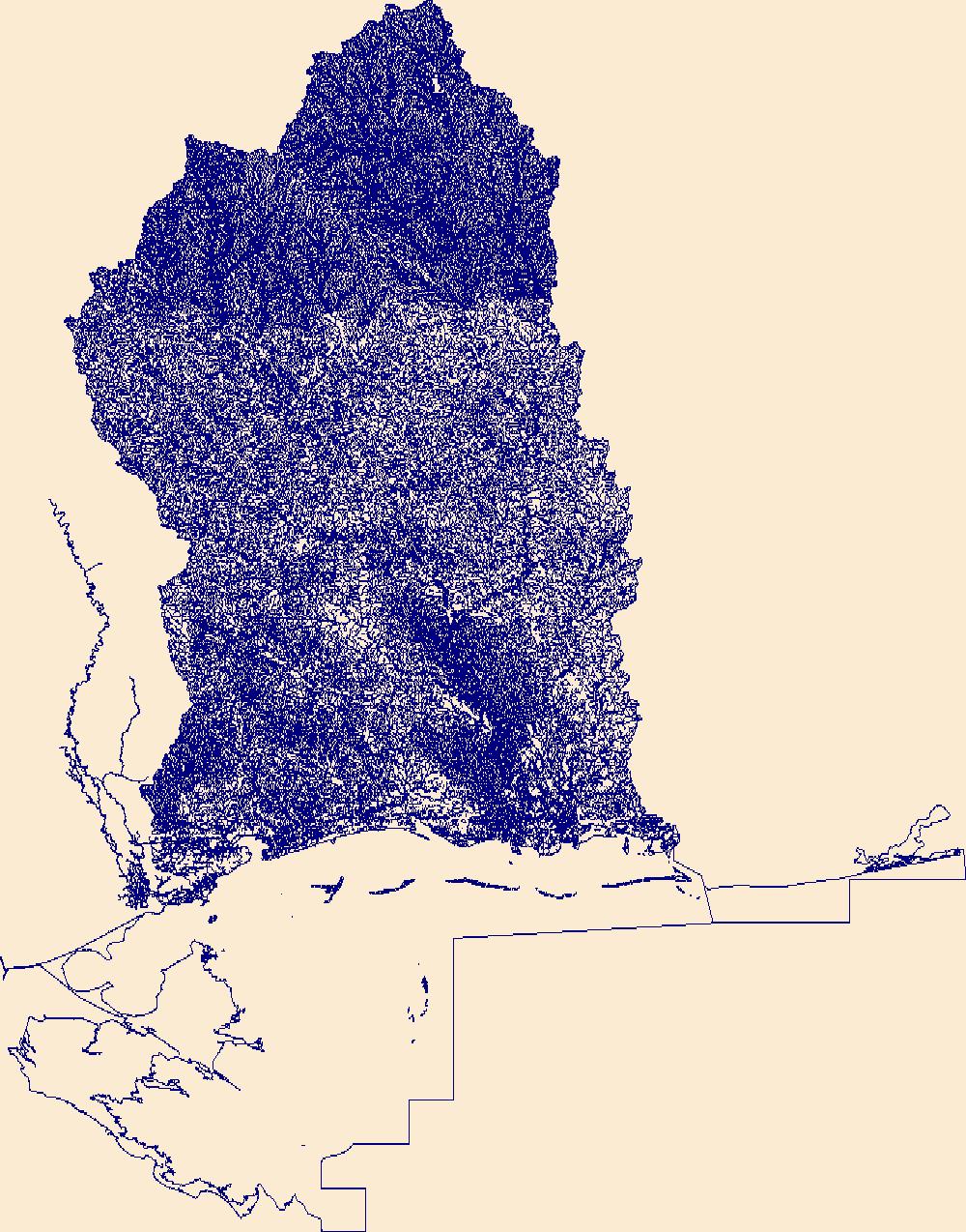
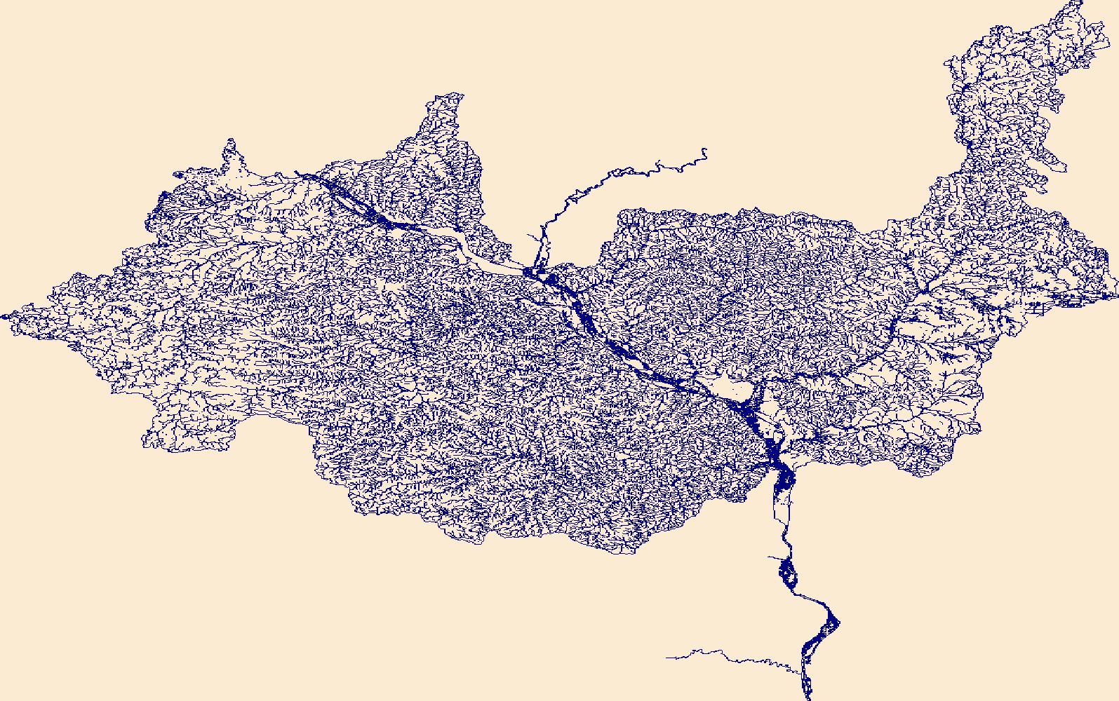
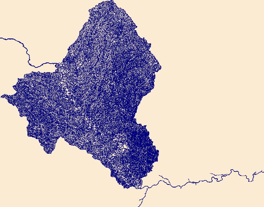
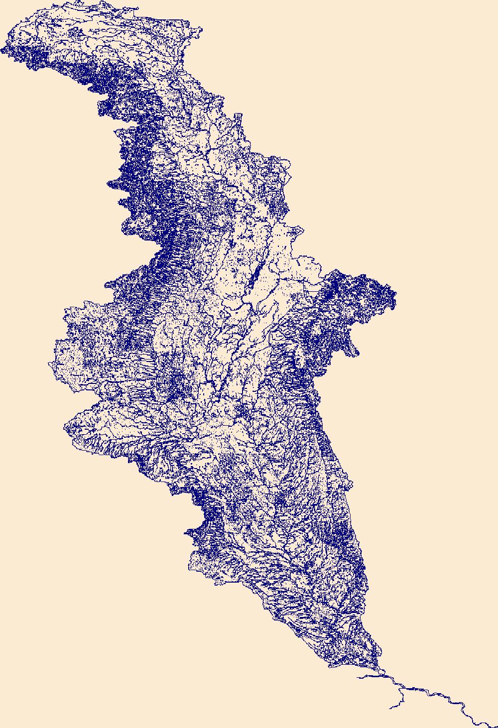
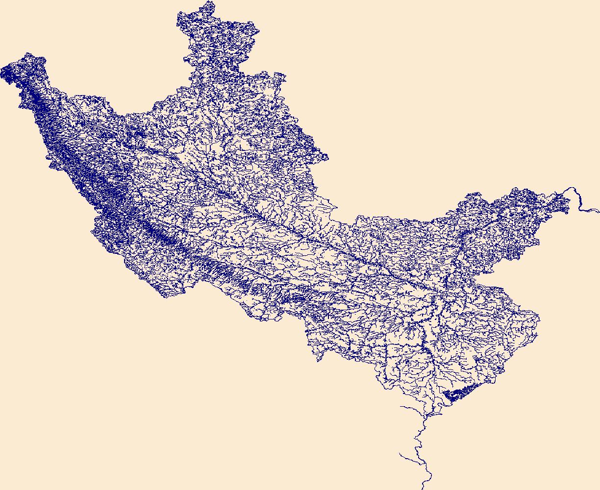
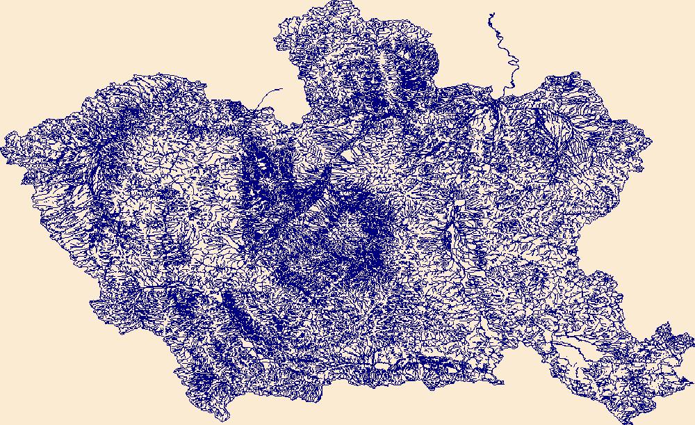
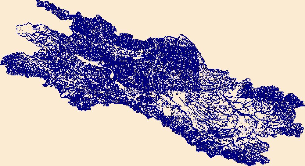
The High Resolution National Hydrography Dataset Plus (NHDPlus HR) is an integrated set of geospatial data layers, including the best available National Hydrography Dataset (NHD), the 10-meter 3D Elevation Program Digital Elevation Model (3DEP DEM), and the National Watershed Boundary Dataset (WBD). The NHDPlus HR combines the NHD, 3DEP DEMs, and WBD to create a stream network with linear referencing, feature naming, "value added attributes" (VAAs), elevation-derived catchments, and other features for hydrologic data analysis. The stream network with linear referencing is a system of data relationships applied to hydrographic systems so that one stream reach "flows" into another and "events" can be tied to and traced...
Tags: Benton County,
Chelan County,
Downloadable Data,
FileGDB,
FileGDB 10.1, All tags...
HU-4 Subregion,
HU-4 Subregion,
HU4_1703,
Hydrography,
King County,
Kittitas County,
Klickitat County,
Lewis County,
NHDPlus HR Rasters,
NHDPlus High Resolution (NHDPlus HR),
National Hydrography Dataset (NHD),
National Hydrography Dataset Plus High Resolution (NHDPlus HR),
National Hydrography Dataset Plus High Resolution (NHDPlus HR) Current,
Pierce County,
US,
United States,
WA,
Washington,
Yakima County,
base maps,
cartography,
catchments,
channels,
digital elevation models,
drainage basins,
earth sciences,
elevation,
environment,
geographic information systems,
geoscientific,
geospatial analysis,
hydrographic datasets,
hydrographic features,
hydrology,
imagery,
inland waters,
lakes,
land surface characteristics,
reservoirs,
river reaches,
rivers,
streamflow,
streamflow data,
streams,
topography,
water bodies,
water quality,
water resources,
watersheds, Fewer tags
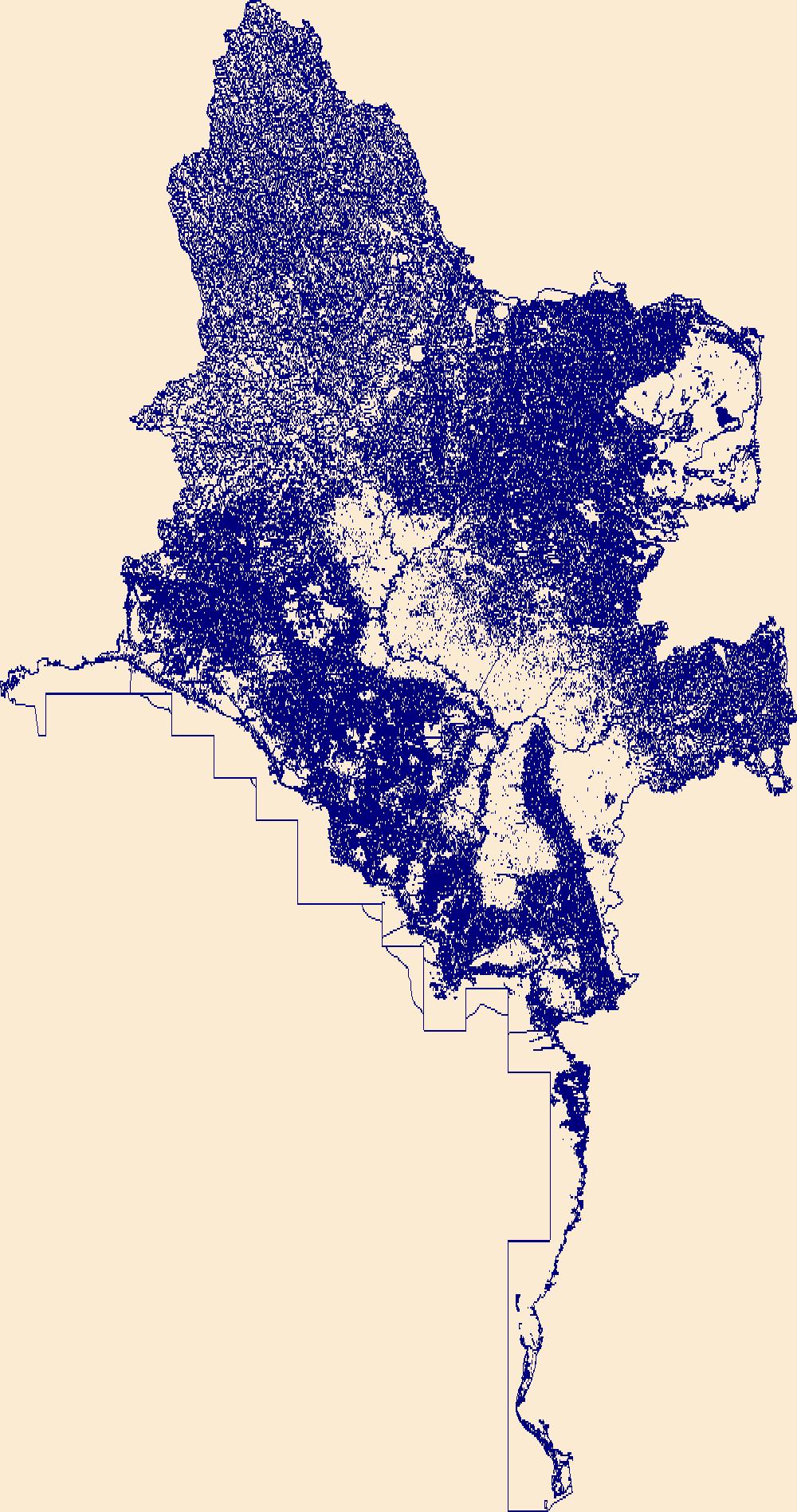
The High Resolution National Hydrography Dataset Plus (NHDPlus HR) is an integrated set of geospatial data layers, including the best available National Hydrography Dataset (NHD), the 10-meter 3D Elevation Program Digital Elevation Model (3DEP DEM), and the National Watershed Boundary Dataset (WBD). The NHDPlus HR combines the NHD, 3DEP DEMs, and WBD to create a stream network with linear referencing, feature naming, "value added attributes" (VAAs), elevation-derived catchments, and other features for hydrologic data analysis. The stream network with linear referencing is a system of data relationships applied to hydrographic systems so that one stream reach "flows" into another and "events" can be tied to and traced...
Tags: Addison County,
Bennington County,
Caledonia County,
Chittenden County,
Clinton County, All tags...
Coos County,
Downloadable Data,
Essex County,
Essex County,
FileGDB,
FileGDB 10.1,
Franklin County,
Franklin County,
Grand Isle County,
HU-4 Subregion,
HU-4 Subregion,
HU4_0430,
Hydrography,
Lamoille County,
ME,
Maine,
NH,
NHDPlus HR Rasters,
NHDPlus High Resolution (NHDPlus HR),
NY,
National Hydrography Dataset (NHD),
National Hydrography Dataset Plus High Resolution (NHDPlus HR),
National Hydrography Dataset Plus High Resolution (NHDPlus HR) Current,
New Hampshire,
New York,
Orange County,
Orleans County,
Oxford County,
Rutland County,
US,
United States,
VT,
Vermont,
Warren County,
Washington County,
Washington County,
Windsor County,
base maps,
cartography,
catchments,
channels,
digital elevation models,
drainage basins,
earth sciences,
elevation,
environment,
geographic information systems,
geoscientific,
geospatial analysis,
hydrographic datasets,
hydrographic features,
hydrology,
imagery,
inland waters,
lakes,
land surface characteristics,
reservoirs,
river reaches,
rivers,
streamflow,
streamflow data,
streams,
topography,
water bodies,
water quality,
water resources,
watersheds, Fewer tags
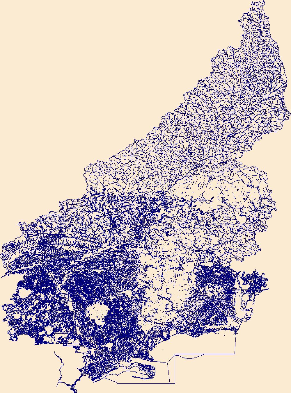
The High Resolution National Hydrography Dataset Plus (NHDPlus HR) is an integrated set of geospatial data layers, including the best available National Hydrography Dataset (NHD), the 10-meter 3D Elevation Program Digital Elevation Model (3DEP DEM), and the National Watershed Boundary Dataset (WBD). The NHDPlus HR combines the NHD, 3DEP DEMs, and WBD to create a stream network with linear referencing, feature naming, "value added attributes" (VAAs), elevation-derived catchments, and other features for hydrologic data analysis. The stream network with linear referencing is a system of data relationships applied to hydrographic systems so that one stream reach "flows" into another and "events" can be tied to and traced...
Tags: Dimmit County,
Downloadable Data,
Edwards County,
FileGDB,
FileGDB 10.1, All tags...
HU-4 Subregion,
HU-4 Subregion,
HU4_1308,
Hydrography,
Jim Hogg County,
Kinney County,
Maverick County,
NHDPlus HR Rasters,
NHDPlus High Resolution (NHDPlus HR),
National Hydrography Dataset (NHD),
National Hydrography Dataset Plus High Resolution (NHDPlus HR),
National Hydrography Dataset Plus High Resolution (NHDPlus HR) Current,
Starr County,
TX,
Texas,
US,
United States,
Val Verde County,
Webb County,
Zapata County,
base maps,
cartography,
catchments,
channels,
digital elevation models,
drainage basins,
earth sciences,
elevation,
environment,
geographic information systems,
geoscientific,
geospatial analysis,
hydrographic datasets,
hydrographic features,
hydrology,
imagery,
inland waters,
lakes,
land surface characteristics,
reservoirs,
river reaches,
rivers,
streamflow,
streamflow data,
streams,
topography,
water bodies,
water quality,
water resources,
watersheds, Fewer tags
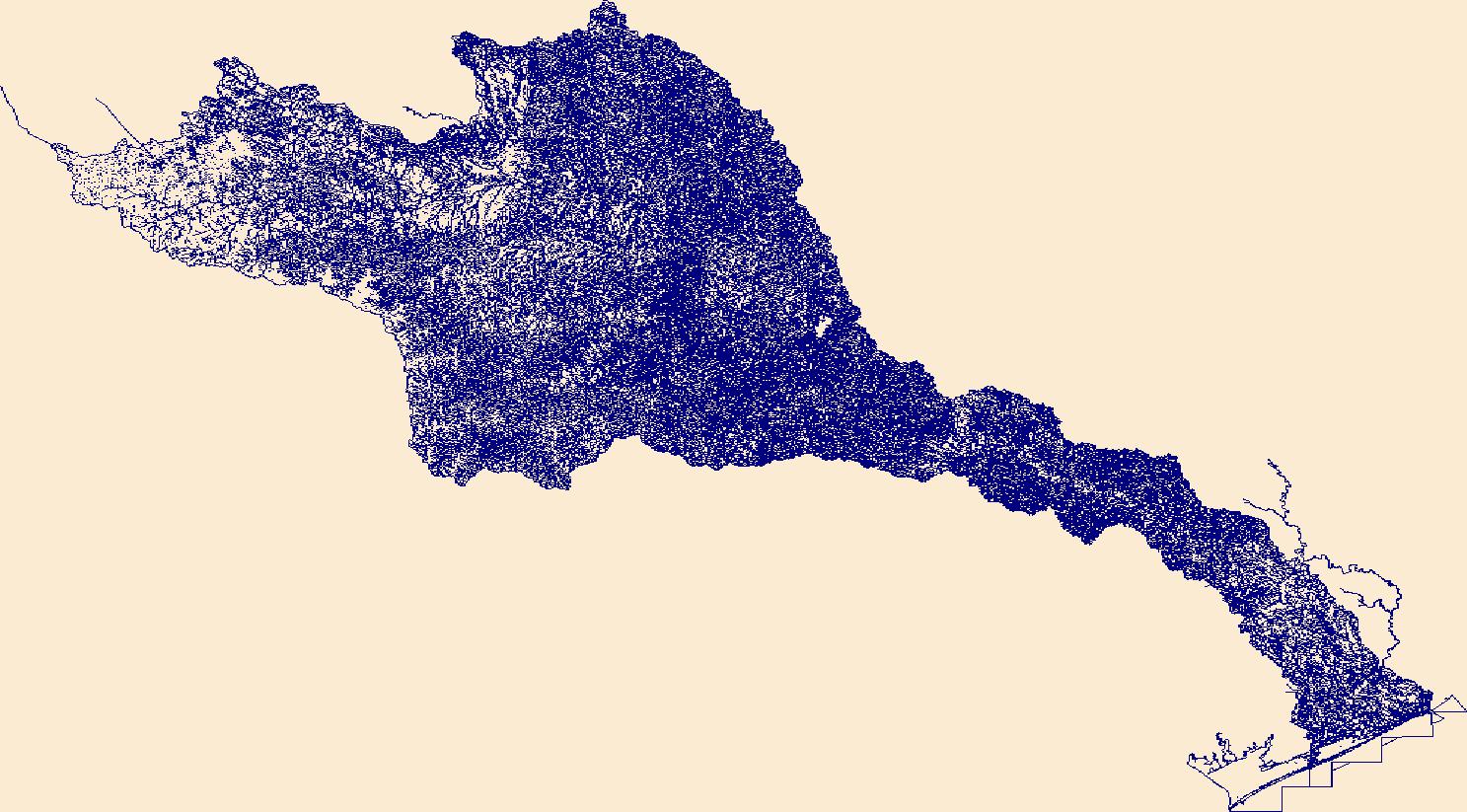
The High Resolution National Hydrography Dataset Plus (NHDPlus HR) is an integrated set of geospatial data layers, including the best available National Hydrography Dataset (NHD), the 10-meter 3D Elevation Program Digital Elevation Model (3DEP DEM), and the National Watershed Boundary Dataset (WBD). The NHDPlus HR combines the NHD, 3DEP DEMs, and WBD to create a stream network with linear referencing, feature naming, "value added attributes" (VAAs), elevation-derived catchments, and other features for hydrologic data analysis. The stream network with linear referencing is a system of data relationships applied to hydrographic systems so that one stream reach "flows" into another and "events" can be tied to and traced...
Tags: Ada County,
Adams County,
Baker County,
Blaine County,
Boise County, All tags...
Camas County,
Canyon County,
Custer County,
Downloadable Data,
Elko County,
Elmore County,
FileGDB,
FileGDB 10.1,
Gem County,
Grant County,
HU-4 Subregion,
HU-4 Subregion,
HU4_1705,
Harney County,
Humboldt County,
Hydrography,
ID,
Idaho,
Idaho County,
Malheur County,
NHDPlus HR Rasters,
NHDPlus High Resolution (NHDPlus HR),
NV,
National Hydrography Dataset (NHD),
National Hydrography Dataset Plus High Resolution (NHDPlus HR),
National Hydrography Dataset Plus High Resolution (NHDPlus HR) Current,
Nevada,
OR,
Oregon,
Owyhee County,
Payette County,
Twin Falls County,
US,
Union County,
United States,
Valley County,
Wallowa County,
Washington County,
base maps,
cartography,
catchments,
channels,
digital elevation models,
drainage basins,
earth sciences,
elevation,
environment,
geographic information systems,
geoscientific,
geospatial analysis,
hydrographic datasets,
hydrographic features,
hydrology,
imagery,
inland waters,
lakes,
land surface characteristics,
reservoirs,
river reaches,
rivers,
streamflow,
streamflow data,
streams,
topography,
water bodies,
water quality,
water resources,
watersheds, Fewer tags
The High Resolution National Hydrography Dataset Plus (NHDPlus HR) is an integrated set of geospatial data layers, including the best available National Hydrography Dataset (NHD), the 10-meter 3D Elevation Program Digital Elevation Model (3DEP DEM), and the National Watershed Boundary Dataset (WBD). The NHDPlus HR combines the NHD, 3DEP DEMs, and WBD to create a stream network with linear referencing, feature naming, "value added attributes" (VAAs), elevation-derived catchments, and other features for hydrologic data analysis. The stream network with linear referencing is a system of data relationships applied to hydrographic systems so that one stream reach "flows" into another and "events" can be tied to and traced...
Tags: Allegany County,
Ashtabula County,
Cattaraugus County,
Chautauqua County,
Crawford County, All tags...
Downloadable Data,
Erie County,
Erie County,
FileGDB,
FileGDB 10.1,
Genesee County,
HU-4 Subregion,
HU-4 Subregion,
HU4_0412,
Hydrography,
NHDPlus HR Rasters,
NHDPlus High Resolution (NHDPlus HR),
NY,
National Hydrography Dataset (NHD),
National Hydrography Dataset Plus High Resolution (NHDPlus HR),
National Hydrography Dataset Plus High Resolution (NHDPlus HR) Current,
New York,
OH,
Ohio,
PA,
Pennsylvania,
US,
United States,
Wyoming County,
base maps,
cartography,
catchments,
channels,
digital elevation models,
drainage basins,
earth sciences,
elevation,
environment,
geographic information systems,
geoscientific,
geospatial analysis,
hydrographic datasets,
hydrographic features,
hydrology,
imagery,
inland waters,
lakes,
land surface characteristics,
reservoirs,
river reaches,
rivers,
streamflow,
streamflow data,
streams,
topography,
water bodies,
water quality,
water resources,
watersheds, Fewer tags
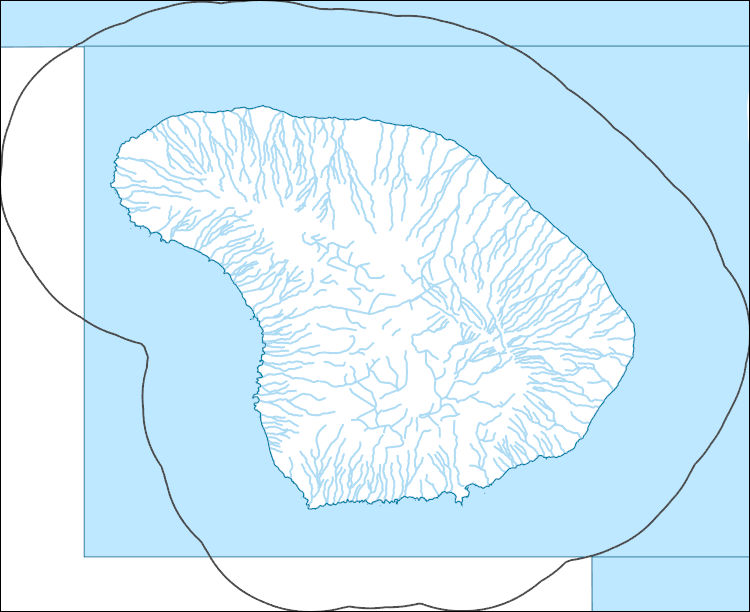
The High Resolution National Hydrography Dataset Plus (NHDPlus HR) is an integrated set of geospatial data layers, including the best available National Hydrography Dataset (NHD), the 10-meter 3D Elevation Program Digital Elevation Model (3DEP DEM), and the National Watershed Boundary Dataset (WBD). The NHDPlus HR combines the NHD, 3DEP DEMs, and WBD to create a stream network with linear referencing, feature naming, "value added attributes" (VAAs), elevation-derived catchments, and other features for hydrologic data analysis. The stream network with linear referencing is a system of data relationships applied to hydrographic systems so that one stream reach "flows" into another and "events" can be tied to and traced...
Tags: Downloadable Data,
FileGDB,
FileGDB 10.1,
HI,
HU-4 Subregion, All tags...
HU-4 Subregion,
HU4_2004,
Hawaii,
Hydrography,
Maui County,
NHDPlus HR Rasters,
NHDPlus High Resolution (NHDPlus HR),
National Hydrography Dataset (NHD),
National Hydrography Dataset Plus High Resolution (NHDPlus HR),
National Hydrography Dataset Plus High Resolution (NHDPlus HR) Current,
US,
United States,
base maps,
cartography,
catchments,
channels,
digital elevation models,
drainage basins,
earth sciences,
elevation,
environment,
geographic information systems,
geoscientific,
geospatial analysis,
hydrographic datasets,
hydrographic features,
hydrology,
imagery,
inland waters,
lakes,
land surface characteristics,
reservoirs,
river reaches,
rivers,
streamflow,
streamflow data,
streams,
topography,
water bodies,
water quality,
water resources,
watersheds, Fewer tags

The High Resolution National Hydrography Dataset Plus (NHDPlus HR) is an integrated set of geospatial data layers, including the best available National Hydrography Dataset (NHD), the 10-meter 3D Elevation Program Digital Elevation Model (3DEP DEM), and the National Watershed Boundary Dataset (WBD). The NHDPlus HR combines the NHD, 3DEP DEMs, and WBD to create a stream network with linear referencing, feature naming, "value added attributes" (VAAs), elevation-derived catchments, and other features for hydrologic data analysis. The stream network with linear referencing is a system of data relationships applied to hydrographic systems so that one stream reach "flows" into another and "events" can be tied to and traced...
Tags: AL,
Alabama,
Baldwin County,
Bibb County,
Blount County, All tags...
Chickasaw County,
Choctaw County,
Choctaw County,
Clarke County,
Clarke County,
Clay County,
Cullman County,
Downloadable Data,
Etowah County,
Fayette County,
FileGDB,
FileGDB 10.1,
Franklin County,
Greene County,
HU-4 Subregion,
HU-4 Subregion,
HU4_0316,
Hale County,
Hydrography,
Itawamba County,
Jefferson County,
Kemper County,
Lamar County,
Lauderdale County,
Lawrence County,
Lee County,
Lowndes County,
MS,
Marengo County,
Marion County,
Marshall County,
Mississippi,
Mobile County,
Monroe County,
Morgan County,
NHDPlus HR Rasters,
NHDPlus High Resolution (NHDPlus HR),
National Hydrography Dataset (NHD),
National Hydrography Dataset Plus High Resolution (NHDPlus HR),
National Hydrography Dataset Plus High Resolution (NHDPlus HR) Current,
Noxubee County,
Oktibbeha County,
Perry County,
Pickens County,
Pontotoc County,
Prentiss County,
St. Clair County,
Sumter County,
Tippah County,
Tishomingo County,
Tuscaloosa County,
US,
Union County,
United States,
Walker County,
Washington County,
Wayne County,
Webster County,
Winston County,
Winston County,
base maps,
cartography,
catchments,
channels,
digital elevation models,
drainage basins,
earth sciences,
elevation,
environment,
geographic information systems,
geoscientific,
geospatial analysis,
hydrographic datasets,
hydrographic features,
hydrology,
imagery,
inland waters,
lakes,
land surface characteristics,
reservoirs,
river reaches,
rivers,
streamflow,
streamflow data,
streams,
topography,
water bodies,
water quality,
water resources,
watersheds, Fewer tags
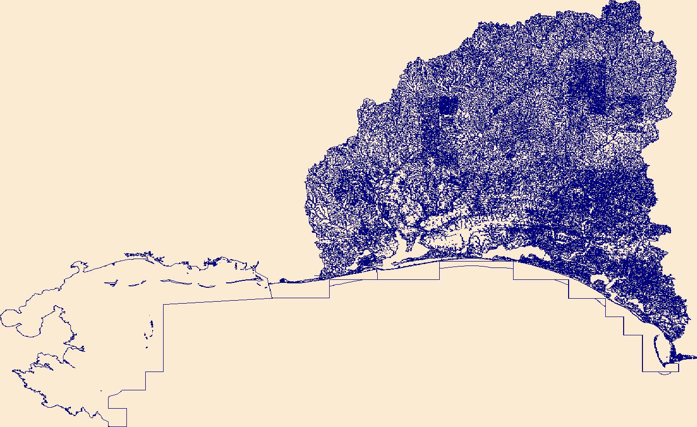
The High Resolution National Hydrography Dataset Plus (NHDPlus HR) is an integrated set of geospatial data layers, including the best available National Hydrography Dataset (NHD), the 10-meter 3D Elevation Program Digital Elevation Model (3DEP DEM), and the National Watershed Boundary Dataset (WBD). The NHDPlus HR combines the NHD, 3DEP DEMs, and WBD to create a stream network with linear referencing, feature naming, "value added attributes" (VAAs), elevation-derived catchments, and other features for hydrologic data analysis. The stream network with linear referencing is a system of data relationships applied to hydrographic systems so that one stream reach "flows" into another and "events" can be tied to and traced...
Tags: AL,
Alabama,
BaldwinCounty,
BarbourCounty,
BayCounty, All tags...
BullockCounty,
ButlerCounty,
CalhounCounty,
CoffeeCounty,
ConecuhCounty,
CovingtonCounty,
CrenshawCounty,
DaleCounty,
Downloadable Data,
EscambiaCounty,
EscambiaCounty,
FileGDB,
FileGDB 10.1,
GenevaCounty,
GulfCounty,
HU-4 Subregion,
HU-4 Subregion,
HenryCounty,
HolmesCounty,
HoustonCounty,
Hydrography,
JacksonCounty,
LowndesCounty,
MobileCounty,
MonroeCounty,
MontgomeryCounty,
NHDPlus HR Rasters,
NHDPlus High Resolution (NHDPlus HR),
National Hydrography Dataset (NHD),
National Hydrography Dataset Plus High Resolution (NHDPlus HR),
National Hydrography Dataset Plus High Resolution (NHDPlus HR) Current,
OkaloosaCounty,
PikeCounty,
Santa RosaCounty,
US,
United States,
WaltonCounty,
WashingtonCounty,
base maps,
cartography,
catchments,
channels,
digital elevation models,
drainage basins,
earth sciences,
elevation,
environment,
geographic information systems,
geoscientific,
geospatial analysis,
hydrographic datasets,
hydrographic features,
hydrology,
imagery,
inland waters,
lakes,
land surface characteristics,
reservoirs,
river reaches,
rivers,
streamflow,
streamflow data,
streams,
topography,
water bodies,
water quality,
water resources,
watersheds, Fewer tags

The High Resolution National Hydrography Dataset Plus (NHDPlus HR) is an integrated set of geospatial data layers, including the best available National Hydrography Dataset (NHD), the 10-meter 3D Elevation Program Digital Elevation Model (3DEP DEM), and the National Watershed Boundary Dataset (WBD). The NHDPlus HR combines the NHD, 3DEP DEMs, and WBD to create a stream network with linear referencing, feature naming, "value added attributes" (VAAs), elevation-derived catchments, and other features for hydrologic data analysis. The stream network with linear referencing is a system of data relationships applied to hydrographic systems so that one stream reach "flows" into another and "events" can be tied to and traced...
Tags: Attala County,
Choctaw County,
Copiah County,
Downloadable Data,
FileGDB, All tags...
FileGDB 10.1,
HU-4 Subregion,
HU-4 Subregion,
HU4_0318,
Hancock County,
Hinds County,
Hydrography,
Jefferson Davis County,
Kemper County,
LA,
Lamar County,
Lawrence County,
Leake County,
Lincoln County,
Louisiana,
MS,
Madison County,
Marion County,
Mississippi,
NHDPlus HR Rasters,
NHDPlus High Resolution (NHDPlus HR),
National Hydrography Dataset (NHD),
National Hydrography Dataset Plus High Resolution (NHDPlus HR),
National Hydrography Dataset Plus High Resolution (NHDPlus HR) Current,
Neshoba County,
Newton County,
Noxubee County,
Pearl River County,
Pike County,
Rankin County,
Scott County,
Simpson County,
Smith County,
St. Tammany County,
Tangipahoa County,
US,
United States,
Walthall County,
Washington County,
Winston County,
base maps,
cartography,
catchments,
channels,
digital elevation models,
drainage basins,
earth sciences,
elevation,
environment,
geographic information systems,
geoscientific,
geospatial analysis,
hydrographic datasets,
hydrographic features,
hydrology,
imagery,
inland waters,
lakes,
land surface characteristics,
reservoirs,
river reaches,
rivers,
streamflow,
streamflow data,
streams,
topography,
water bodies,
water quality,
water resources,
watersheds, Fewer tags
The High Resolution National Hydrography Dataset Plus (NHDPlus HR) is an integrated set of geospatial data layers, including the best available National Hydrography Dataset (NHD), the 10-meter 3D Elevation Program Digital Elevation Model (3DEP DEM), and the National Watershed Boundary Dataset (WBD). The NHDPlus HR combines the NHD, 3DEP DEMs, and WBD to create a stream network with linear referencing, feature naming, "value added attributes" (VAAs), elevation-derived catchments, and other features for hydrologic data analysis. The stream network with linear referencing is a system of data relationships applied to hydrographic systems so that one stream reach "flows" into another and "events" can be tied to and traced...
Tags: AlamanceCounty,
BladenCounty,
BrunswickCounty,
CaswellCounty,
ChathamCounty, All tags...
ColumbusCounty,
CumberlandCounty,
Downloadable Data,
DuplinCounty,
DurhamCounty,
FileGDB,
FileGDB 10.1,
ForsythCounty,
GuilfordCounty,
HU-4 Subregion,
HU-4 Subregion,
HarnettCounty,
HokeCounty,
Hydrography,
JohnstonCounty,
JonesCounty,
LeeCounty,
LenoirCounty,
MontgomeryCounty,
MooreCounty,
NC,
NHDPlus HR Rasters,
NHDPlus High Resolution (NHDPlus HR),
National Hydrography Dataset (NHD),
National Hydrography Dataset Plus High Resolution (NHDPlus HR),
National Hydrography Dataset Plus High Resolution (NHDPlus HR) Current,
New HanoverCounty,
North Carolina,
OnslowCounty,
OrangeCounty,
PenderCounty,
RandolphCounty,
RobesonCounty,
RockinghamCounty,
SampsonCounty,
US,
United States,
WakeCounty,
WayneCounty,
base maps,
cartography,
catchments,
channels,
digital elevation models,
drainage basins,
earth sciences,
elevation,
environment,
geographic information systems,
geoscientific,
geospatial analysis,
hydrographic datasets,
hydrographic features,
hydrology,
imagery,
inland waters,
lakes,
land surface characteristics,
reservoirs,
river reaches,
rivers,
streamflow,
streamflow data,
streams,
topography,
water bodies,
water quality,
water resources,
watersheds, Fewer tags
The High Resolution National Hydrography Dataset Plus (NHDPlus HR) is an integrated set of geospatial data layers, including the best available National Hydrography Dataset (NHD), the 10-meter 3D Elevation Program Digital Elevation Model (3DEP DEM), and the National Watershed Boundary Dataset (WBD). The NHDPlus HR combines the NHD, 3DEP DEMs, and WBD to create a stream network with linear referencing, feature naming, "value added attributes" (VAAs), elevation-derived catchments, and other features for hydrologic data analysis. The stream network with linear referencing is a system of data relationships applied to hydrographic systems so that one stream reach "flows" into another and "events" can be tied to and traced...
Tags: AL,
Alabama,
BaldwinCounty,
ChoctawCounty,
ClarkeCounty, All tags...
CovingtonCounty,
Downloadable Data,
FileGDB,
FileGDB 10.1,
ForrestCounty,
GeorgeCounty,
GreeneCounty,
HU-4 Subregion,
HU-4 Subregion,
HancockCounty,
HarrisonCounty,
Hydrography,
JacksonCounty,
JasperCounty,
Jefferson DavisCounty,
JonesCounty,
KemperCounty,
LamarCounty,
LauderdaleCounty,
MarionCounty,
MobileCounty,
NHDPlus HR Rasters,
NHDPlus High Resolution (NHDPlus HR),
National Hydrography Dataset (NHD),
National Hydrography Dataset Plus High Resolution (NHDPlus HR),
National Hydrography Dataset Plus High Resolution (NHDPlus HR) Current,
NeshobaCounty,
NewtonCounty,
Pearl RiverCounty,
PerryCounty,
ScottCounty,
SimpsonCounty,
SmithCounty,
St. BernardCounty,
St. TammanyCounty,
StoneCounty,
US,
United States,
WashingtonCounty,
WayneCounty,
base maps,
cartography,
catchments,
channels,
digital elevation models,
drainage basins,
earth sciences,
elevation,
environment,
geographic information systems,
geoscientific,
geospatial analysis,
hydrographic datasets,
hydrographic features,
hydrology,
imagery,
inland waters,
lakes,
land surface characteristics,
reservoirs,
river reaches,
rivers,
streamflow,
streamflow data,
streams,
topography,
water bodies,
water quality,
water resources,
watersheds, Fewer tags
The High Resolution National Hydrography Dataset Plus (NHDPlus HR) is an integrated set of geospatial data layers, including the best available National Hydrography Dataset (NHD), the 10-meter 3D Elevation Program Digital Elevation Model (3DEP DEM), and the National Watershed Boundary Dataset (WBD). The NHDPlus HR combines the NHD, 3DEP DEMs, and WBD to create a stream network with linear referencing, feature naming, "value added attributes" (VAAs), elevation-derived catchments, and other features for hydrologic data analysis. The stream network with linear referencing is a system of data relationships applied to hydrographic systems so that one stream reach "flows" into another and "events" can be tied to and traced...
Tags: AlachuaCounty,
AtkinsonCounty,
BakerCounty,
Ben HillCounty,
BerrienCounty, All tags...
BradfordCounty,
BrantleyCounty,
BrooksCounty,
CharltonCounty,
ClayCounty,
ClinchCounty,
CoffeeCounty,
ColquittCounty,
ColumbiaCounty,
CookCounty,
CrispCounty,
DixieCounty,
DoolyCounty,
Downloadable Data,
EcholsCounty,
FL,
FileGDB,
FileGDB 10.1,
Florida,
GilchristCounty,
HU-4 Subregion,
HU-4 Subregion,
HamiltonCounty,
Hydrography,
IrwinCounty,
JeffersonCounty,
LafayetteCounty,
LanierCounty,
LevyCounty,
LowndesCounty,
MadisonCounty,
MarionCounty,
NHDPlus HR Rasters,
NHDPlus High Resolution (NHDPlus HR),
National Hydrography Dataset (NHD),
National Hydrography Dataset Plus High Resolution (NHDPlus HR),
National Hydrography Dataset Plus High Resolution (NHDPlus HR) Current,
PutnamCounty,
SuwanneeCounty,
TaylorCounty,
ThomasCounty,
TiftCounty,
TurnerCounty,
US,
UnionCounty,
United States,
WareCounty,
WilcoxCounty,
WorthCounty,
base maps,
cartography,
catchments,
channels,
digital elevation models,
drainage basins,
earth sciences,
elevation,
environment,
geographic information systems,
geoscientific,
geospatial analysis,
hydrographic datasets,
hydrographic features,
hydrology,
imagery,
inland waters,
lakes,
land surface characteristics,
reservoirs,
river reaches,
rivers,
streamflow,
streamflow data,
streams,
topography,
water bodies,
water quality,
water resources,
watersheds, Fewer tags
The High Resolution National Hydrography Dataset Plus (NHDPlus HR) is an integrated set of geospatial data layers, including the best available National Hydrography Dataset (NHD), the 10-meter 3D Elevation Program Digital Elevation Model (3DEP DEM), and the National Watershed Boundary Dataset (WBD). The NHDPlus HR combines the NHD, 3DEP DEMs, and WBD to create a stream network with linear referencing, feature naming, "value added attributes" (VAAs), elevation-derived catchments, and other features for hydrologic data analysis. The stream network with linear referencing is a system of data relationships applied to hydrographic systems so that one stream reach "flows" into another and "events" can be tied to and traced...
Tags: ColquittCounty,
DecaturCounty,
Downloadable Data,
FileGDB,
FileGDB 10.1, All tags...
FranklinCounty,
GA,
GadsdenCounty,
Georgia,
GradyCounty,
HU-4 Subregion,
HU-4 Subregion,
Hydrography,
JeffersonCounty,
LeonCounty,
LibertyCounty,
MitchellCounty,
NHDPlus HR Rasters,
NHDPlus High Resolution (NHDPlus HR),
National Hydrography Dataset (NHD),
National Hydrography Dataset Plus High Resolution (NHDPlus HR),
National Hydrography Dataset Plus High Resolution (NHDPlus HR) Current,
ThomasCounty,
US,
United States,
WakullaCounty,
WorthCounty,
base maps,
cartography,
catchments,
channels,
digital elevation models,
drainage basins,
earth sciences,
elevation,
environment,
geographic information systems,
geoscientific,
geospatial analysis,
hydrographic datasets,
hydrographic features,
hydrology,
imagery,
inland waters,
lakes,
land surface characteristics,
reservoirs,
river reaches,
rivers,
streamflow,
streamflow data,
streams,
topography,
water bodies,
water quality,
water resources,
watersheds, Fewer tags
The High Resolution National Hydrography Dataset Plus (NHDPlus HR) is an integrated set of geospatial data layers, including the best available National Hydrography Dataset (NHD), the 10-meter 3D Elevation Program Digital Elevation Model (3DEP DEM), and the National Watershed Boundary Dataset (WBD). The NHDPlus HR combines the NHD, 3DEP DEMs, and WBD to create a stream network with linear referencing, feature naming, "value added attributes" (VAAs), elevation-derived catchments, and other features for hydrologic data analysis. The stream network with linear referencing is a system of data relationships applied to hydrographic systems so that one stream reach "flows" into another and "events" can be tied to and traced...
Tags: Austin County,
Bastrop County,
Blanco County,
Brazoria County,
Brown County, All tags...
Burnet County,
Caldwell County,
Callahan County,
Coke County,
Coleman County,
Colorado County,
Comanche County,
Concho County,
Crockett County,
Downloadable Data,
Eastland County,
Edwards County,
Fayette County,
FileGDB,
FileGDB 10.1,
Fort Bend County,
Gillespie County,
Glasscock County,
HU-4 Subregion,
HU-4 Subregion,
HU4_1209,
Hays County,
Howard County,
Hydrography,
Irion County,
Kendall County,
Kerr County,
Kimble County,
Lampasas County,
Lee County,
Llano County,
Mason County,
Matagorda County,
McCulloch County,
Menard County,
Midland County,
Mills County,
NHDPlus HR Rasters,
NHDPlus High Resolution (NHDPlus HR),
National Hydrography Dataset (NHD),
National Hydrography Dataset Plus High Resolution (NHDPlus HR),
National Hydrography Dataset Plus High Resolution (NHDPlus HR) Current,
Nolan County,
Reagan County,
Real County,
Runnels County,
San Saba County,
Schleicher County,
Sterling County,
Sutton County,
TX,
Taylor County,
Texas,
Tom Green County,
Travis County,
US,
United States,
Upton County,
Washington County,
Wharton County,
Williamson County,
base maps,
cartography,
catchments,
channels,
digital elevation models,
drainage basins,
earth sciences,
elevation,
environment,
geographic information systems,
geoscientific,
geospatial analysis,
hydrographic datasets,
hydrographic features,
hydrology,
imagery,
inland waters,
lakes,
land surface characteristics,
reservoirs,
river reaches,
rivers,
streamflow,
streamflow data,
streams,
topography,
water bodies,
water quality,
water resources,
watersheds, Fewer tags
The High Resolution National Hydrography Dataset Plus (NHDPlus HR) is an integrated set of geospatial data layers, including the best available National Hydrography Dataset (NHD), the 10-meter 3D Elevation Program Digital Elevation Model (3DEP DEM), and the National Watershed Boundary Dataset (WBD). The NHDPlus HR combines the NHD, 3DEP DEMs, and WBD to create a stream network with linear referencing, feature naming, "value added attributes" (VAAs), elevation-derived catchments, and other features for hydrologic data analysis. The stream network with linear referencing is a system of data relationships applied to hydrographic systems so that one stream reach "flows" into another and "events" can be tied to and traced...
Tags: Blue EarthCounty,
BuffaloCounty,
ClarkCounty,
DakotaCounty,
DodgeCounty, All tags...
Downloadable Data,
Eau ClaireCounty,
FileGDB,
FileGDB 10.1,
FillmoreCounty,
FreebornCounty,
GoodhueCounty,
HU-4 Subregion,
HU-4 Subregion,
HoustonCounty,
Hydrography,
JacksonCounty,
La CrosseCounty,
Le SueurCounty,
MarathonCounty,
MonroeCounty,
MowerCounty,
NHDPlus HR Rasters,
NHDPlus High Resolution (NHDPlus HR),
National Hydrography Dataset (NHD),
National Hydrography Dataset Plus High Resolution (NHDPlus HR),
National Hydrography Dataset Plus High Resolution (NHDPlus HR) Current,
OlmstedCounty,
PepinCounty,
PierceCounty,
RiceCounty,
ScottCounty,
St. CroixCounty,
SteeleCounty,
TaylorCounty,
TrempealeauCounty,
US,
United States,
WI,
WabashaCounty,
WasecaCounty,
WashingtonCounty,
WinneshiekCounty,
WinonaCounty,
Wisconsin,
WoodCounty,
base maps,
cartography,
catchments,
channels,
digital elevation models,
drainage basins,
earth sciences,
elevation,
environment,
geographic information systems,
geoscientific,
geospatial analysis,
hydrographic datasets,
hydrographic features,
hydrology,
imagery,
inland waters,
lakes,
land surface characteristics,
reservoirs,
river reaches,
rivers,
streamflow,
streamflow data,
streams,
topography,
water bodies,
water quality,
water resources,
watersheds, Fewer tags
The High Resolution National Hydrography Dataset Plus (NHDPlus HR) is an integrated set of geospatial data layers, including the best available National Hydrography Dataset (NHD), the 10-meter 3D Elevation Program Digital Elevation Model (3DEP DEM), and the National Watershed Boundary Dataset (WBD). The NHDPlus HR combines the NHD, 3DEP DEMs, and WBD to create a stream network with linear referencing, feature naming, "value added attributes" (VAAs), elevation-derived catchments, and other features for hydrologic data analysis. The stream network with linear referencing is a system of data relationships applied to hydrographic systems so that one stream reach "flows" into another and "events" can be tied to and traced...
Tags: AdairCounty,
AdamsCounty,
AndrewCounty,
AtchisonCounty,
AtchisonCounty, All tags...
AudubonCounty,
BrownCounty,
BuchananCounty,
CarrollCounty,
CassCounty,
CassCounty,
ClayCounty,
ClintonCounty,
CrawfordCounty,
DeKalbCounty,
DoniphanCounty,
Downloadable Data,
FileGDB,
FileGDB 10.1,
FremontCounty,
GageCounty,
GentryCounty,
GuthrieCounty,
HU-4 Subregion,
HU-4 Subregion,
HarrisonCounty,
HoltCounty,
Hydrography,
JohnsonCounty,
LancasterCounty,
LeavenworthCounty,
MO,
MarshallCounty,
MillsCounty,
Missouri,
MontgomeryCounty,
NHDPlus HR Rasters,
NHDPlus High Resolution (NHDPlus HR),
National Hydrography Dataset (NHD),
National Hydrography Dataset Plus High Resolution (NHDPlus HR),
National Hydrography Dataset Plus High Resolution (NHDPlus HR) Current,
NemahaCounty,
NemahaCounty,
NodawayCounty,
OtoeCounty,
PageCounty,
PawneeCounty,
PlatteCounty,
PottawattamieCounty,
RichardsonCounty,
RinggoldCounty,
SarpyCounty,
ShelbyCounty,
TaylorCounty,
US,
UnionCounty,
United States,
WorthCounty,
WyandotteCounty,
base maps,
cartography,
catchments,
channels,
digital elevation models,
drainage basins,
earth sciences,
elevation,
environment,
geographic information systems,
geoscientific,
geospatial analysis,
hydrographic datasets,
hydrographic features,
hydrology,
imagery,
inland waters,
lakes,
land surface characteristics,
reservoirs,
river reaches,
rivers,
streamflow,
streamflow data,
streams,
topography,
water bodies,
water quality,
water resources,
watersheds, Fewer tags
The High Resolution National Hydrography Dataset Plus (NHDPlus HR) is an integrated set of geospatial data layers, including the best available National Hydrography Dataset (NHD), the 10-meter 3D Elevation Program Digital Elevation Model (3DEP DEM), and the National Watershed Boundary Dataset (WBD). The NHDPlus HR combines the NHD, 3DEP DEMs, and WBD to create a stream network with linear referencing, feature naming, "value added attributes" (VAAs), elevation-derived catchments, and other features for hydrologic data analysis. The stream network with linear referencing is a system of data relationships applied to hydrographic systems so that one stream reach "flows" into another and "events" can be tied to and traced...
Tags: AuroraCounty,
BarnesCounty,
BeadleCounty,
Bon HommeCounty,
BrownCounty, All tags...
ClarkCounty,
DavisonCounty,
DayCounty,
DickeyCounty,
DouglasCounty,
Downloadable Data,
EddyCounty,
EdmundsCounty,
FaulkCounty,
FileGDB,
FileGDB 10.1,
FosterCounty,
HU-4 Subregion,
HU-4 Subregion,
HandCounty,
HansonCounty,
HutchinsonCounty,
HydeCounty,
Hydrography,
JerauldCounty,
KidderCounty,
KingsburyCounty,
LaMoureCounty,
LoganCounty,
MarshallCounty,
McCookCounty,
McIntoshCounty,
McPhersonCounty,
MinerCounty,
NHDPlus HR Rasters,
NHDPlus High Resolution (NHDPlus HR),
National Hydrography Dataset (NHD),
National Hydrography Dataset Plus High Resolution (NHDPlus HR),
National Hydrography Dataset Plus High Resolution (NHDPlus HR) Current,
PotterCounty,
RansomCounty,
RobertsCounty,
SD,
SanbornCounty,
SargentCounty,
SheridanCounty,
South Dakota,
SpinkCounty,
StutsmanCounty,
TurnerCounty,
US,
United States,
WalworthCounty,
WellsCounty,
YanktonCounty,
base maps,
cartography,
catchments,
channels,
digital elevation models,
drainage basins,
earth sciences,
elevation,
environment,
geographic information systems,
geoscientific,
geospatial analysis,
hydrographic datasets,
hydrographic features,
hydrology,
imagery,
inland waters,
lakes,
land surface characteristics,
reservoirs,
river reaches,
rivers,
streamflow,
streamflow data,
streams,
topography,
water bodies,
water quality,
water resources,
watersheds, Fewer tags
The High Resolution National Hydrography Dataset Plus (NHDPlus HR) is an integrated set of geospatial data layers, including the best available National Hydrography Dataset (NHD), the 10-meter 3D Elevation Program Digital Elevation Model (3DEP DEM), and the National Watershed Boundary Dataset (WBD). The NHDPlus HR combines the NHD, 3DEP DEMs, and WBD to create a stream network with linear referencing, feature naming, "value added attributes" (VAAs), elevation-derived catchments, and other features for hydrologic data analysis. The stream network with linear referencing is a system of data relationships applied to hydrographic systems so that one stream reach "flows" into another and "events" can be tied to and traced...
Tags: Big StoneCounty,
Blue EarthCounty,
BrookingsCounty,
BrownCounty,
CarverCounty, All tags...
ChippewaCounty,
CodingtonCounty,
CottonwoodCounty,
DakotaCounty,
DayCounty,
DeuelCounty,
DouglasCounty,
Downloadable Data,
EmmetCounty,
FaribaultCounty,
FileGDB,
FileGDB 10.1,
FreebornCounty,
GrantCounty,
GrantCounty,
HU-4 Subregion,
HU-4 Subregion,
HennepinCounty,
Hydrography,
JacksonCounty,
KandiyohiCounty,
KossuthCounty,
Lac qui ParleCounty,
Le SueurCounty,
LincolnCounty,
LyonCounty,
MN,
MarshallCounty,
MartinCounty,
McLeodCounty,
Minnesota,
MurrayCounty,
NHDPlus HR Rasters,
NHDPlus High Resolution (NHDPlus HR),
National Hydrography Dataset (NHD),
National Hydrography Dataset Plus High Resolution (NHDPlus HR),
National Hydrography Dataset Plus High Resolution (NHDPlus HR) Current,
NicolletCounty,
Otter TailCounty,
PipestoneCounty,
PopeCounty,
RamseyCounty,
RedwoodCounty,
RenvilleCounty,
RiceCounty,
RichlandCounty,
RobertsCounty,
ScottCounty,
SibleyCounty,
StearnsCounty,
SteeleCounty,
StevensCounty,
SwiftCounty,
TraverseCounty,
US,
United States,
WasecaCounty,
WatonwanCounty,
WinnebagoCounty,
Yellow MedicineCounty,
base maps,
cartography,
catchments,
channels,
digital elevation models,
drainage basins,
earth sciences,
elevation,
environment,
geographic information systems,
geoscientific,
geospatial analysis,
hydrographic datasets,
hydrographic features,
hydrology,
imagery,
inland waters,
lakes,
land surface characteristics,
reservoirs,
river reaches,
rivers,
streamflow,
streamflow data,
streams,
topography,
water bodies,
water quality,
water resources,
watersheds, Fewer tags
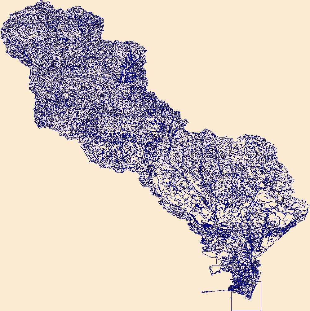
The High Resolution National Hydrography Dataset Plus (NHDPlus HR) is an integrated set of geospatial data layers, including the best available National Hydrography Dataset (NHD), the 10-meter 3D Elevation Program Digital Elevation Model (3DEP DEM), and the National Watershed Boundary Dataset (WBD). The NHDPlus HR combines the NHD, 3DEP DEMs, and WBD to create a stream network with linear referencing, feature naming, "value added attributes" (VAAs), elevation-derived catchments, and other features for hydrologic data analysis. The stream network with linear referencing is a system of data relationships applied to hydrographic systems so that one stream reach "flows" into another and "events" can be tied to and traced...
Tags: BeaverheadCounty,
BroadwaterCounty,
ClarkCounty,
Deer LodgeCounty,
Downloadable Data, All tags...
FileGDB,
FileGDB 10.1,
FremontCounty,
GallatinCounty,
GraniteCounty,
HU-4 Subregion,
HU-4 Subregion,
Hydrography,
ID,
Idaho,
JeffersonCounty,
LemhiCounty,
Lewis and ClarkCounty,
MadisonCounty,
NHDPlus HR Rasters,
NHDPlus High Resolution (NHDPlus HR),
National Hydrography Dataset (NHD),
National Hydrography Dataset Plus High Resolution (NHDPlus HR),
National Hydrography Dataset Plus High Resolution (NHDPlus HR) Current,
ParkCounty,
ParkCounty,
PowellCounty,
RavalliCounty,
Silver BowCounty,
TetonCounty,
US,
United States,
base maps,
cartography,
catchments,
channels,
digital elevation models,
drainage basins,
earth sciences,
elevation,
environment,
geographic information systems,
geoscientific,
geospatial analysis,
hydrographic datasets,
hydrographic features,
hydrology,
imagery,
inland waters,
lakes,
land surface characteristics,
reservoirs,
river reaches,
rivers,
streamflow,
streamflow data,
streams,
topography,
water bodies,
water quality,
water resources,
watersheds, Fewer tags
The High Resolution National Hydrography Dataset Plus (NHDPlus HR) is an integrated set of geospatial data layers, including the best available National Hydrography Dataset (NHD), the 10-meter 3D Elevation Program Digital Elevation Model (3DEP DEM), and the National Watershed Boundary Dataset (WBD). The NHDPlus HR combines the NHD, 3DEP DEMs, and WBD to create a stream network with linear referencing, feature naming, "value added attributes" (VAAs), elevation-derived catchments, and other features for hydrologic data analysis. The stream network with linear referencing is a system of data relationships applied to hydrographic systems so that one stream reach "flows" into another and "events" can be tied to and traced...
Tags: Benson County,
Bottineau County,
Burke County,
Divide County,
Downloadable Data, All tags...
FileGDB,
FileGDB 10.1,
HU-4 Subregion,
HU-4 Subregion,
HU4_0901,
Hydrography,
McHenry County,
McLean County,
Mountrail County,
ND,
NHDPlus HR Rasters,
NHDPlus High Resolution (NHDPlus HR),
National Hydrography Dataset (NHD),
National Hydrography Dataset Plus High Resolution (NHDPlus HR),
National Hydrography Dataset Plus High Resolution (NHDPlus HR) Current,
North Dakota,
Pierce County,
Renville County,
Rolette County,
Sheridan County,
US,
United States,
Ward County,
base maps,
cartography,
catchments,
channels,
digital elevation models,
drainage basins,
earth sciences,
elevation,
environment,
geographic information systems,
geoscientific,
geospatial analysis,
hydrographic datasets,
hydrographic features,
hydrology,
imagery,
inland waters,
lakes,
land surface characteristics,
reservoirs,
river reaches,
rivers,
streamflow,
streamflow data,
streams,
topography,
water bodies,
water quality,
water resources,
watersheds, Fewer tags
|
|

