Filters: Tags: wildlife management area (X)
16 results (570ms)|
Filters
Date Range
Contacts
Tag Types Tag Schemes
|

This map layer consists of federally owned or administered lands of the United States, Puerto Rico, and the U.S. Virgin Islands. For the most part, only areas of 320 acres or more are included; some smaller areas deemed to be important or significant are also included. There may be private inholdings within the boundaries of Federal lands in this map layer. Some established Federal lands which are larger than 320 acres are not included in this map layer, because their boundaries were not available from the owning or administering agency.

The datatset is a compilation of all permanent (legally established) protected areas in Ontario, Canada.

The datatset is a compilation of all permanent (legally established) protected areas in Nunavut, Canada.
The datatset is a compilation of all permanent (legally established) protected areas in Quebec, Canada.

The datatset is a compilation of all permanent (legally established) protected areas in Northwest Territories, Canada.

The datatset is a compilation of all permanent (legally established) protected areas in New Brunswick, Canada.

The datatset is a compilation of all permanent (legally established) protected areas in Manitoba, Canada.

The datatset is a compilation of all permanent (legally established) protected areas in British Columbia, Canada.
This map layer consists of federally owned or administered lands of the United States, Puerto Rico, and the U.S. Virgin Islands. For the most part, only areas of 320 acres or more are included; some smaller areas deemed to be important or significant are also included. There may be private inholdings within the boundaries of Federal lands in this map layer. Some established Federal lands which are larger than 320 acres are not included in this map layer, because their boundaries were not available from the owning or administering agency.

The datatset is a compilation of all permanent (legally established) protected areas in Nova Scotia, Canada.

The datatset is a compilation of all permanent (legally established) protected areas in Yukon, Canada.

The datatset is a compilation of all permanent (legally established) protected areas in Prince Edward Island, Canada.

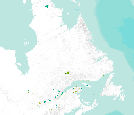
The datatset is a compilation of all permanent (legally established) protected areas in Newfoundland and Labrador, Canada.

The datatset is a compilation of all permanent (legally established) protected areas in Saskatchewan, Canada.

The datatset is a compilation of all permanent (legally established) protected areas in Alberta, Canada.

This DRAFT datatset is a compilation of all interim (time limited) protected areas in Canada.
|

|
