|
|

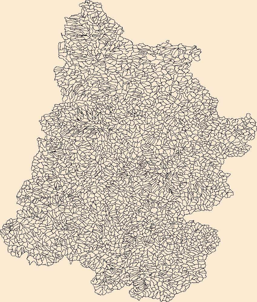
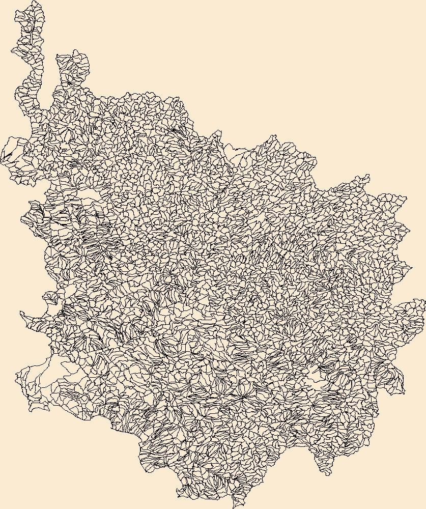
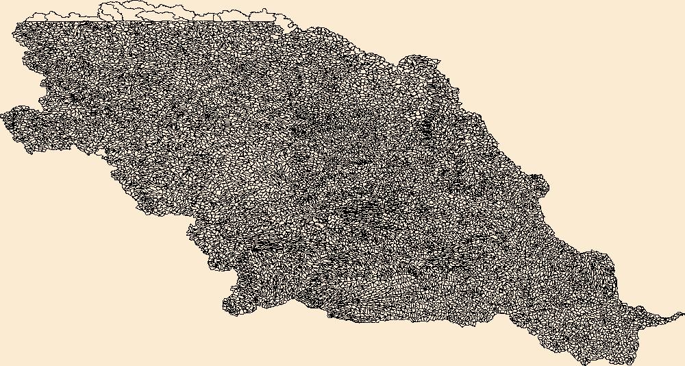
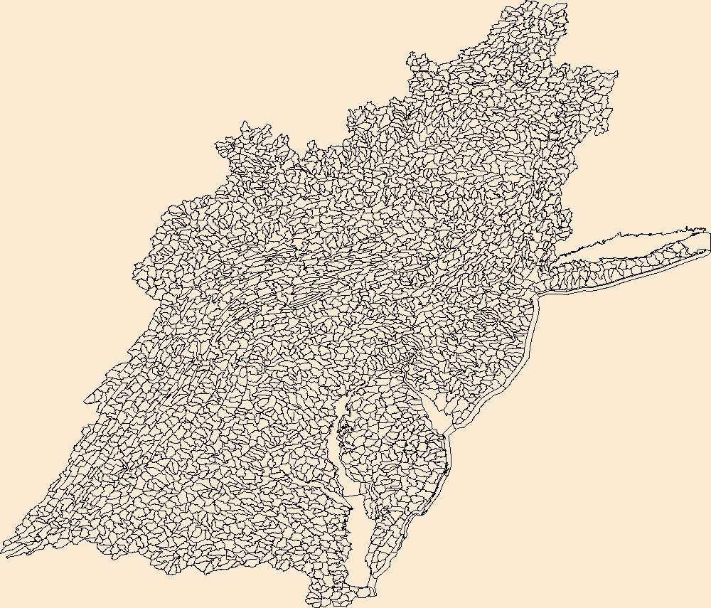
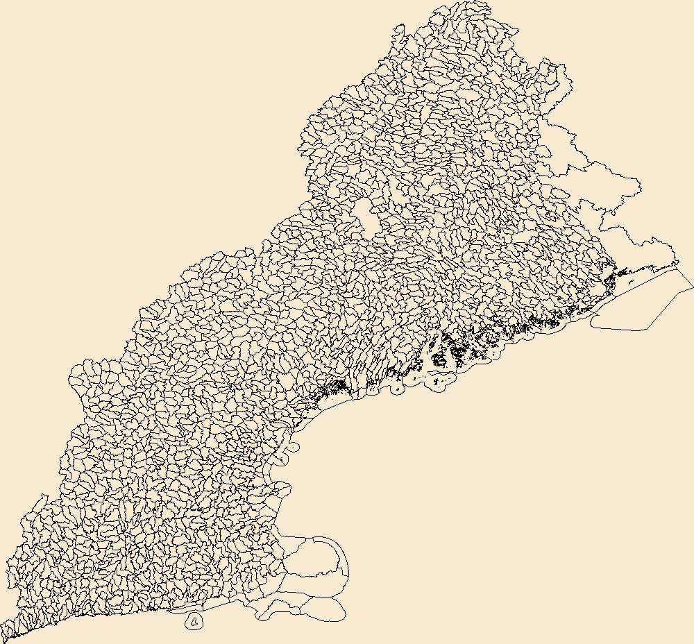
The Watershed Boundary Dataset (WBD) is a comprehensive aggregated collection of hydrologic unit data consistent with the national criteria for delineation and resolution. It defines the areal extent of surface water drainage to a point except in coastal or lake front areas where there could be multiple outlets as stated by the "Federal Standards and Procedures for the National Watershed Boundary Dataset (WBD)" "Standard" (https://pubs.usgs.gov/tm/11/a3/). Watershed boundaries are determined solely upon science-based hydrologic principles, not favoring any administrative boundaries or special projects, nor particular program or agency. This dataset represents the hydrologic unit boundaries to the 12-digit (6th level)...
Tags: 10-digit,
12-digit,
14-digit,
16-digit,
2-digit, All tags...
4-digit,
6-digit,
8-digit,
Adair,
Adams,
Alexander,
Allegany,
Alleghany,
Allegheny,
Allen,
Anderson,
Armstrong,
Ashe,
Ashland,
Ashtabula,
Athens,
Auglaize,
Ballard,
Barbour,
Barren,
Bartholomew,
Basin,
Bath,
Beaver,
Bedford,
Bell,
Belmont,
Benton,
Blackford,
Blair,
Bland,
Bledsoe,
Boone,
Bourbon,
Boyd,
Boyle,
Bracken,
Braxton,
Breathitt,
Breckinridge,
Brooke,
Brown,
Buchanan,
Bullitt,
Butler,
Cabell,
Caldwell,
Calhoun,
Cambria,
Cameron,
Campbell,
Cannon,
Carroll,
Carter,
Casey,
Cass,
Cattaraugus,
Champaign,
Chautauqua,
Cheatham,
Christian,
Claiborne,
Clarion,
Clark,
Clay,
Clearfield,
Clermont,
Clinton,
Coffee,
Coles,
Columbiana,
Coshocton,
Craig,
Crawford,
Crittenden,
Cumberland,
Darke,
Davidson,
Daviess,
DeKalb,
Dearborn,
Decatur,
Delaware,
Dickenson,
Dickson,
Doddridge,
Douglas,
Downloadable Data,
Dubois,
Edgar,
Edmonson,
Edwards,
Effingham,
Elk,
Elliott,
Erie,
Estill,
Fairfield,
Fayette,
Fentress,
Fleming,
Floyd,
Ford,
Forest,
Fountain,
Franklin,
Fulton,
Galax,
Gallatin,
Gallia,
Garrard,
Garrett,
Geauga,
GeoPackage,
Gibson,
Giles,
Gilmer,
Grant,
Grayson,
Green,
Greenbrier,
Greene,
Greenup,
Grundy,
Guernsey,
HU-2,
HU-2 Region,
HU2_05,
HUC,
Hamilton,
Hancock,
Hardin,
Harlan,
Harrison,
Hart,
Henderson,
Hendricks,
Henry,
Hickman,
Highland,
Hocking,
Holmes,
Hopkins,
Houston,
Howard,
Humphreys,
Huntington,
Hydrography,
Hydrologic Unit Code,
Hydrologic Units,
IL,
IN,
Illinois,
Indiana,
Indiana,
Iroquois,
Jackson,
Jasper,
Jay,
Jefferson,
Jennings,
Jessamine,
Johnson,
KY,
Kanawha,
Kenton,
Kentucky,
Knott,
Knox,
Kosciusko,
Larue,
Laurel,
Lawrence,
Lee,
Leslie,
Letcher,
Lewis,
Licking,
Lincoln,
Livingston,
Logan,
Lyon,
MD,
Macon,
Madison,
Magoffin,
Mahoning,
Marion,
Marshall,
Martin,
Maryland,
Mason,
Massac,
McCracken,
McCreary,
McDowell,
McKean,
McLean,
Meade,
Medina,
Meigs,
Menifee,
Mercer,
Metcalfe,
Miami,
Mingo,
Monongalia,
Monroe,
Montgomery,
Morgan,
Morrow,
Moultrie,
Muhlenberg,
Muskingum,
NC,
NY,
National Watershed Boundary Dataset (WBD),
National Watershed Boundary Dataset (WBD),
Nelson,
New York,
Nicholas,
Noble,
North Carolina,
OH,
Ohio,
Ohio,
Oldham,
Open Geospatial Consortium GeoPackage 1.2,
Orange,
Overton,
Owen,
Owsley,
PA,
Parke,
Patrick,
Pendleton,
Pennsylvania,
Perry,
Pickaway,
Pickett,
Pike,
Pleasants,
Pocahontas,
Pope,
Portage,
Posey,
Potter,
Powell,
Preble,
Preston,
Pulaski,
Putnam,
Radford,
Raleigh,
Randolph,
Region,
Richland,
Ripley,
Ritchie,
Roane,
Robertson,
Rockcastle,
Ross,
Rowan,
Rush,
Russell,
Rutherford,
Saline,
Scioto,
Scott,
Sequatchie,
Shelby,
Simpson,
Smith,
Smyth,
Somerset,
Spencer,
Stark,
Starke,
Stewart,
Sub-basin,
Sub-region,
Subwatershed,
Sullivan,
Summers,
Summit,
Sumner,
Surry,
Switzerland,
TN,
Taylor,
Tazewell,
Tennessee,
Tippecanoe,
Tipton,
Todd,
Trigg,
Trimble,
Trousdale,
Trumbull,
Tucker,
Tuscarawas,
Tyler,
US,
Union,
United States,
Upshur,
VA,
Van Buren,
Vanderburgh,
Venango,
Vermilion,
Vermillion,
Vigo,
Vinton,
Virginia,
WBD,
WV,
Wabash,
Warren,
Warrick,
Washington,
Watauga,
Watershed,
Watershed Boundary Dataset,
Wayne,
Webster,
Wells,
West Virginia,
Westmoreland,
Wetzel,
White,
Whitley,
Wilkes,
Williamson,
Wilson,
Wirt,
Wise,
Wolfe,
Wood,
Woodford,
Wyandot,
Wyoming,
Wythe,
inlandWaters, Fewer tags
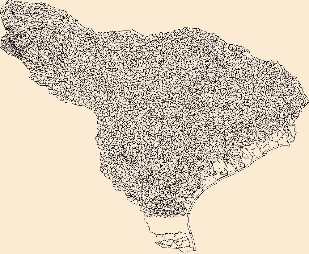
The Watershed Boundary Dataset (WBD) is a comprehensive aggregated collection of hydrologic unit data consistent with the national criteria for delineation and resolution. It defines the areal extent of surface water drainage to a point except in coastal or lake front areas where there could be multiple outlets as stated by the "Federal Standards and Procedures for the National Watershed Boundary Dataset (WBD)" "Standard" (https://pubs.usgs.gov/tm/11/a3/). Watershed boundaries are determined solely upon science-based hydrologic principles, not favoring any administrative boundaries or special projects, nor particular program or agency. This dataset represents the hydrologic unit boundaries to the 12-digit (6th level)...
Tags: 10-digit,
12-digit,
14-digit,
16-digit,
2-digit, All tags...
4-digit,
6-digit,
8-digit,
Anderson,
Andrews,
Angelina,
Aransas,
Archer,
Atascosa,
Austin,
Bailey,
Bandera,
Basin,
Bastrop,
Baylor,
Beauregard,
Bee,
Bell,
Bexar,
Blanco,
Borden,
Bosque,
Brazoria,
Brazos,
Brooks,
Brown,
Burleson,
Burnet,
Caddo,
Calcasieu,
Caldwell,
Calhoun,
Callahan,
Cameron,
Castro,
Chambers,
Chaves,
Cherokee,
Clay,
Cochran,
Coke,
Coleman,
Collin,
Colorado,
Comal,
Comanche,
Concho,
Cooke,
Coryell,
Crockett,
Crosby,
Curry,
Dallas,
Dawson,
De Soto,
DeWitt,
Denton,
Dickens,
Dimmit,
Downloadable Data,
Duval,
Eastland,
Ector,
Edwards,
Ellis,
Erath,
Falls,
Fannin,
Fayette,
Fisher,
Floyd,
Fort Bend,
Franklin,
Freestone,
Frio,
Gaines,
Galveston,
Garza,
GeoPackage,
Gillespie,
Glasscock,
Goliad,
Gonzales,
Grayson,
Gregg,
Grimes,
Guadalupe,
HU-2,
HU-2 Region,
HU2_12,
HUC,
Hale,
Hamilton,
Hardin,
Harris,
Harrison,
Haskell,
Hays,
Henderson,
Hidalgo,
Hill,
Hockley,
Hood,
Hopkins,
Houston,
Howard,
Hunt,
Hydrography,
Hydrologic Unit Code,
Hydrologic Units,
Irion,
Jack,
Jackson,
Jasper,
Jefferson,
Jim Hogg,
Jim Wells,
Johnson,
Jones,
Karnes,
Kaufman,
Kendall,
Kenedy,
Kent,
Kerr,
Kimble,
King,
Kinney,
Kleberg,
Knox,
LA,
La Salle,
Lamb,
Lampasas,
Lavaca,
Lea,
Lee,
Leon,
Liberty,
Limestone,
Live Oak,
Llano,
Louisiana,
Lubbock,
Lynn,
Madison,
Martin,
Mason,
Matagorda,
Maverick,
McCulloch,
McLennan,
McMullen,
Medina,
Menard,
Midland,
Milam,
Mills,
Mitchell,
Montague,
Montgomery,
NM,
Nacogdoches,
Natchitoches,
National Watershed Boundary Dataset (WBD),
National Watershed Boundary Dataset (WBD),
Navarro,
New Mexico,
Newton,
Nolan,
Nueces,
Open Geospatial Consortium GeoPackage 1.2,
Orange,
Palo Pinto,
Panola,
Parker,
Parmer,
Polk,
Rains,
Reagan,
Real,
Refugio,
Region,
Robertson,
Rockwall,
Roosevelt,
Runnels,
Rusk,
Sabine,
San Augustine,
San Jacinto,
San Patricio,
San Saba,
Schleicher,
Scurry,
Shackelford,
Shelby,
Smith,
Somervell,
Starr,
Stephens,
Sterling,
Stonewall,
Sub-basin,
Sub-region,
Subwatershed,
Sutton,
Swisher,
TX,
Tarrant,
Taylor,
Terry,
Texas,
Throckmorton,
Tom Green,
Travis,
Trinity,
Tyler,
US,
United States,
Upshur,
Upton,
Uvalde,
Van Zandt,
Vernon,
Victoria,
WBD,
Walker,
Waller,
Washington,
Watershed,
Watershed Boundary Dataset,
Webb,
Wharton,
Willacy,
Williamson,
Wilson,
Winkler,
Wise,
Wood,
Yoakum,
Young,
Zavala,
inlandWaters, Fewer tags
The Watershed Boundary Dataset (WBD) is a comprehensive aggregated collection of hydrologic unit data consistent with the national criteria for delineation and resolution. It defines the areal extent of surface water drainage to a point except in coastal or lake front areas where there could be multiple outlets as stated by the "Federal Standards and Procedures for the National Watershed Boundary Dataset (WBD)" "Standard" (https://pubs.usgs.gov/tm/11/a3/). Watershed boundaries are determined solely upon science-based hydrologic principles, not favoring any administrative boundaries or special projects, nor particular program or agency. This dataset represents the hydrologic unit boundaries to the 12-digit (6th level)...
Tags: 10-digit,
12-digit,
14-digit,
16-digit,
2-digit, All tags...
4-digit,
6-digit,
8-digit,
AZ,
Apache,
Archuleta,
Arizona,
Basin,
Boulder,
CO,
Carbon,
Chaffee,
Clear Creek,
Coconino,
Colorado,
Conejos,
Daggett,
Delta,
Dolores,
Downloadable Data,
Duchesne,
Eagle,
Emery,
Esri Shapefile nan,
Fremont,
Garfield,
Gilpin,
Grand,
Gunnison,
HU-2,
HU-2 Region,
HU2_14,
HUC,
Hinsdale,
Hydrography,
Hydrologic Unit Code,
Hydrologic Units,
Jackson,
Kane,
La Plata,
Lake,
Larimer,
Lincoln,
McKinley,
Mesa,
Mineral,
Moffat,
Montezuma,
Montrose,
NM,
National Watershed Boundary Dataset (WBD),
National Watershed Boundary Dataset (WBD),
Navajo,
New Mexico,
Ouray,
Park,
Pitkin,
Piute,
Region,
Rio Arriba,
Rio Blanco,
Rio Grande,
Routt,
Saguache,
San Juan,
San Miguel,
Sandoval,
Sanpete,
Sevier,
Shapefile,
Sub-basin,
Sub-region,
Sublette,
Subwatershed,
Summit,
Sweetwater,
Teton,
US,
UT,
Uinta,
Uintah,
United States,
Utah,
Utah,
WBD,
WY,
Wasatch,
Watershed,
Watershed Boundary Dataset,
Wayne,
Wyoming,
inlandWaters, Fewer tags
The Watershed Boundary Dataset (WBD) is a comprehensive aggregated collection of hydrologic unit data consistent with the national criteria for delineation and resolution. It defines the areal extent of surface water drainage to a point except in coastal or lake front areas where there could be multiple outlets as stated by the "Federal Standards and Procedures for the National Watershed Boundary Dataset (WBD)" "Standard" (https://pubs.usgs.gov/tm/11/a3/). Watershed boundaries are determined solely upon science-based hydrologic principles, not favoring any administrative boundaries or special projects, nor particular program or agency. This dataset represents the hydrologic unit boundaries to the 12-digit (6th level)...
Tags: 10-digit,
12-digit,
14-digit,
16-digit,
2-digit, All tags...
4-digit,
6-digit,
8-digit,
AZ,
Apache,
Arizona,
Basin,
CA,
California,
Catron,
Cibola,
Clark,
Cochise,
Coconino,
Downloadable Data,
Esri Shapefile nan,
Gila,
Graham,
Grant,
Greenlee,
HU-2,
HU-2 Region,
HU2_15,
HUC,
Hidalgo,
Hydrography,
Hydrologic Unit Code,
Hydrologic Units,
Imperial,
Iron,
Kane,
La Paz,
Lincoln,
Luna,
Maricopa,
McKinley,
Mohave,
NM,
NV,
National Watershed Boundary Dataset (WBD),
National Watershed Boundary Dataset (WBD),
Navajo,
Nevada,
New Mexico,
Nye,
Pima,
Pinal,
Region,
Riverside,
San Bernardino,
San Juan,
Santa Cruz,
Shapefile,
Sierra,
Sub-basin,
Sub-region,
Subwatershed,
US,
UT,
United States,
Utah,
WBD,
Washington,
Watershed,
Watershed Boundary Dataset,
White Pine,
Yavapai,
Yuma,
inlandWaters, Fewer tags

This data set replaces the 2010 edition (Edition 1.0) of the 2005 Land Cover of North America. Following the release of the first 2005 land cover data, several errors were identified in the data, including both errors in labeling and misinterpretation of thematic classes. To correct the labeling errors, each country focused on its national territory and corrected the errors which it considered most critical or misleading. For the continental data sets (including surrounding water fringe) 17440830 pixels (4.33% of the area) changed in the update. The following national counts exclude the water fringe: Canada, 10223412 pixels changed (6.44%); Mexico, 141142 pixels changed (0.45%), and U.S., 6878656 pixels changed...
Tags: Canada,
Land Surface > Land Use/Land Cover > Land Cover,
Land Surface > Surface Radiative Properties > Reflectance,
Land Use Land Cover Theme,
Land cover, All tags...
MODIS,
Mexico,
Mid-latitude,
NAFTA,
NGDA,
National Geospatial Data Asset,
North America,
North America Free Trade Agreement,
Northern Hemisphere,
Reflectance,
Remote sensing,
United States,
Western Hemisphere,
imageryBaseMapsEarthCover,
landingPage, Fewer tags
The Watershed Boundary Dataset (WBD) is a comprehensive aggregated collection of hydrologic unit data consistent with the national criteria for delineation and resolution. It defines the areal extent of surface water drainage to a point except in coastal or lake front areas where there could be multiple outlets as stated by the "Federal Standards and Procedures for the National Watershed Boundary Dataset (WBD)" "Standard" (https://pubs.usgs.gov/tm/11/a3/). Watershed boundaries are determined solely upon science-based hydrologic principles, not favoring any administrative boundaries or special projects, nor particular program or agency. This dataset represents the hydrologic unit boundaries to the 12-digit (6th level)...
Tags: 10-digit,
12-digit,
14-digit,
16-digit,
2-digit, All tags...
4-digit,
6-digit,
8-digit,
Adair,
Adams,
Albany,
Allen,
Anderson,
Andrew,
Antelope,
Appanoose,
Arapahoe,
Arthur,
Atchison,
Audrain,
Audubon,
Aurora,
Banner,
Barnes,
Barton,
Basin,
Bates,
Beadle,
Beaverhead,
Bennett,
Benton,
Big Horn,
Billings,
Blaine,
Bon Homme,
Boone,
Boulder,
Bourbon,
Bowman,
Box Butte,
Boyd,
Broadwater,
Brookings,
Broomfield,
Brown,
Brule,
Buchanan,
Buena Vista,
Buffalo,
Burke,
Burleigh,
Burt,
Butler,
Butte,
CO,
Caldwell,
Callaway,
Camden,
Campbell,
Carbon,
Carroll,
Carter,
Cascade,
Cass,
Cedar,
Chaffee,
Chariton,
Charles Mix,
Chase,
Cherokee,
Cherry,
Cheyenne,
Chouteau,
Christian,
Clark,
Clarke,
Clay,
Clear Creek,
Clinton,
Cloud,
Codington,
Coffey,
Cole,
Colfax,
Colorado,
Converse,
Cooper,
Corson,
Crawford,
Crook,
Cuming,
Custer,
Dade,
Dakota,
Dallas,
Daniels,
Daviess,
Davis,
Davison,
Dawes,
Dawson,
Day,
DeKalb,
Decatur,
Deer Lodge,
Dent,
Denver,
Deuel,
Dewey,
Dickey,
Dickinson,
Divide,
Dixon,
Dodge,
Doniphan,
Douglas,
Downloadable Data,
Dundy,
Dunn,
Eddy,
Edmunds,
El Paso,
Elbert,
Ellis,
Ellsworth,
Emmet,
Emmons,
Esri File GeoDatabase 10,
Fall River,
Fallon,
Faulk,
Fergus,
FileGDB,
Fillmore,
Flathead,
Foster,
Franklin,
Fremont,
Frontier,
Furnas,
Gage,
Gallatin,
Garden,
Garfield,
Gasconade,
Geary,
Gentry,
Gilpin,
Glacier,
Golden Valley,
Goshen,
Gosper,
Gove,
Graham,
Grand,
Granite,
Grant,
Greeley,
Greene,
Gregory,
Grundy,
Guthrie,
HU-2,
HU-2 Region,
HU2_10,
HUC,
Haakon,
Hall,
Hamilton,
Hamlin,
Hand,
Hanson,
Harding,
Harlan,
Harrison,
Hayes,
Henry,
Hettinger,
Hickory,
Hill,
Hitchcock,
Holt,
Hooker,
Hot Springs,
Howard,
Howell,
Hughes,
Hutchinson,
Hyde,
Hydrography,
Hydrologic Unit Code,
Hydrologic Units,
IA,
ID,
Ida,
Idaho,
Iowa,
Jackson,
Jefferson,
Jerauld,
Jewell,
Johnson,
Jones,
Judith Basin,
KS,
Kansas,
Kearney,
Keith,
Keya Paha,
Kidder,
Kimball,
Kingsbury,
Kit Carson,
Knox,
LaMoure,
Laclede,
Lafayette,
Lake,
Lancaster,
Lane,
Laramie,
Larimer,
Lawrence,
Leavenworth,
Lemhi,
Lewis and Clark,
Liberty,
Lincoln,
Linn,
Livingston,
Logan,
Loup,
Lucas,
Lyman,
Lyon,
MN,
MO,
MT,
Macon,
Madison,
Maries,
Marion,
Marshall,
McCone,
McCook,
McHenry,
McIntosh,
McKenzie,
McLean,
McPherson,
Meade,
Meagher,
Mellette,
Mercer,
Merrick,
Miami,
Miller,
Mills,
Miner,
Minnehaha,
Minnesota,
Missouri,
Mitchell,
Moniteau,
Monona,
Monroe,
Montana,
Montgomery,
Moody,
Morgan,
Morrill,
Morris,
Morton,
Mountrail,
Murray,
Musselshell,
ND,
NE,
Nance,
National Watershed Boundary Dataset (WBD),
National Watershed Boundary Dataset (WBD),
Natrona,
Nebraska,
Nemaha,
Ness,
Niobrara,
Nobles,
Nodaway,
North Dakota,
Norton,
Nuckolls,
O'Brien,
Oglala Lakota,
Oliver,
Osage,
Osborne,
Osceola,
Otoe,
Ottawa,
Page,
Palo Alto,
Park,
Pawnee,
Pennington,
Perkins,
Petroleum,
Pettis,
Phelps,
Phillips,
Pierce,
Pipestone,
Platte,
Plymouth,
Polk,
Pondera,
Pottawatomie,
Pottawattamie,
Potter,
Powder River,
Powell,
Prairie,
Pulaski,
Putnam,
Randolph,
Ransom,
Ravalli,
Rawlins,
Ray,
Red Willow,
Region,
Republic,
Rice,
Richardson,
Richland,
Riley,
Ringgold,
Roberts,
Rock,
Rooks,
Roosevelt,
Rosebud,
Routt,
Rush,
Russell,
SD,
Sac,
Saline,
Sanborn,
Sargent,
Sarpy,
Saunders,
Schuyler,
Scott,
Scotts Bluff,
Sedgwick,
Seward,
Shawnee,
Shelby,
Sheridan,
Sherman,
Silver Bow,
Sioux,
Slope,
Smith,
South Dakota,
Spink,
St. Charles,
St. Clair,
St. Louis,
Stanley,
Stanton,
Stark,
Stillwater,
Stutsman,
Sub-basin,
Sub-region,
Sublette,
Subwatershed,
Sullivan,
Sully,
Summit,
Sweet Grass,
Sweetwater,
Taylor,
Teller,
Teton,
Texas,
Thayer,
Thomas,
Thurston,
Todd,
Toole,
Treasure,
Trego,
Tripp,
Turner,
US,
Union,
United States,
Valley,
Vernon,
WBD,
WY,
Wabaunsee,
Wallace,
Walworth,
Ward,
Warren,
Washakie,
Washington,
Watershed,
Watershed Boundary Dataset,
Wayne,
Webster,
Weld,
Wells,
Weston,
Wheatland,
Wheeler,
Wibaux,
Wichita,
Williams,
Woodbury,
Worth,
Wright,
Wyandotte,
Wyoming,
Yankton,
Yellowstone,
York,
Yuma,
Ziebach,
inlandWaters, Fewer tags

Spatial analysis and statistical summaries of the Protected Areas Database of the United States (PAD-US) provide land managers and decision makers with a general assessment of management intent for biodiversity protection, natural resource management, and recreation access across the nation. The PAD-US 4.0 Combined Fee, Designation, Easement feature classes (with Military Lands and Tribal Areas from the Proclamation and Other Planning Boundaries feature classes) were modified to remove overlaps, avoiding overestimation in protected area statistics and to support user needs. A Python scripted process ("PADUS4_0_VectorAnalysis_Script_Python3.zip") associated with this data release prioritized overlapping designations...
Tags: Agricultural Research Service,
Alabama (AL),
Alaska (AK),
American Samoa (AS),
Arizona (AZ), All tags...
Arkansas (AR),
Army Corps of Engineers,
Biodiversity,
Bureau of Land Management,
Bureau of Reclamation,
California (CA),
Census,
Colorado (CO),
Connecticut (CT),
Conservation,
Data Integration,
Delaware (DE),
Department of Defense,
Department of Energy,
Federal Lands,
Florida (FL),
Forest Service,
GAP Status Code,
Gap Analysis,
Geography,
Georgia (GA),
Governmental Units,
Guam (GU),
Hawaii (HI),
IUCN Category,
Idaho (ID),
Illinois (IL),
Indiana (IN),
Iowa (IA),
Kansas (KS),
Kentucky (KY),
Land Manager,
Land Ownership,
Land Stewardship,
Land Use and Land Cover,
Local Government Lands,
Louisiana (LA),
Maine (ME),
Mariana Islands (MP),
Maryland (MD),
Massachusetts (MA),
Michigan (MI),
Minnesota (MN),
Mississippi (MS),
Missouri (MO),
Montana (MT),
NGDA Portfolio Themes,
National Oceanic and Atmospheric Administration,
National Park Service,
Natural Resource Management,
Natural Resources Conservation Service,
Nebraska (NE),
Nevada (NV),
New Hampshire (NH),
New Jersey (NJ),
New Mexico (NM),
New York (NY),
North Carolina (NC),
North Dakota (ND),
Ohio (OH),
Oklahoma (OK),
Oregon (OR),
Outdoor Recreation,
Parks,
Pennsylvania (PA),
Private Lands,
Protected Area,
Protection Status,
Public Access,
Public Health,
Public Lands,
Public Open Space,
Puerto Rico (PR),
Rhode Island (RI),
South Carolina (SC),
South Dakota (SD),
State Lands,
Tennessee (TN),
Tennessee Valley Authority,
Texas (TX),
U.S. Fish and Wildlife Service,
U.S. Minor Outlying Islands (UM),
United States,
United States,
United States Virgin Islands (VI),
Utah (UT),
Vermont (VT),
Veterans Affairs,
Virginia (VA),
Washington (WA),
West Virginia (WV),
Wisconsin (WI),
Wyoming (WY), Fewer tags

This data set shows areas where the land cover classification changed between 2005and 2010. The 2005-2010 Land Cover Change of North America at 250 meters wasproduced as part of the North American Land Change Monitoring System (NALCMS), atrilateral effort between the Canada Centre for Remote Sensing, the United StatesGeological Survey, and three Mexican organizations including the National Instituteof Statistics and Geography (Instituto Nacional de Estadistica y Geografia),National Commission for the Knowledge and Use of the Biodiversity (ComisiónNacional Para el Conocimiento y Uso de la Biodiversidad), and the National ForestryCommission of Mexico (Comisión Nacional Forestal). The collaboration isfacilitated by...
Tags: Canada,
Land Surface > Land Use/Land Cover > Land Cover,
Land Surface > Surface Radiative Properties > Reflectance,
Land Use Land Cover Theme,
Land cover, All tags...
MODIS,
Mexico,
Mid-latitude,
NAFTA,
NGDA,
National Geospatial Data Asset,
North America,
North America Free Trade Agreement,
Northern Hemisphere,
Reflectance,
Remote sensing,
United States,
Western Hemisphere,
imageryBaseMapsEarthCover,
landingPage, Fewer tags
The Watershed Boundary Dataset (WBD) is a comprehensive aggregated collection of hydrologic unit data consistent with the national criteria for delineation and resolution. It defines the areal extent of surface water drainage to a point except in coastal or lake front areas where there could be multiple outlets as stated by the "Federal Standards and Procedures for the National Watershed Boundary Dataset (WBD)" "Standard" (https://pubs.usgs.gov/tm/11/a3/). Watershed boundaries are determined solely upon science-based hydrologic principles, not favoring any administrative boundaries or special projects, nor particular program or agency. This dataset represents the hydrologic unit boundaries to the 12-digit (6th level)...
Tags: 10-digit,
12-digit,
14-digit,
16-digit,
2-digit, All tags...
4-digit,
6-digit,
8-digit,
AR,
Adair,
Alamosa,
Alfalfa,
Allen,
Anderson,
Archer,
Arkansas,
Armstrong,
Atoka,
Baca,
Barber,
Barry,
Barton,
Basin,
Baxter,
Baylor,
Beaver,
Beckham,
Bent,
Benton,
Bienville,
Blaine,
Boone,
Bossier,
Bourbon,
Bowie,
Briscoe,
Bryan,
Butler,
CO,
Caddo,
Camp,
Canadian,
Carroll,
Carson,
Carter,
Cass,
Castro,
Chaffee,
Chase,
Chautauqua,
Cherokee,
Cheyenne,
Childress,
Choctaw,
Christian,
Cimarron,
Claiborne,
Clark,
Clay,
Cleburne,
Cleveland,
Coal,
Coffey,
Colfax,
Collingsworth,
Colorado,
Columbia,
Comanche,
Conway,
Cooke,
Costilla,
Cottle,
Cotton,
Cowley,
Craig,
Crawford,
Creek,
Crosby,
Crowley,
Curry,
Custer,
Dade,
Dallam,
De Soto,
Deaf Smith,
Delaware,
Delta,
Dent,
Dewey,
Dickens,
Donley,
Douglas,
Downloadable Data,
Eagle,
Edwards,
El Paso,
Elbert,
Elk,
Ellis,
Ellsworth,
Fannin,
Faulkner,
Finney,
Floyd,
Foard,
Ford,
Franklin,
Fremont,
Fulton,
Garfield,
Garland,
Garvin,
GeoPackage,
Grady,
Grant,
Gray,
Grayson,
Greeley,
Greene,
Greenwood,
Greer,
Gregg,
Guadalupe,
Gunnison,
HU-2,
HU-2 Region,
HU2_11,
HUC,
Hale,
Hall,
Hamilton,
Hansford,
Hardeman,
Harding,
Harmon,
Harper,
Harrison,
Hartley,
Harvey,
Haskell,
Hemphill,
Hempstead,
Hodgeman,
Hopkins,
Howard,
Howell,
Huerfano,
Hughes,
Hunt,
Hutchinson,
Hydrography,
Hydrologic Unit Code,
Hydrologic Units,
Independence,
Iron,
Izard,
Jackson,
Jasper,
Jefferson,
Johnson,
Johnston,
KS,
Kansas,
Kay,
Kearny,
King,
Kingfisher,
Kingman,
Kiowa,
Kit Carson,
Knox,
LA,
Labette,
Lafayette,
Lake,
Lamar,
Lane,
Las Animas,
Latimer,
Lawrence,
Le Flore,
Lincoln,
Lipscomb,
Little River,
Logan,
Lonoke,
Louisiana,
Love,
Lyon,
MO,
Madison,
Major,
Marion,
Marshall,
Mayes,
McClain,
McCurtain,
McDonald,
McIntosh,
McPherson,
Meade,
Miller,
Missouri,
Montague,
Montgomery,
Moore,
Mora,
Morris,
Morton,
Motley,
Murray,
Muskogee,
NM,
Natchitoches,
National Watershed Boundary Dataset (WBD),
National Watershed Boundary Dataset (WBD),
Neosho,
Ness,
Nevada,
New Mexico,
Newton,
Noble,
Nowata,
OK,
Ochiltree,
Okfuskee,
Oklahoma,
Oklahoma,
Okmulgee,
Oldham,
Open Geospatial Consortium GeoPackage 1.2,
Oregon,
Osage,
Otero,
Ottawa,
Ozark,
Panola,
Park,
Parmer,
Pawnee,
Payne,
Perry,
Pike,
Pitkin,
Pittsburg,
Polk,
Pontotoc,
Pope,
Pottawatomie,
Potter,
Pratt,
Prowers,
Pueblo,
Pulaski,
Pushmataha,
Quay,
Randall,
Randolph,
Rapides,
Red River,
Region,
Reno,
Reynolds,
Rice,
Rio Arriba,
Ripley,
Roberts,
Roger Mills,
Rogers,
Rush,
Sabine,
Saguache,
Saline,
San Miguel,
Scott,
Searcy,
Sebastian,
Sedgwick,
Seminole,
Sequoyah,
Sevier,
Seward,
Shannon,
Sharp,
Sherman,
Stafford,
Stanton,
Stephens,
Stevens,
Stone,
Sub-basin,
Sub-region,
Subwatershed,
Summit,
Sumner,
Swisher,
TX,
Taney,
Taos,
Teller,
Texas,
Texas,
Tillman,
Titus,
Tulsa,
US,
Union,
United States,
Upshur,
Van Buren,
Vernon,
WBD,
Wabaunsee,
Wagoner,
Washington,
Washita,
Watershed,
Watershed Boundary Dataset,
Wayne,
Webster,
Wheeler,
White,
Wichita,
Wilbarger,
Wilson,
Winn,
Wood,
Woodruff,
Woods,
Woodson,
Woodward,
Wright,
Yell,
Young,
inlandWaters, Fewer tags

The Watershed Boundary Dataset (WBD) is a comprehensive aggregated collection of hydrologic unit data consistent with the national criteria for delineation and resolution. It defines the areal extent of surface water drainage to a point except in coastal or lake front areas where there could be multiple outlets as stated by the "Federal Standards and Procedures for the National Watershed Boundary Dataset (WBD)" "Standard" (https://pubs.usgs.gov/tm/11/a3/). Watershed boundaries are determined solely upon science-based hydrologic principles, not favoring any administrative boundaries or special projects, nor particular program or agency. This dataset represents the hydrologic unit boundaries to the 12-digit (6th level)...
Tags: 10-digit,
12-digit,
14-digit,
16-digit,
2-digit, All tags...
4-digit,
6-digit,
8-digit,
Barnes,
Basin,
Becker,
Beltrami,
Benson,
Big Stone,
Bottineau,
Burke,
Cass,
Cavalier,
Clay,
Clearwater,
Cook,
Dickey,
Divide,
Downloadable Data,
Eddy,
Esri Shapefile nan,
Flathead,
Foster,
Glacier,
Grand Forks,
Grant,
Griggs,
HU-2,
HU-2 Region,
HU2_09,
HUC,
Hydrography,
Hydrologic Unit Code,
Hydrologic Units,
Itasca,
Kittson,
Koochiching,
Lake,
Lake of the Woods,
MN,
MT,
Mahnomen,
Marshall,
McHenry,
McLean,
Minnesota,
Montana,
Mountrail,
ND,
National Watershed Boundary Dataset (WBD),
National Watershed Boundary Dataset (WBD),
Nelson,
Norman,
North Dakota,
Otter Tail,
Pembina,
Pennington,
Pierce,
Polk,
Ramsey,
Ransom,
Red Lake,
Region,
Renville,
Richland,
Roberts,
Rolette,
Roseau,
SD,
Sargent,
Shapefile,
Sheridan,
South Dakota,
St. Louis,
Steele,
Stevens,
Stutsman,
Sub-basin,
Sub-region,
Subwatershed,
Towner,
Traill,
Traverse,
US,
United States,
WBD,
Walsh,
Ward,
Watershed,
Watershed Boundary Dataset,
Wells,
Wilkin,
inlandWaters, Fewer tags

The Watershed Boundary Dataset (WBD) is a comprehensive aggregated collection of hydrologic unit data consistent with the national criteria for delineation and resolution. It defines the areal extent of surface water drainage to a point except in coastal or lake front areas where there could be multiple outlets as stated by the "Federal Standards and Procedures for the National Watershed Boundary Dataset (WBD)" "Standard" (https://pubs.usgs.gov/tm/11/a3/). Watershed boundaries are determined solely upon science-based hydrologic principles, not favoring any administrative boundaries or special projects, nor particular program or agency. This dataset represents the hydrologic unit boundaries to the 12-digit (6th level)...
Types: Citation;
Tags: 10-digit,
12-digit,
14-digit,
16-digit,
2-digit, All tags...
4-digit,
6-digit,
8-digit,
AS,
American Samoa,
Basin,
Downloadable Data,
Eastern,
Esri Shapefile nan,
GU,
Guam,
Guam,
HU-2,
HU-2 Region,
HU2_22,
HUC,
Hydrography,
Hydrologic Unit Code,
Hydrologic Units,
MP,
Manu'a,
National Watershed Boundary Dataset (WBD),
National Watershed Boundary Dataset (WBD),
Northern Islands,
Northern Mariana Islands,
Region,
Rose Island,
Rota,
Saipan,
Shapefile,
Sub-basin,
Sub-region,
Subwatershed,
Swains Island,
Tinian,
US,
United States,
WBD,
Watershed,
Watershed Boundary Dataset,
Western,
inlandWaters, Fewer tags
The Watershed Boundary Dataset (WBD) is a comprehensive aggregated collection of hydrologic unit data consistent with the national criteria for delineation and resolution. It defines the areal extent of surface water drainage to a point except in coastal or lake front areas where there could be multiple outlets as stated by the "Federal Standards and Procedures for the National Watershed Boundary Dataset (WBD)" "Standard" (https://pubs.usgs.gov/tm/11/a3/). Watershed boundaries are determined solely upon science-based hydrologic principles, not favoring any administrative boundaries or special projects, nor particular program or agency. This dataset represents the hydrologic unit boundaries to the 12-digit (6th level)...
Tags: 10-digit,
12-digit,
14-digit,
16-digit,
2-digit, All tags...
4-digit,
6-digit,
8-digit,
Alamosa,
Andrews,
Archuleta,
Basin,
Bernalillo,
Brewster,
CO,
Cameron,
Catron,
Chaffee,
Chaves,
Cibola,
Colfax,
Colorado,
Conejos,
Costilla,
Crane,
Crockett,
Culberson,
Curry,
Custer,
De Baca,
Dimmit,
Downloadable Data,
Doña Ana,
Ector,
Eddy,
Edwards,
El Paso,
Fremont,
GeoPackage,
Grant,
Guadalupe,
HU-2,
HU-2 Region,
HU2_13,
HUC,
Hidalgo,
Hinsdale,
Hudspeth,
Huerfano,
Hydrography,
Hydrologic Unit Code,
Hydrologic Units,
Jeff Davis,
Jim Hogg,
Kinney,
Las Animas,
Lea,
Lincoln,
Los Alamos,
Loving,
Luna,
Maverick,
McKinley,
Midland,
Mineral,
Mora,
NM,
National Watershed Boundary Dataset (WBD),
National Watershed Boundary Dataset (WBD),
New Mexico,
Open Geospatial Consortium GeoPackage 1.2,
Otero,
Pecos,
Presidio,
Quay,
Reagan,
Reeves,
Region,
Rio Arriba,
Rio Grande,
Roosevelt,
Saguache,
San Juan,
San Miguel,
Sandoval,
Santa Fe,
Schleicher,
Sierra,
Socorro,
Starr,
Sub-basin,
Sub-region,
Subwatershed,
Sutton,
TX,
Taos,
Terrell,
Texas,
Torrance,
US,
United States,
Upton,
Val Verde,
Valencia,
WBD,
Ward,
Watershed,
Watershed Boundary Dataset,
Webb,
Winkler,
Zapata,
inlandWaters, Fewer tags

The Watershed Boundary Dataset (WBD) is a comprehensive aggregated collection of hydrologic unit data consistent with the national criteria for delineation and resolution. It defines the areal extent of surface water drainage to a point except in coastal or lake front areas where there could be multiple outlets as stated by the "Federal Standards and Procedures for the National Watershed Boundary Dataset (WBD)" "Standard" (https://pubs.usgs.gov/tm/11/a3/). Watershed boundaries are determined solely upon science-based hydrologic principles, not favoring any administrative boundaries or special projects, nor particular program or agency. This dataset represents the hydrologic unit boundaries to the 12-digit (6th level)...
Tags: 10-digit,
12-digit,
14-digit,
16-digit,
2-digit, All tags...
4-digit,
6-digit,
8-digit,
AS,
American Samoa,
Basin,
Downloadable Data,
Eastern,
GU,
GeoPackage,
Guam,
Guam,
HU-2,
HU-2 Region,
HU2_22,
HUC,
Hydrography,
Hydrologic Unit Code,
Hydrologic Units,
MP,
Manu'a,
National Watershed Boundary Dataset (WBD),
National Watershed Boundary Dataset (WBD),
Northern Islands,
Northern Mariana Islands,
Open Geospatial Consortium GeoPackage 1.2,
Region,
Rose Island,
Rota,
Saipan,
Sub-basin,
Sub-region,
Subwatershed,
Swains Island,
Tinian,
US,
United States,
WBD,
Watershed,
Watershed Boundary Dataset,
Western,
inlandWaters, Fewer tags
The Watershed Boundary Dataset (WBD) is a comprehensive aggregated collection of hydrologic unit data consistent with the national criteria for delineation and resolution. It defines the areal extent of surface water drainage to a point except in coastal or lake front areas where there could be multiple outlets as stated by the "Federal Standards and Procedures for the National Watershed Boundary Dataset (WBD)" "Standard" (https://pubs.usgs.gov/tm/11/a3/). Watershed boundaries are determined solely upon science-based hydrologic principles, not favoring any administrative boundaries or special projects, nor particular program or agency. This dataset represents the hydrologic unit boundaries to the 12-digit (6th level)...
Tags: 10-digit,
12-digit,
14-digit,
16-digit,
2-digit, All tags...
4-digit,
6-digit,
8-digit,
Barnes,
Basin,
Becker,
Beltrami,
Benson,
Big Stone,
Bottineau,
Burke,
Cass,
Cavalier,
Clay,
Clearwater,
Cook,
Dickey,
Divide,
Downloadable Data,
Eddy,
Esri File GeoDatabase 10,
FileGDB,
Flathead,
Foster,
Glacier,
Grand Forks,
Grant,
Griggs,
HU-2,
HU-2 Region,
HU2_09,
HUC,
Hydrography,
Hydrologic Unit Code,
Hydrologic Units,
Itasca,
Kittson,
Koochiching,
Lake,
Lake of the Woods,
MN,
MT,
Mahnomen,
Marshall,
McHenry,
McLean,
Minnesota,
Montana,
Mountrail,
ND,
National Watershed Boundary Dataset (WBD),
National Watershed Boundary Dataset (WBD),
Nelson,
Norman,
North Dakota,
Otter Tail,
Pembina,
Pennington,
Pierce,
Polk,
Ramsey,
Ransom,
Red Lake,
Region,
Renville,
Richland,
Roberts,
Rolette,
Roseau,
SD,
Sargent,
Sheridan,
South Dakota,
St. Louis,
Steele,
Stevens,
Stutsman,
Sub-basin,
Sub-region,
Subwatershed,
Towner,
Traill,
Traverse,
US,
United States,
WBD,
Walsh,
Ward,
Watershed,
Watershed Boundary Dataset,
Wells,
Wilkin,
inlandWaters, Fewer tags
The Watershed Boundary Dataset (WBD) is a comprehensive aggregated collection of hydrologic unit data consistent with the national criteria for delineation and resolution. It defines the areal extent of surface water drainage to a point except in coastal or lake front areas where there could be multiple outlets as stated by the "Federal Standards and Procedures for the National Watershed Boundary Dataset (WBD)" "Standard" (https://pubs.usgs.gov/tm/11/a3/). Watershed boundaries are determined solely upon science-based hydrologic principles, not favoring any administrative boundaries or special projects, nor particular program or agency. This dataset represents the hydrologic unit boundaries to the 12-digit (6th level)...
Tags: 10-digit,
12-digit,
14-digit,
16-digit,
2-digit, All tags...
4-digit,
6-digit,
8-digit,
Adair,
Adams,
Alexander,
Allegany,
Alleghany,
Allegheny,
Allen,
Anderson,
Armstrong,
Ashe,
Ashland,
Ashtabula,
Athens,
Auglaize,
Ballard,
Barbour,
Barren,
Bartholomew,
Basin,
Bath,
Beaver,
Bedford,
Bell,
Belmont,
Benton,
Blackford,
Blair,
Bland,
Bledsoe,
Boone,
Bourbon,
Boyd,
Boyle,
Bracken,
Braxton,
Breathitt,
Breckinridge,
Brooke,
Brown,
Buchanan,
Bullitt,
Butler,
Cabell,
Caldwell,
Calhoun,
Cambria,
Cameron,
Campbell,
Cannon,
Carroll,
Carter,
Casey,
Cass,
Cattaraugus,
Champaign,
Chautauqua,
Cheatham,
Christian,
Claiborne,
Clarion,
Clark,
Clay,
Clearfield,
Clermont,
Clinton,
Coffee,
Coles,
Columbiana,
Coshocton,
Craig,
Crawford,
Crittenden,
Cumberland,
Darke,
Davidson,
Daviess,
DeKalb,
Dearborn,
Decatur,
Delaware,
Dickenson,
Dickson,
Doddridge,
Douglas,
Downloadable Data,
Dubois,
Edgar,
Edmonson,
Edwards,
Effingham,
Elk,
Elliott,
Erie,
Esri Shapefile nan,
Estill,
Fairfield,
Fayette,
Fentress,
Fleming,
Floyd,
Ford,
Forest,
Fountain,
Franklin,
Fulton,
Galax,
Gallatin,
Gallia,
Garrard,
Garrett,
Geauga,
Gibson,
Giles,
Gilmer,
Grant,
Grayson,
Green,
Greenbrier,
Greene,
Greenup,
Grundy,
Guernsey,
HU-2,
HU-2 Region,
HU2_05,
HUC,
Hamilton,
Hancock,
Hardin,
Harlan,
Harrison,
Hart,
Henderson,
Hendricks,
Henry,
Hickman,
Highland,
Hocking,
Holmes,
Hopkins,
Houston,
Howard,
Humphreys,
Huntington,
Hydrography,
Hydrologic Unit Code,
Hydrologic Units,
IL,
IN,
Illinois,
Indiana,
Indiana,
Iroquois,
Jackson,
Jasper,
Jay,
Jefferson,
Jennings,
Jessamine,
Johnson,
KY,
Kanawha,
Kenton,
Kentucky,
Knott,
Knox,
Kosciusko,
Larue,
Laurel,
Lawrence,
Lee,
Leslie,
Letcher,
Lewis,
Licking,
Lincoln,
Livingston,
Logan,
Lyon,
MD,
Macon,
Madison,
Magoffin,
Mahoning,
Marion,
Marshall,
Martin,
Maryland,
Mason,
Massac,
McCracken,
McCreary,
McDowell,
McKean,
McLean,
Meade,
Medina,
Meigs,
Menifee,
Mercer,
Metcalfe,
Miami,
Mingo,
Monongalia,
Monroe,
Montgomery,
Morgan,
Morrow,
Moultrie,
Muhlenberg,
Muskingum,
NC,
NY,
National Watershed Boundary Dataset (WBD),
National Watershed Boundary Dataset (WBD),
Nelson,
New York,
Nicholas,
Noble,
North Carolina,
OH,
Ohio,
Ohio,
Oldham,
Orange,
Overton,
Owen,
Owsley,
PA,
Parke,
Patrick,
Pendleton,
Pennsylvania,
Perry,
Pickaway,
Pickett,
Pike,
Pleasants,
Pocahontas,
Pope,
Portage,
Posey,
Potter,
Powell,
Preble,
Preston,
Pulaski,
Putnam,
Radford,
Raleigh,
Randolph,
Region,
Richland,
Ripley,
Ritchie,
Roane,
Robertson,
Rockcastle,
Ross,
Rowan,
Rush,
Russell,
Rutherford,
Saline,
Scioto,
Scott,
Sequatchie,
Shapefile,
Shelby,
Simpson,
Smith,
Smyth,
Somerset,
Spencer,
Stark,
Starke,
Stewart,
Sub-basin,
Sub-region,
Subwatershed,
Sullivan,
Summers,
Summit,
Sumner,
Surry,
Switzerland,
TN,
Taylor,
Tazewell,
Tennessee,
Tippecanoe,
Tipton,
Todd,
Trigg,
Trimble,
Trousdale,
Trumbull,
Tucker,
Tuscarawas,
Tyler,
US,
Union,
United States,
Upshur,
VA,
Van Buren,
Vanderburgh,
Venango,
Vermilion,
Vermillion,
Vigo,
Vinton,
Virginia,
WBD,
WV,
Wabash,
Warren,
Warrick,
Washington,
Watauga,
Watershed,
Watershed Boundary Dataset,
Wayne,
Webster,
Wells,
West Virginia,
Westmoreland,
Wetzel,
White,
Whitley,
Wilkes,
Williamson,
Wilson,
Wirt,
Wise,
Wolfe,
Wood,
Woodford,
Wyandot,
Wyoming,
Wythe,
inlandWaters, Fewer tags

The National Map Viewer and Download Platform allows visualization and download of our most current topographic base map data and products for free. Managed by the USGS National Geospatial Program (NGP), users can access data from all eight primary data themes of The National Map, and products, such as US Topo, Historical Topographic Maps, and Map Indices. The viewer platform was initially extended upon the National Geospatial Intelligence Agency's (NGA) Palanterra x3 viewer. Beta applications are in development to replace functionality of older viewer technology and include: Bulk Download Client, Download Manager, topoView, Bulk Point Query, and Mobile Download Client. Additional applications may be added in the...
Types: Map Service,
OGC WFS Layer,
OGC WMS Layer,
OGC WMS Service;
Tags: English,
GIS,
Mexico,
US,
ecoregion, All tags...
land cover,
map,
ownership,
protected area,
remote sensing,
reservoir,
riparian,
river,
road,
soil,
stream,
topography,
vegetation,
water,
watershed,
wetland, Fewer tags

Spatial analysis and statistical summaries of the Protected Areas Database of the United States (PAD-US) provide land managers and decision makers with a general assessment of management intent for biodiversity protection, natural resource management, and outdoor recreation access across the nation. This data release presents results from statistical summaries of the PAD-US 4.0 protection status (by GAP Status Code) and public access status for various land unit boundaries (PAD-US 4.0 Vector Analysis and Summary Statistics). Summary statistics are also available to explore and download from the PAD-US Statistics Dashboard ( https://www.usgs.gov/programs/gap-analysis-project/science/pad-us-statistics ). The vector...
Tags: Agricultural Research Service,
Alabama (AL),
Alaska (AK),
American Samoa (AS),
Arizona (AZ), All tags...
Arkansas (AR),
Army Corps of Engineers,
Biodiversity,
Bureau of Land Management,
Bureau of Reclamation,
California (CA),
Census,
Colorado (CO),
Connecticut (CT),
Conservation,
Data integration,
Delaware (DE),
Department of Defense,
Department of Energy,
Federal Lands,
Florida (FL),
Forest Service,
GAP Status Code,
Gap Analysis,
Georgia (GA),
Governmental Units,
Guam (GU),
Hawaii (HI),
IUCN Category,
Idaho (ID),
Illinois (IL),
Indiana (IN),
Iowa (IA),
Kansas (KS),
Kentucky (KY),
Land Manager,
Land Ownership,
Land Stewardship,
Land Use and Land Cover,
Local Government Lands,
Louisiana (LA),
Maine (ME),
Mariana Islands (MP),
Maryland (MD),
Massachusetts (MA),
Michigan (MI),
Minnesota (MN),
Mississippi (MS),
Missouri (MO),
Montana (MT),
National Oceanic and Atmospheric Administration,
National Park Service,
Natural Resource Management,
Natural Resources Conservation Service,
Nebraska (NE),
Nevada (NV),
New Hampshire (NH),
New Jersey (NJ),
New Mexico (NM),
New York (NY),
North Carolina (NC),
North Dakota (ND),
Ohio (OH),
Oklahoma (OK),
Oregon (OR),
Outdoor Recreation,
Parks,
Pennsylvania (PA),
Private Lands,
Protected Area,
Protection Status,
Public Access,
Public Health,
Public Lands,
Public Open Space,
Puerto Rico (PR),
Rhode Island (RI),
South Carolina (SC),
South Dakota (SD),
State Lands,
Tennessee (TN),
Tennessee Valley Authority,
Texas (TX),
U.S. Fish and Wildlife Service,
U.S. Minor Outlying Islands (UM),
United States,
United States,
United States Virgin Islands (VI),
Utah (UT),
Vermont (VT),
Veterans Affairs,
Virginia (VA),
Washington (WA),
West Virginia (WV),
Wisconsin (WI),
Wyoming (WY), Fewer tags

The USGS Protected Areas Database of the United States (PAD-US) is the nation's inventory of protected areas, including public land and voluntarily provided private protected areas, identified as an A-16 National Geospatial Data Asset in the Cadastre Theme ( https://ngda-cadastre-geoplatform.hub.arcgis.com/ ). The PAD-US is an ongoing project with several published versions of a spatial database including areas dedicated to the preservation of biological diversity, and other natural (including extraction), recreational, or cultural uses, managed for these purposes through legal or other effective means. The database was originally designed to support biodiversity assessments; however, its scope expanded in recent...
Tags: Agricultural Research Service,
Alabama (AL),
Alaska (AK),
American Samoa (AS),
Arizona (AZ), All tags...
Arkansas (AR),
Army Corps of Engineers,
Biodiversity,
Bureau of Land Management,
Bureau of Reclamation,
California (CA),
Census,
Colorado (CO),
Connecticut (CT),
Conservation,
Data Integration,
Delaware (DE),
Department of Defense,
Department of Energy,
Federal Lands,
Florida (FL),
Forest Service,
GAP Status Code,
Gap Analysis,
Geography,
Georgia (GA),
Governmental Units,
Guam (GU),
Hawaii (HI),
IUCN Category,
Idaho (ID),
Illinois (IL),
Indiana (IN),
Iowa (IA),
Kansas (KS),
Kentucky (KY),
Land Manager,
Land Ownership,
Land Stewardship,
Land Use and Land Cover,
Local Government Lands,
Louisiana (LA),
Maine (ME),
Mariana Islands (MP),
Maryland (MD),
Massachusetts (MA),
Michigan (MI),
Minnesota (MN),
Mississippi (MS),
Missouri (MO),
Montana (MT),
National Oceanic and Atmospheric Administration,
National Park Service,
Natural Resource Management,
Natural Resources Conservation Service,
Nebraska (NE),
Nevada (NV),
New Hampshire (NH),
New Jersey (NJ),
New Mexico (NM),
New York (NY),
North Carolina (NC),
North Dakota (ND),
Ohio (OH),
Oklahoma (OK),
Oregon (OR),
Outdoor Recreation,
Parks,
Pennsylvania (PA),
Private Lands,
Protected Area,
Protected Area,
Protection Status,
Public Access,
Public Health,
Public Lands,
Public Open Space,
Puerto Rico (PR),
Rhode Island (RI),
South Carolina (SC),
South Dakota (SD),
State Lands,
Tennessee (TN),
Tennessee Valley Authority,
Texas (TX),
U.S. Fish and Wildlife Service,
U.S. Minor Outlying Islands (UM),
United States,
United States,
United States Virgin Islands (VI),
Utah (UT),
Vermont (VT),
Veterans Affairs,
Virginia (VA),
Washington (WA),
West Virginia (WV),
Wisconsin (WI),
Wyoming (WY), Fewer tags
The Watershed Boundary Dataset (WBD) is a comprehensive aggregated collection of hydrologic unit data consistent with the national criteria for delineation and resolution. It defines the areal extent of surface water drainage to a point except in coastal or lake front areas where there could be multiple outlets as stated by the "Federal Standards and Procedures for the National Watershed Boundary Dataset (WBD)" "Standard" (https://pubs.usgs.gov/tm/11/a3/). Watershed boundaries are determined solely upon science-based hydrologic principles, not favoring any administrative boundaries or special projects, nor particular program or agency. This dataset represents the hydrologic unit boundaries to the 12-digit (6th level)...
Tags: 10-digit,
12-digit,
14-digit,
16-digit,
2-digit, All tags...
4-digit,
6-digit,
8-digit,
Accomack,
Adams,
Albany,
Albemarle,
Alexandria,
Allegany,
Alleghany,
Amelia,
Amherst,
Anne Arundel,
Appomattox,
Arlington,
Atlantic,
Augusta,
Baltimore,
Basin,
Bath,
Bedford,
Bennington,
Bergen,
Berkeley,
Berks,
Berkshire,
Blair,
Botetourt,
Bradford,
Bronx,
Broome,
Buckingham,
Bucks,
Buena Vista,
Burlington,
CT,
Calvert,
Cambria,
Camden,
Cameron,
Campbell,
Cape May,
Carbon,
Caroline,
Carroll,
Cecil,
Centre,
Charles,
Charles City,
Charlotte,
Charlottesville,
Chemung,
Chenango,
Chesapeake,
Chester,
Chesterfield,
Clarke,
Clearfield,
Clinton,
Colonial Heights,
Columbia,
Connecticut,
Cortland,
Covington,
Craig,
Culpeper,
Cumberland,
DC,
DE,
Dauphin,
Delaware,
Delaware,
Dinwiddie,
District of Columbia,
District of Columbia,
Dorchester,
Downloadable Data,
Dutchess,
Elk,
Esri File GeoDatabase 10,
Essex,
Fairfax,
Falls Church,
Fauquier,
FileGDB,
Fluvanna,
Franklin,
Frederick,
Fredericksburg,
Fulton,
Garrett,
Giles,
Gloucester,
Goochland,
Grant,
Greater Bridgeport,
Greenbrier,
Greene,
HU-2,
HU-2 Region,
HU2_02,
HUC,
Hamilton,
Hampshire,
Hampton,
Hanover,
Hardy,
Harford,
Harrisonburg,
Henrico,
Herkimer,
Highland,
Hopewell,
Howard,
Hudson,
Hunterdon,
Huntingdon,
Hydrography,
Hydrologic Unit Code,
Hydrologic Units,
Indiana,
Isle of Wight,
James City,
Jefferson,
Juniata,
Kent,
King George,
King William,
King and Queen,
Kings,
Lackawanna,
Lancaster,
Lebanon,
Lehigh,
Lewis,
Lexington,
Livingston,
Loudoun,
Louisa,
Lower Connecticut River Valley,
Lunenburg,
Luzerne,
Lycoming,
Lynchburg,
MA,
MD,
Madison,
Manassas,
Manassas Park,
Maryland,
Massachusetts,
Mathews,
McKean,
Mercer,
Middlesex,
Mifflin,
Mineral,
Monmouth,
Monroe,
Montgomery,
Montour,
Morgan,
Morris,
NJ,
NY,
Nassau,
National Watershed Boundary Dataset (WBD),
National Watershed Boundary Dataset (WBD),
Nelson,
New Castle,
New Jersey,
New Kent,
New York,
New York,
Newport News,
Norfolk,
Northampton,
Northumberland,
Nottoway,
Ocean,
Oneida,
Onondaga,
Ontario,
Orange,
Otsego,
PA,
Page,
Passaic,
Pendleton,
Pennsylvania,
Perry,
Petersburg,
Philadelphia,
Pike,
Pocahontas,
Poquoson,
Portsmouth,
Potter,
Powhatan,
Preston,
Prince Edward,
Prince George,
Prince George's,
Prince William,
Putnam,
Queen Anne's,
Queens,
RI,
Randolph,
Rappahannock,
Region,
Rensselaer,
Rhode Island,
Richmond,
Roanoke,
Rockbridge,
Rockingham,
Rockland,
Rutland,
Salem,
Saratoga,
Schenectady,
Schoharie,
Schuyler,
Schuylkill,
Shenandoah,
Snyder,
Somerset,
South Central Connecticut,
Southeastern Connecticut,
Spotsylvania,
St. Mary's,
Stafford,
Staunton,
Steuben,
Sub-basin,
Sub-region,
Subwatershed,
Suffolk,
Sullivan,
Surry,
Susquehanna,
Sussex,
Talbot,
Tioga,
Tompkins,
Tucker,
US,
Ulster,
Union,
United States,
VA,
VT,
Vermont,
Virginia,
Virginia Beach,
WBD,
WV,
Warren,
Washington,
Watershed,
Watershed Boundary Dataset,
Wayne,
Waynesboro,
West Virginia,
Westchester,
Western Connecticut,
Westmoreland,
Wicomico,
Williamsburg,
Winchester,
Windham,
Worcester,
Wyoming,
Yates,
York,
inlandWaters, Fewer tags
The Watershed Boundary Dataset (WBD) is a comprehensive aggregated collection of hydrologic unit data consistent with the national criteria for delineation and resolution. It defines the areal extent of surface water drainage to a point except in coastal or lake front areas where there could be multiple outlets as stated by the "Federal Standards and Procedures for the National Watershed Boundary Dataset (WBD)" "Standard" (https://pubs.usgs.gov/tm/11/a3/). Watershed boundaries are determined solely upon science-based hydrologic principles, not favoring any administrative boundaries or special projects, nor particular program or agency. This dataset represents the hydrologic unit boundaries to the 12-digit (6th level)...
Types: Citation;
Tags: 10-digit,
12-digit,
14-digit,
16-digit,
2-digit, All tags...
4-digit,
6-digit,
8-digit,
Addison,
Androscoggin,
Aroostook,
Barnstable,
Basin,
Belknap,
Bennington,
Berkshire,
Bristol,
CT,
Caledonia,
Capitol,
Carroll,
Cheshire,
Columbia,
Connecticut,
Coos,
Cumberland,
Downloadable Data,
Dukes,
Dutchess,
Esri Shapefile nan,
Essex,
Franklin,
Grafton,
Greater Bridgeport,
HU-2,
HU-2 Region,
HU2_01,
HUC,
Hampden,
Hampshire,
Hancock,
Hillsborough,
Hydrography,
Hydrologic Unit Code,
Hydrologic Units,
Kennebec,
Kent,
Knox,
Lincoln,
Lower Connecticut River Valley,
MA,
ME,
Maine,
Massachusetts,
Merrimack,
Middlesex,
NH,
NY,
Nantucket,
National Watershed Boundary Dataset (WBD),
National Watershed Boundary Dataset (WBD),
Naugatuck Valley,
New Hampshire,
New York,
Newport,
Norfolk,
Northeastern Connecticut,
Northwest Hills,
Orange,
Orleans,
Oxford,
Penobscot,
Piscataquis,
Plymouth,
Providence,
Putnam,
RI,
Region,
Rhode Island,
Rockingham,
Rutland,
Sagadahoc,
Shapefile,
Somerset,
South Central Connecticut,
Southeastern Connecticut,
Strafford,
Sub-basin,
Sub-region,
Subwatershed,
Suffolk,
Sullivan,
US,
United States,
VT,
Vermont,
WBD,
Waldo,
Washington,
Watershed,
Watershed Boundary Dataset,
Westchester,
Western Connecticut,
Windham,
Windsor,
Worcester,
York,
inlandWaters, Fewer tags
|
|

