Filters: partyWithName: Water Resources (X) > partyWithName: Dakota Water Science Center (X)
110 results (49ms)|
Filters
Date Range
Types Contacts
Categories Tag Types Tag Schemes |
A generalized least squares (GLS) technique was used with at-site n-day low-flow time series and frequencies, from SWToolbox (Kiang and others, 2018), and 14 basin characteristics (basin perimeter, drainage area, maximum basin elevation, mean total annual reference evapotranspiration, groundwater head, length of longest flow path, minimum basin elevation, runoff-curve number, relief, ruggedness, slope ratio, percentage of hydrologic soil type B, available water capacity, and total length of streams in a basin) for 28 selected streamflow gaging stations in Puerto Rico to calculate regional n-day low-flow frequency regression equations for ungaged stream locations. The GLS approach assigns weights based on uncertainty...

These data were released prior to the October 1, 2016 effective date for the USGS’s policy dictating the review, approval, and release of scientific data as referenced in USGS Survey Manual Chapter 502.8 Fundamental Science Practices: Review and Approval of Scientific Data for Release. This data set provides information for evaluation of streamflow loss as mechanism of transport of potential contaminants when assessing sensitivity of ground-water to contamination in Lawrence County, SD. This data set is a result of a larger work (WRIR 00-4103 cited above), which includes a paper plate titled: "Map showing drainage areas upstream from potential streamflow-loss zones and locations of selected streamflow-gaging stations...
These data were released prior to the October 1, 2016 effective date for the USGS’s policy dictating the review, approval, and release of scientific data as referenced in USGS Survey Manual Chapter 502.8 Fundamental Science Practices: Review and Approval of Scientific Data for Release. This coverage contains information about the probability of obtaining a water supply within the Standing Rock Indian Reservation, Sioux County, North Dakota, and Corson County, South Dakota. The digital data were produced by the U.S. Geological Survey (USGS) in cooperation with the U.S. Environmental Protection Agency. The possibility of obtaining adequate supplies of good quality water from surficial deposits generally is limited...

These data were released prior to the October 1, 2016 effective date for the USGS’s policy dictating the review, approval, and release of scientific data as referenced in USGS Survey Manual Chapter 502.8 Fundamental Science Practices: Review and Approval of Scientific Data for Release. This data set describes areas where the Deadwood Formation is directly overlain by surficial deposits, as well as those areas where the Deadwood Formation is absent in the Black Hills area, South Dakota.

These data were released prior to the October 1, 2016 effective date for the USGS’s policy dictating the review, approval, and release of scientific data as referenced in USGS Survey Manual Chapter 502.8 Fundamental Science Practices: Review and Approval of Scientific Data for Release. This data set represents potentiometric surface contours for the Minnekahta aquifer, Black Hills, South Dakota.

These data were released prior to the October 1, 2016 effective date for the USGS’s policy dictating the review, approval, and release of scientific data as referenced in USGS Survey Manual Chapter 502.8 Fundamental Science Practices: Review and Approval of Scientific Data for Release. Real-time kinematic global navigation satellite systems equipment was used to map features of wetlands at six locations of interest to the Lower Brule Sioux Tribe. Items mapped include general cross-sections (primarily to show elevation differences); man-made features such as access roads, outlet control structures, and water-supply pipes; vegetation features such as edge of cattails or food plots, trees or tree clusters; and hydrologic...

These data were released prior to the October 1, 2016 effective date for the USGS’s policy dictating the review, approval, and release of scientific data as referenced in USGS Survey Manual Chapter 502.8 Fundamental Science Practices: Review and Approval of Scientific Data for Release. This data set represents geologic structure contours for the top of the Minnekahta Limestone, Black Hills, South Dakota.

These data were released prior to the October 1, 2016 effective date for the USGS’s policy dictating the review, approval, and release of scientific data as referenced in USGS Survey Manual Chapter 502.8 Fundamental Science Practices: Review and Approval of Scientific Data for Release. This data set represents geologic structure contours for the top of the Inyan Kara Group, Black Hills, South Dakota.

These data were released prior to the October 1, 2016 effective date for the USGS’s policy dictating the review, approval, and release of scientific data as referenced in USGS Survey Manual Chapter 502.8 Fundamental Science Practices: Review and Approval of Scientific Data for Release. Real-time kinematic global navigation satellite systems equipment was used to map features of wetlands at six locations of interest to the Lower Brule Sioux Tribe. Items mapped include general cross-sections (primarily to show elevation differences); man-made features such as access roads, outlet control structures, and water-supply pipes; vegetation features such as edge of cattails or food plots, trees or tree clusters; and hydrologic...
Additional data layers have been developed to supplement recently published information collected and developed for an investigation of shoreline erosion along the Lower Brule Reservation in Central South Dakota. The additional data layers presented in this data release include georeferenced 1965 single frame aerial photos, digitized shoreline features from the georeferenced 1965 images, digitized shoreline features from 2016 aerial imagery, and real-time kinematic surveys of shoreline features on selected reaches of the Lake Sharpe shoreline in 2018. This effort was completed by the USGS Dakota Water Science Center in cooperation with the Lower Brule Sioux Tribe, Tribal Preservation Office.

These data were released prior to the October 1, 2016 effective date for the USGS’s policy dictating the review, approval, and release of scientific data as referenced in USGS Survey Manual Chapter 502.8 Fundamental Science Practices: Review and Approval of Scientific Data for Release. This data set depicts land use and land cover from the 1970s and 1980s and has been previously published by the U.S. Geological Survey (USGS) in other file formats. This version has been reformatted to other file formats and includes minor edits applied by the U.S. Environmental Protection Agency (USEPA) and USGS scientists. This data set was developed to meet the needs of the USGS National Water-Quality Assessment (NAWQA) Program.

These data were released prior to the October 1, 2016 effective date for the USGS’s policy dictating the review, approval, and release of scientific data as referenced in USGS Survey Manual Chapter 502.8 Fundamental Science Practices: Review and Approval of Scientific Data for Release. This data set depicts land use and land cover from the 1970s and 1980s and has been previously published by the U.S. Geological Survey (USGS) in other file formats. This version has been reformatted to other file formats and includes minor edits applied by the U.S. Environmental Protection Agency (USEPA) and USGS scientists. This data set was developed to meet the needs of the USGS National Water-Quality Assessment (NAWQA) Program.
These data were released prior to the October 1, 2016 effective date for the USGS’s policy dictating the review, approval, and release of scientific data as referenced in USGS Survey Manual Chapter 502.8 Fundamental Science Practices: Review and Approval of Scientific Data for Release. This data set describes springs issuing from the Arikaree aquifer or overlying alluvium that were used to create a map of the generalized potentiometric surface of the Arikaree aquifer in the Pine Ridge Indian Reservation and Bennett County. All data were retrived from the U.S. Geological Survey's NWISWeb database at http://nwis.waterdata.usgs.gov/sd/nwis/.

Mapped Wetland Features for a part of Dorman Slough near the Lower Brule Indian Reservation, 2012-13
These data were released prior to the October 1, 2016 effective date for the USGS’s policy dictating the review, approval, and release of scientific data as referenced in USGS Survey Manual Chapter 502.8 Fundamental Science Practices: Review and Approval of Scientific Data for Release. Real-time kinematic global navigation satellite systems equipment was used to map features of wetlands at six locations of interest to the Lower Brule Sioux Tribe. Items mapped include general cross-sections (primarily to show elevation differences); man-made features such as access roads, outlet control structures, and water-supply pipes; vegetation features such as edge of cattails or food plots, trees or tree clusters; and hydrologic...

These data were released prior to the October 1, 2016 effective date for the USGS’s policy dictating the review, approval, and release of scientific data as referenced in USGS Survey Manual Chapter 502.8 Fundamental Science Practices: Review and Approval of Scientific Data for Release. This dataset describes wells and test holes completed in the Minnekahta Limestone that were used to create the structure-contours for the top of the Minnekahta Limestone, Black Hills, South Dakota.

These data were released prior to the October 1, 2016 effective date for the USGS’s policy dictating the review, approval, and release of scientific data as referenced in USGS Survey Manual Chapter 502.8 Fundamental Science Practices: Review and Approval of Scientific Data for Release. Real-time kinematic global navigation satellite systems equipment was used to map features of wetlands at six locations of interest to the Lower Brule Sioux Tribe. Items mapped include general cross-sections (primarily to show elevation differences); man-made features such as access roads, outlet control structures, and water-supply pipes; vegetation features such as edge of cattails or food plots, trees or tree clusters; and hydrologic...
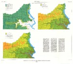
These data were released prior to the October 1, 2016 effective date for the USGS’s policy dictating the review, approval, and release of scientific data as referenced in USGS Survey Manual Chapter 502.8 Fundamental Science Practices: Review and Approval of Scientific Data for Release. This data set describes ground-water regions in the United States defined by the U.S. Geological Survey. These ground-water regions are useful for dividing the United States into areas of roughly similar hydrologic characterstics and water-use patterns. Most of these regions are very generalized and were developed from a illustration published at a scale of approximately 1:20 million. The data set also includes polygon features for...
These data were released prior to the October 1, 2016 effective date for the USGS’s policy dictating the review, approval, and release of scientific data as referenced in USGS Survey Manual Chapter 502.8 Fundamental Science Practices: Review and Approval of Scientific Data for Release. This data set includes 956 polygons labeled with a sensitivity-unit code that represents the sensitivity of ground water to contamination in Lawrence County, SD. This data set is a result of a larger work (WRIR 00-4103 cited above), which includes a paper plate titled: "Map showing sensitivity of ground-water to contamination in Lawrence County, South Dakota." This data set is part of the digital data that was used to create that...
Data were collected in August, 2020 to support development of a bathymetric map for Larimore Dam in Grand Forks County, North Dakota. Global Navigation Satellite System (GNSS) surveying equipment was used in static and real-time kinematic (RTK) mode to establish a local reference mark and check-in/check-out point, to collect water surface elevations, and to collect topographic points along established data collection transects. Topographic points were collected on land, in water too shallow for boating, and in areas of the lake where thick aquatic vegetation prohibited use of an echosounder and transducer. In areas of the lake deep enough for boating and where aquatic vegetation was not present, depth data was collected...
Categories: Data;
Types: Map Service,
OGC WFS Layer,
OGC WMS Layer,
OGC WMS Service;
Tags: Bathymetry,
Grand Forks County,
Larimore Dam,
Limnology,
North Dakota,

These data were released prior to the October 1, 2016 effective date for the USGS’s policy dictating the review, approval, and release of scientific data as referenced in USGS Survey Manual Chapter 502.8 Fundamental Science Practices: Review and Approval of Scientific Data for Release. This data set represents potentiometric surface contours for the Madison aquifer, Black Hills, South Dakota.
|

|
