Filters: Date Range: {"choice":"week"} (X) > Tags: {"scheme":"None"} (X)
Folder: ROOT ( Show direct descendants )
247 results (46ms)
LocationFilters
Date Types (for Date Range)
Types (Less)
Contacts (Less)
Categories (Less) Tag Types Tags (with Scheme=None)
|
This is a child item of the USGS Data Release: https://doi.org/10.5066/F7K072DR. This dataset includes zooplankton biomass from Prince William Sound, Icy Bay and Yakutat Bay, Alaska. Zooplankton were sampled with a ring net (0.6 m diameter with 211 µ mesh) on a 50 m vertical haul or to within 5 m of the bottom in shallow water. Zooplankton samples were identified to species and life stage when possible.
Total and organic carbon values from soil samples taken from the Yukon River Basin, Alaska. These samples were used to create a relationship between total carbon and organic carbon for samples which were only run for total carbon. This is a child item of the USGS Data Release: https://doi.org/10.5066/P9QF8RR5
The Southern Nevada volcanic-rock aquifers reside in southern-central Nevada. This group of aquifers can be categorized into welded tuff, bedded tuff, and lava flow aquifers. Each of these categories possess different physical characteristics and have varying degrees of welding and number of interconnected joints. The lithology of these aquifers is primarily dependent on mode of eruption and cooling and are highly variable. Because the lithology is so variable, so is groundwater transmission, storage, and yield (HA 730-B). This product provides source data for the Southern Nevada volcanic-rock aquifers framework, including: Extent shapefiles: 1. p_57SRNVDV.shp: Polygon shapefile containing the areal extent...

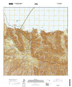
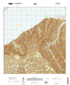
Layered geospatial PDF 7.5 Minute Quadrangle Map. Layers of geospatial data include orthoimagery, roads, grids, geographic names, elevation contours, hydrography, and other selected map features. This map is derived from GIS (geospatial information system) data. It represents a repackaging of GIS data in traditional map form, not creation of new information. The geospatial data in this map are from selected National Map data holdings and other government sources.
This dataset is a single comma-delimited text file (.csv). Data include the name of lakes where samples were obtained, the historical dynamics of that lake, the sampled community type, and the dry mass of annual new growth. Shrub community measurements are a combination of understory mass from quadrat harvests and shrub stem mass derived from published allometric equations. This is a child item of the USGS Data Release: https://doi.org/10.5066/P9QF8RR5
This dataset is a single comma-delimited text file (.csv). Data include the name of lakes where samples were obtained, soil pH, electrical conductivity (EC), water content (VWC), and bulk density (BD) of soil core samples within organic soil horizon in lake-margin wetland plant communities. This is a child item of the USGS Data Release: https://doi.org/10.5066/P9QF8RR5
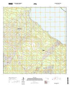
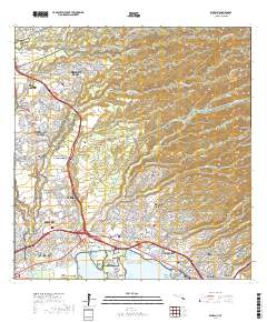
Layered geospatial PDF 7.5 Minute Quadrangle Map. Layers of geospatial data include orthoimagery, roads, grids, geographic names, elevation contours, hydrography, and other selected map features. This map is derived from GIS (geospatial information system) data. It represents a repackaging of GIS data in traditional map form, not creation of new information. The geospatial data in this map are from selected National Map data holdings and other government sources.
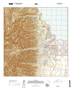
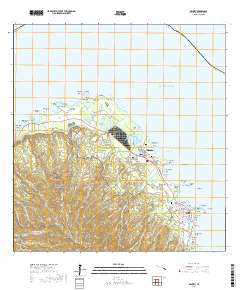
Layered geospatial PDF 7.5 Minute Quadrangle Map. Layers of geospatial data include orthoimagery, roads, grids, geographic names, elevation contours, hydrography, and other selected map features. This map is derived from GIS (geospatial information system) data. It represents a repackaging of GIS data in traditional map form, not creation of new information. The geospatial data in this map are from selected National Map data holdings and other government sources.
This dataset consists of Structure-from-Motion (SfM) - derived point clouds and highly detailed orthomosaic images of four roadcut exposures covering the upper part of the Harrell Shale, the full Brallier Formation, the full Foreknobs Formation, and the lower part of the Hampshire Formation at Baker, West Virginia. For each roadcut exposure, two datasets are published: an orthomosaic raster image and a point cloud. The orthomosaic raster image is a vertical outcrop orthomosaic constructed from multiple orthophotos to create a geometrically rectified image. This facilitates a detailed visual inspection of the stratigraphic succession outside of a GIS environment, unlike georefrenced orthomosaics derived from aerial...
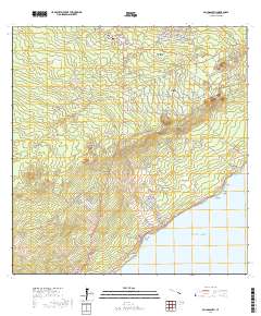
Layered geospatial PDF 7.5 Minute Quadrangle Map. Layers of geospatial data include orthoimagery, roads, grids, geographic names, elevation contours, hydrography, and other selected map features. This map is derived from GIS (geospatial information system) data. It represents a repackaging of GIS data in traditional map form, not creation of new information. The geospatial data in this map are from selected National Map data holdings and other government sources.
Layered geospatial PDF 7.5 Minute Quadrangle Map. Layers of geospatial data include orthoimagery, roads, grids, geographic names, elevation contours, hydrography, and other selected map features. This map is derived from GIS (geospatial information system) data. It represents a repackaging of GIS data in traditional map form, not creation of new information. The geospatial data in this map are from selected National Map data holdings and other government sources.
Layered geospatial PDF 7.5 Minute Quadrangle Map. Layers of geospatial data include orthoimagery, roads, grids, geographic names, elevation contours, hydrography, and other selected map features. This map is derived from GIS (geospatial information system) data. It represents a repackaging of GIS data in traditional map form, not creation of new information. The geospatial data in this map are from selected National Map data holdings and other government sources.
Layered geospatial PDF 7.5 Minute Quadrangle Map. Layers of geospatial data include orthoimagery, roads, grids, geographic names, elevation contours, hydrography, and other selected map features. This map is derived from GIS (geospatial information system) data. It represents a repackaging of GIS data in traditional map form, not creation of new information. The geospatial data in this map are from selected National Map data holdings and other government sources.
Layered geospatial PDF 7.5 Minute Quadrangle Map. Layers of geospatial data include orthoimagery, roads, grids, geographic names, elevation contours, hydrography, and other selected map features. This map is derived from GIS (geospatial information system) data. It represents a repackaging of GIS data in traditional map form, not creation of new information. The geospatial data in this map are from selected National Map data holdings and other government sources.
Layered geospatial PDF 7.5 Minute Quadrangle Map. Layers of geospatial data include orthoimagery, roads, grids, geographic names, elevation contours, hydrography, and other selected map features. This map is derived from GIS (geospatial information system) data. It represents a repackaging of GIS data in traditional map form, not creation of new information. The geospatial data in this map are from selected National Map data holdings and other government sources.

Layered geospatial PDF 7.5 Minute Quadrangle Map. Layers of geospatial data include orthoimagery, roads, grids, geographic names, elevation contours, hydrography, and other selected map features. This map is derived from GIS (geospatial information system) data. It represents a repackaging of GIS data in traditional map form, not creation of new information. The geospatial data in this map are from selected National Map data holdings and other government sources.

Layered geospatial PDF 7.5 Minute Quadrangle Map. Layers of geospatial data include orthoimagery, roads, grids, geographic names, elevation contours, hydrography, and other selected map features. This map is derived from GIS (geospatial information system) data. It represents a repackaging of GIS data in traditional map form, not creation of new information. The geospatial data in this map are from selected National Map data holdings and other government sources.
Estimates of various low-flow statistics were computed at 56 ungaged stream locations throughout New Jersey during the 2023 water year using methods in the published reports, 1) Streamflow characteristics and trends in New Jersey, water years 1897-2003 (Watson and others, 2005) and 2) Implementation of MOVE.1, censored MOVE.1, and piecewise MOVE.1 low-flow regressions with applications at partial-record streamgaging stations in New Jersey (Colarullo and others, 2018). The estimates are computed as needed for use in water-resources permitting, assessment, and management by the New Jersey Department of Environmental Protection. The data release includes the stream name, location, drainage area, method of estimation,...
Types: Map Service,
OGC WFS Layer,
OGC WMS Layer,
OGC WMS Service;
Tags: Estimation,
Hydrology,
Low-flow statistics,
MOVE.1,
New Jersey,

Layered geospatial PDF 7.5 Minute Quadrangle Map. Layers of geospatial data include orthoimagery, roads, grids, geographic names, elevation contours, hydrography, and other selected map features. This map is derived from GIS (geospatial information system) data. It represents a repackaging of GIS data in traditional map form, not creation of new information. The geospatial data in this map are from selected National Map data holdings and other government sources.
Layered geospatial PDF 7.5 Minute Quadrangle Map. Layers of geospatial data include orthoimagery, roads, grids, geographic names, elevation contours, hydrography, and other selected map features. This map is derived from GIS (geospatial information system) data. It represents a repackaging of GIS data in traditional map form, not creation of new information. The geospatial data in this map are from selected National Map data holdings and other government sources.
|

|
