Filters: Date Range: {"choice":"week"} (X) > Tags: {"type":"Theme","scheme":"3D Elevation Program (3DEP)","name":"digital elevation model"} (X)
11,374 results (34ms)|
Filters
Date Types (for Date Range)
Tags (with Type=Theme and Scheme=3D Elevation Program (3DEP)) |

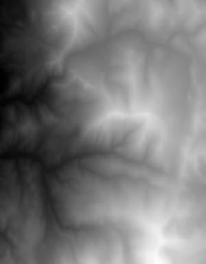
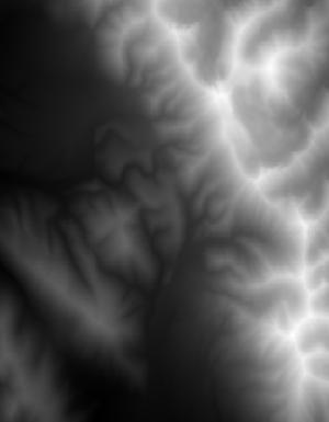
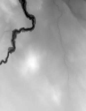
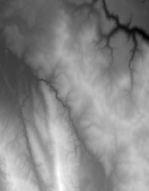
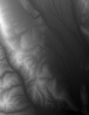
This is a tile of the standard one-meter resolution digital elevation model (DEM) produced through the 3D Elevation Program (3DEP) . The elevations in this DEM represent the topographic bare-earth surface. USGS standard one-meter DEMs are produced exclusively from high resolution light detection and ranging (lidar) source data of one-meter or higher resolution. One-meter DEM surfaces are seamless within collection projects, but, not necessarily seamless across projects. The spatial reference used for tiles of the one-meter DEM within the conterminous United States (CONUS) is Universal Transverse Mercator (UTM) in units of meters, and in conformance with the North American Datum of 1983 (NAD83). All bare earth elevation...
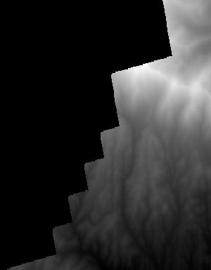
This is a tile of the standard one-meter resolution digital elevation model (DEM) produced through the 3D Elevation Program (3DEP) . The elevations in this DEM represent the topographic bare-earth surface. USGS standard one-meter DEMs are produced exclusively from high resolution light detection and ranging (lidar) source data of one-meter or higher resolution. One-meter DEM surfaces are seamless within collection projects, but, not necessarily seamless across projects. The spatial reference used for tiles of the one-meter DEM within the conterminous United States (CONUS) is Universal Transverse Mercator (UTM) in units of meters, and in conformance with the North American Datum of 1983 (NAD83). All bare earth elevation...
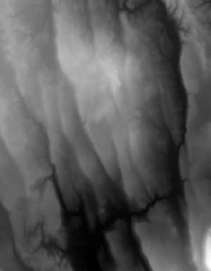
This is a tile of the standard one-meter resolution digital elevation model (DEM) produced through the 3D Elevation Program (3DEP) . The elevations in this DEM represent the topographic bare-earth surface. USGS standard one-meter DEMs are produced exclusively from high resolution light detection and ranging (lidar) source data of one-meter or higher resolution. One-meter DEM surfaces are seamless within collection projects, but, not necessarily seamless across projects. The spatial reference used for tiles of the one-meter DEM within the conterminous United States (CONUS) is Universal Transverse Mercator (UTM) in units of meters, and in conformance with the North American Datum of 1983 (NAD83). All bare earth elevation...
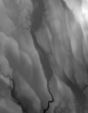
This is a tile of the standard one-meter resolution digital elevation model (DEM) produced through the 3D Elevation Program (3DEP) . The elevations in this DEM represent the topographic bare-earth surface. USGS standard one-meter DEMs are produced exclusively from high resolution light detection and ranging (lidar) source data of one-meter or higher resolution. One-meter DEM surfaces are seamless within collection projects, but, not necessarily seamless across projects. The spatial reference used for tiles of the one-meter DEM within the conterminous United States (CONUS) is Universal Transverse Mercator (UTM) in units of meters, and in conformance with the North American Datum of 1983 (NAD83). All bare earth elevation...

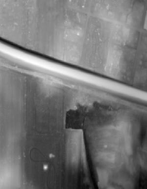
This is a tile of the standard one-meter resolution digital elevation model (DEM) produced through the 3D Elevation Program (3DEP) . The elevations in this DEM represent the topographic bare-earth surface. USGS standard one-meter DEMs are produced exclusively from high resolution light detection and ranging (lidar) source data of one-meter or higher resolution. One-meter DEM surfaces are seamless within collection projects, but, not necessarily seamless across projects. The spatial reference used for tiles of the one-meter DEM within the conterminous United States (CONUS) is Universal Transverse Mercator (UTM) in units of meters, and in conformance with the North American Datum of 1983 (NAD83). All bare earth elevation...
This is a tile of the standard one-meter resolution digital elevation model (DEM) produced through the 3D Elevation Program (3DEP) . The elevations in this DEM represent the topographic bare-earth surface. USGS standard one-meter DEMs are produced exclusively from high resolution light detection and ranging (lidar) source data of one-meter or higher resolution. One-meter DEM surfaces are seamless within collection projects, but, not necessarily seamless across projects. The spatial reference used for tiles of the one-meter DEM within the conterminous United States (CONUS) is Universal Transverse Mercator (UTM) in units of meters, and in conformance with the North American Datum of 1983 (NAD83). All bare earth elevation...

This is a tile of the standard one-meter resolution digital elevation model (DEM) produced through the 3D Elevation Program (3DEP) . The elevations in this DEM represent the topographic bare-earth surface. USGS standard one-meter DEMs are produced exclusively from high resolution light detection and ranging (lidar) source data of one-meter or higher resolution. One-meter DEM surfaces are seamless within collection projects, but, not necessarily seamless across projects. The spatial reference used for tiles of the one-meter DEM within the conterminous United States (CONUS) is Universal Transverse Mercator (UTM) in units of meters, and in conformance with the North American Datum of 1983 (NAD83). All bare earth elevation...

This is a tile of the standard one-meter resolution digital elevation model (DEM) produced through the 3D Elevation Program (3DEP) . The elevations in this DEM represent the topographic bare-earth surface. USGS standard one-meter DEMs are produced exclusively from high resolution light detection and ranging (lidar) source data of one-meter or higher resolution. One-meter DEM surfaces are seamless within collection projects, but, not necessarily seamless across projects. The spatial reference used for tiles of the one-meter DEM within the conterminous United States (CONUS) is Universal Transverse Mercator (UTM) in units of meters, and in conformance with the North American Datum of 1983 (NAD83). All bare earth elevation...

This is a tile of the standard one-meter resolution digital elevation model (DEM) produced through the 3D Elevation Program (3DEP) . The elevations in this DEM represent the topographic bare-earth surface. USGS standard one-meter DEMs are produced exclusively from high resolution light detection and ranging (lidar) source data of one-meter or higher resolution. One-meter DEM surfaces are seamless within collection projects, but, not necessarily seamless across projects. The spatial reference used for tiles of the one-meter DEM within the conterminous United States (CONUS) is Universal Transverse Mercator (UTM) in units of meters, and in conformance with the North American Datum of 1983 (NAD83). All bare earth elevation...

This is a tile of the standard one-meter resolution digital elevation model (DEM) produced through the 3D Elevation Program (3DEP) . The elevations in this DEM represent the topographic bare-earth surface. USGS standard one-meter DEMs are produced exclusively from high resolution light detection and ranging (lidar) source data of one-meter or higher resolution. One-meter DEM surfaces are seamless within collection projects, but, not necessarily seamless across projects. The spatial reference used for tiles of the one-meter DEM within the conterminous United States (CONUS) is Universal Transverse Mercator (UTM) in units of meters, and in conformance with the North American Datum of 1983 (NAD83). All bare earth elevation...
This is a tile of the standard one-meter resolution digital elevation model (DEM) produced through the 3D Elevation Program (3DEP) . The elevations in this DEM represent the topographic bare-earth surface. USGS standard one-meter DEMs are produced exclusively from high resolution light detection and ranging (lidar) source data of one-meter or higher resolution. One-meter DEM surfaces are seamless within collection projects, but, not necessarily seamless across projects. The spatial reference used for tiles of the one-meter DEM within the conterminous United States (CONUS) is Universal Transverse Mercator (UTM) in units of meters, and in conformance with the North American Datum of 1983 (NAD83). All bare earth elevation...
This is a tile of the standard one-meter resolution digital elevation model (DEM) produced through the 3D Elevation Program (3DEP) . The elevations in this DEM represent the topographic bare-earth surface. USGS standard one-meter DEMs are produced exclusively from high resolution light detection and ranging (lidar) source data of one-meter or higher resolution. One-meter DEM surfaces are seamless within collection projects, but, not necessarily seamless across projects. The spatial reference used for tiles of the one-meter DEM within the conterminous United States (CONUS) is Universal Transverse Mercator (UTM) in units of meters, and in conformance with the North American Datum of 1983 (NAD83). All bare earth elevation...
This is a tile of the standard one-meter resolution digital elevation model (DEM) produced through the 3D Elevation Program (3DEP) . The elevations in this DEM represent the topographic bare-earth surface. USGS standard one-meter DEMs are produced exclusively from high resolution light detection and ranging (lidar) source data of one-meter or higher resolution. One-meter DEM surfaces are seamless within collection projects, but, not necessarily seamless across projects. The spatial reference used for tiles of the one-meter DEM within the conterminous United States (CONUS) is Universal Transverse Mercator (UTM) in units of meters, and in conformance with the North American Datum of 1983 (NAD83). All bare earth elevation...
This is a tile of the standard one-meter resolution digital elevation model (DEM) produced through the 3D Elevation Program (3DEP) . The elevations in this DEM represent the topographic bare-earth surface. USGS standard one-meter DEMs are produced exclusively from high resolution light detection and ranging (lidar) source data of one-meter or higher resolution. One-meter DEM surfaces are seamless within collection projects, but, not necessarily seamless across projects. The spatial reference used for tiles of the one-meter DEM within the conterminous United States (CONUS) is Universal Transverse Mercator (UTM) in units of meters, and in conformance with the North American Datum of 1983 (NAD83). All bare earth elevation...
This is a tile of the standard one-meter resolution digital elevation model (DEM) produced through the 3D Elevation Program (3DEP) . The elevations in this DEM represent the topographic bare-earth surface. USGS standard one-meter DEMs are produced exclusively from high resolution light detection and ranging (lidar) source data of one-meter or higher resolution. One-meter DEM surfaces are seamless within collection projects, but, not necessarily seamless across projects. The spatial reference used for tiles of the one-meter DEM within the conterminous United States (CONUS) is Universal Transverse Mercator (UTM) in units of meters, and in conformance with the North American Datum of 1983 (NAD83). All bare earth elevation...
This is a tile of the standard one-meter resolution digital elevation model (DEM) produced through the 3D Elevation Program (3DEP) . The elevations in this DEM represent the topographic bare-earth surface. USGS standard one-meter DEMs are produced exclusively from high resolution light detection and ranging (lidar) source data of one-meter or higher resolution. One-meter DEM surfaces are seamless within collection projects, but, not necessarily seamless across projects. The spatial reference used for tiles of the one-meter DEM within the conterminous United States (CONUS) is Universal Transverse Mercator (UTM) in units of meters, and in conformance with the North American Datum of 1983 (NAD83). All bare earth elevation...
This is a tile of the standard one-meter resolution digital elevation model (DEM) produced through the 3D Elevation Program (3DEP) . The elevations in this DEM represent the topographic bare-earth surface. USGS standard one-meter DEMs are produced exclusively from high resolution light detection and ranging (lidar) source data of one-meter or higher resolution. One-meter DEM surfaces are seamless within collection projects, but, not necessarily seamless across projects. The spatial reference used for tiles of the one-meter DEM within the conterminous United States (CONUS) is Universal Transverse Mercator (UTM) in units of meters, and in conformance with the North American Datum of 1983 (NAD83). All bare earth elevation...

This is a tile of the standard one-meter resolution digital elevation model (DEM) produced through the 3D Elevation Program (3DEP) . The elevations in this DEM represent the topographic bare-earth surface. USGS standard one-meter DEMs are produced exclusively from high resolution light detection and ranging (lidar) source data of one-meter or higher resolution. One-meter DEM surfaces are seamless within collection projects, but, not necessarily seamless across projects. The spatial reference used for tiles of the one-meter DEM within the conterminous United States (CONUS) is Universal Transverse Mercator (UTM) in units of meters, and in conformance with the North American Datum of 1983 (NAD83). All bare earth elevation...
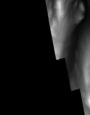
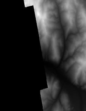
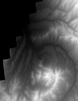
This is the Original Product Resolution (OPR) Digital Elevation Model (DEM) as provided to the USGS. This DEM is delivered in the original resolution, with the original spatial reference. These data may be used as the source of updates to the seamless layers of the 3D Elevation Program, which serves as the elevation layer of the National Map. These data can be used by scientists and resource managers for global change research, hydrologic modeling, resource monitoring, mapping and visualization, and many other applications.
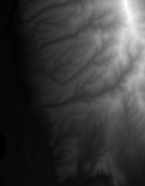
This is a tile of the standard one-meter resolution digital elevation model (DEM) produced through the 3D Elevation Program (3DEP) . The elevations in this DEM represent the topographic bare-earth surface. USGS standard one-meter DEMs are produced exclusively from high resolution light detection and ranging (lidar) source data of one-meter or higher resolution. One-meter DEM surfaces are seamless within collection projects, but, not necessarily seamless across projects. The spatial reference used for tiles of the one-meter DEM within the conterminous United States (CONUS) is Universal Transverse Mercator (UTM) in units of meters, and in conformance with the North American Datum of 1983 (NAD83). All bare earth elevation...
|

|
