Filters: Tags: {"scheme":"USGS Metadata Identifier"} (X) > partyWithName: U.S. Geological Survey (X) > Types: OGC WFS Layer (X)
16 results (32ms)|
Filters
Date Range
Extensions (Less) Types (Less)
Contacts (Less)
Categories (Less) Tag Types Tags (with Scheme=USGS Metadata Identifier)
|

This part of DS 781 presents data for the faults for the geologic and geomorphic map of the Offshore of Scott Creek map area, California. The vector data file is included in "Faults_OffshoreScottCreek.zip," which is accessible from https://doi.org/10.5066/F7CJ8BJW. These data accompany the pamphlet and map sheets of Cochrane, G.R., Dartnell, P., Johnson, S.Y., Greene, H.G., Erdey, M.D., Dieter, B.E., Golden, N.E., Endris, C.A., Hartwell, S.R., Kvitek, R.G., Davenport, C.W., Watt, J.T., Krigsman, L.M., Ritchie, A.C., Sliter, R.W., Finlayson, D.P., and Maier, K.L. (G.R. Cochrane and S.A. Cochran, eds.), 2015, California State Waters Map Series--Offshore of Scott Creek, California: U.S. Geological Survey Open-File...
Categories: Data;
Types: Downloadable,
Map Service,
OGC WFS Layer,
OGC WMS Layer,
Shapefile;
Tags: Bathymetry,
CMHRP,
Coastal and Marine Hazards and Resources Program,
Continental/Island Shelf,
Marine Nearshore Subtidal,
Summary: This directory contains a second version of the mosaics of the 2-dimensional (2D) surface strain fields of the 2019 Mw7.1 and Mw6.4 Ridgecrest earthquakes derived from optical correlation. These results are derived through a modification to the inversion approach described in Barnhart et al. 2020 (Nature Geoscience) wherein we remove the UTM reference frame when building the Green’s function that is incorporated into the inversion for the displacement gradient tensor. The removal of the reference frame has the effect of improving the condition number of the Green’s function and making the inversion more stable. The mosaics are in UTM Zone 11N coordinates with 10m spatial resolution. Each file is in units...
This part of DS 781 presents data for the sediment-thickness isopachs for the Pigeon Point to Monterey Bay, California, map region. The vector data file is included in "Isopachs_PigeonPointToMonterey.zip," which is accessible from https://doi.org/10.5066/F7N29V0Z. As part of the USGS's California State Waters Mapping Project, a 50-m-resolution grid of sediment thickness for the seafloor within the limit of California’s State Waters between Pigeon Point and southern Monterey Bay was generated from seismic-reflection data collected in 2009, 2010, and 2011 (USGS activities (S-15-10-NC, S-N1-09-MB, and S-06-11-MB) supplemented with outcrop and geologic structure from DS 781. Isopach contours at 2.5-meter intervals were...
Categories: Data;
Types: Downloadable,
Map Service,
OGC WFS Layer,
OGC WMS Layer,
Shapefile;
Tags: Ano Nuevo,
Aptos,
Distributions,
Marina,
Monterey,

This part of DS 781 presents data for the folds for the geologic and geomorphic map of the Offshore of Scott Creek map area, California. The vector data file is included in "Folds_OffshoreScottCreek.zip," which is accessible from https://doi.org/10.5066/F7CJ8BJW. These data accompany the pamphlet and map sheets of Cochrane, G.R., Dartnell, P., Johnson, S.Y., Greene, H.G., Erdey, M.D., Dieter, B.E., Golden, N.E., Endris, C.A., Hartwell, S.R., Kvitek, R.G., Davenport, C.W., Watt, J.T., Krigsman, L.M., Ritchie, A.C., Sliter, R.W., Finlayson, D.P., and Maier, K.L. (G.R. Cochrane and S.A. Cochran, eds.), 2015, California State Waters Map Series--Offshore of Scott Creek, California: U.S. Geological Survey Open-File Report...
Categories: Data;
Types: Downloadable,
Map Service,
OGC WFS Layer,
OGC WMS Layer,
Shapefile;
Tags: Bathymetry,
CMHRP,
Coastal and Marine Hazards and Resources Program,
Continental/Island Shelf,
Marine Nearshore Subtidal,
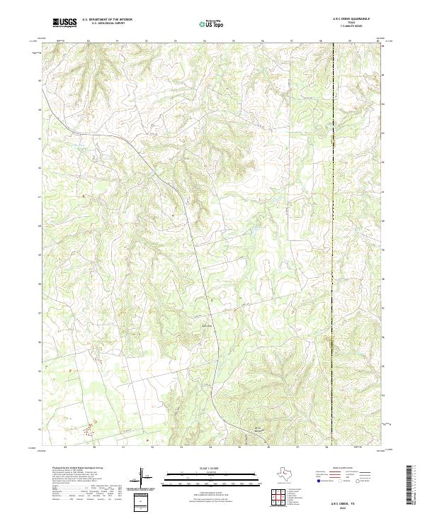
Layered geospatial PDF 7.5 Minute Quadrangle Map. Layers of geospatial data include orthoimagery, roads, grids, geographic names, elevation contours, hydrography, boundaries, and other selected map features. This map depicts geographic features on the surface of the earth. One intended purpose is to support emergency response at all levels of government. The geospatial data in this map are from selected National Map data holdings and other government sources.
Categories: Collection;
Types: Map Service,
OGC WFS Layer,
OGC WMS Layer,
OGC WMS Service;
Tags: Public Land Survey System,
U.S. National Grid,
US,
USGS:6d94af68-1f05-4f9e-9b5a-63f7a05d258b,
United States,
This part of DS 781 presents data for the transgressive contours for the depth-to-transition map of the Pigeon Point to Monterey, California, map region. The vector file is included in T "TransgressiveContours_PigeonPointToMonterey.zip," which is accessible from https://doi.org/10.5066/F7N29V0Z. As part of the USGS's California State Waters Mapping Project, a 50-m grid of sediment thickness for the seafloor within the limit of California’s State Waters between Pigeon Point and southern Monterey Bay was generated from seismic-reflection data collected in 2009 and 2010 (USGS activities (S-15-10-NC, S-N1-09-MB, and S-06-11-MB) supplemented with outcrop and geologic structure from DS 781. The resulting grid covers was...
Categories: Data;
Types: Downloadable,
Map Service,
OGC WFS Layer,
OGC WMS Layer,
Shapefile;
Tags: Ano Nuevo,
Aptos,
Distributions,
Marina,
Monterey,
This is a tiled collection of the 3D Elevation Program (3DEP) and is 1 arc-second (approximately 30 m) resolution. The elevations in this Digital Elevation Model (DEM) represent the topographic bare-earth surface. The 3DEP data holdings serve as the elevation layer of The National Map, and provide foundational elevation information for earth science studies and mapping applications in the United States. Scientists and resource managers use 3DEP data for hydrologic modeling, resource monitoring, mapping and visualization, and many other applications.. The seamless 1 arc-second DEM layers are derived from diverse source data that are processed to a common coordinate system and unit of vertical measure. These data...
Types: Citation,
Map Service,
OGC WFS Layer,
OGC WMS Layer,
OGC WMS Service;
Tags: 1-Degree DEM,
3D Elevation Program,
3DEP,
Bare Earth,
Cartography,
This is a tiled collection of the 3D Elevation Program (3DEP) and is 2 arc-second (approximately 60 m) resolution covering Alaska. The elevations in this Digital Elevation Model (DEM) represent the topographic bare-earth surface. The 3DEP data holdings serve as the elevation layer of The National Map, and provide foundational elevation information for earth science studies and mapping applications in the United States. Scientists and resource managers use 3DEP data for hydrologic modeling, resource monitoring, mapping and visualization, and many other applications. The seamless 2 arc-second DEM layers are derived from diverse source data that are processed to a common coordinate system and unit of vertical measure....
Types: Citation,
Map Service,
OGC WFS Layer,
OGC WMS Layer,
OGC WMS Service;
Tags: 1-degree DEM,
2 arc-second DEM,
3DEP,
Bare Earth,
Cartography,
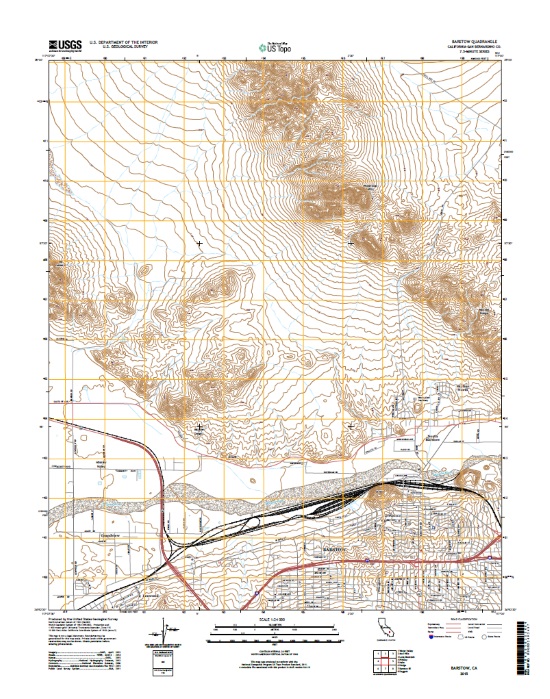
Layers of geospatial data include contours, boundaries, land cover, hydrography, roads, transportation, geographic names, structures, and other selected map features.
This data release provides digital flight line data for a high-resolution airborne magnetic and radiometric survey over parts of Montana in the vicinity of the Boulder Batholith. The airborne survey was jointly funded by the Earth Mapping Resources Initiative and Kennecott Exploration Company. The survey was designed to meet complementary needs related to geologic mapping and characterization of mineral resource potential. A total of 34,041-line km of magnetic and radiometric data were acquired over an irregular-shaped area of 6178 km2. Data were collected from a helicopter flown at a nominal terrain clearance of 100 meters (m) above topography along E-W flight lines spaced at 200 m intervals. Tie lines were flown...
Categories: Data;
Types: Downloadable,
Map Service,
OGC WFS Layer,
OGC WMS Layer,
Shapefile;
Tags: AASG,
Aeromagnetic survey,
Aeroradiometric survey,
Airborne geophysical survey,
Association of State Geologists,
This Data Release accompanies the publication "State of stress in areas of active unconventional oil and gas development in North America" by J.-E. Lund Snee (now J.-E. Lundstern) and M.D. Zoback (2022) in the AAPG Bulletin. This dataset provides maximum horizontal stress (SHmax) orientation and relative stress magnitude (faulting regime) information that comprise a new-generation crustal stress map for North America. Relative stress magnitudes are presented using the Aϕ (A_phi) parameter, a single scalar that represents the ratio of the three principal stress magnitudes. Data were collected between 2015 and 2022. Data points for SHmax orientations, relative stress magnitudes, and the earthquake focal mechanisms...
Categories: Data;
Types: ArcGIS REST Map Service,
ArcGIS Service Definition,
Downloadable,
GeoTIFF,
Map Service,
OGC WFS Layer,
OGC WMS Layer,
Raster,
Shapefile;
Tags: Canada,
Caribbean Islands,
Caribbean Sea,
Holocene,
NCCWSC,

This part of DS 781 presents data for the habitat map of the seafloor of the Offshore of Scott Creek map area, California. The vector data file is included in "Habitat_OffshoreScottCreek.zip," which is accessible from https://doi.org/10.5066/F7CJ8BJW. These data accompany the pamphlet and map sheets of Cochrane, G.R., Dartnell, P., Johnson, S.Y., Greene, H.G., Erdey, M.D., Dieter, B.E., Golden, N.E., Endris, C.A., Hartwell, S.R., Kvitek, R.G., Davenport, C.W., Watt, J.T., Krigsman, L.M., Ritchie, A.C., Sliter, R.W., Finlayson, D.P., and Maier, K.L. (G.R. Cochrane and S.A. Cochran, eds.), 2015, California State Waters Map Series--Offshore of Scott Creek, California: U.S. Geological Survey Open-File Report 2015-1191,...
Categories: Data;
Types: Downloadable,
Map Service,
OGC WFS Layer,
OGC WMS Layer,
Shapefile;
Tags: CMHRP,
Coastal and Marine Hazards and Resources Program,
Continental/Island Shelf,
Davenport,
Fisheries,
This portion of the data release presents sediment grain-size data from samples collected on the Elwha River delta, Washington, in August 2022 (USGS Field Activity 2022-638-FA). Surface sediment was collected from 67 locations using a small ponar, or 'grab', sampler from the R/V Frontier in water depths between about 1 and 17 m around the delta. An additional 44 samples were collected by hand at low tide. A hand-held global satellite navigation system (GNSS) receiver was used to determine the locations of sediment samples. The grain size distributions of suitable samples were determined using standard techniques developed by the USGS Pacific Coastal and Marine Science Center sediment lab. Grab samples that yielded...

This part of DS 781 presents data for the geologic and geomorphic map of the Offshore of Scott Creek map area, California. The vector data file is included in "Geology_OffshoreScottCreek.zip," which is accessible from https://doi.org/10.5066/F7CJ8BJW. These data accompany the pamphlet and map sheets of Cochrane, G.R., Dartnell, P., Johnson, S.Y., Greene, H.G., Erdey, M.D., Dieter, B.E., Golden, N.E., Endris, C.A., Hartwell, S.R., Kvitek, R.G., Davenport, C.W., Watt, J.T., Krigsman, L.M., Ritchie, A.C., Sliter, R.W., Finlayson, D.P., and Maier, K.L. (G.R. Cochrane and S.A. Cochran, eds.), 2015, California State Waters Map Series--Offshore of Scott Creek, California: U.S. Geological Survey Open-File Report 2015-1191,...

This part of DS 781 presents data for the bathymetric contours for several seafloor maps of the Offshore Scott Creek map area, California. The vector data file is included in "Contours_OffshoreScottCreek.zip", which is accessible from https://doi.org/10.5066/F7CJ8BJW. These data accompany the pamphlet and map sheets of Cochrane, G.R., Dartnell, P., Johnson, S.Y., Greene, H.G., Erdey, M.D., Dieter, B.E., Golden, N.E., Endris, C.A., Hartwell, S.R., Kvitek, R.G., Davenport, C.W., Watt, J.T., Krigsman, L.M., Ritchie, A.C., Sliter, R.W., Finlayson, D.P., and Maier, K.L. (G.R. Cochrane and S.A. Cochran, eds.), 2015, California State Waters Map Series--Offshore of Scott Creek, California: U.S. Geological Survey Open-File...
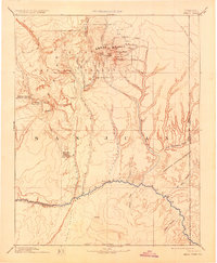
USGS Historical Quadrangle in GeoPDF. The USGS Historical Quadrangle Scanning Project (HQSP) is scanning all scales and all editions of topographic maps published by the U.S. Geological Survey (USGS) since the inception of the topographic mapping program in 1884.
Categories: Collection;
Types: Citation,
Map Service,
OGC WFS Layer,
OGC WMS Layer,
OGC WMS Service;
Tags: Public Land Survey System,
U.S. National Grid,
US,
USGS:bb7b145f-8d7f-405b-96ae-348d61172951,
United States,
|

|