Filters: Tags: Arctic (X)
454 results (110ms)|
Filters
Date Range
Extensions (Less)
Types (Less)
Contacts (Less)
Categories (Less)
Tag Types
|
Typed information accompanying slide: Telephone lines to the GM camp in the twilight. The colors at dusk were lovely. Similar to D-9. Link to this photograph is listed below in Web Links. Note: T-3 Color slides - Roll D - Color slides September 1969. These photos were developed in late 1969 after I returned from T-3 and made into Kodacolor slides. Photos by Dave Scoboria.
Typed information accompanying negatives: Graham Law was one of the two employees on T-3 working for Lamont in the summer of 1969. I believe that he was a student at Columiba University. We flew to T-3 on one of the NARL DC-3s on June 1, 1969. We had never met before, but in an odd coincidence we had once dated sisters when we were in high school. Note: T-3 Photographs - Roll F B&W negatives - June paradrop, 1969. There were three paradrops during the summer of 1969 performed by Navy C-130 planes from Elmendorf Air Force Base in Fairbanks, Alaska. These are described in this website, http://www.firebirds.org/menu2/t3/t3_p02.htm On the receiving end of the paradrops on T-3, these days were the high points of...
USGS hydrohut with pressure ridges in the distance. T-3 (Fletcher's) Ice Island, Arctic Ocean. 1969.
Typed information accompanying photograph: Slide and print: USGS hydrohut with pressure ridges in the distance. Taken from the top of the Lamont hydrohut tower. Similar to B-16, but slightly different view. Note: T-3 Photographs - Roll B - Color slides April 1969. These photos were developed into Ektachrome slides in May of 1969. Some have deteriorated. Some were printed as color prints and these may be in better condition than the slides. A few slides were copied into Kodacolor slides. Some images are missing. Photos by Dave Scoboria.
Information about photograph: USGS living quarters on T-3 Ice Island. 02/25/63. Art Lachenbruch, USGS, in photograph.
Typed information accompanying photograph: Print and slide. Lamont hydrohut in the foreground, USGS hydrohut in the distance. Probably early March. Poor focus. Note: T-3 Photographs - Roll A - Color slides February - March 1969. These photos were taken during February and March of 1969 and developed into Ektachrome slides in May of 1969. Some have deteroriated. When the slides were new some of them were printed as color prints. Some prints don't have matching slides. A few slides were copied as Kodacolor slides some time during the 1970s and there are some duplicate slides. The Kodacolor slides have not deteriorated. Some images are missing. (Photos on Roll A taken by Dave Scoboria)
Typed information accompanying slides: Gary Willinski and camera taking photographs of the Lamont work trailer move. June 1969. Note: T-3 Color slides - Roll C - Color slides June 1969. These photos were taken between June 6, 1969 and June 27, 1969 and developed in late 1969 into Kodacolor slides after returning from T-3. One slide has deteriorated. Photos by Dave Scoboria, except for C-6.
Typed information accompanying negative: The ice boat: Several of the crew constructed an ice boat with sails made from parachutes. These photos show the ice boat in action. Note: T-3 Photographs - Roll I B&W negatives – August-September 1969 This roll shows activities during August and September 1969 on T-3. The summer season had now lasted two months. The weather grew cold. Photos by Dave Scoboria.
Typed information accompanying negative: Trail to the pressure ridges. Note: T-3 Photographs - Roll I B&W negatives – August-September 1969 This roll shows activities during August and September 1969 on T-3. The summer season had now lasted two months. The weather grew cold. Photos by Dave Scoboria.
Typed information accompanying negative: The ice boat: Several of the crew constructed an ice boat with sails made from parachutes. These photos show the ice boat in action. Note: T-3 Photographs - Roll I B&W negatives – August-September 1969 This roll shows activities during August and September 1969 on T-3. The summer season had now lasted two months. The weather grew cold. Photos by Dave Scoboria.
Typed information accompanying slides: Wreckage of abandoned huts, empty diesel drums, garbage, everything emerged out of the snow by the end of June. The ground was coated with soot from the generator smoke. June 1969. Similar to C-25. Link to this image listed in Web Links below. Note: T-3 Color slides - Roll C - Color slides June 1969. These photos were taken between June 6, 1969 and June 27, 1969 and developed in late 1969 into Kodacolor slides after returning from T-3. One slide has deteriorated. Photos by Dave Scoboria, except for C-6.
Typed information accompanying slides: DC-3 planes were used for regular flights to T-3. These had limited payloads because of the long distance (800 miles) from T-3 to Barrow. The plane on June 6, 1969 was not supposed to be the final plane before the summer season. The weather bureau employee shown in this photo was scheduled to leave on the flight, but either because of payload issues or possibly training needed for the weather bureau summer crew, he chose to wait for the next plane. The weather warmed suddenly and the final plane could not land on the T-3 runway. He was stranded on T-3 for four months until the first plane of the fal season landed on October 3, 1969. Note: T-3 Color slides - Roll C - Color...
This dataset includes a reference baseline used by the Digital Shoreline Analysis System (DSAS) to calculate rate-of-change statistics for the sheltered north coast of Alaska coastal region between the Colville River and Point Barrow for the time period 1947 to 2012. This baseline layer serves as the starting point for all transects cast by the DSAS application and can be used to establish measurement points used to calculate shoreline-change rates.
Categories: Data;
Types: Citation,
Downloadable,
Map Service,
OGC WFS Layer,
OGC WMS Layer,
Shapefile;
Tags: Arctic,
Baseline,
Beaufort Sea,
CMGP,
Cape Halkett,
This dataset consists of long-term (70 years) shoreline change rates for the exposed, open-ocean coast of Alaska from the U.S. Canadian Border to the Hulahula River. Rate calculations were computed within a GIS using the Digital Shoreline Analysis System (DSAS) version 5.1, an ArcGIS extension developed by the U.S. Geological Survey. Long-term rates of shoreline change were calculated using a linear regression rate-of-change method based on available shoreline data between 1947 and 2017. A reference baseline was used as the originating point for the orthogonal transects cast by the DSAS software. The transects intersect each shoreline establishing measurement points, which are then used to calculate long-term rates.
Categories: Data;
Types: Downloadable,
Map Service,
OGC WFS Layer,
OGC WMS Layer,
Shapefile;
Tags: ANWR,
Arctic,
Arctic National Wildlife Refuge,
Barter Island,
Beaufort Sea,
This dataset has been superseded. The most current data for this data release are available here: https://www.sciencebase.gov/catalog/item/663a50c9d34e77890839b03b This dataset consists of long-term (~63 years) shoreline change rates for the north coast of Alaska between the Hulahula River and the Colville River. Rate calculations were computed within a GIS using the Digital Shoreline Analysis System (DSAS) version 4.3, an ArcGIS extension developed by the U.S. Geological Survey. Long-term rates of shoreline change were calculated using a linear regression rate-of-change method based on available shoreline data between 1947 and 2010. A reference baseline was used as the originating point for the orthogonal transects...
Categories: Data;
Types: Citation,
Downloadable,
Map Service,
OGC WFS Layer,
OGC WMS Layer,
Shapefile;
Tags: ANWR,
Arctic,
Arctic National Wildlife Refuge,
Beaufort Sea,
CMGP,
This dataset has been superseded. The most current data for this data release are available here: https://www.sciencebase.gov/catalog/item/663a51ded34e77890839b048 This dataset includes a reference baseline used by the Digital Shoreline Analysis System (DSAS) to calculate rate-of-change statistics for the exposed north coast of Alaska coastal region between the Hulahula River and the Colville River for the time period 1947 to 2010. This baseline layer serves as the starting point for all transects cast by the DSAS application and can be used to establish measurement points used to calculate shoreline-change rates.
Categories: Data;
Types: Citation,
Downloadable,
Map Service,
OGC WFS Layer,
OGC WMS Layer,
Shapefile;
Tags: ANWR,
Arctic,
Arctic National Wildlife Refuge,
Baseline,
Beaufort Sea,
This dataset includes a reference baseline used by the Digital Shoreline Analysis System (DSAS) to calculate rate-of-change statistics for the mainland coast of Alaska sheltered by barrier islands from the Hulahula River and the Colville River for the time period 1947 to 2017. This baseline layer serves as the starting point for all transects cast by the DSAS application and can be used to establish measurement points used to calculate shoreline-change rates.
Categories: Data;
Types: Downloadable,
Map Service,
OGC WFS Layer,
OGC WMS Layer,
Shapefile;
Tags: ANWR,
Arctic,
Arctic National Wildlife Refuge,
Beaufort Sea,
CMHRP,
Climate change is already affecting ecosystems, and will likely trigger significant and permanent changes in both ecological and human communities. Such transformations are already occurring in the Arctic region of Alaska, where temperatures are warming at twice the global average and causing some ecosystems to transition to new states. Arctic warming has led to coastal erosion that has forced human communities to relocate and a loss of sea ice that has forced marine mammals, such as polar bears and walrus, to adapt to a more terrestrial mode of living. Meanwhile, in the Great Plains of the U.S., past interactions between land and water use during the Dust Bowl and recent high rates of depletion of the Ogallala...
Categories: Project;
Types: Map Service,
OGC WFS Layer,
OGC WMS Layer,
OGC WMS Service;
Tags: 2019,
Arctic,
Arctic,
CASC,
Drought,
This coverage includes arcs, polygons and polygon labels that describe Arctic portion of the U.S. Geological Survey defined geologic provinces of the World in 2000.
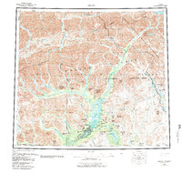
USGS Historical Quadrangle in GeoPDF.
This dataset consists of short-term (less than 37 years) shoreline change rates for the exposed coast of the north coast of Alaska from Icy Cape to Cape Prince of Wales. Rate calculations were computed within a GIS using the Digital Shoreline Analysis System (DSAS) version 4.4, an ArcGIS extension developed by the U.S. Geological Survey. Rates of shoreline change were calculated using an end point rate-of-change (epr) method based on available shoreline data between 1980 and 2016. A reference baseline was used as the originating point for the orthogonal transects cast by the DSAS software. The transects intersect each shoreline establishing measurement points, which are then used to calculate shoreline change rates.
Categories: Data;
Types: Downloadable,
Map Service,
OGC WFS Layer,
OGC WMS Layer,
Shapefile;
Tags: Arctic,
Bering Land Bridge National Preserve,
CMHRP,
Cape Espenberg,
Cape Krusenstern National Monument,
|

|
