Filters
Date Types (for Date Range)
Contacts
Tag Types
Tag Schemes
|
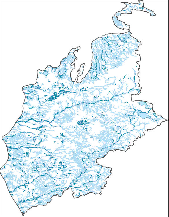
The High Resolution National Hydrography Dataset Plus (NHDPlus HR) is an integrated set of geospatial data layers, including the best available National Hydrography Dataset (NHD), the 10-meter 3D Elevation Program Digital Elevation Model (3DEP DEM), and the National Watershed Boundary Dataset (WBD). The NHDPlus HR combines the NHD, 3DEP DEMs, and WBD to create a stream network with linear referencing, feature naming, "value added attributes" (VAAs), elevation-derived catchments, and other features for hydrologic data analysis. The stream network with linear referencing is a system of data relationships applied to hydrographic systems so that one stream reach "flows" into another and "events" can be tied to and traced...
Tags: Antrim County,
Benzie County,
Charlevoix County,
Cheboygan County,
Clare County, All tags...
Crawford County,
Downloadable Data,
Emmet County,
GeoPackage,
Grand Traverse County,
HU-4 Subregion,
HU-4 Subregion,
HU4_0406,
Hydrography,
Kalkaska County,
Lake County,
Leelanau County,
MI,
Manistee County,
Mason County,
Mecosta County,
Michigan,
Missaukee County,
Montcalm County,
Muskegon County,
NHDPlus HR Rasters,
NHDPlus High Resolution (NHDPlus HR),
National Hydrography Dataset (NHD),
National Hydrography Dataset Plus High Resolution (NHDPlus HR),
National Hydrography Dataset Plus High Resolution (NHDPlus HR) Current,
Newaygo County,
Oceana County,
Open Geospatial Consortium GeoPackage 1.2,
Osceola County,
Otsego County,
Ottawa County,
Roscommon County,
US,
United States,
Wexford County,
base maps,
cartography,
catchments,
channels,
digital elevation models,
drainage basins,
earth sciences,
elevation,
environment,
geographic information systems,
geoscientific,
geospatial analysis,
hydrographic datasets,
hydrographic features,
hydrology,
imagery,
inland waters,
lakes,
land surface characteristics,
reservoirs,
river reaches,
rivers,
streamflow,
streamflow data,
streams,
topography,
water bodies,
water quality,
water resources,
watersheds, Fewer tags

The High Resolution National Hydrography Dataset Plus (NHDPlus HR) is an integrated set of geospatial data layers, including the best available National Hydrography Dataset (NHD), the 10-meter 3D Elevation Program Digital Elevation Model (3DEP DEM), and the National Watershed Boundary Dataset (WBD). The NHDPlus HR combines the NHD, 3DEP DEMs, and WBD to create a stream network with linear referencing, feature naming, "value added attributes" (VAAs), elevation-derived catchments, and other features for hydrologic data analysis. The stream network with linear referencing is a system of data relationships applied to hydrographic systems so that one stream reach "flows" into another and "events" can be tied to and traced...
Tags: Allegan County,
Antrim County,
Benzie County,
Berrien County,
Brown County, All tags...
Charlevoix County,
Cheboygan County,
Cook County,
Delta County,
Door County,
Downloadable Data,
Emmet County,
GeoPackage,
Grand Traverse County,
HU-4 Subregion,
HU-4 Subregion,
HU4_0419,
Hydrography,
IL,
IN,
Illinois,
Indiana,
Kenosha County,
Kewaunee County,
LaPorte County,
Lake County,
Lake County,
Leelanau County,
MI,
Mackinac County,
Manistee County,
Manitowoc County,
Marinette County,
Mason County,
Menominee County,
Michigan,
Milwaukee County,
Muskegon County,
NHDPlus HR Rasters,
NHDPlus High Resolution (NHDPlus HR),
National Hydrography Dataset (NHD),
National Hydrography Dataset Plus High Resolution (NHDPlus HR),
National Hydrography Dataset Plus High Resolution (NHDPlus HR) Current,
Oceana County,
Oconto County,
Open Geospatial Consortium GeoPackage 1.2,
Ottawa County,
Ozaukee County,
Porter County,
Racine County,
Schoolcraft County,
Sheboygan County,
US,
United States,
Van Buren County,
WI,
Wisconsin,
base maps,
cartography,
catchments,
channels,
digital elevation models,
drainage basins,
earth sciences,
elevation,
environment,
geographic information systems,
geoscientific,
geospatial analysis,
hydrographic datasets,
hydrographic features,
hydrology,
imagery,
inland waters,
lakes,
land surface characteristics,
reservoirs,
river reaches,
rivers,
streamflow,
streamflow data,
streams,
topography,
water bodies,
water quality,
water resources,
watersheds, Fewer tags

The High Resolution National Hydrography Dataset Plus (NHDPlus HR) is an integrated set of geospatial data layers, including the best available National Hydrography Dataset (NHD), the 10-meter 3D Elevation Program Digital Elevation Model (3DEP DEM), and the National Watershed Boundary Dataset (WBD). The NHDPlus HR combines the NHD, 3DEP DEMs, and WBD to create a stream network with linear referencing, feature naming, "value added attributes" (VAAs), elevation-derived catchments, and other features for hydrologic data analysis. The stream network with linear referencing is a system of data relationships applied to hydrographic systems so that one stream reach "flows" into another and "events" can be tied to and traced...
Tags: Allegan County,
Antrim County,
Benzie County,
Berrien County,
Brown County, All tags...
Charlevoix County,
Cheboygan County,
Cook County,
Delta County,
Door County,
Downloadable Data,
Emmet County,
GeoPackage,
Grand Traverse County,
HU-4 Subregion,
HU-4 Subregion,
HU4_0419i,
Hydrography,
IL,
IN,
Illinois,
Indiana,
Kenosha County,
Kewaunee County,
LaPorte County,
Lake County,
Lake County,
Leelanau County,
MI,
Mackinac County,
Manistee County,
Manitowoc County,
Marinette County,
Mason County,
Menominee County,
Michigan,
Milwaukee County,
Muskegon County,
NHDPlus HR Rasters,
NHDPlus High Resolution (NHDPlus HR),
National Hydrography Dataset (NHD),
National Hydrography Dataset Plus High Resolution (NHDPlus HR),
National Hydrography Dataset Plus High Resolution (NHDPlus HR) Current,
Oceana County,
Oconto County,
Open Geospatial Consortium GeoPackage 1.2,
Ottawa County,
Ozaukee County,
Porter County,
Racine County,
Schoolcraft County,
Sheboygan County,
US,
United States,
Van Buren County,
WI,
Wisconsin,
base maps,
cartography,
catchments,
channels,
digital elevation models,
drainage basins,
earth sciences,
elevation,
environment,
geographic information systems,
geoscientific,
geospatial analysis,
hydrographic datasets,
hydrographic features,
hydrology,
imagery,
inland waters,
lakes,
land surface characteristics,
reservoirs,
river reaches,
rivers,
streamflow,
streamflow data,
streams,
topography,
water bodies,
water quality,
water resources,
watersheds, Fewer tags
|
|

