|
|

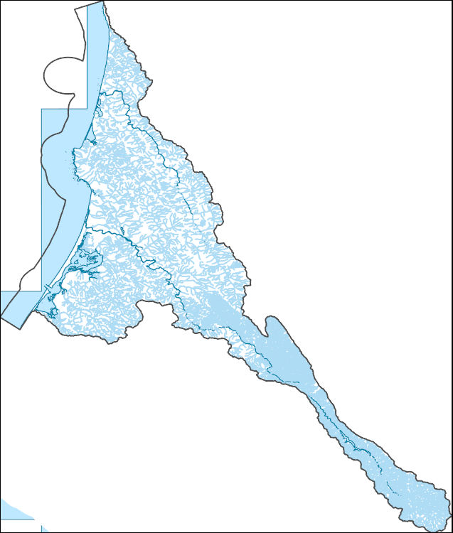
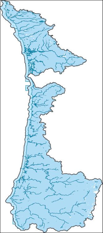
The Watershed Boundary Dataset (WBD) is a comprehensive aggregated collection of hydrologic unit data consistent with the national criteria for delineation and resolution. It defines the areal extent of surface water drainage to a point except in coastal or lake front areas where there could be multiple outlets as stated by the "Federal Standards and Procedures for the National Watershed Boundary Dataset (WBD)" "Standard" (https://pubs.usgs.gov/tm/11/a3/). Watershed boundaries are determined solely upon science-based hydrologic principles, not favoring any administrative boundaries or special projects, nor particular program or agency. This dataset represents the hydrologic unit boundaries to the 12-digit (6th level)...
Tags: 10-digit,
12-digit,
14-digit,
16-digit,
2-digit, All tags...
4-digit,
6-digit,
8-digit,
Ada,
Adams,
Asotin,
Baker,
Bannock,
Basin,
Bear Lake,
Beaverhead,
Benewah,
Benton,
Bingham,
Blaine,
Boise,
Bonner,
Bonneville,
Boundary,
Box Elder,
Butte,
CA,
California,
Camas,
Canyon,
Caribou,
Cassia,
Chelan,
Clackamas,
Clallam,
Clark,
Clatsop,
Clearwater,
Columbia,
Coos,
Cowlitz,
Crook,
Curry,
Custer,
Deer Lodge,
Del Norte,
Deschutes,
Douglas,
Downloadable Data,
Elko,
Elmore,
Ferry,
Flathead,
Franklin,
Fremont,
Gallatin,
Garfield,
Gem,
GeoPackage,
Gilliam,
Glacier,
Gooding,
Granite,
Grant,
Grays Harbor,
HU-2,
HU-2 Region,
HU2_17,
HUC,
Harney,
Hood River,
Humboldt,
Hydrography,
Hydrologic Unit Code,
Hydrologic Units,
ID,
Idaho,
Idaho,
Island,
Jackson,
Jefferson,
Jerome,
Josephine,
King,
Kitsap,
Kittitas,
Klamath,
Klickitat,
Kootenai,
Lake,
Lane,
Latah,
Lemhi,
Lewis,
Lewis and Clark,
Lincoln,
Linn,
MT,
Madison,
Malheur,
Marion,
Mason,
Mineral,
Minidoka,
Missoula,
Modoc,
Montana,
Morrow,
Multnomah,
NV,
National Watershed Boundary Dataset (WBD),
National Watershed Boundary Dataset (WBD),
Nevada,
Nez Perce,
OR,
Okanogan,
Oneida,
Open Geospatial Consortium GeoPackage 1.2,
Oregon,
Owyhee,
Pacific,
Park,
Payette,
Pend Oreille,
Pierce,
Polk,
Pondera,
Powell,
Power,
Ravalli,
Region,
San Juan,
Sanders,
Sherman,
Shoshone,
Silver Bow,
Siskiyou,
Skagit,
Skamania,
Snohomish,
Spokane,
Stevens,
Sub-basin,
Sub-region,
Sublette,
Subwatershed,
Teton,
Thurston,
Tillamook,
Twin Falls,
US,
UT,
Umatilla,
Union,
United States,
Utah,
Valley,
WA,
WBD,
WY,
Wahkiakum,
Walla Walla,
Wallowa,
Wasco,
Washington,
Washington,
Washoe,
Watershed,
Watershed Boundary Dataset,
Whatcom,
Wheeler,
Whitman,
Wyoming,
Yakima,
Yamhill,
inlandWaters, Fewer tags

The U.S. Geological Survey Precipitation-Runoff Modeling System (PRMS) was used to assess the effects of changing climate and land disturbance on seasonal streamflow in the Rio Grande Headwaters (RGHW) region. Three applications of PRMS in the RGHW were used to simulate 1) baseline effects of climate (see RGHW-PRMS_baseline_simulation.zip), 2) effects of bark-beetle induced tree mortality (see RGHW-PRMS_BB_simulation.zip), and 3) effects of wildfire (see RGHW-PRMS_fire_simulation.zip), on components of the hydrologic cycle by hydrologic response unit (HRU) and subsequent seasonal streamflow runoff from April through September for water years 1980 through 2017. Select PRMS output variables for each simulation are...
Categories: Data;
Tags: Data Visualization & Tools,
Del Norte,
Rio Grande,
Rivers, Streams and Lakes,
Science Tools For Managers, All tags...
South Central CASC,
South Fork Rio Grande,
Water, Coasts and Ice,
streamflow modeling,
water supply and demand, Fewer tags
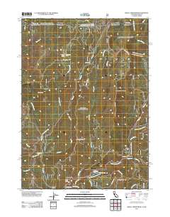
Layered GeoPDF 7.5 Minute Quadrangle Map. Layers of geospatial data include orthoimagery, roads, grids, geographic names, elevation contours, hydrography, and other selected map features.
Tags: 7.5 x 7.5 minute,
California,
Childs Hill, CA,
Del Norte,
Downloadable Data, All tags...
EarthCover,
GeoPDF,
Imagery and Base Maps,
Map,
Public Land Survey System,
U.S. National Grid,
US,
US Topo,
US Topo Historical,
United States,
boundary,
contour,
geographic names,
hydrography,
imageryBaseMapsEarthCover,
orthoimage,
structures,
topographic,
transportation,
woodland, Fewer tags
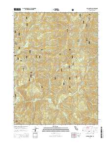
Layered GeoPDF 7.5 Minute Quadrangle Map. Layers of geospatial data include orthoimagery, roads, grids, geographic names, elevation contours, hydrography, and other selected map features.
Tags: 7.5 x 7.5 minute,
Bark Shanty Gulch, CA,
California,
Del Norte,
Downloadable Data, All tags...
EarthCover,
GeoPDF,
Humboldt,
Imagery and Base Maps,
Map,
Public Land Survey System,
Siskiyou,
U.S. National Grid,
US,
US Topo,
US Topo Historical,
United States,
boundary,
contour,
geographic names,
hydrography,
imageryBaseMapsEarthCover,
orthoimage,
structures,
topographic,
transportation,
woodland, Fewer tags
Layered GeoPDF 7.5 Minute Quadrangle Map. Layers of geospatial data include orthoimagery, roads, grids, geographic names, elevation contours, hydrography, and other selected map features.
Tags: 7.5 x 7.5 minute,
California,
Childs Hill, CA,
Del Norte,
Downloadable Data, All tags...
EarthCover,
GeoPDF,
Imagery and Base Maps,
Map,
U.S. National Grid,
US,
US Topo,
US Topo Historical,
United States,
contour,
geographic names,
hydrography,
imageryBaseMapsEarthCover,
orthoimage,
structures,
topographic,
transportation, Fewer tags
Layered geospatial PDF Map. Layers of geospatial data include orthoimagery, roads, grids, geographic names, elevation contours, hydrography, and other selected map features.
Tags: 7.5 x 7.5 minute,
California,
Del Norte,
Downloadable Data,
EarthCover, All tags...
GeoPDF,
Imagery and Base Maps,
Josephine,
Map,
Oregon,
Public Land Survey System,
Siskiyou,
Takilma, OR-CA,
U.S. National Grid,
US,
US Topo,
US Topo Historical,
United States,
boundary,
contour,
geographic names,
hydrography,
imageryBaseMapsEarthCover,
orthoimage,
structures,
topographic,
transportation,
woodland, Fewer tags
Layered GeoPDF 7.5 Minute Quadrangle Map. Layers of geospatial data include orthoimagery, roads, grids, geographic names, elevation contours, hydrography, and other selected map features.
Tags: 7.5 x 7.5 minute,
California,
Curry,
Del Norte,
Downloadable Data, All tags...
EarthCover,
GeoPDF,
Imagery and Base Maps,
Josephine,
Map,
Oregon,
Shelly Creek Ridge, CA-OR,
U.S. National Grid,
US,
US Topo,
US Topo Historical,
United States,
contour,
geographic names,
hydrography,
imageryBaseMapsEarthCover,
orthoimage,
structures,
topographic,
transportation, Fewer tags
Layered GeoPDF 7.5 Minute Quadrangle Map. Layers of geospatial data include orthoimagery, roads, grids, geographic names, elevation contours, hydrography, and other selected map features.
Tags: 7.5 x 7.5 minute,
California,
Del Norte,
Downloadable Data,
EarthCover, All tags...
GeoPDF,
Imagery and Base Maps,
Map,
Public Land Survey System,
Ship Mountain, CA,
U.S. National Grid,
US,
US Topo,
US Topo Historical,
United States,
boundary,
contour,
geographic names,
hydrography,
imageryBaseMapsEarthCover,
orthoimage,
structures,
topographic,
transportation,
woodland, Fewer tags
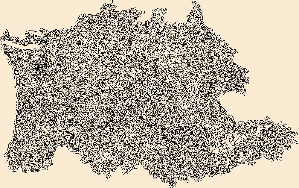
The National Hydrography Dataset (NHD) is a feature-based database that interconnects and uniquely identifies the stream segments or reaches that make up the nation's surface water drainage system. NHD data was originally developed at 1:100,000-scale and exists at that scale for the whole country. This high-resolution NHD, generally developed at 1:24,000/1:12,000 scale, adds detail to the original 1:100,000-scale NHD. (Data for Alaska, Puerto Rico and the Virgin Islands was developed at high-resolution, not 1:100,000 scale.) Local resolution NHD is being developed where partners and data exist. The NHD contains reach codes for networked features, flow direction, names, and centerline representations for areal water...
Tags: Administrative watershed units,
Administrative watershed units,
Area of Complex Channels,
Area to be submerged,
Basin, All tags...
Basin,
Bay/Inlet,
Boundaries,
Boundary,
Bridge,
CA,
California,
Canal/Ditch,
Coastline,
Connector,
Dam/Weir,
Del Norte,
Downloadable Data,
Drainage areas for surface water,
Drainageway,
Esri Shapefile nan,
Estuary,
Flow direction network,
Flume,
ForeShore,
Gaging Station,
Gate,
HU-8,
HU-8 Subbasin,
HU10,
HU12,
HU14,
HU16,
HU2,
HU4,
HU6,
HU8,
HU8_18010102,
HUC,
Hazard Zone,
Humboldt,
Hydrographic,
Hydrography,
Hydrography,
Hydrography,
Hydrologic Unit Code,
Hydrologic Units,
Ice mass,
Inundation Area,
Levee,
Line,
Lock Chamber,
Marsh,
National Hydrography Dataset (NHD),
National Hydrography Dataset (NHD) Best Resolution,
National Hydrography Dataset (NHD) Best Resolution,
Nonearthen Shore,
Orthoimage,
Playa,
Point,
PointEvent,
Pond,
Rapids,
Rapids,
Reach,
Reach code,
Reef,
Region,
Reservoir,
Rock,
Sea/Ocean,
Shapefile,
Sink/Rise,
Sounding Datum Line,
Special Use Zone,
Special Use Zone Limit,
Spillway,
Stream,
Stream/River,
Sub-basin,
Sub-region,
Subbasin,
Submerged Stream,
Subregion,
Subwatershed,
Surface water systems,
Swamp,
Topographic,
Trinity,
Tunnel,
US,
Underground Conduit,
United States,
WBD,
WBD,
Wall,
Wash,
Water Intake Outflow,
Waterfall,
Watershed,
Watershed Boundaries,
Watershed Boundary Dataset,
Watershed Boundary Dataset,
Well,
artificial path,
boundaries,
dams,
drainage systems and characteristics,
inlandWaters,
lakes,
ngda,
rivers, Fewer tags
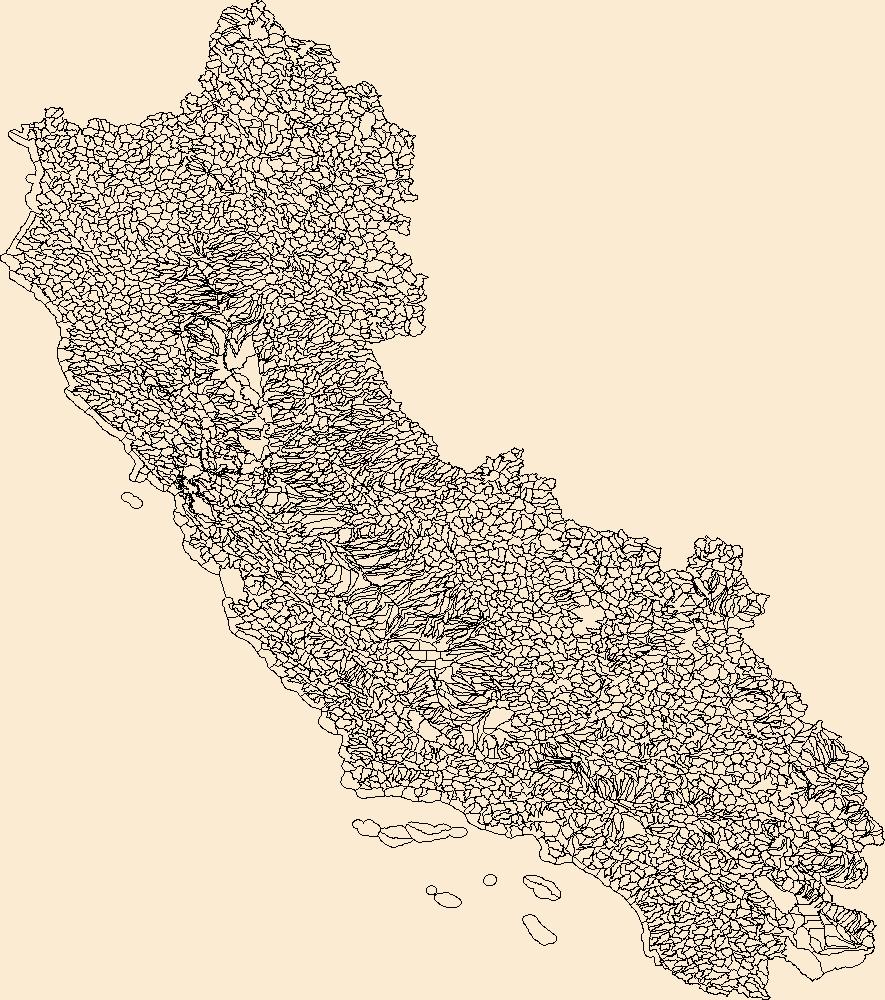
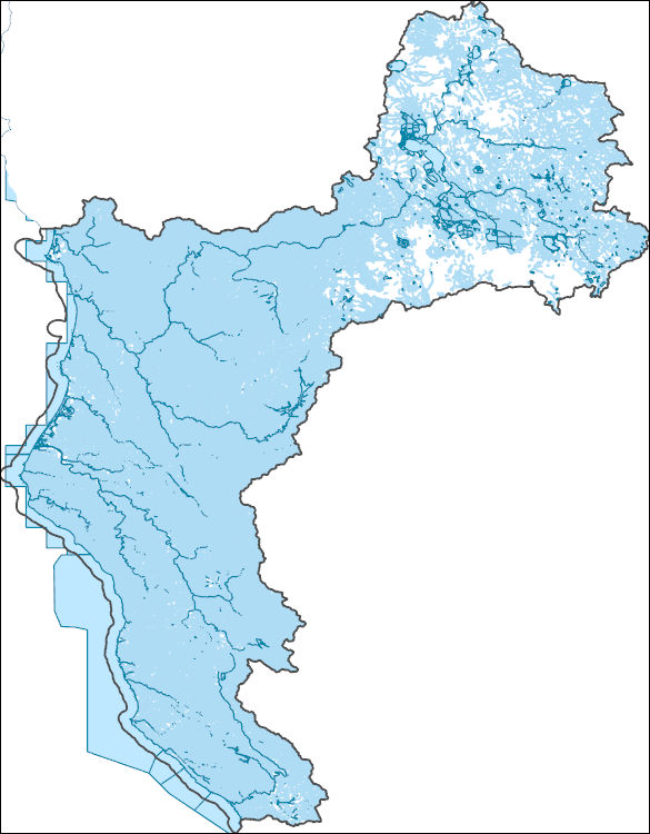
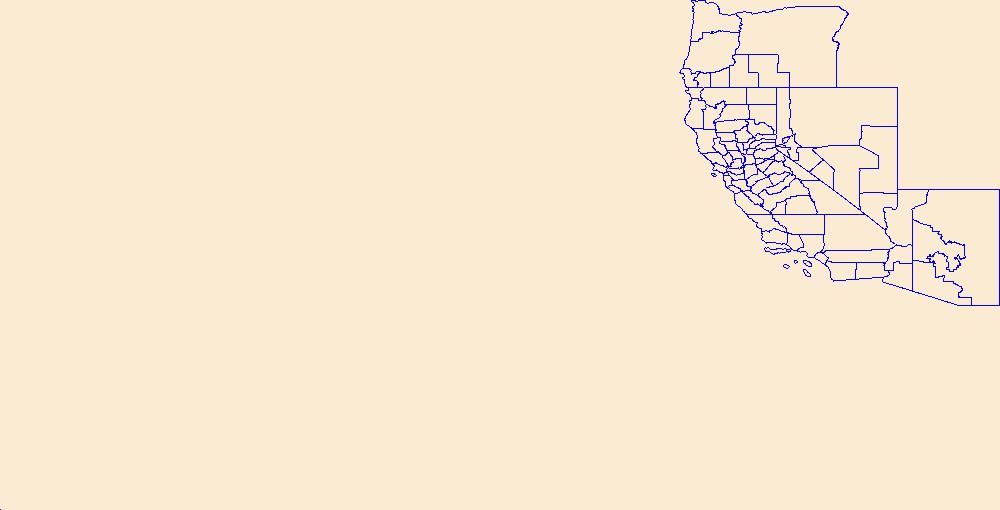
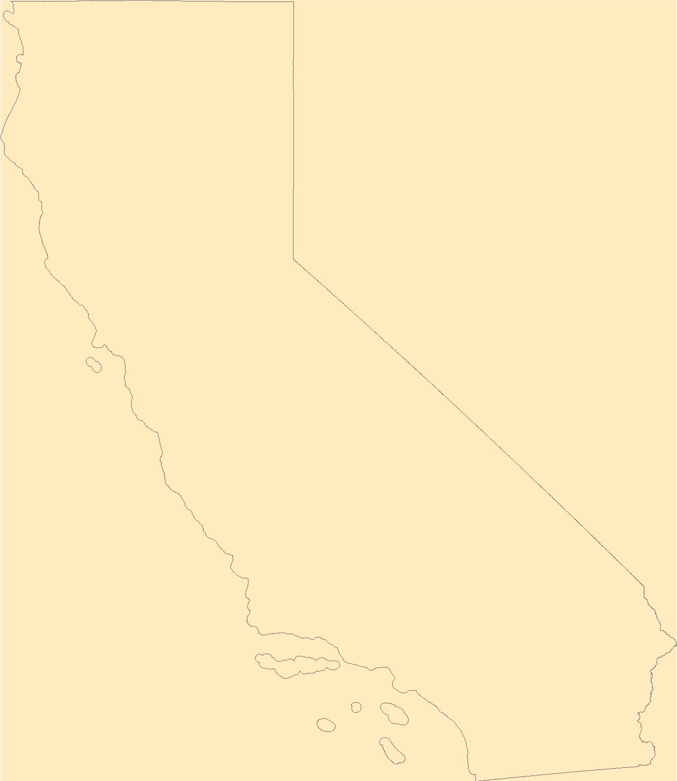
The Watershed Boundary Dataset (WBD) is a comprehensive aggregated collection of hydrologic unit data consistent with the national criteria for delineation and resolution. It defines the areal extent of surface water drainage to a point except in coastal or lake front areas where there could be multiple outlets as stated by the "Federal Standards and Procedures for the National Watershed Boundary Dataset (WBD)" "Standard" (https://pubs.usgs.gov/tm/11/a3/). Watershed boundaries are determined solely upon science-based hydrologic principles, not favoring any administrative boundaries or special projects, nor particular program or agency. This dataset represents the hydrologic unit boundaries to the 12-digit (6th level)...
Tags: 10-digit,
12-digit,
14-digit,
16-digit,
2-digit, All tags...
4-digit,
6-digit,
8-digit,
Alameda,
Alpine,
Amador,
Basin,
Butte,
CA,
Calaveras,
California,
Colusa,
Contra Costa,
Curry,
Del Norte,
Douglas,
Downloadable Data,
El Dorado,
Esmeralda,
Esri File GeoDatabase 10,
FileGDB,
Fresno,
Glenn,
HU-2,
HU-2 Region,
HU2_18,
HUC,
Humboldt,
Hydrography,
Hydrologic Unit Code,
Hydrologic Units,
Imperial,
Inyo,
Jackson,
Josephine,
Kern,
Kings,
Klamath,
Lake,
Lassen,
Los Angeles,
Madera,
Marin,
Mariposa,
Mendocino,
Merced,
Mineral,
Modoc,
Mono,
Monterey,
NV,
Napa,
National Watershed Boundary Dataset (WBD),
National Watershed Boundary Dataset (WBD),
Nevada,
Nevada,
Nye,
OR,
Orange,
Oregon,
Placer,
Plumas,
Region,
Riverside,
Sacramento,
San Benito,
San Bernardino,
San Diego,
San Francisco,
San Joaquin,
San Luis Obispo,
San Mateo,
Santa Barbara,
Santa Clara,
Santa Cruz,
Shasta,
Sierra,
Siskiyou,
Solano,
Sonoma,
Stanislaus,
Sub-basin,
Sub-region,
Subwatershed,
Sutter,
Tehama,
Trinity,
Tulare,
Tuolumne,
US,
United States,
Ventura,
WBD,
Washoe,
Watershed,
Watershed Boundary Dataset,
Yolo,
Yuba,
inlandWaters, Fewer tags

The Watershed Boundary Dataset (WBD) is a comprehensive aggregated collection of hydrologic unit data consistent with the national criteria for delineation and resolution. It defines the areal extent of surface water drainage to a point except in coastal or lake front areas where there could be multiple outlets as stated by the "Federal Standards and Procedures for the National Watershed Boundary Dataset (WBD)" "Standard" (https://pubs.usgs.gov/tm/11/a3/). Watershed boundaries are determined solely upon science-based hydrologic principles, not favoring any administrative boundaries or special projects, nor particular program or agency. This dataset represents the hydrologic unit boundaries to the 12-digit (6th level)...
Tags: 10-digit,
12-digit,
14-digit,
16-digit,
2-digit, All tags...
4-digit,
6-digit,
8-digit,
Alameda,
Alpine,
Amador,
Basin,
Butte,
CA,
Calaveras,
California,
Colusa,
Contra Costa,
Curry,
Del Norte,
Douglas,
Downloadable Data,
El Dorado,
Esmeralda,
Esri Shapefile nan,
Fresno,
Glenn,
HU-2,
HU-2 Region,
HU2_18,
HUC,
Humboldt,
Hydrography,
Hydrologic Unit Code,
Hydrologic Units,
Imperial,
Inyo,
Jackson,
Josephine,
Kern,
Kings,
Klamath,
Lake,
Lassen,
Los Angeles,
Madera,
Marin,
Mariposa,
Mendocino,
Merced,
Mineral,
Modoc,
Mono,
Monterey,
NV,
Napa,
National Watershed Boundary Dataset (WBD),
National Watershed Boundary Dataset (WBD),
Nevada,
Nevada,
Nye,
OR,
Orange,
Oregon,
Placer,
Plumas,
Region,
Riverside,
Sacramento,
San Benito,
San Bernardino,
San Diego,
San Francisco,
San Joaquin,
San Luis Obispo,
San Mateo,
Santa Barbara,
Santa Clara,
Santa Cruz,
Shapefile,
Shasta,
Sierra,
Siskiyou,
Solano,
Sonoma,
Stanislaus,
Sub-basin,
Sub-region,
Subwatershed,
Sutter,
Tehama,
Trinity,
Tulare,
Tuolumne,
US,
United States,
Ventura,
WBD,
Washoe,
Watershed,
Watershed Boundary Dataset,
Yolo,
Yuba,
inlandWaters, Fewer tags
The National Hydrography Dataset (NHD) is a feature-based database that interconnects and uniquely identifies the stream segments or reaches that make up the nation's surface water drainage system. NHD data was originally developed at 1:100,000-scale and exists at that scale for the whole country. This high-resolution NHD, generally developed at 1:24,000/1:12,000 scale, adds detail to the original 1:100,000-scale NHD. (Data for Alaska, Puerto Rico and the Virgin Islands was developed at high-resolution, not 1:100,000 scale.) Local resolution NHD is being developed where partners and data exist. The NHD contains reach codes for networked features, flow direction, names, and centerline representations for areal water...
Tags: Administrative watershed units,
Administrative watershed units,
Area of Complex Channels,
Area to be submerged,
Basin, All tags...
Basin,
Bay/Inlet,
Benton,
Boundaries,
Boundary,
Bridge,
CA,
California,
Canal/Ditch,
Clallam,
Clatsop,
Coastline,
Columbia,
Connector,
Coos,
Cowlitz,
Curry,
Dam/Weir,
Del Norte,
Douglas,
Downloadable Data,
Drainage areas for surface water,
Drainageway,
Esri File GeoDatabase 10,
Estuary,
FileGDB,
Flow direction network,
Flume,
ForeShore,
Gaging Station,
Gate,
Grays Harbor,
HU-4,
HU-4 Subregion,
HU10,
HU12,
HU14,
HU16,
HU2,
HU4,
HU4_1710,
HU6,
HU8,
HUC,
Hazard Zone,
Hydrographic,
Hydrography,
Hydrography,
Hydrography,
Hydrologic Unit Code,
Hydrologic Units,
Ice mass,
Inundation Area,
Jackson,
Jefferson,
Josephine,
Klamath,
Lane,
Levee,
Lewis,
Lincoln,
Line,
Lock Chamber,
Marsh,
Mason,
National Hydrography Dataset (NHD),
National Hydrography Dataset (NHD) Best Resolution,
National Hydrography Dataset (NHD) Best Resolution,
Nonearthen Shore,
OR,
Oregon,
Orthoimage,
Pacific,
Playa,
Point,
PointEvent,
Polk,
Pond,
Rapids,
Rapids,
Reach,
Reach code,
Reef,
Region,
Reservoir,
Rock,
Sea/Ocean,
Sink/Rise,
Siskiyou,
Sounding Datum Line,
Special Use Zone,
Special Use Zone Limit,
Spillway,
Stream,
Stream/River,
Sub-basin,
Sub-region,
Subbasin,
Submerged Stream,
Subregion,
Subwatershed,
Surface water systems,
Swamp,
Thurston,
Tillamook,
Topographic,
Tunnel,
US,
Underground Conduit,
United States,
WA,
WBD,
WBD,
Wahkiakum,
Wall,
Wash,
Washington,
Washington,
Water Intake Outflow,
Waterfall,
Watershed,
Watershed Boundaries,
Watershed Boundary Dataset,
Watershed Boundary Dataset,
Well,
Yamhill,
artificial path,
boundaries,
dams,
drainage systems and characteristics,
inlandWaters,
lakes,
ngda,
rivers, Fewer tags

The Geographic Names Information System (GNIS) is the Federal standard for geographic nomenclature. The U.S. Geological Survey developed the GNIS for the U.S. Board on Geographic Names, a Federal inter-agency body chartered by public law to maintain uniform feature name usage throughout the Government and to promulgate standard names to the public. The GNIS is the official repository of domestic geographic names data; the official vehicle for geographic names use by all departments of the Federal Government; and the source for applying geographic names to Federal electronic and printed products of all types.
Tags: Alameda,
Alpine,
Amador,
Antarctica,
Antarctica, All tags...
BGN,
Board on Geographic Names,
Borough,
Butte,
CA,
Calaveras,
California,
Census Area,
Colusa,
Commonwealth,
Contra Costa,
County,
Del Norte,
District,
Downloadable Data,
El Dorado,
Feature class,
Feature coordinates,
Feature county,
Feature description,
Feature designation,
Feature history,
Feature indentification,
Feature name,
Feature state,
Fresno,
GNIS,
Geographic Names,
Geographic Names Domestic Names,
Geographic Names Information System,
Geographic feature,
Geographic name,
Geographical feature,
Geographical name,
Glenn,
Humboldt,
Imperial,
Inyo,
Kern,
Kings,
Lake,
Lassen,
Los Angeles,
Madera,
Marin,
Mariposa,
Mendocino,
Merced,
Modoc,
Mono,
Monterey,
Municipio,
Napa,
National Geographic Names Information System (GNIS),
National Geographic Names Information System (GNIS),
Nevada,
Official feature name,
Orange,
Outlying Area,
Parish,
Place name,
Placer,
Plumas,
Populated Place,
Riverside,
Sacramento,
San Benito,
San Bernardino,
San Diego,
San Francisco,
San Joaquin,
San Luis Obispo,
San Mateo,
Santa Barbara,
Santa Clara,
Santa Cruz,
Shasta,
Sierra,
Siskiyou,
Solano,
Sonoma,
Stanislaus,
State,
Sutter,
TXT (pipes),
Tehama,
Territories,
Territory,
Topographic Map,
Trinity,
Tulare,
Tuolumne,
U.S. Board on Geographic Names,
U.S. Geological Survey,
US,
USA,
USBGN,
USGS,
UTF-8 Pipe Delimited Text File nan,
United States,
United States,
United States,
Variant name,
Ventura,
Yolo,
Yuba,
antarctic,
database,
economy,
environment,
feature,
gazetteer,
geographic,
geographic names,
geographical,
geography,
geospatial,
imageryBaseMapsEarthCover,
inlandWaters,
location,
map,
name,
place,
placename,
society,
structure,
topographic map,
toponymy, Fewer tags
USGS Historical Quadrangle in GeoPDF.
Tags: 7.5 x 7.5 minute,
CO,
Del Norte,
Downloadable Data,
GeoPDF, All tags...
GeoTIFF,
Historical Topographic Maps,
Historical Topographic Maps 7.5 x 7.5 Minute Map Series,
Map,
imageryBaseMapsEarthCover, Fewer tags
Layered GeoPDF 7.5 Minute Quadrangle Map. Layers of geospatial data include orthoimagery, roads, grids, geographic names, elevation contours, hydrography, and other selected map features.
Tags: 7.5 x 7.5 minute,
California,
Crescent City OE W, CA,
Del Norte,
Downloadable Data, All tags...
EarthCover,
GeoPDF,
Imagery and Base Maps,
Map,
U.S. National Grid,
US,
US Topo,
US Topo Historical,
United States,
contour,
geographic names,
hydrography,
imageryBaseMapsEarthCover,
orthoimage,
structures,
topographic,
transportation, Fewer tags
The National Hydrography Dataset (NHD) is a feature-based database that interconnects and uniquely identifies the stream segments or reaches that make up the nation's surface water drainage system. NHD data was originally developed at 1:100,000-scale and exists at that scale for the whole country. This high-resolution NHD, generally developed at 1:24,000/1:12,000 scale, adds detail to the original 1:100,000-scale NHD. (Data for Alaska, Puerto Rico and the Virgin Islands was developed at high-resolution, not 1:100,000 scale.) Local resolution NHD is being developed where partners and data exist. The NHD contains reach codes for networked features, flow direction, names, and centerline representations for areal water...
Tags: Administrative watershed units,
Administrative watershed units,
Area of Complex Channels,
Area to be submerged,
Basin, All tags...
Basin,
Bay/Inlet,
Boundaries,
Boundary,
Bridge,
CA,
California,
Canal/Ditch,
Coastline,
Colusa,
Connector,
Curry,
Dam/Weir,
Del Norte,
Douglas,
Downloadable Data,
Drainage areas for surface water,
Drainageway,
Estuary,
Flow direction network,
Flume,
ForeShore,
Gaging Station,
Gate,
GeoPackage,
Glenn,
HU-4,
HU-4 Subregion,
HU10,
HU12,
HU14,
HU16,
HU2,
HU4,
HU4_1801,
HU6,
HU8,
HUC,
Hazard Zone,
Humboldt,
Hydrographic,
Hydrography,
Hydrography,
Hydrography,
Hydrologic Unit Code,
Hydrologic Units,
Ice mass,
Inundation Area,
Jackson,
Josephine,
Klamath,
Lake,
Levee,
Line,
Lock Chamber,
Marin,
Marsh,
Mendocino,
Modoc,
Napa,
National Hydrography Dataset (NHD),
National Hydrography Dataset (NHD) Best Resolution,
National Hydrography Dataset (NHD) Best Resolution,
Nonearthen Shore,
OR,
Open Geospatial Consortium GeoPackage 1.2,
Oregon,
Orthoimage,
Playa,
Point,
PointEvent,
Pond,
Rapids,
Rapids,
Reach,
Reach code,
Reef,
Region,
Reservoir,
Rock,
Sea/Ocean,
Shasta,
Sink/Rise,
Siskiyou,
Sonoma,
Sounding Datum Line,
Special Use Zone,
Special Use Zone Limit,
Spillway,
Stream,
Stream/River,
Sub-basin,
Sub-region,
Subbasin,
Submerged Stream,
Subregion,
Subwatershed,
Surface water systems,
Swamp,
Tehama,
Topographic,
Trinity,
Tunnel,
US,
Underground Conduit,
United States,
WBD,
WBD,
Wall,
Wash,
Water Intake Outflow,
Waterfall,
Watershed,
Watershed Boundaries,
Watershed Boundary Dataset,
Watershed Boundary Dataset,
Well,
artificial path,
boundaries,
dams,
drainage systems and characteristics,
inlandWaters,
lakes,
ngda,
rivers, Fewer tags
Geospatial data is comprised of government boundaries.
Types: Citation;
Tags: Alameda,
Alpine,
Amador,
Boundaries,
Butte, All tags...
CA,
Calaveras,
California,
Colusa,
Contra Costa,
County or Equivalent,
Del Norte,
Downloadable Data,
El Dorado,
Esri File GeoDatabase 10,
FileGDB,
Fresno,
Glenn,
Humboldt,
Imperial,
Incorporated Place,
Inyo,
Jurisdictional,
Kern,
Kings,
Lake,
Lassen,
Los Angeles,
Madera,
Marin,
Mariposa,
Mendocino,
Merced,
Minor Civil Division,
Modoc,
Mono,
Monterey,
Napa,
National Boundary Dataset (NBD),
National Boundary Dataset (NBD),
Native American Area,
Nevada,
Orange,
PLSS First Division,
PLSS Special Survey,
PLSS Township,
Placer,
Plumas,
Public Land Survey System,
Reserve,
Riverside,
Sacramento,
San Benito,
San Bernardino,
San Diego,
San Francisco,
San Joaquin,
San Luis Obispo,
San Mateo,
Santa Barbara,
Santa Clara,
Santa Cruz,
Shasta,
Sierra,
Siskiyou,
Solano,
Sonoma,
Stanislaus,
State,
State,
State or Territory,
Sutter,
Tehama,
Trinity,
Tulare,
Tuolumne,
U.S. National Grid,
US,
Unincorporated Place,
United States,
Ventura,
Yolo,
Yuba,
boundaries,
boundary,
cadastral surveys,
geographic names,
land ownership,
land use maps,
legal land descriptions,
political and administrative boundaries,
zoning maps, Fewer tags
The Watershed Boundary Dataset (WBD) is a comprehensive aggregated collection of hydrologic unit data consistent with the national criteria for delineation and resolution. It defines the areal extent of surface water drainage to a point except in coastal or lake front areas where there could be multiple outlets as stated by the "Federal Standards and Procedures for the National Watershed Boundary Dataset (WBD)" "Standard" (https://pubs.usgs.gov/tm/11/a3/). Watershed boundaries are determined solely upon science-based hydrologic principles, not favoring any administrative boundaries or special projects, nor particular program or agency. This dataset represents the hydrologic unit boundaries to the 12-digit (6th level)...
Tags: 10-digit,
12-digit,
14-digit,
16-digit,
2-digit, All tags...
4-digit,
6-digit,
8-digit,
Ada,
Adams,
Asotin,
Baker,
Bannock,
Basin,
Bear Lake,
Beaverhead,
Benewah,
Benton,
Bingham,
Blaine,
Boise,
Bonner,
Bonneville,
Boundary,
Box Elder,
Butte,
CA,
California,
Camas,
Canyon,
Caribou,
Cassia,
Chelan,
Clackamas,
Clallam,
Clark,
Clatsop,
Clearwater,
Columbia,
Coos,
Cowlitz,
Crook,
Curry,
Custer,
Deer Lodge,
Del Norte,
Deschutes,
Douglas,
Downloadable Data,
Elko,
Elmore,
Esri Shapefile nan,
Ferry,
Flathead,
Franklin,
Fremont,
Gallatin,
Garfield,
Gem,
Gilliam,
Glacier,
Gooding,
Granite,
Grant,
Grays Harbor,
HU-2,
HU-2 Region,
HU2_17,
HUC,
Harney,
Hood River,
Humboldt,
Hydrography,
Hydrologic Unit Code,
Hydrologic Units,
ID,
Idaho,
Idaho,
Island,
Jackson,
Jefferson,
Jerome,
Josephine,
King,
Kitsap,
Kittitas,
Klamath,
Klickitat,
Kootenai,
Lake,
Lane,
Latah,
Lemhi,
Lewis,
Lewis and Clark,
Lincoln,
Linn,
MT,
Madison,
Malheur,
Marion,
Mason,
Mineral,
Minidoka,
Missoula,
Modoc,
Montana,
Morrow,
Multnomah,
NV,
National Watershed Boundary Dataset (WBD),
National Watershed Boundary Dataset (WBD),
Nevada,
Nez Perce,
OR,
Okanogan,
Oneida,
Oregon,
Owyhee,
Pacific,
Park,
Payette,
Pend Oreille,
Pierce,
Polk,
Pondera,
Powell,
Power,
Ravalli,
Region,
San Juan,
Sanders,
Shapefile,
Sherman,
Shoshone,
Silver Bow,
Siskiyou,
Skagit,
Skamania,
Snohomish,
Spokane,
Stevens,
Sub-basin,
Sub-region,
Sublette,
Subwatershed,
Teton,
Thurston,
Tillamook,
Twin Falls,
US,
UT,
Umatilla,
Union,
United States,
Utah,
Valley,
WA,
WBD,
WY,
Wahkiakum,
Walla Walla,
Wallowa,
Wasco,
Washington,
Washington,
Washoe,
Watershed,
Watershed Boundary Dataset,
Whatcom,
Wheeler,
Whitman,
Wyoming,
Yakima,
Yamhill,
inlandWaters, Fewer tags
The Geographic Names Information System (GNIS) is the Federal standard for geographic nomenclature. The U.S. Geological Survey developed the GNIS for the U.S. Board on Geographic Names, a Federal inter-agency body chartered by public law to maintain uniform feature name usage throughout the Government and to promulgate standard names to the public. The GNIS is the official repository of domestic geographic names data; the official vehicle for geographic names use by all departments of the Federal Government; and the source for applying geographic names to Federal electronic and printed products of all types.
Tags: Alameda,
Alpine,
Amador,
Antarctica,
Antarctica, All tags...
BGN,
Board on Geographic Names,
Borough,
Butte,
CA,
Calaveras,
California,
Census Area,
Colusa,
Commonwealth,
Contra Costa,
County,
Del Norte,
District,
Downloadable Data,
El Dorado,
Esri File GeoDatabase 10,
Feature class,
Feature coordinates,
Feature county,
Feature description,
Feature designation,
Feature history,
Feature indentification,
Feature name,
Feature state,
FileGDB,
Fresno,
GNIS,
Geographic Names,
Geographic Names Full Model,
Geographic Names Information System,
Geographic feature,
Geographic name,
Geographical feature,
Geographical name,
Glenn,
Humboldt,
Imperial,
Inyo,
Kern,
Kings,
Lake,
Lassen,
Los Angeles,
Madera,
Marin,
Mariposa,
Mendocino,
Merced,
Modoc,
Mono,
Monterey,
Municipio,
Napa,
National Geographic Names Information System (GNIS),
National Geographic Names Information System (GNIS),
Nevada,
Official feature name,
Orange,
Outlying Area,
Parish,
Place name,
Placer,
Plumas,
Populated Place,
Riverside,
Sacramento,
San Benito,
San Bernardino,
San Diego,
San Francisco,
San Joaquin,
San Luis Obispo,
San Mateo,
Santa Barbara,
Santa Clara,
Santa Cruz,
Shasta,
Sierra,
Siskiyou,
Solano,
Sonoma,
Stanislaus,
State,
Sutter,
Tehama,
Territories,
Territory,
Topographic Map,
Trinity,
Tulare,
Tuolumne,
U.S. Board on Geographic Names,
U.S. Geological Survey,
US,
USA,
USBGN,
USGS,
United States,
United States,
United States,
Variant name,
Ventura,
Yolo,
Yuba,
antarctic,
database,
economy,
environment,
feature,
gazetteer,
geographic,
geographic names,
geographical,
geography,
geospatial,
imageryBaseMapsEarthCover,
inlandWaters,
location,
map,
name,
place,
placename,
society,
structure,
topographic map,
toponymy, Fewer tags

The Geographic Names Information System (GNIS) is the Federal standard for geographic nomenclature. The U.S. Geological Survey developed the GNIS for the U.S. Board on Geographic Names, a Federal inter-agency body chartered by public law to maintain uniform feature name usage throughout the Government and to promulgate standard names to the public. The GNIS is the official repository of domestic geographic names data; the official vehicle for geographic names use by all departments of the Federal Government; and the source for applying geographic names to Federal electronic and printed products of all types.
Tags: Alameda,
Alpine,
Amador,
Antarctica,
Antarctica, All tags...
BGN,
Board on Geographic Names,
Borough,
Butte,
CA,
Calaveras,
California,
Census Area,
Colusa,
Commonwealth,
Contra Costa,
County,
Del Norte,
District,
Downloadable Data,
El Dorado,
Feature class,
Feature coordinates,
Feature county,
Feature description,
Feature designation,
Feature history,
Feature indentification,
Feature name,
Feature state,
Fresno,
GNIS,
GeoPackage,
Geographic Names,
Geographic Names Full Model,
Geographic Names Information System,
Geographic feature,
Geographic name,
Geographical feature,
Geographical name,
Glenn,
Humboldt,
Imperial,
Inyo,
Kern,
Kings,
Lake,
Lassen,
Los Angeles,
Madera,
Marin,
Mariposa,
Mendocino,
Merced,
Modoc,
Mono,
Monterey,
Municipio,
Napa,
National Geographic Names Information System (GNIS),
National Geographic Names Information System (GNIS),
Nevada,
Official feature name,
Open Geospatial Consortium GeoPackage 1.2,
Orange,
Outlying Area,
Parish,
Place name,
Placer,
Plumas,
Populated Place,
Riverside,
Sacramento,
San Benito,
San Bernardino,
San Diego,
San Francisco,
San Joaquin,
San Luis Obispo,
San Mateo,
Santa Barbara,
Santa Clara,
Santa Cruz,
Shasta,
Sierra,
Siskiyou,
Solano,
Sonoma,
Stanislaus,
State,
Sutter,
Tehama,
Territories,
Territory,
Topographic Map,
Trinity,
Tulare,
Tuolumne,
U.S. Board on Geographic Names,
U.S. Geological Survey,
US,
USA,
USBGN,
USGS,
United States,
United States,
United States,
Variant name,
Ventura,
Yolo,
Yuba,
antarctic,
database,
economy,
environment,
feature,
gazetteer,
geographic,
geographic names,
geographical,
geography,
geospatial,
imageryBaseMapsEarthCover,
inlandWaters,
location,
map,
name,
place,
placename,
society,
structure,
topographic map,
toponymy, Fewer tags
|
|

