Filters: Tags: Digital elevation model (X) > Types: Citation (X)
10,842 results (90ms)|
Filters
Date Range
Extensions Types
Contacts
Categories Tag Types
|

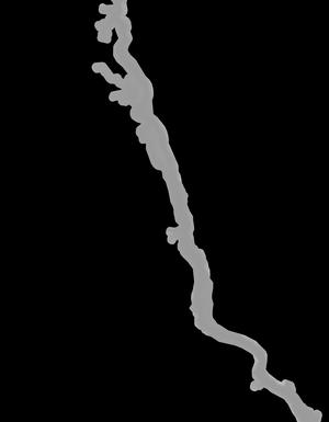
This is the Original Product Resolution (OPR) Digital Elevation Model (DEM) as provided to the USGS. This DEM is delivered in the original resolution, with the original spatial reference. All elevation units have been converted to meters. These data may be used as the source of updates to the National Elevation Dataset (NED), which serves as the elevation layer of the National Map. These data can be used by scientists and resource managers for global change research, hydrologic modeling, resource monitoring, mapping and visualization, and many other applications.

This is the Original Product Resolution (OPR) Digital Elevation Model (DEM) as provided to the USGS. This DEM is delivered in the original resolution, with the original spatial reference. All elevation units have been converted to meters. These data may be used as the source of updates to the National Elevation Dataset (NED), which serves as the elevation layer of the National Map. These data can be used by scientists and resource managers for global change research, hydrologic modeling, resource monitoring, mapping and visualization, and many other applications.

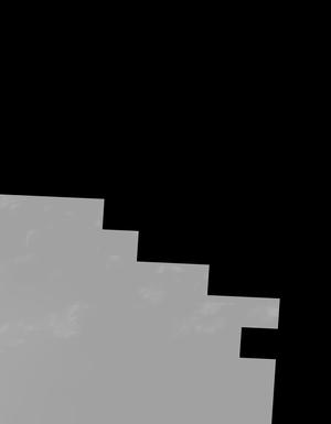
This tile of the National Elevation Dataset (NED) is 1/9 arc-second resolution. The National Elevation Dataset (NED) serves the elevation layer of The National Map, and provides basic elevation information for earth science studies and mapping applications in the United States. Scientists and resource managers use NED data for global change research, hydrologic modeling, resource monitoring, mapping and visualization, and many other applications. The NED is an elevation dataset that consists of seamless layers and a high resolution layer. Each of these layers are composed of the best available raster elevation data of the conterminous United States, Alaska, Hawaii, territorial islands, Mexico and Canada. The NED...

This tile of the National Elevation Dataset (NED) is 1/9 arc-second resolution. The National Elevation Dataset (NED) serves the elevation layer of The National Map, and provides basic elevation information for earth science studies and mapping applications in the United States. Scientists and resource managers use NED data for global change research, hydrologic modeling, resource monitoring, mapping and visualization, and many other applications. The NED is an elevation dataset that consists of seamless layers and a high resolution layer. Each of these layers are composed of the best available raster elevation data of the conterminous United States, Alaska, Hawaii, territorial islands, Mexico and Canada. The NED...

This tile of the National Elevation Dataset (NED) is 1/9 arc-second resolution. The National Elevation Dataset (NED) serves the elevation layer of The National Map, and provides basic elevation information for earth science studies and mapping applications in the United States. Scientists and resource managers use NED data for global change research, hydrologic modeling, resource monitoring, mapping and visualization, and many other applications. The NED is an elevation dataset that consists of seamless layers and a high resolution layer. Each of these layers are composed of the best available raster elevation data of the conterminous United States, Alaska, Hawaii, territorial islands, Mexico and Canada. The NED...

This tile of the National Elevation Dataset (NED) is 1/9 arc-second resolution. The National Elevation Dataset (NED) serves the elevation layer of The National Map, and provides basic elevation information for earth science studies and mapping applications in the United States. Scientists and resource managers use NED data for global change research, hydrologic modeling, resource monitoring, mapping and visualization, and many other applications. The NED is an elevation dataset that consists of seamless layers and a high resolution layer. Each of these layers are composed of the best available raster elevation data of the conterminous United States, Alaska, Hawaii, territorial islands, Mexico and Canada. The NED...
This tile of the National Elevation Dataset (NED) is 1/9 arc-second resolution. The National Elevation Dataset (NED) serves the elevation layer of The National Map, and provides basic elevation information for earth science studies and mapping applications in the United States. Scientists and resource managers use NED data for global change research, hydrologic modeling, resource monitoring, mapping and visualization, and many other applications. The NED is an elevation dataset that consists of seamless layers and a high resolution layer. Each of these layers are composed of the best available raster elevation data of the conterminous United States, Alaska, Hawaii, territorial islands, Mexico and Canada. The NED...

This tile of the National Elevation Dataset (NED) is 1/9 arc-second resolution. The National Elevation Dataset (NED) serves the elevation layer of The National Map, and provides basic elevation information for earth science studies and mapping applications in the United States. Scientists and resource managers use NED data for global change research, hydrologic modeling, resource monitoring, mapping and visualization, and many other applications. The NED is an elevation dataset that consists of seamless layers and a high resolution layer. Each of these layers are composed of the best available raster elevation data of the conterminous United States, Alaska, Hawaii, territorial islands, Mexico and Canada. The NED...

This tile of the National Elevation Dataset (NED) is 1/9 arc-second resolution. The National Elevation Dataset (NED) serves the elevation layer of The National Map, and provides basic elevation information for earth science studies and mapping applications in the United States. Scientists and resource managers use NED data for global change research, hydrologic modeling, resource monitoring, mapping and visualization, and many other applications. The NED is an elevation dataset that consists of seamless layers and a high resolution layer. Each of these layers are composed of the best available raster elevation data of the conterminous United States, Alaska, Hawaii, territorial islands, Mexico and Canada. The NED...

This tile of the National Elevation Dataset (NED) is 1/9 arc-second resolution. The National Elevation Dataset (NED) serves the elevation layer of The National Map, and provides basic elevation information for earth science studies and mapping applications in the United States. Scientists and resource managers use NED data for global change research, hydrologic modeling, resource monitoring, mapping and visualization, and many other applications. The NED is an elevation dataset that consists of seamless layers and a high resolution layer. Each of these layers are composed of the best available raster elevation data of the conterminous United States, Alaska, Hawaii, territorial islands, Mexico and Canada. The NED...

This tile of the National Elevation Dataset (NED) is 1/9 arc-second resolution. The National Elevation Dataset (NED) serves the elevation layer of The National Map, and provides basic elevation information for earth science studies and mapping applications in the United States. Scientists and resource managers use NED data for global change research, hydrologic modeling, resource monitoring, mapping and visualization, and many other applications. The NED is an elevation dataset that consists of seamless layers and a high resolution layer. Each of these layers are composed of the best available raster elevation data of the conterminous United States, Alaska, Hawaii, territorial islands, Mexico and Canada. The NED...

This tile of the National Elevation Dataset (NED) is 1/9 arc-second resolution. The National Elevation Dataset (NED) serves the elevation layer of The National Map, and provides basic elevation information for earth science studies and mapping applications in the United States. Scientists and resource managers use NED data for global change research, hydrologic modeling, resource monitoring, mapping and visualization, and many other applications. The NED is an elevation dataset that consists of seamless layers and a high resolution layer. Each of these layers are composed of the best available raster elevation data of the conterminous United States, Alaska, Hawaii, territorial islands, Mexico and Canada. The NED...

This tile of the National Elevation Dataset (NED) is 1/9 arc-second resolution. The National Elevation Dataset (NED) serves the elevation layer of The National Map, and provides basic elevation information for earth science studies and mapping applications in the United States. Scientists and resource managers use NED data for global change research, hydrologic modeling, resource monitoring, mapping and visualization, and many other applications. The NED is an elevation dataset that consists of seamless layers and a high resolution layer. Each of these layers are composed of the best available raster elevation data of the conterminous United States, Alaska, Hawaii, territorial islands, Mexico and Canada. The NED...

This tile of the National Elevation Dataset (NED) is 1/9 arc-second resolution. The National Elevation Dataset (NED) serves the elevation layer of The National Map, and provides basic elevation information for earth science studies and mapping applications in the United States. Scientists and resource managers use NED data for global change research, hydrologic modeling, resource monitoring, mapping and visualization, and many other applications. The NED is an elevation dataset that consists of seamless layers and a high resolution layer. Each of these layers are composed of the best available raster elevation data of the conterminous United States, Alaska, Hawaii, territorial islands, Mexico and Canada. The NED...

This tile of the National Elevation Dataset (NED) is 1/9 arc-second resolution. The National Elevation Dataset (NED) serves the elevation layer of The National Map, and provides basic elevation information for earth science studies and mapping applications in the United States. Scientists and resource managers use NED data for global change research, hydrologic modeling, resource monitoring, mapping and visualization, and many other applications. The NED is an elevation dataset that consists of seamless layers and a high resolution layer. Each of these layers are composed of the best available raster elevation data of the conterminous United States, Alaska, Hawaii, territorial islands, Mexico and Canada. The NED...
This tile of the National Elevation Dataset (NED) is 1/9 arc-second resolution. The National Elevation Dataset (NED) serves the elevation layer of The National Map, and provides basic elevation information for earth science studies and mapping applications in the United States. Scientists and resource managers use NED data for global change research, hydrologic modeling, resource monitoring, mapping and visualization, and many other applications. The NED is an elevation dataset that consists of seamless layers and a high resolution layer. Each of these layers are composed of the best available raster elevation data of the conterminous United States, Alaska, Hawaii, territorial islands, Mexico and Canada. The NED...

This tile of the National Elevation Dataset (NED) is 1/9 arc-second resolution. The National Elevation Dataset (NED) serves the elevation layer of The National Map, and provides basic elevation information for earth science studies and mapping applications in the United States. Scientists and resource managers use NED data for global change research, hydrologic modeling, resource monitoring, mapping and visualization, and many other applications. The NED is an elevation dataset that consists of seamless layers and a high resolution layer. Each of these layers are composed of the best available raster elevation data of the conterminous United States, Alaska, Hawaii, territorial islands, Mexico and Canada. The NED...

This tile of the National Elevation Dataset (NED) is 1/9 arc-second resolution. The National Elevation Dataset (NED) serves the elevation layer of The National Map, and provides basic elevation information for earth science studies and mapping applications in the United States. Scientists and resource managers use NED data for global change research, hydrologic modeling, resource monitoring, mapping and visualization, and many other applications. The NED is an elevation dataset that consists of seamless layers and a high resolution layer. Each of these layers are composed of the best available raster elevation data of the conterminous United States, Alaska, Hawaii, territorial islands, Mexico and Canada. The NED...

This tile of the National Elevation Dataset (NED) is 1/9 arc-second resolution. The National Elevation Dataset (NED) serves the elevation layer of The National Map, and provides basic elevation information for earth science studies and mapping applications in the United States. Scientists and resource managers use NED data for global change research, hydrologic modeling, resource monitoring, mapping and visualization, and many other applications. The NED is an elevation dataset that consists of seamless layers and a high resolution layer. Each of these layers are composed of the best available raster elevation data of the conterminous United States, Alaska, Hawaii, territorial islands, Mexico and Canada. The NED...

This tile of the National Elevation Dataset (NED) is 1/9 arc-second resolution. The National Elevation Dataset (NED) serves the elevation layer of The National Map, and provides basic elevation information for earth science studies and mapping applications in the United States. Scientists and resource managers use NED data for global change research, hydrologic modeling, resource monitoring, mapping and visualization, and many other applications. The NED is an elevation dataset that consists of seamless layers and a high resolution layer. Each of these layers are composed of the best available raster elevation data of the conterminous United States, Alaska, Hawaii, territorial islands, Mexico and Canada. The NED...
|

|
