Filters: Tags: Earth sciences (X) > partyWithName: U.S. Geological Survey (X)
247 results (119ms)|
Filters
Date Range
Extensions Types
Contacts
Categories Tag Types Tag Schemes |

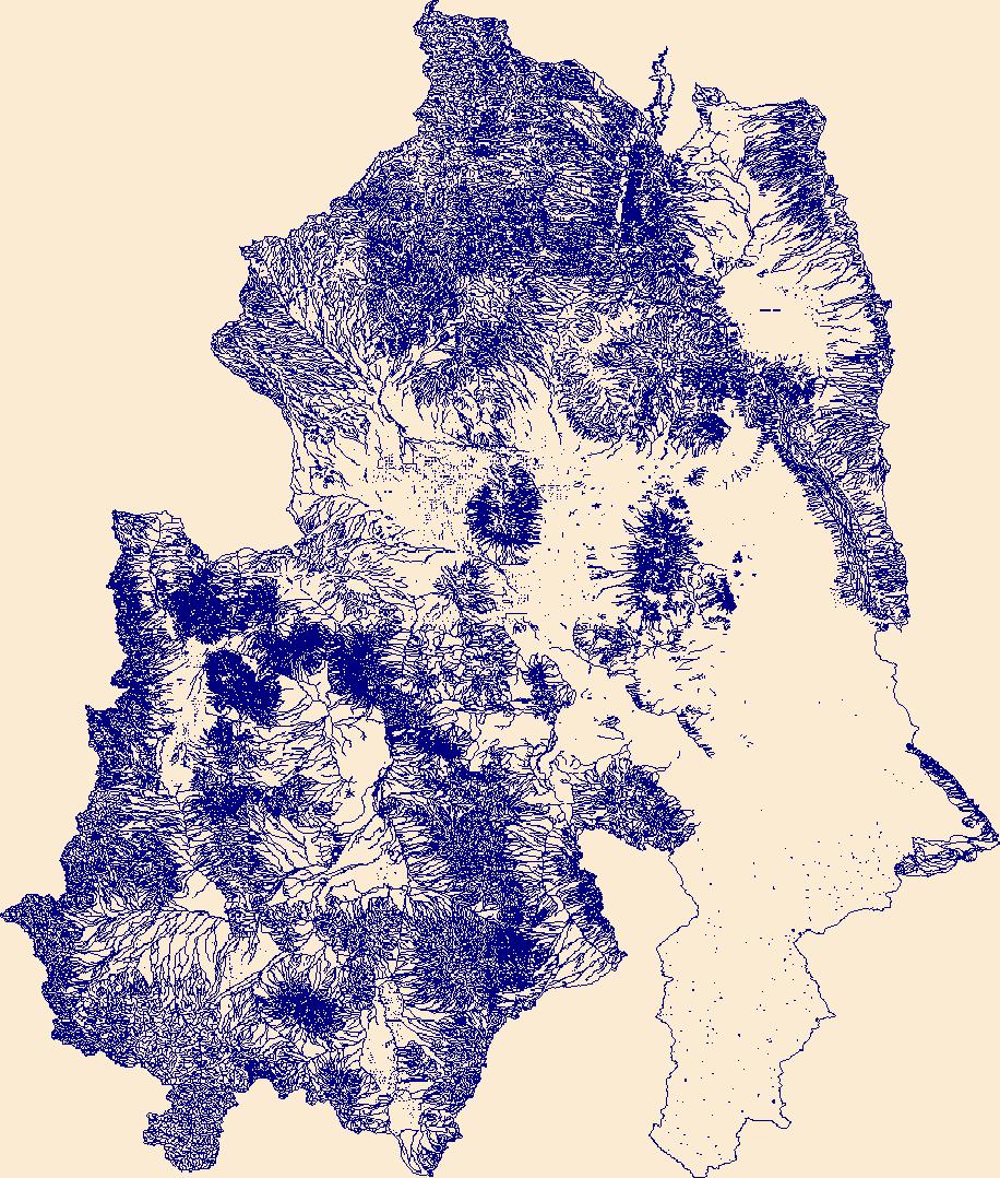
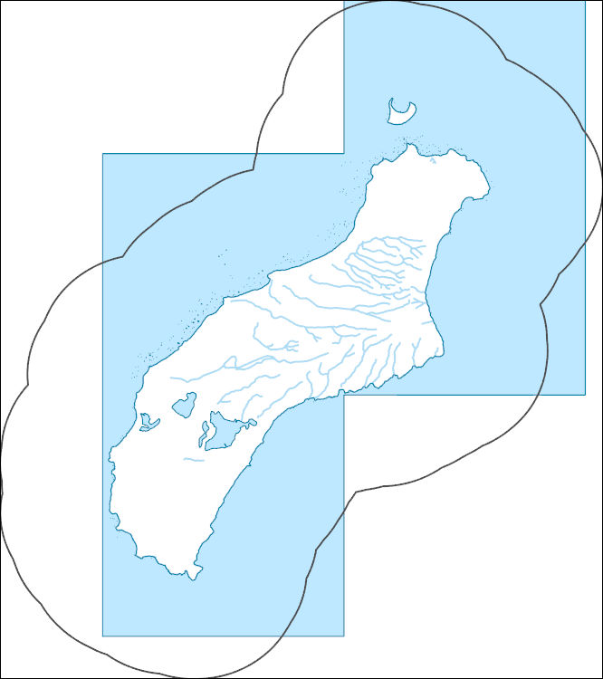
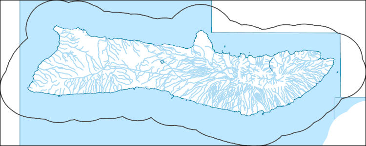
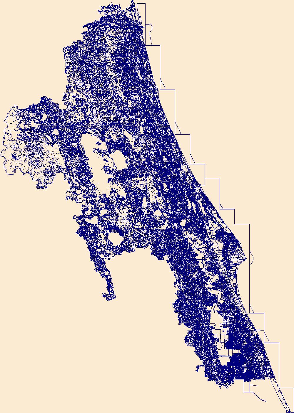
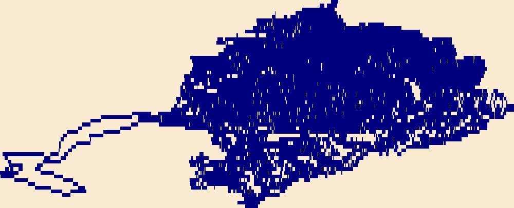
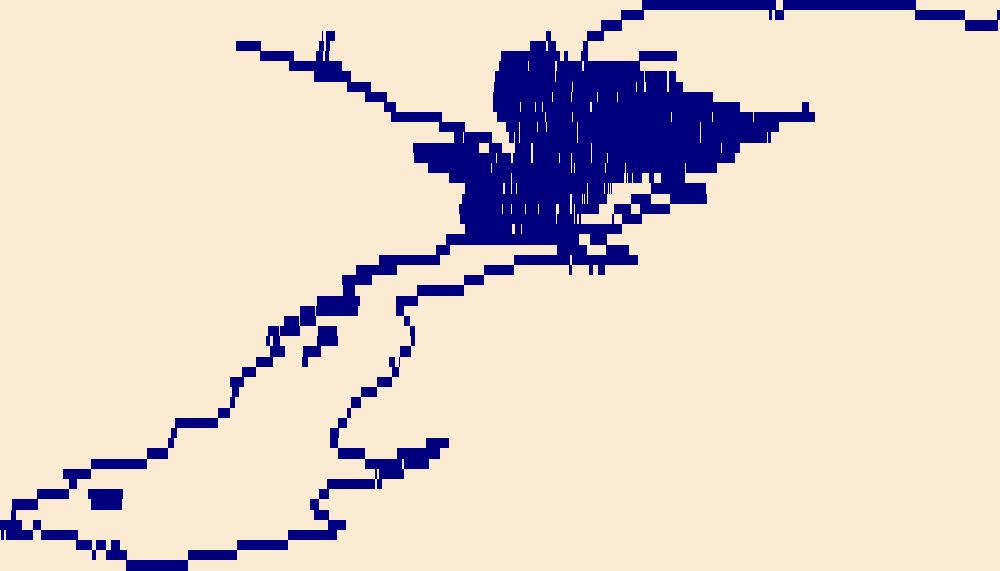
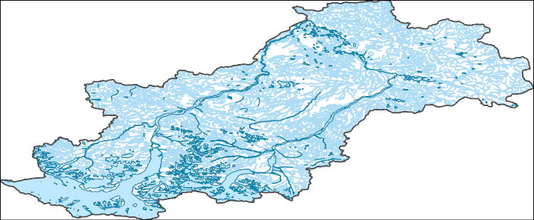
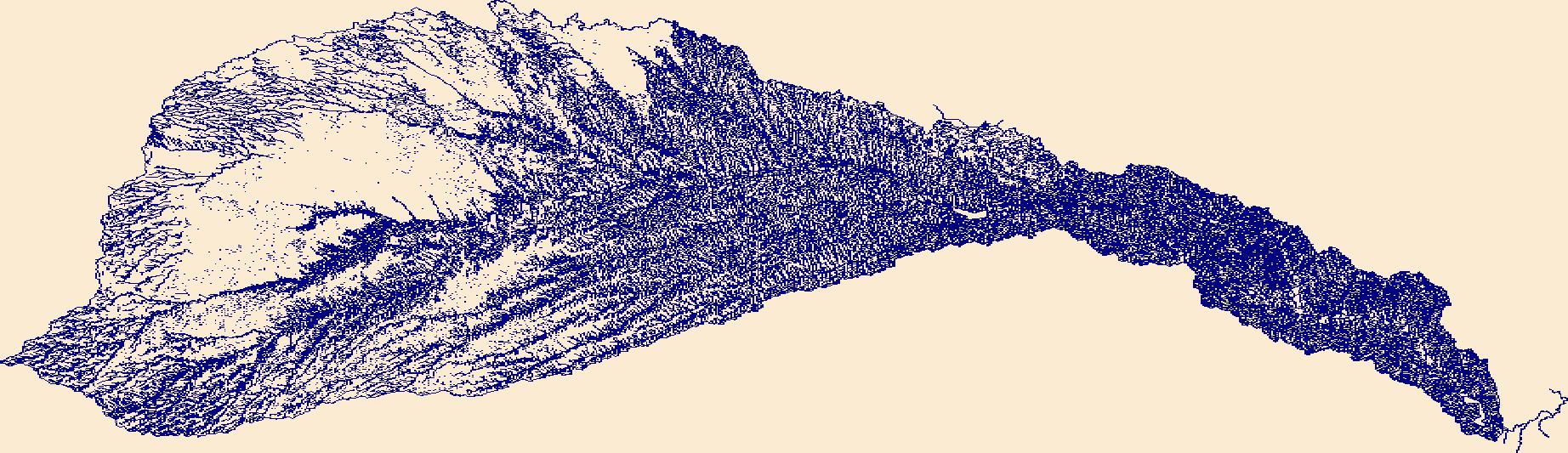
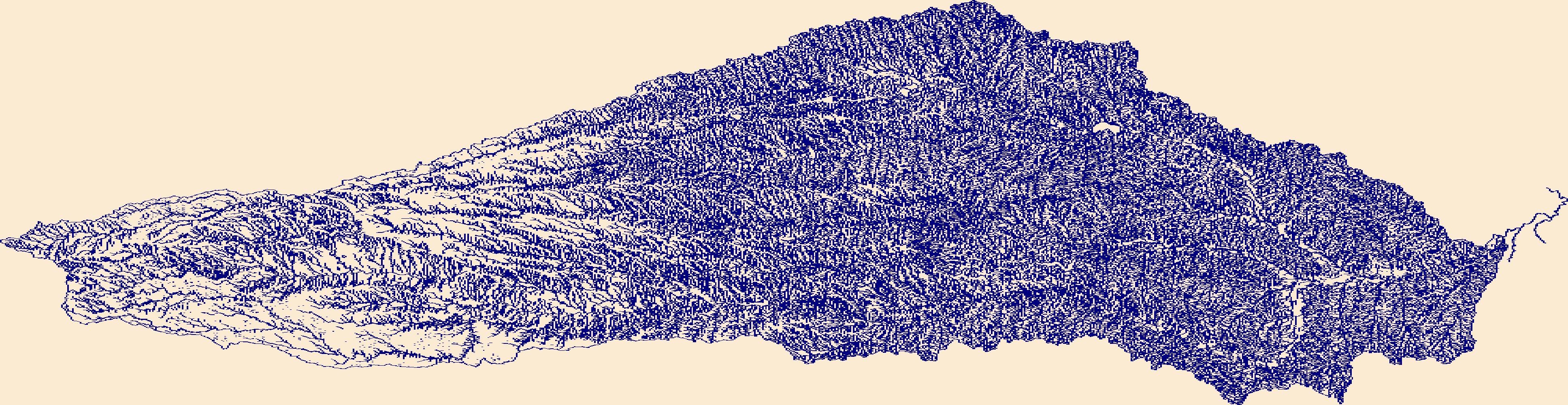
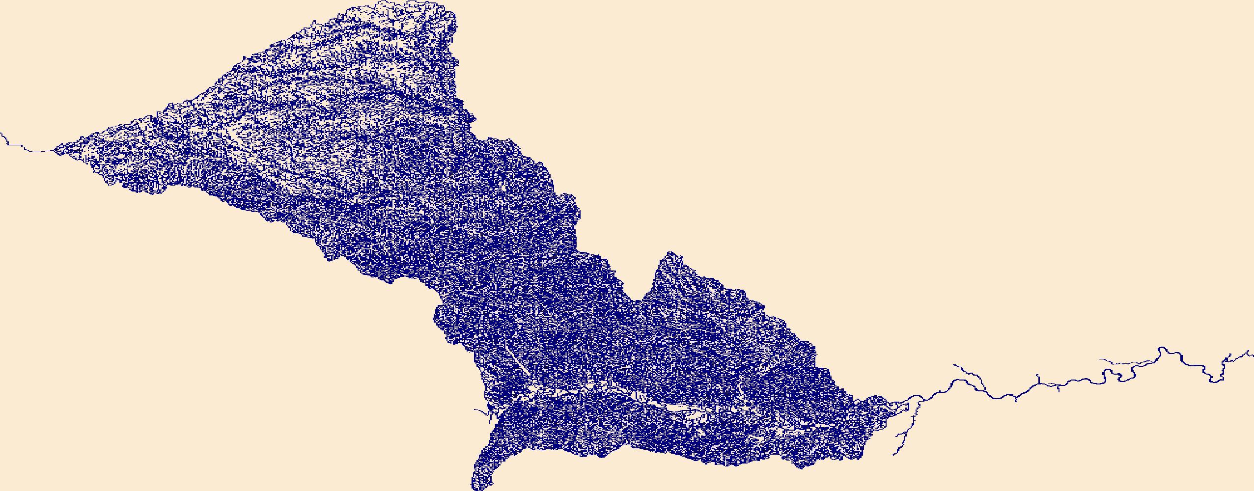
The High Resolution National Hydrography Dataset Plus (NHDPlus HR) is an integrated set of geospatial data layers, including the best available National Hydrography Dataset (NHD), the 10-meter 3D Elevation Program Digital Elevation Model (3DEP DEM), and the National Watershed Boundary Dataset (WBD). The NHDPlus HR combines the NHD, 3DEP DEMs, and WBD to create a stream network with linear referencing, feature naming, "value added attributes" (VAAs), elevation-derived catchments, and other features for hydrologic data analysis. The stream network with linear referencing is a system of data relationships applied to hydrographic systems so that one stream reach "flows" into another and "events" can be tied to and traced...
The High Resolution National Hydrography Dataset Plus (NHDPlus HR) is an integrated set of geospatial data layers, including the best available National Hydrography Dataset (NHD), the 10-meter 3D Elevation Program Digital Elevation Model (3DEP DEM), and the National Watershed Boundary Dataset (WBD). The NHDPlus HR combines the NHD, 3DEP DEMs, and WBD to create a stream network with linear referencing, feature naming, "value added attributes" (VAAs), elevation-derived catchments, and other features for hydrologic data analysis. The stream network with linear referencing is a system of data relationships applied to hydrographic systems so that one stream reach "flows" into another and "events" can be tied to and traced...
The High Resolution National Hydrography Dataset Plus (NHDPlus HR) is an integrated set of geospatial data layers, including the best available National Hydrography Dataset (NHD), the 10-meter 3D Elevation Program Digital Elevation Model (3DEP DEM), and the National Watershed Boundary Dataset (WBD). The NHDPlus HR combines the NHD, 3DEP DEMs, and WBD to create a stream network with linear referencing, feature naming, "value added attributes" (VAAs), elevation-derived catchments, and other features for hydrologic data analysis. The stream network with linear referencing is a system of data relationships applied to hydrographic systems so that one stream reach "flows" into another and "events" can be tied to and traced...
The High Resolution National Hydrography Dataset Plus (NHDPlus HR) is an integrated set of geospatial data layers, including the best available National Hydrography Dataset (NHD), the 10-meter 3D Elevation Program Digital Elevation Model (3DEP DEM), and the National Watershed Boundary Dataset (WBD). The NHDPlus HR combines the NHD, 3DEP DEMs, and WBD to create a stream network with linear referencing, feature naming, "value added attributes" (VAAs), elevation-derived catchments, and other features for hydrologic data analysis. The stream network with linear referencing is a system of data relationships applied to hydrographic systems so that one stream reach "flows" into another and "events" can be tied to and traced...
The High Resolution National Hydrography Dataset Plus (NHDPlus HR) is an integrated set of geospatial data layers, including the best available National Hydrography Dataset (NHD), the 10-meter 3D Elevation Program Digital Elevation Model (3DEP DEM), and the National Watershed Boundary Dataset (WBD). The NHDPlus HR combines the NHD, 3DEP DEMs, and WBD to create a stream network with linear referencing, feature naming, "value added attributes" (VAAs), elevation-derived catchments, and other features for hydrologic data analysis. The stream network with linear referencing is a system of data relationships applied to hydrographic systems so that one stream reach "flows" into another and "events" can be tied to and traced...

The High Resolution National Hydrography Dataset Plus (NHDPlus HR) is an integrated set of geospatial data layers, including the best available National Hydrography Dataset (NHD), the 10-meter 3D Elevation Program Digital Elevation Model (3DEP DEM), and the National Watershed Boundary Dataset (WBD). The NHDPlus HR combines the NHD, 3DEP DEMs, and WBD to create a stream network with linear referencing, feature naming, "value added attributes" (VAAs), elevation-derived catchments, and other features for hydrologic data analysis. The stream network with linear referencing is a system of data relationships applied to hydrographic systems so that one stream reach "flows" into another and "events" can be tied to and traced...
This dataset is a compilation of samples collected from draining mine adits, including water and mineral precipitates, from several mines in California and Colorado. The Golinsky, Copper Bluff, and Afterthought Mines (located in northern California) and the Gold King mine (located in southern Colorado) have historically operated to recover metals including copper, lead, zinc, gold, silver and other resources (Albers and Robertson, 1961; USGS, 2005; USEPA, 2015). Data reported include field parameters, water chemistry, solid phase mineralogy and solid phase chemistry. Water samples collected from the four mine sites in 2019 were analyzed for unfiltered and filtered (0.1-0.45 micrometer) major and trace elements and...
Categories: Data;
Tags: Afterthought Mine,
California,
Colorado,
Copper Bluff Mine,
Environmental Health,
The High Resolution National Hydrography Dataset Plus (NHDPlus HR) is an integrated set of geospatial data layers, including the best available National Hydrography Dataset (NHD), the 10-meter 3D Elevation Program Digital Elevation Model (3DEP DEM), and the National Watershed Boundary Dataset (WBD). The NHDPlus HR combines the NHD, 3DEP DEMs, and WBD to create a stream network with linear referencing, feature naming, "value added attributes" (VAAs), elevation-derived catchments, and other features for hydrologic data analysis. The stream network with linear referencing is a system of data relationships applied to hydrographic systems so that one stream reach "flows" into another and "events" can be tied to and traced...
The High Resolution National Hydrography Dataset Plus (NHDPlus HR) is an integrated set of geospatial data layers, including the best available National Hydrography Dataset (NHD), the 10-meter 3D Elevation Program Digital Elevation Model (3DEP DEM), and the National Watershed Boundary Dataset (WBD). The NHDPlus HR combines the NHD, 3DEP DEMs, and WBD to create a stream network with linear referencing, feature naming, "value added attributes" (VAAs), elevation-derived catchments, and other features for hydrologic data analysis. The stream network with linear referencing is a system of data relationships applied to hydrographic systems so that one stream reach "flows" into another and "events" can be tied to and traced...
The High Resolution National Hydrography Dataset Plus (NHDPlus HR) is an integrated set of geospatial data layers, including the best available National Hydrography Dataset (NHD), the 10-meter 3D Elevation Program Digital Elevation Model (3DEP DEM), and the National Watershed Boundary Dataset (WBD). The NHDPlus HR combines the NHD, 3DEP DEMs, and WBD to create a stream network with linear referencing, feature naming, "value added attributes" (VAAs), elevation-derived catchments, and other features for hydrologic data analysis. The stream network with linear referencing is a system of data relationships applied to hydrographic systems so that one stream reach "flows" into another and "events" can be tied to and traced...

The High Resolution National Hydrography Dataset Plus (NHDPlus HR) is an integrated set of geospatial data layers, including the best available National Hydrography Dataset (NHD), the 10-meter 3D Elevation Program Digital Elevation Model (3DEP DEM), and the National Watershed Boundary Dataset (WBD). The NHDPlus HR combines the NHD, 3DEP DEMs, and WBD to create a stream network with linear referencing, feature naming, "value added attributes" (VAAs), elevation-derived catchments, and other features for hydrologic data analysis. The stream network with linear referencing is a system of data relationships applied to hydrographic systems so that one stream reach "flows" into another and "events" can be tied to and traced...
Digital elevation models (DEMs) were created from aerial imagery collected between September 08 and September 13, 2019, along the North Carolina coast between the Virginia-North Carolina border vicinity and Cape Lookout, North Carolina. These DEMs were created to document ground conditions post-Hurricane Dorian, which made landfall on the North Carolina coast on September 6, 2019. The DEMs help researchers estimate the land surface after Hurricane Dorian and were created to document inter-annual changes in shoreline position and coastal morphology in response to storm events using aerial imagery collections and a structure from motion (SFM) workflow. These data can be used with geographic information systems or...
Digital elevation models (DEMs) were created from aerial imagery collected May 08 and 09, 2020, along the North Carolina coast between the Virginia-North Carolina border vicinity and Cape Lookout, North Carolina. These DEMs were created to document recovery ground conditions after Hurricane Dorian, which made landfall on the North Carolina coast on September 6, 2019. The DEMs help researchers document inter-annual changes in shoreline position and coastal morphology in response to storm events using aerial imagery collections and a structure from motion (SFM) workflow. These data can be used with geographic information systems or other software to identify topographic and shallow-water bathymetric features.
Digital elevation models (DEMs) were created from aerial imagery collected between August 30 and September 2, 2019, along the North Carolina coast between the Virginia-North Carolina border vicinity and Cape Lookout, North Carolina. These DEMs were created to document ground conditions prior to Hurricane Dorian, which made landfall on the North Carolina coast on September 6, 2019. The digital elevation models (DEMs) help researchers estimate the land surface before Hurricane Dorian and were created to document inter-annual changes in shoreline position and coastal morphology in response to storm events using aerial imagery collections and a structure from motion (SFM) workflow. These data can be used with geographic...
Orthoimages were created from aerial imagery collected between August 30 and September 2, 2019, along the North Carolina coast between the Virginia-North Carolina border vicinity and Cape Lookout, North Carolina. These RBG-averaged orthoimages were created to document ground conditions prior to Hurricane Dorian, which made landfall on the North Carolina coast on September 6, 2019. The RBG-averaged orthoimages help researchers estimate the land surface before Hurricane Dorian and were created to document inter-annual changes in shoreline position and coastal morphology in response to storm events using aerial imagery collections and a structure from motion (SFM) workflow. These data can be used with geographic information...
RGB-averaged orthoimages were created from aerial imagery collected February 08 and 09, 2020, along the North Carolina coast between the Virginia-North Carolina border vicinity and Cape Lookout, North Carolina. These RGB-averaged orthoimages were created to document recovery ground conditions after Hurricane Dorian, which made landfall on the North Carolina coast on September 6, 2019. The RGB-averaged orthoimages help researchers document inter-annual changes in shoreline position and coastal morphology in response to storm events using aerial imagery collections and a structure from motion (SFM) workflow. These data can be used with geographic information systems or other software to identify topographic and shallow-water...
This part of the data release presents orthoimagery spanning the ocean shoreline of Alaska from Icy Cape to Cape Prince of Wales. Aerial images were collected, and data were processed, by Fairbanks Fodar (https://www.fairbanksfodar.com) in Fairbanks, Alaska, for the U.S. Geological Survey. The aerial images, from which the orthoimages were created, were collected in 2016 between August 29 and September 4 and extend from the shoreline to 400-4000 meters inland. The aerial images were collected with precise Global Positioning System (GPS) navigation data from a manned aircraft and were then processed into orthoimages photogrammetrically and using structure-from-motion (SFM) processing methods as described in Nolan...
The High Resolution National Hydrography Dataset Plus (NHDPlus HR) is an integrated set of geospatial data layers, including the best available National Hydrography Dataset (NHD), the 10-meter 3D Elevation Program Digital Elevation Model (3DEP DEM), and the National Watershed Boundary Dataset (WBD). The NHDPlus HR combines the NHD, 3DEP DEMs, and WBD to create a stream network with linear referencing, feature naming, "value added attributes" (VAAs), elevation-derived catchments, and other features for hydrologic data analysis. The stream network with linear referencing is a system of data relationships applied to hydrographic systems so that one stream reach "flows" into another and "events" can be tied to and traced...
The High Resolution National Hydrography Dataset Plus (NHDPlus HR) is an integrated set of geospatial data layers, including the best available National Hydrography Dataset (NHD), the 10-meter 3D Elevation Program Digital Elevation Model (3DEP DEM), and the National Watershed Boundary Dataset (WBD). The NHDPlus HR combines the NHD, 3DEP DEMs, and WBD to create a stream network with linear referencing, feature naming, "value added attributes" (VAAs), elevation-derived catchments, and other features for hydrologic data analysis. The stream network with linear referencing is a system of data relationships applied to hydrographic systems so that one stream reach "flows" into another and "events" can be tied to and traced...
The High Resolution National Hydrography Dataset Plus (NHDPlus HR) is an integrated set of geospatial data layers, including the best available National Hydrography Dataset (NHD), the 10-meter 3D Elevation Program Digital Elevation Model (3DEP DEM), and the National Watershed Boundary Dataset (WBD). The NHDPlus HR combines the NHD, 3DEP DEMs, and WBD to create a stream network with linear referencing, feature naming, "value added attributes" (VAAs), elevation-derived catchments, and other features for hydrologic data analysis. The stream network with linear referencing is a system of data relationships applied to hydrographic systems so that one stream reach "flows" into another and "events" can be tied to and traced...
|

|
