Filters
Date Range
Contacts
Tag Types
Tag Schemes
|
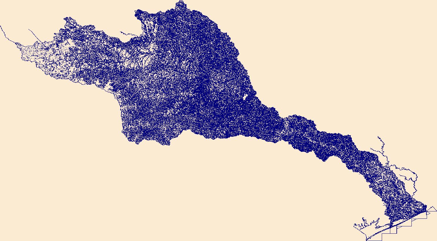
The High Resolution National Hydrography Dataset Plus (NHDPlus HR) is an integrated set of geospatial data layers, including the best available National Hydrography Dataset (NHD), the 10-meter 3D Elevation Program Digital Elevation Model (3DEP DEM), and the National Watershed Boundary Dataset (WBD). The NHDPlus HR combines the NHD, 3DEP DEMs, and WBD to create a stream network with linear referencing, feature naming, "value added attributes" (VAAs), elevation-derived catchments, and other features for hydrologic data analysis. The stream network with linear referencing is a system of data relationships applied to hydrographic systems so that one stream reach "flows" into another and "events" can be tied to and traced...
Tags: Austin County,
Bastrop County,
Blanco County,
Brazoria County,
Brown County, All tags...
Burnet County,
Caldwell County,
Callahan County,
Coke County,
Coleman County,
Colorado County,
Comanche County,
Concho County,
Crockett County,
Downloadable Data,
Eastland County,
Edwards County,
Fayette County,
FileGDB,
FileGDB 10.1,
Fort Bend County,
Gillespie County,
Glasscock County,
HU-4 Subregion,
HU-4 Subregion,
HU4_1209,
Hays County,
Howard County,
Hydrography,
Irion County,
Kendall County,
Kerr County,
Kimble County,
Lampasas County,
Lee County,
Llano County,
Mason County,
Matagorda County,
McCulloch County,
Menard County,
Midland County,
Mills County,
NHDPlus HR Rasters,
NHDPlus High Resolution (NHDPlus HR),
National Hydrography Dataset (NHD),
National Hydrography Dataset Plus High Resolution (NHDPlus HR),
National Hydrography Dataset Plus High Resolution (NHDPlus HR) Current,
Nolan County,
Reagan County,
Real County,
Runnels County,
San Saba County,
Schleicher County,
Sterling County,
Sutton County,
TX,
Taylor County,
Texas,
Tom Green County,
Travis County,
US,
United States,
Upton County,
Washington County,
Wharton County,
Williamson County,
base maps,
cartography,
catchments,
channels,
digital elevation models,
drainage basins,
earth sciences,
elevation,
environment,
geographic information systems,
geoscientific,
geospatial analysis,
hydrographic datasets,
hydrographic features,
hydrology,
imagery,
inland waters,
lakes,
land surface characteristics,
reservoirs,
river reaches,
rivers,
streamflow,
streamflow data,
streams,
topography,
water bodies,
water quality,
water resources,
watersheds, Fewer tags
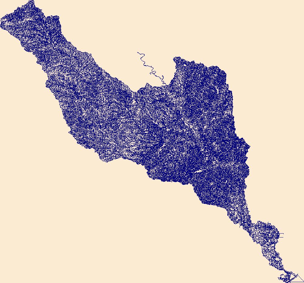
The High Resolution National Hydrography Dataset Plus (NHDPlus HR) is an integrated set of geospatial data layers, including the best available National Hydrography Dataset (NHD), the 10-meter 3D Elevation Program Digital Elevation Model (3DEP DEM), and the National Watershed Boundary Dataset (WBD). The NHDPlus HR combines the NHD, 3DEP DEMs, and WBD to create a stream network with linear referencing, feature naming, "value added attributes" (VAAs), elevation-derived catchments, and other features for hydrologic data analysis. The stream network with linear referencing is a system of data relationships applied to hydrographic systems so that one stream reach "flows" into another and "events" can be tied to and traced...
Tags: Austin County,
Bastrop County,
Bell County,
Brazoria County,
Brazos County, All tags...
Brown County,
Burleson County,
Burnet County,
Callahan County,
Comanche County,
Coryell County,
Downloadable Data,
Eastland County,
Erath County,
Falls County,
Fayette County,
FileGDB,
FileGDB 10.1,
Fort Bend County,
Freestone County,
Grimes County,
HU-4 Subregion,
HU-4 Subregion,
HU4_1207,
Hamilton County,
Harris County,
Hill County,
Hydrography,
Lampasas County,
Lee County,
Leon County,
Limestone County,
Madison County,
McLennan County,
Milam County,
Mills County,
NHDPlus HR Rasters,
NHDPlus High Resolution (NHDPlus HR),
National Hydrography Dataset (NHD),
National Hydrography Dataset Plus High Resolution (NHDPlus HR),
National Hydrography Dataset Plus High Resolution (NHDPlus HR) Current,
Robertson County,
Stephens County,
TX,
Texas,
Travis County,
US,
United States,
Waller County,
Washington County,
Williamson County,
base maps,
cartography,
catchments,
channels,
digital elevation models,
drainage basins,
earth sciences,
elevation,
environment,
geographic information systems,
geoscientific,
geospatial analysis,
hydrographic datasets,
hydrographic features,
hydrology,
imagery,
inland waters,
lakes,
land surface characteristics,
reservoirs,
river reaches,
rivers,
streamflow,
streamflow data,
streams,
topography,
water bodies,
water quality,
water resources,
watersheds, Fewer tags
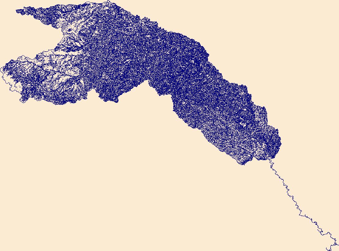
The High Resolution National Hydrography Dataset Plus (NHDPlus HR) is an integrated set of geospatial data layers, including the best available National Hydrography Dataset (NHD), the 10-meter 3D Elevation Program Digital Elevation Model (3DEP DEM), and the National Watershed Boundary Dataset (WBD). The NHDPlus HR combines the NHD, 3DEP DEMs, and WBD to create a stream network with linear referencing, feature naming, "value added attributes" (VAAs), elevation-derived catchments, and other features for hydrologic data analysis. The stream network with linear referencing is a system of data relationships applied to hydrographic systems so that one stream reach "flows" into another and "events" can be tied to and traced...
Tags: Archer County,
Baylor County,
Bosque County,
Callahan County,
Coryell County, All tags...
Dickens County,
Downloadable Data,
Eastland County,
Erath County,
Falls County,
FileGDB,
FileGDB 10.1,
Fisher County,
HU-4 Subregion,
HU-4 Subregion,
HU4_1206,
Hamilton County,
Haskell County,
Hill County,
Hood County,
Hydrography,
Jack County,
Johnson County,
Jones County,
King County,
Knox County,
Limestone County,
McLennan County,
Mitchell County,
NHDPlus HR Rasters,
NHDPlus High Resolution (NHDPlus HR),
National Hydrography Dataset (NHD),
National Hydrography Dataset Plus High Resolution (NHDPlus HR),
National Hydrography Dataset Plus High Resolution (NHDPlus HR) Current,
Nolan County,
Palo Pinto County,
Parker County,
Scurry County,
Shackelford County,
Somervell County,
Stephens County,
Stonewall County,
TX,
Taylor County,
Texas,
Throckmorton County,
US,
United States,
Young County,
base maps,
cartography,
catchments,
channels,
digital elevation models,
drainage basins,
earth sciences,
elevation,
environment,
geographic information systems,
geoscientific,
geospatial analysis,
hydrographic datasets,
hydrographic features,
hydrology,
imagery,
inland waters,
lakes,
land surface characteristics,
reservoirs,
river reaches,
rivers,
streamflow,
streamflow data,
streams,
topography,
water bodies,
water quality,
water resources,
watersheds, Fewer tags
|
|

