Filters
Date Types (for Date Range)
Contacts
(Less)
Tag Types
Tag Schemes
|
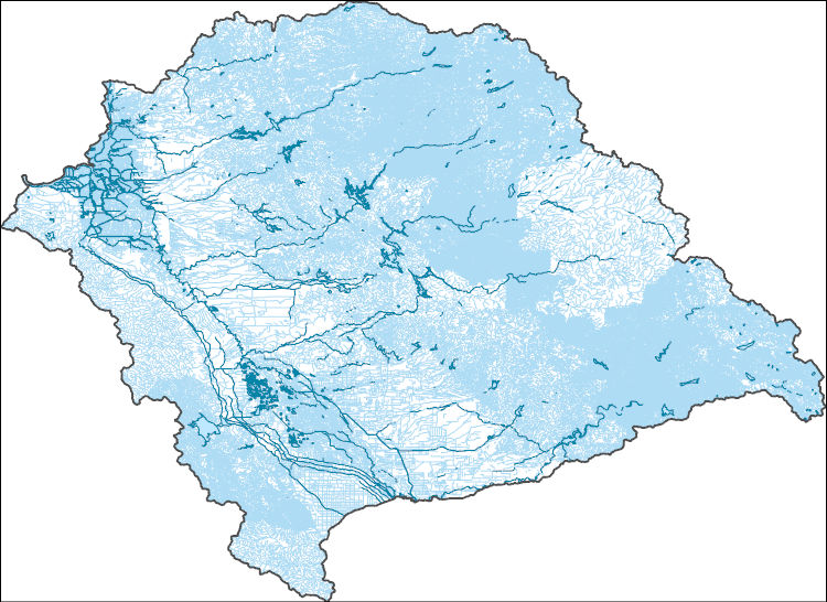
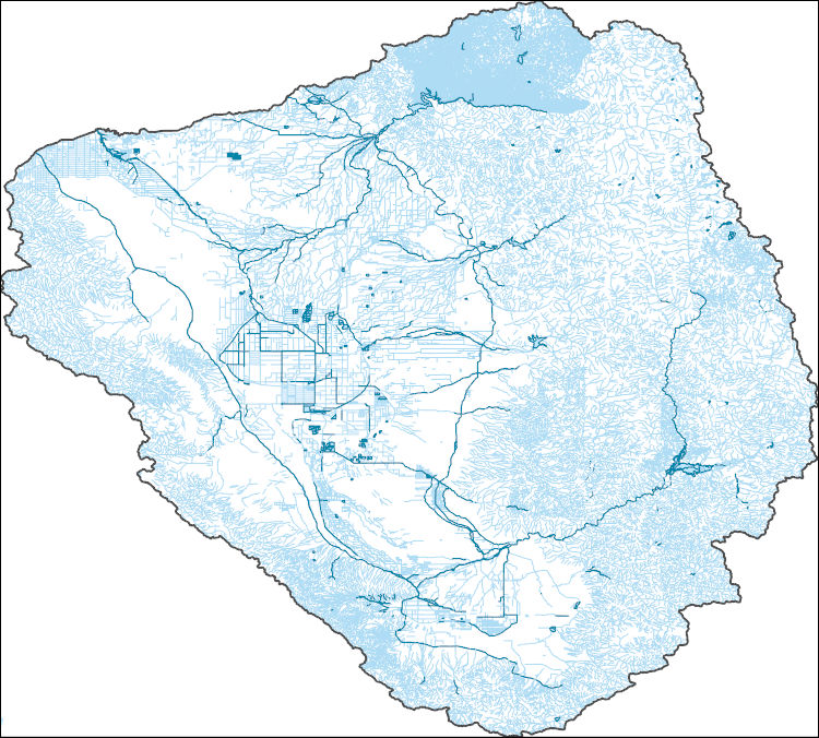
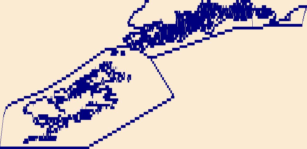
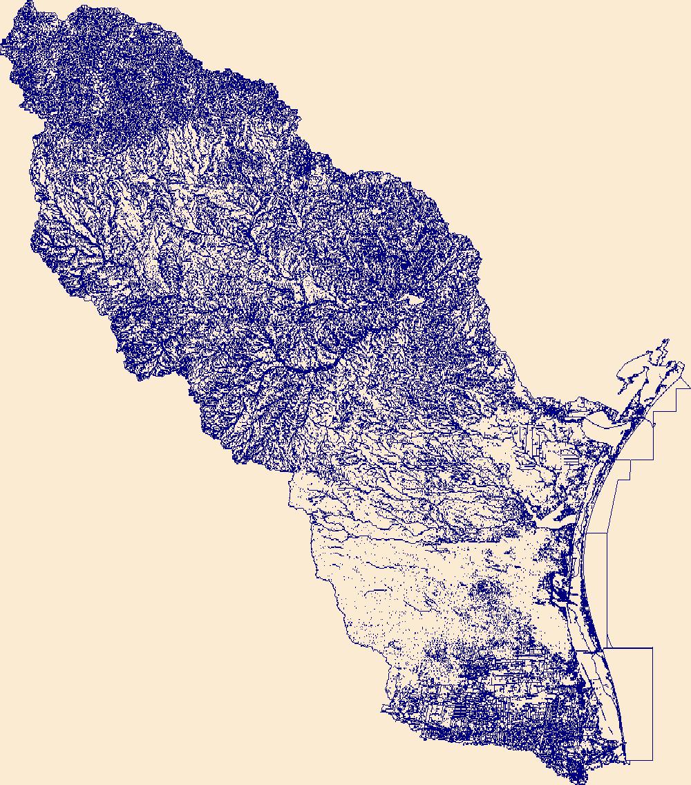
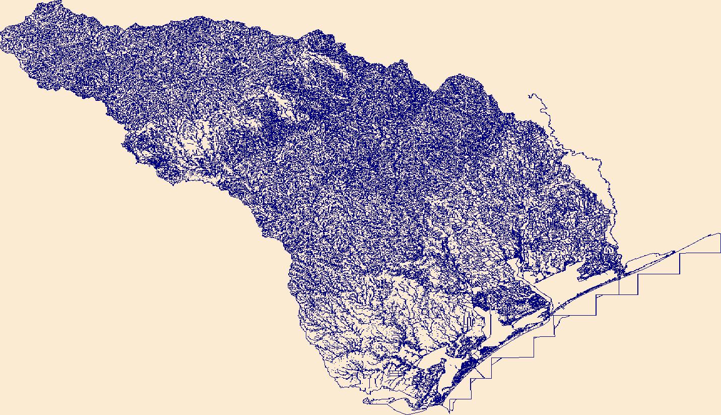
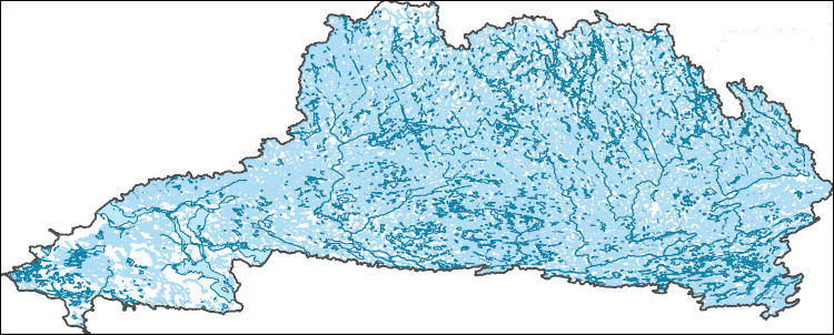
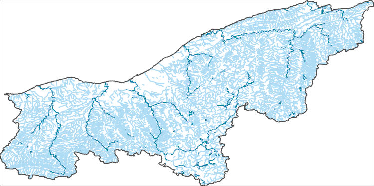
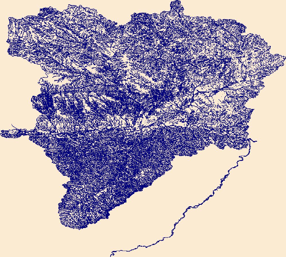
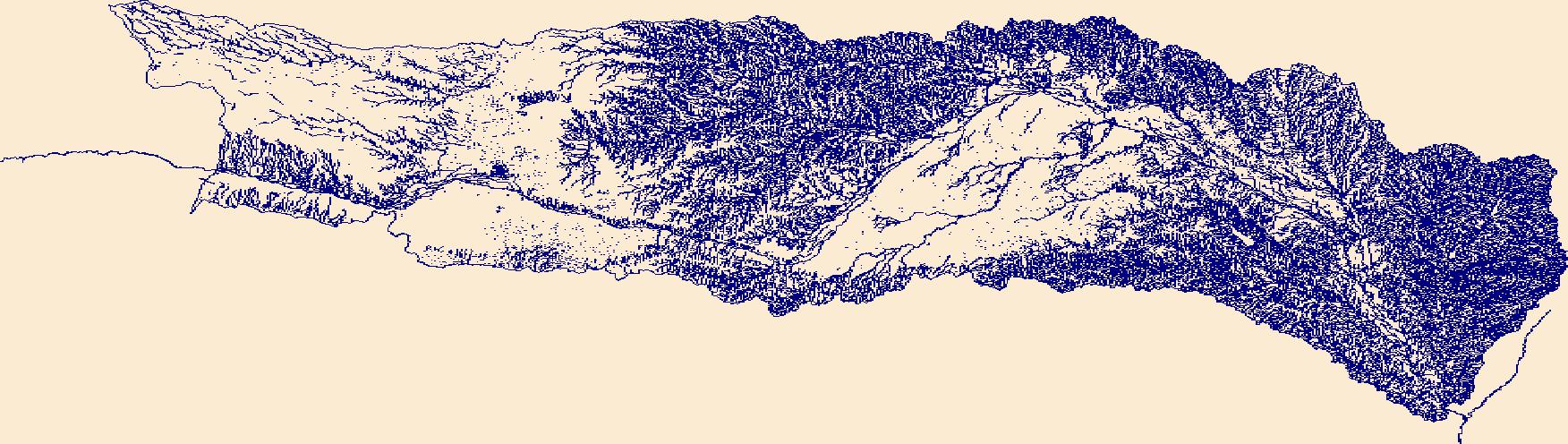
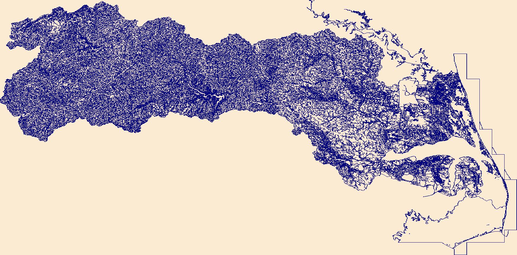
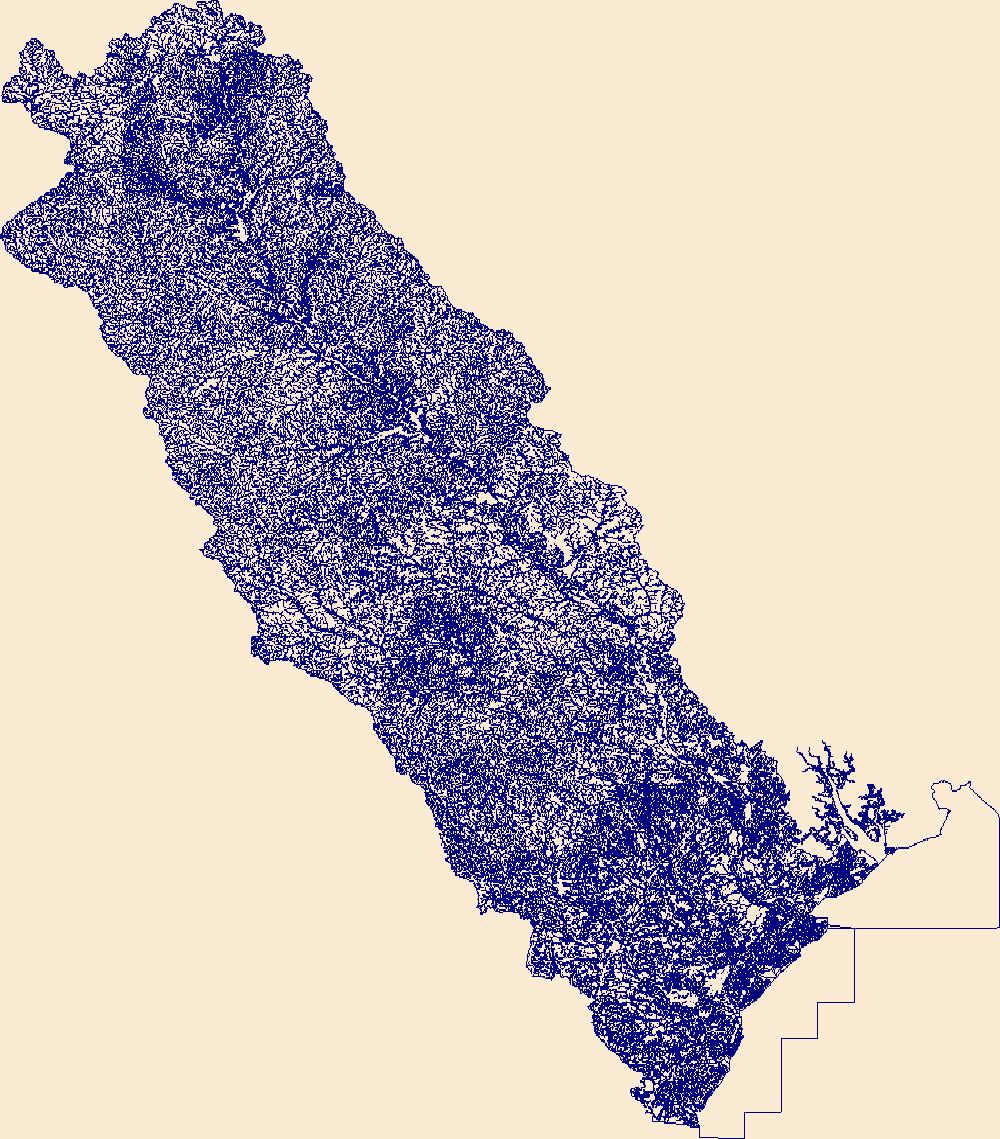
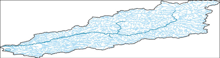
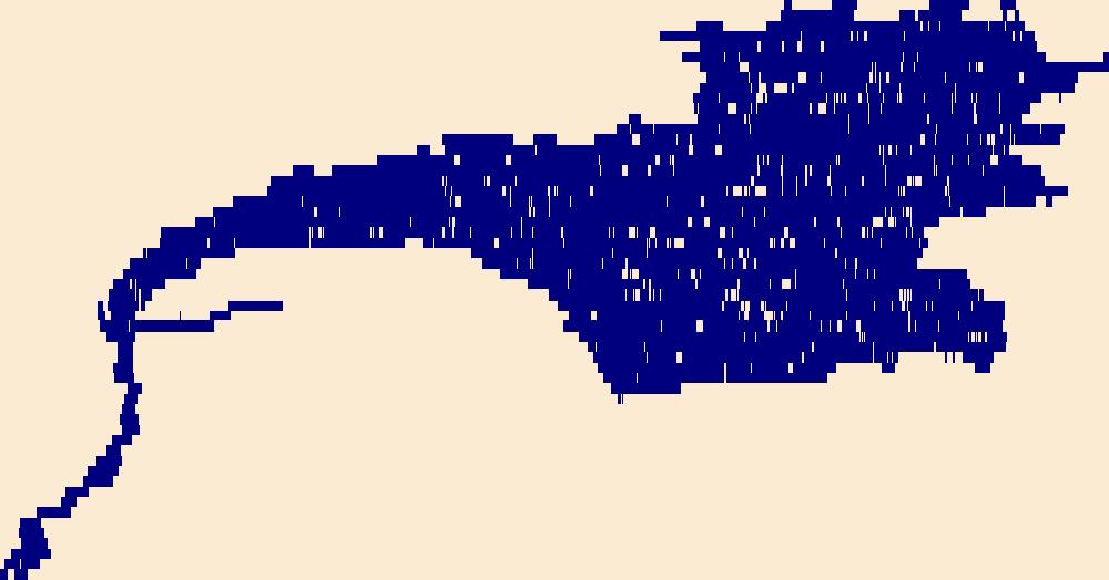
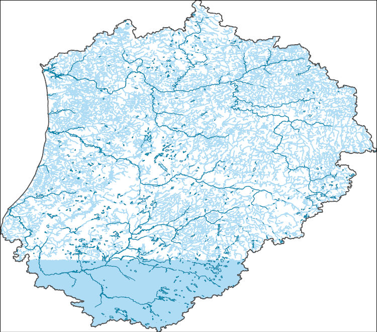
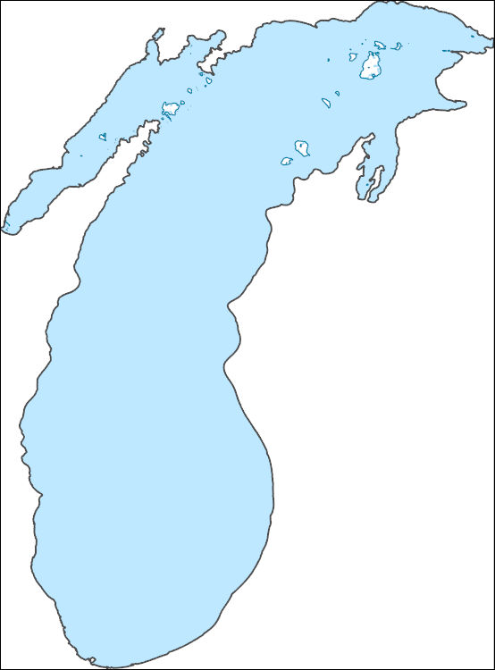
The High Resolution National Hydrography Dataset Plus (NHDPlus HR) is an integrated set of geospatial data layers, including the best available National Hydrography Dataset (NHD), the 10-meter 3D Elevation Program Digital Elevation Model (3DEP DEM), and the National Watershed Boundary Dataset (WBD). The NHDPlus HR combines the NHD, 3DEP DEMs, and WBD to create a stream network with linear referencing, feature naming, "value added attributes" (VAAs), elevation-derived catchments, and other features for hydrologic data analysis. The stream network with linear referencing is a system of data relationships applied to hydrographic systems so that one stream reach "flows" into another and "events" can be tied to and traced...
Tags: Alameda County,
Alpine County,
Amador County,
CA,
Calaveras County, All tags...
California,
Contra Costa County,
Downloadable Data,
El Dorado County,
FileGDB,
FileGDB 10.1,
Fresno County,
HU-4 Subregion,
HU-4 Subregion,
HU4_1804,
Hydrography,
Inyo County,
Madera County,
Mariposa County,
Merced County,
Mono County,
NHDPlus HR Rasters,
NHDPlus High Resolution (NHDPlus HR),
National Hydrography Dataset (NHD),
National Hydrography Dataset Plus High Resolution (NHDPlus HR),
National Hydrography Dataset Plus High Resolution (NHDPlus HR) Current,
Sacramento County,
San Benito County,
San Joaquin County,
Santa Clara County,
Stanislaus County,
Tuolumne County,
US,
United States,
base maps,
cartography,
catchments,
channels,
digital elevation models,
drainage basins,
earth sciences,
elevation,
environment,
geographic information systems,
geoscientific,
geospatial analysis,
hydrographic datasets,
hydrographic features,
hydrology,
imagery,
inland waters,
lakes,
land surface characteristics,
reservoirs,
river reaches,
rivers,
streamflow,
streamflow data,
streams,
topography,
water bodies,
water quality,
water resources,
watersheds, Fewer tags
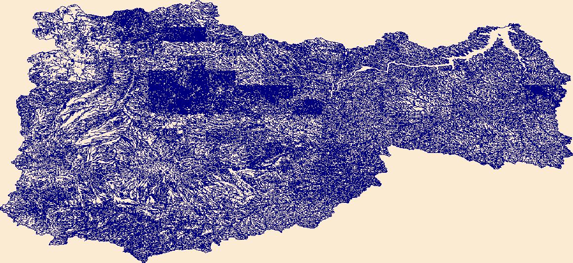
The High Resolution National Hydrography Dataset Plus (NHDPlus HR) is an integrated set of geospatial data layers, including the best available National Hydrography Dataset (NHD), the 10-meter 3D Elevation Program Digital Elevation Model (3DEP DEM), and the National Watershed Boundary Dataset (WBD). The NHDPlus HR combines the NHD, 3DEP DEMs, and WBD to create a stream network with linear referencing, feature naming, "value added attributes" (VAAs), elevation-derived catchments, and other features for hydrologic data analysis. The stream network with linear referencing is a system of data relationships applied to hydrographic systems so that one stream reach "flows" into another and "events" can be tied to and traced...
Tags: CA,
California,
Downloadable Data,
FileGDB,
FileGDB 10.1, All tags...
Fresno County,
HU-4 Subregion,
HU-4 Subregion,
HU4_1803,
Hydrography,
Inyo County,
Kern County,
Kings County,
Los Angeles County,
Monterey County,
NHDPlus HR Rasters,
NHDPlus High Resolution (NHDPlus HR),
National Hydrography Dataset (NHD),
National Hydrography Dataset Plus High Resolution (NHDPlus HR),
National Hydrography Dataset Plus High Resolution (NHDPlus HR) Current,
San Benito County,
San Luis Obispo County,
Tulare County,
US,
United States,
Ventura County,
base maps,
cartography,
catchments,
channels,
digital elevation models,
drainage basins,
earth sciences,
elevation,
environment,
geographic information systems,
geoscientific,
geospatial analysis,
hydrographic datasets,
hydrographic features,
hydrology,
imagery,
inland waters,
lakes,
land surface characteristics,
reservoirs,
river reaches,
rivers,
streamflow,
streamflow data,
streams,
topography,
water bodies,
water quality,
water resources,
watersheds, Fewer tags
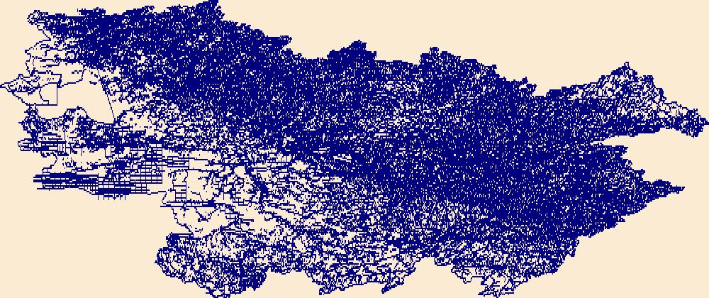
The High Resolution National Hydrography Dataset Plus (NHDPlus HR) is an integrated set of geospatial data layers, including the best available National Hydrography Dataset (NHD), the 10-meter 3D Elevation Program Digital Elevation Model (3DEP DEM), and the National Watershed Boundary Dataset (WBD). The NHDPlus HR combines the NHD, 3DEP DEMs, and WBD to create a stream network with linear referencing, feature naming, "value added attributes" (VAAs), elevation-derived catchments, and other features for hydrologic data analysis. The stream network with linear referencing is a system of data relationships applied to hydrographic systems so that one stream reach "flows" into another and "events" can be tied to and traced...
Tags: AK,
Alaska,
Downloadable Data,
FileGDB,
FileGDB 10.1, All tags...
HU-8 Subbasin,
HU-8 Subbasin,
HU8_19020202,
Hydrography,
Kenai Peninsula County,
NHDPlus HR Rasters,
NHDPlus High Resolution (NHDPlus HR),
National Hydrography Dataset (NHD),
National Hydrography Dataset Plus High Resolution (NHDPlus HR),
National Hydrography Dataset Plus High Resolution (NHDPlus HR) Current,
US,
United States,
Valdez-Cordova County,
base maps,
cartography,
catchments,
channels,
digital elevation models,
drainage basins,
earth sciences,
elevation,
environment,
geographic information systems,
geoscientific,
geospatial analysis,
hydrographic datasets,
hydrographic features,
hydrology,
imagery,
inland waters,
lakes,
land surface characteristics,
reservoirs,
river reaches,
rivers,
streamflow,
streamflow data,
streams,
topography,
water bodies,
water quality,
water resources,
watersheds, Fewer tags
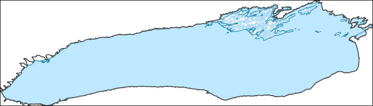
The High Resolution National Hydrography Dataset Plus (NHDPlus HR) is an integrated set of geospatial data layers, including the best available National Hydrography Dataset (NHD), the 10-meter 3D Elevation Program Digital Elevation Model (3DEP DEM), and the National Watershed Boundary Dataset (WBD). The NHDPlus HR combines the NHD, 3DEP DEMs, and WBD to create a stream network with linear referencing, feature naming, "value added attributes" (VAAs), elevation-derived catchments, and other features for hydrologic data analysis. The stream network with linear referencing is a system of data relationships applied to hydrographic systems so that one stream reach "flows" into another and "events" can be tied to and traced...
Tags: Aransas County,
Atascosa County,
Bandera County,
Bee County,
Bexar County, All tags...
Brooks County,
Cameron County,
Dimmit County,
Downloadable Data,
Duval County,
Edwards County,
FileGDB,
FileGDB 10.1,
Frio County,
HU-4 Subregion,
HU-4 Subregion,
HU4_1211,
Hidalgo County,
Hydrography,
Jim Hogg County,
Jim Wells County,
Karnes County,
Kenedy County,
Kerr County,
Kinney County,
Kleberg County,
La Salle County,
Live Oak County,
Maverick County,
McMullen County,
Medina County,
NHDPlus HR Rasters,
NHDPlus High Resolution (NHDPlus HR),
National Hydrography Dataset (NHD),
National Hydrography Dataset Plus High Resolution (NHDPlus HR),
National Hydrography Dataset Plus High Resolution (NHDPlus HR) Current,
Nueces County,
Real County,
San Patricio County,
Starr County,
TX,
Texas,
US,
United States,
Uvalde County,
Webb County,
Willacy County,
Wilson County,
Zavala County,
base maps,
cartography,
catchments,
channels,
digital elevation models,
drainage basins,
earth sciences,
elevation,
environment,
geographic information systems,
geoscientific,
geospatial analysis,
hydrographic datasets,
hydrographic features,
hydrology,
imagery,
inland waters,
lakes,
land surface characteristics,
reservoirs,
river reaches,
rivers,
streamflow,
streamflow data,
streams,
topography,
water bodies,
water quality,
water resources,
watersheds, Fewer tags
The High Resolution National Hydrography Dataset Plus (NHDPlus HR) is an integrated set of geospatial data layers, including the best available National Hydrography Dataset (NHD), the 10-meter 3D Elevation Program Digital Elevation Model (3DEP DEM), and the National Watershed Boundary Dataset (WBD). The NHDPlus HR combines the NHD, 3DEP DEMs, and WBD to create a stream network with linear referencing, feature naming, "value added attributes" (VAAs), elevation-derived catchments, and other features for hydrologic data analysis. The stream network with linear referencing is a system of data relationships applied to hydrographic systems so that one stream reach "flows" into another and "events" can be tied to and traced...
Tags: Aransas County,
Atascosa County,
Bandera County,
Bastrop County,
Bee County, All tags...
Bexar County,
Blanco County,
Caldwell County,
Calhoun County,
Colorado County,
Comal County,
DeWitt County,
Downloadable Data,
Fayette County,
FileGDB,
FileGDB 10.1,
Gillespie County,
Goliad County,
Gonzales County,
Guadalupe County,
HU-4 Subregion,
HU-4 Subregion,
HU4_1210,
Hays County,
Hydrography,
Jackson County,
Karnes County,
Kendall County,
Kerr County,
Lavaca County,
Live Oak County,
Matagorda County,
Medina County,
NHDPlus HR Rasters,
NHDPlus High Resolution (NHDPlus HR),
National Hydrography Dataset (NHD),
National Hydrography Dataset Plus High Resolution (NHDPlus HR),
National Hydrography Dataset Plus High Resolution (NHDPlus HR) Current,
Nueces County,
Real County,
Refugio County,
San Patricio County,
TX,
Texas,
Travis County,
US,
United States,
Victoria County,
Wharton County,
Wilson County,
base maps,
cartography,
catchments,
channels,
digital elevation models,
drainage basins,
earth sciences,
elevation,
environment,
geographic information systems,
geoscientific,
geospatial analysis,
hydrographic datasets,
hydrographic features,
hydrology,
imagery,
inland waters,
lakes,
land surface characteristics,
reservoirs,
river reaches,
rivers,
streamflow,
streamflow data,
streams,
topography,
water bodies,
water quality,
water resources,
watersheds, Fewer tags
The High Resolution National Hydrography Dataset Plus (NHDPlus HR) is an integrated set of geospatial data layers, including the best available National Hydrography Dataset (NHD), the 10-meter 3D Elevation Program Digital Elevation Model (3DEP DEM), and the National Watershed Boundary Dataset (WBD). The NHDPlus HR combines the NHD, 3DEP DEMs, and WBD to create a stream network with linear referencing, feature naming, "value added attributes" (VAAs), elevation-derived catchments, and other features for hydrologic data analysis. The stream network with linear referencing is a system of data relationships applied to hydrographic systems so that one stream reach "flows" into another and "events" can be tied to and traced...
Tags: Chippewa County,
Downloadable Data,
FileGDB,
FileGDB 10.1,
HU-4 Subregion, All tags...
HU-4 Subregion,
HU4_0420,
Hydrography,
MI,
Mackinac County,
Michigan,
NHDPlus HR Rasters,
NHDPlus High Resolution (NHDPlus HR),
National Hydrography Dataset (NHD),
National Hydrography Dataset Plus High Resolution (NHDPlus HR),
National Hydrography Dataset Plus High Resolution (NHDPlus HR) Current,
US,
United States,
base maps,
cartography,
catchments,
channels,
digital elevation models,
drainage basins,
earth sciences,
elevation,
environment,
geographic information systems,
geoscientific,
geospatial analysis,
hydrographic datasets,
hydrographic features,
hydrology,
imagery,
inland waters,
lakes,
land surface characteristics,
reservoirs,
river reaches,
rivers,
streamflow,
streamflow data,
streams,
topography,
water bodies,
water quality,
water resources,
watersheds, Fewer tags
The High Resolution National Hydrography Dataset Plus (NHDPlus HR) is an integrated set of geospatial data layers, including the best available National Hydrography Dataset (NHD), the 10-meter 3D Elevation Program Digital Elevation Model (3DEP DEM), and the National Watershed Boundary Dataset (WBD). The NHDPlus HR combines the NHD, 3DEP DEMs, and WBD to create a stream network with linear referencing, feature naming, "value added attributes" (VAAs), elevation-derived catchments, and other features for hydrologic data analysis. The stream network with linear referencing is a system of data relationships applied to hydrographic systems so that one stream reach "flows" into another and "events" can be tied to and traced...
Tags: Ashland County,
Ashtabula County,
Crawford County,
Cuyahoga County,
Downloadable Data, All tags...
Erie County,
Erie County,
FileGDB,
FileGDB 10.1,
Geauga County,
HU-4 Subregion,
HU-4 Subregion,
HU4_0411,
Huron County,
Hydrography,
Lake County,
Lorain County,
Medina County,
NHDPlus HR Rasters,
NHDPlus High Resolution (NHDPlus HR),
National Hydrography Dataset (NHD),
National Hydrography Dataset Plus High Resolution (NHDPlus HR),
National Hydrography Dataset Plus High Resolution (NHDPlus HR) Current,
OH,
Ohio,
PA,
Pennsylvania,
Portage County,
Stark County,
Summit County,
Trumbull County,
US,
United States,
base maps,
cartography,
catchments,
channels,
digital elevation models,
drainage basins,
earth sciences,
elevation,
environment,
geographic information systems,
geoscientific,
geospatial analysis,
hydrographic datasets,
hydrographic features,
hydrology,
imagery,
inland waters,
lakes,
land surface characteristics,
reservoirs,
river reaches,
rivers,
streamflow,
streamflow data,
streams,
topography,
water bodies,
water quality,
water resources,
watersheds, Fewer tags
The High Resolution National Hydrography Dataset Plus (NHDPlus HR) is an integrated set of geospatial data layers, including the best available National Hydrography Dataset (NHD), the 10-meter 3D Elevation Program Digital Elevation Model (3DEP DEM), and the National Watershed Boundary Dataset (WBD). The NHDPlus HR combines the NHD, 3DEP DEMs, and WBD to create a stream network with linear referencing, feature naming, "value added attributes" (VAAs), elevation-derived catchments, and other features for hydrologic data analysis. The stream network with linear referencing is a system of data relationships applied to hydrographic systems so that one stream reach "flows" into another and "events" can be tied to and traced...
Tags: DanielsCounty,
DawsonCounty,
DivideCounty,
Downloadable Data,
FileGDB, All tags...
FileGDB 10.1,
HU-4 Subregion,
HU-4 Subregion,
Hydrography,
MT,
McConeCounty,
McKenzieCounty,
Montana,
NHDPlus HR Rasters,
NHDPlus High Resolution (NHDPlus HR),
National Hydrography Dataset (NHD),
National Hydrography Dataset Plus High Resolution (NHDPlus HR),
National Hydrography Dataset Plus High Resolution (NHDPlus HR) Current,
PrairieCounty,
RichlandCounty,
RooseveltCounty,
SheridanCounty,
US,
United States,
ValleyCounty,
WilliamsCounty,
base maps,
cartography,
catchments,
channels,
digital elevation models,
drainage basins,
earth sciences,
elevation,
environment,
geographic information systems,
geoscientific,
geospatial analysis,
hydrographic datasets,
hydrographic features,
hydrology,
imagery,
inland waters,
lakes,
land surface characteristics,
reservoirs,
river reaches,
rivers,
streamflow,
streamflow data,
streams,
topography,
water bodies,
water quality,
water resources,
watersheds, Fewer tags
The High Resolution National Hydrography Dataset Plus (NHDPlus HR) is an integrated set of geospatial data layers, including the best available National Hydrography Dataset (NHD), the 10-meter 3D Elevation Program Digital Elevation Model (3DEP DEM), and the National Watershed Boundary Dataset (WBD). The NHDPlus HR combines the NHD, 3DEP DEMs, and WBD to create a stream network with linear referencing, feature naming, "value added attributes" (VAAs), elevation-derived catchments, and other features for hydrologic data analysis. The stream network with linear referencing is a system of data relationships applied to hydrographic systems so that one stream reach "flows" into another and "events" can be tied to and traced...
Tags: Barton County,
Butler County,
CO,
Chase County,
Cheyenne County, All tags...
Clark County,
Colorado,
Cowley County,
Downloadable Data,
Edwards County,
Ellsworth County,
FileGDB,
FileGDB 10.1,
Finney County,
Ford County,
Grant County,
Gray County,
Greeley County,
Greenwood County,
HU-4 Subregion,
HU-4 Subregion,
HU4_1103,
Hamilton County,
Harvey County,
Haskell County,
Hodgeman County,
Hydrography,
KS,
Kansas,
Kearny County,
Kingman County,
Kiowa County,
Kiowa County,
Lane County,
Marion County,
McPherson County,
NHDPlus HR Rasters,
NHDPlus High Resolution (NHDPlus HR),
National Hydrography Dataset (NHD),
National Hydrography Dataset Plus High Resolution (NHDPlus HR),
National Hydrography Dataset Plus High Resolution (NHDPlus HR) Current,
Ness County,
Pawnee County,
Pratt County,
Prowers County,
Reno County,
Rice County,
Rush County,
Scott County,
Sedgwick County,
Stafford County,
Sumner County,
US,
United States,
Wichita County,
base maps,
cartography,
catchments,
channels,
digital elevation models,
drainage basins,
earth sciences,
elevation,
environment,
geographic information systems,
geoscientific,
geospatial analysis,
hydrographic datasets,
hydrographic features,
hydrology,
imagery,
inland waters,
lakes,
land surface characteristics,
reservoirs,
river reaches,
rivers,
streamflow,
streamflow data,
streams,
topography,
water bodies,
water quality,
water resources,
watersheds, Fewer tags
The High Resolution National Hydrography Dataset Plus (NHDPlus HR) is an integrated set of geospatial data layers, including the best available National Hydrography Dataset (NHD), the 10-meter 3D Elevation Program Digital Elevation Model (3DEP DEM), and the National Watershed Boundary Dataset (WBD). The NHDPlus HR combines the NHD, 3DEP DEMs, and WBD to create a stream network with linear referencing, feature naming, "value added attributes" (VAAs), elevation-derived catchments, and other features for hydrologic data analysis. The stream network with linear referencing is a system of data relationships applied to hydrographic systems so that one stream reach "flows" into another and "events" can be tied to and traced...
Tags: BlaineCounty,
CascadeCounty,
ChouteauCounty,
CusterCounty,
Downloadable Data, All tags...
FergusCounty,
FileGDB,
FileGDB 10.1,
GarfieldCounty,
Golden ValleyCounty,
HU-4 Subregion,
HU-4 Subregion,
HillCounty,
Hydrography,
Judith BasinCounty,
MT,
McConeCounty,
MeagherCounty,
Montana,
MusselshellCounty,
NHDPlus HR Rasters,
NHDPlus High Resolution (NHDPlus HR),
National Hydrography Dataset (NHD),
National Hydrography Dataset Plus High Resolution (NHDPlus HR),
National Hydrography Dataset Plus High Resolution (NHDPlus HR) Current,
ParkCounty,
PetroleumCounty,
PhillipsCounty,
PrairieCounty,
RosebudCounty,
StillwaterCounty,
Sweet GrassCounty,
US,
United States,
ValleyCounty,
WheatlandCounty,
YellowstoneCounty,
base maps,
cartography,
catchments,
channels,
digital elevation models,
drainage basins,
earth sciences,
elevation,
environment,
geographic information systems,
geoscientific,
geospatial analysis,
hydrographic datasets,
hydrographic features,
hydrology,
imagery,
inland waters,
lakes,
land surface characteristics,
reservoirs,
river reaches,
rivers,
streamflow,
streamflow data,
streams,
topography,
water bodies,
water quality,
water resources,
watersheds, Fewer tags
The High Resolution National Hydrography Dataset Plus (NHDPlus HR) is an integrated set of geospatial data layers, including the best available National Hydrography Dataset (NHD), the 10-meter 3D Elevation Program Digital Elevation Model (3DEP DEM), and the National Watershed Boundary Dataset (WBD). The NHDPlus HR combines the NHD, 3DEP DEMs, and WBD to create a stream network with linear referencing, feature naming, "value added attributes" (VAAs), elevation-derived catchments, and other features for hydrologic data analysis. The stream network with linear referencing is a system of data relationships applied to hydrographic systems so that one stream reach "flows" into another and "events" can be tied to and traced...
Tags: BeltramiCounty,
CookCounty,
Downloadable Data,
FileGDB,
FileGDB 10.1, All tags...
HU-4 Subregion,
HU-4 Subregion,
Hydrography,
ItascaCounty,
KoochichingCounty,
Lake of the WoodsCounty,
LakeCounty,
MN,
Minnesota,
NHDPlus HR Rasters,
NHDPlus High Resolution (NHDPlus HR),
National Hydrography Dataset (NHD),
National Hydrography Dataset Plus High Resolution (NHDPlus HR),
National Hydrography Dataset Plus High Resolution (NHDPlus HR) Current,
RoseauCounty,
St. LouisCounty,
US,
United States,
base maps,
cartography,
catchments,
channels,
digital elevation models,
drainage basins,
earth sciences,
elevation,
environment,
geographic information systems,
geoscientific,
geospatial analysis,
hydrographic datasets,
hydrographic features,
hydrology,
imagery,
inland waters,
lakes,
land surface characteristics,
reservoirs,
river reaches,
rivers,
streamflow,
streamflow data,
streams,
topography,
water bodies,
water quality,
water resources,
watersheds, Fewer tags
The High Resolution National Hydrography Dataset Plus (NHDPlus HR) is an integrated set of geospatial data layers, including the best available National Hydrography Dataset (NHD), the 10-meter 3D Elevation Program Digital Elevation Model (3DEP DEM), and the National Watershed Boundary Dataset (WBD). The NHDPlus HR combines the NHD, 3DEP DEMs, and WBD to create a stream network with linear referencing, feature naming, "value added attributes" (VAAs), elevation-derived catchments, and other features for hydrologic data analysis. The stream network with linear referencing is a system of data relationships applied to hydrographic systems so that one stream reach "flows" into another and "events" can be tied to and traced...
Tags: Cayuga County,
Downloadable Data,
FileGDB,
FileGDB 10.1,
HU-4 Subregion, All tags...
HU-4 Subregion,
HU4_0428,
Hydrography,
Jefferson County,
Monroe County,
NHDPlus HR Rasters,
NHDPlus High Resolution (NHDPlus HR),
NY,
National Hydrography Dataset (NHD),
National Hydrography Dataset Plus High Resolution (NHDPlus HR),
National Hydrography Dataset Plus High Resolution (NHDPlus HR) Current,
New York,
Niagara County,
Orleans County,
Oswego County,
US,
United States,
Wayne County,
base maps,
cartography,
catchments,
channels,
digital elevation models,
drainage basins,
earth sciences,
elevation,
environment,
geographic information systems,
geoscientific,
geospatial analysis,
hydrographic datasets,
hydrographic features,
hydrology,
imagery,
inland waters,
lakes,
land surface characteristics,
reservoirs,
river reaches,
rivers,
streamflow,
streamflow data,
streams,
topography,
water bodies,
water quality,
water resources,
watersheds, Fewer tags
The High Resolution National Hydrography Dataset Plus (NHDPlus HR) is an integrated set of geospatial data layers, including the best available National Hydrography Dataset (NHD), the 10-meter 3D Elevation Program Digital Elevation Model (3DEP DEM), and the National Watershed Boundary Dataset (WBD). The NHDPlus HR combines the NHD, 3DEP DEMs, and WBD to create a stream network with linear referencing, feature naming, "value added attributes" (VAAs), elevation-derived catchments, and other features for hydrologic data analysis. The stream network with linear referencing is a system of data relationships applied to hydrographic systems so that one stream reach "flows" into another and "events" can be tied to and traced...
Tags: AlamanceCounty,
AppomattoxCounty,
BeaufortCounty,
BedfordCounty,
BertieCounty, All tags...
BotetourtCounty,
BrunswickCounty,
CamdenCounty,
CampbellCounty,
CarrollCounty,
CaswellCounty,
CharlotteCounty,
ChesapeakeCounty,
ChowanCounty,
CraigCounty,
CurrituckCounty,
DanvilleCounty,
DareCounty,
DinwiddieCounty,
Downloadable Data,
EdgecombeCounty,
EmporiaCounty,
FileGDB,
FileGDB 10.1,
FloydCounty,
ForsythCounty,
FranklinCounty,
FranklinCounty,
GatesCounty,
GranvilleCounty,
GreensvilleCounty,
GuilfordCounty,
HU-4 Subregion,
HU-4 Subregion,
HalifaxCounty,
HalifaxCounty,
HenryCounty,
HertfordCounty,
HydeCounty,
Hydrography,
Isle of WightCounty,
LunenburgCounty,
MartinCounty,
MartinsvilleCounty,
MecklenburgCounty,
MontgomeryCounty,
NC,
NHDPlus HR Rasters,
NHDPlus High Resolution (NHDPlus HR),
National Hydrography Dataset (NHD),
National Hydrography Dataset Plus High Resolution (NHDPlus HR),
National Hydrography Dataset Plus High Resolution (NHDPlus HR) Current,
North Carolina,
NorthamptonCounty,
NottowayCounty,
OrangeCounty,
PasquotankCounty,
PatrickCounty,
PerquimansCounty,
PersonCounty,
PetersburgCounty,
PittsylvaniaCounty,
Prince EdwardCounty,
Prince GeorgeCounty,
RoanokeCounty,
RoanokeCounty,
RockinghamCounty,
SalemCounty,
SouthamptonCounty,
StokesCounty,
SuffolkCounty,
SurryCounty,
SurryCounty,
SussexCounty,
TyrrellCounty,
US,
United States,
VanceCounty,
Virginia BeachCounty,
WarrenCounty,
WashingtonCounty,
base maps,
cartography,
catchments,
channels,
digital elevation models,
drainage basins,
earth sciences,
elevation,
environment,
geographic information systems,
geoscientific,
geospatial analysis,
hydrographic datasets,
hydrographic features,
hydrology,
imagery,
inland waters,
lakes,
land surface characteristics,
reservoirs,
river reaches,
rivers,
streamflow,
streamflow data,
streams,
topography,
water bodies,
water quality,
water resources,
watersheds, Fewer tags
The High Resolution National Hydrography Dataset Plus (NHDPlus HR) is an integrated set of geospatial data layers, including the best available National Hydrography Dataset (NHD), the 10-meter 3D Elevation Program Digital Elevation Model (3DEP DEM), and the National Watershed Boundary Dataset (WBD). The NHDPlus HR combines the NHD, 3DEP DEMs, and WBD to create a stream network with linear referencing, feature naming, "value added attributes" (VAAs), elevation-derived catchments, and other features for hydrologic data analysis. The stream network with linear referencing is a system of data relationships applied to hydrographic systems so that one stream reach "flows" into another and "events" can be tied to and traced...
Tags: Abbeville County,
Aiken County,
Allendale County,
Anderson County,
Banks County, All tags...
Barnwell County,
Beaufort County,
Bryan County,
Bulloch County,
Burke County,
Candler County,
Chatham County,
Clarke County,
Clay County,
Columbia County,
Downloadable Data,
Edgefield County,
Effingham County,
Elbert County,
Emanuel County,
Evans County,
FileGDB,
FileGDB 10.1,
Franklin County,
GA,
Georgia,
Glascock County,
Greene County,
Greenwood County,
HU-4 Subregion,
HU-4 Subregion,
HU4_0306,
Habersham County,
Hall County,
Hampton County,
Hancock County,
Hart County,
Hydrography,
Jackson County,
Jackson County,
Jasper County,
Jefferson County,
Jenkins County,
Johnson County,
Liberty County,
Lincoln County,
Long County,
Macon County,
Madison County,
McCormick County,
McDuffie County,
McIntosh County,
NC,
NHDPlus HR Rasters,
NHDPlus High Resolution (NHDPlus HR),
National Hydrography Dataset (NHD),
National Hydrography Dataset Plus High Resolution (NHDPlus HR),
National Hydrography Dataset Plus High Resolution (NHDPlus HR) Current,
North Carolina,
Oconee County,
Oglethorpe County,
Pickens County,
Rabun County,
Richmond County,
SC,
Saluda County,
Screven County,
South Carolina,
Stephens County,
Taliaferro County,
Tattnall County,
Towns County,
Transylvania County,
US,
United States,
Warren County,
Washington County,
Wilkes County,
base maps,
cartography,
catchments,
channels,
digital elevation models,
drainage basins,
earth sciences,
elevation,
environment,
geographic information systems,
geoscientific,
geospatial analysis,
hydrographic datasets,
hydrographic features,
hydrology,
imagery,
inland waters,
lakes,
land surface characteristics,
reservoirs,
river reaches,
rivers,
streamflow,
streamflow data,
streams,
topography,
water bodies,
water quality,
water resources,
watersheds, Fewer tags
The High Resolution National Hydrography Dataset Plus (NHDPlus HR) is an integrated set of geospatial data layers, including the best available National Hydrography Dataset (NHD), the 10-meter 3D Elevation Program Digital Elevation Model (3DEP DEM), and the National Watershed Boundary Dataset (WBD). The NHDPlus HR combines the NHD, 3DEP DEMs, and WBD to create a stream network with linear referencing, feature naming, "value added attributes" (VAAs), elevation-derived catchments, and other features for hydrologic data analysis. The stream network with linear referencing is a system of data relationships applied to hydrographic systems so that one stream reach "flows" into another and "events" can be tied to and traced...
Tags: AK,
Alaska,
Downloadable Data,
Fairbanks North Star County,
FileGDB, All tags...
FileGDB 10.1,
HU-8 Subbasin,
HU-8 Subbasin,
HU8_19080305,
Hydrography,
NHDPlus HR Rasters,
NHDPlus High Resolution (NHDPlus HR),
National Hydrography Dataset (NHD),
National Hydrography Dataset Plus High Resolution (NHDPlus HR),
National Hydrography Dataset Plus High Resolution (NHDPlus HR) Current,
Southeast Fairbanks County,
US,
United States,
Yukon-Koyukuk County,
base maps,
cartography,
catchments,
channels,
digital elevation models,
drainage basins,
earth sciences,
elevation,
environment,
geographic information systems,
geoscientific,
geospatial analysis,
hydrographic datasets,
hydrographic features,
hydrology,
imagery,
inland waters,
lakes,
land surface characteristics,
reservoirs,
river reaches,
rivers,
streamflow,
streamflow data,
streams,
topography,
water bodies,
water quality,
water resources,
watersheds, Fewer tags
The High Resolution National Hydrography Dataset Plus (NHDPlus HR) is an integrated set of geospatial data layers, including the best available National Hydrography Dataset (NHD), the 10-meter 3D Elevation Program Digital Elevation Model (3DEP DEM), and the National Watershed Boundary Dataset (WBD). The NHDPlus HR combines the NHD, 3DEP DEMs, and WBD to create a stream network with linear referencing, feature naming, "value added attributes" (VAAs), elevation-derived catchments, and other features for hydrologic data analysis. The stream network with linear referencing is a system of data relationships applied to hydrographic systems so that one stream reach "flows" into another and "events" can be tied to and traced...
Tags: AK,
Alaska,
Denali County,
Downloadable Data,
FileGDB, All tags...
FileGDB 10.1,
HU-8 Subbasin,
HU-8 Subbasin,
HU8_19020501,
Hydrography,
Matanuska-Susitna County,
NHDPlus HR Rasters,
NHDPlus High Resolution (NHDPlus HR),
National Hydrography Dataset (NHD),
National Hydrography Dataset Plus High Resolution (NHDPlus HR),
National Hydrography Dataset Plus High Resolution (NHDPlus HR) Current,
Southeast Fairbanks County,
US,
United States,
Valdez-Cordova County,
base maps,
cartography,
catchments,
channels,
digital elevation models,
drainage basins,
earth sciences,
elevation,
environment,
geographic information systems,
geoscientific,
geospatial analysis,
hydrographic datasets,
hydrographic features,
hydrology,
imagery,
inland waters,
lakes,
land surface characteristics,
reservoirs,
river reaches,
rivers,
streamflow,
streamflow data,
streams,
topography,
water bodies,
water quality,
water resources,
watersheds, Fewer tags
The High Resolution National Hydrography Dataset Plus (NHDPlus HR) is an integrated set of geospatial data layers, including the best available National Hydrography Dataset (NHD), the 10-meter 3D Elevation Program Digital Elevation Model (3DEP DEM), and the National Watershed Boundary Dataset (WBD). The NHDPlus HR combines the NHD, 3DEP DEMs, and WBD to create a stream network with linear referencing, feature naming, "value added attributes" (VAAs), elevation-derived catchments, and other features for hydrologic data analysis. The stream network with linear referencing is a system of data relationships applied to hydrographic systems so that one stream reach "flows" into another and "events" can be tied to and traced...
Tags: Allegan County,
Barry County,
Berrien County,
Branch County,
Calhoun County, All tags...
Cass County,
Clinton County,
DeKalb County,
Downloadable Data,
Eaton County,
Elkhart County,
FileGDB,
FileGDB 10.1,
Gratiot County,
HU-4 Subregion,
HU-4 Subregion,
HU4_0405,
Hillsdale County,
Hydrography,
IN,
Indiana,
Ingham County,
Ionia County,
Isabella County,
Jackson County,
Kalamazoo County,
Kent County,
Kosciusko County,
LaGrange County,
Livingston County,
MI,
Mecosta County,
Michigan,
Montcalm County,
Muskegon County,
NHDPlus HR Rasters,
NHDPlus High Resolution (NHDPlus HR),
National Hydrography Dataset (NHD),
National Hydrography Dataset Plus High Resolution (NHDPlus HR),
National Hydrography Dataset Plus High Resolution (NHDPlus HR) Current,
Newaygo County,
Noble County,
Ottawa County,
Shiawassee County,
St. Joseph County,
St. Joseph County,
Steuben County,
US,
United States,
Van Buren County,
Washtenaw County,
Whitley County,
base maps,
cartography,
catchments,
channels,
digital elevation models,
drainage basins,
earth sciences,
elevation,
environment,
geographic information systems,
geoscientific,
geospatial analysis,
hydrographic datasets,
hydrographic features,
hydrology,
imagery,
inland waters,
lakes,
land surface characteristics,
reservoirs,
river reaches,
rivers,
streamflow,
streamflow data,
streams,
topography,
water bodies,
water quality,
water resources,
watersheds, Fewer tags

The High Resolution National Hydrography Dataset Plus (NHDPlus HR) is an integrated set of geospatial data layers, including the best available National Hydrography Dataset (NHD), the 10-meter 3D Elevation Program Digital Elevation Model (3DEP DEM), and the National Watershed Boundary Dataset (WBD). The NHDPlus HR combines the NHD, 3DEP DEMs, and WBD to create a stream network with linear referencing, feature naming, "value added attributes" (VAAs), elevation-derived catchments, and other features for hydrologic data analysis. The stream network with linear referencing is a system of data relationships applied to hydrographic systems so that one stream reach "flows" into another and "events" can be tied to and traced...
Tags: AR,
Arkansas,
Ashley County,
Avoyelles County,
Bienville County, All tags...
Bradley County,
Caldwell County,
Calhoun County,
Catahoula County,
Chicot County,
Claiborne County,
Clark County,
Cleveland County,
Columbia County,
Concordia County,
Dallas County,
Desha County,
Downloadable Data,
Drew County,
FileGDB,
FileGDB 10.1,
Garland County,
Grant County,
Grant County,
HU-4 Subregion,
HU-4 Subregion,
HU4_0804,
Hempstead County,
Hot Spring County,
Howard County,
Hydrography,
Jackson County,
Jefferson County,
LA,
LaSalle County,
Lincoln County,
Lincoln County,
Louisiana,
Montgomery County,
Morehouse County,
NHDPlus HR Rasters,
NHDPlus High Resolution (NHDPlus HR),
National Hydrography Dataset (NHD),
National Hydrography Dataset Plus High Resolution (NHDPlus HR),
National Hydrography Dataset Plus High Resolution (NHDPlus HR) Current,
Nevada County,
Ouachita County,
Ouachita County,
Perry County,
Pike County,
Pointe Coupee County,
Polk County,
Pulaski County,
Rapides County,
Saline County,
Scott County,
Tensas County,
US,
Union County,
Union County,
United States,
West Feliciana County,
Winn County,
Yell County,
base maps,
cartography,
catchments,
channels,
digital elevation models,
drainage basins,
earth sciences,
elevation,
environment,
geographic information systems,
geoscientific,
geospatial analysis,
hydrographic datasets,
hydrographic features,
hydrology,
imagery,
inland waters,
lakes,
land surface characteristics,
reservoirs,
river reaches,
rivers,
streamflow,
streamflow data,
streams,
topography,
water bodies,
water quality,
water resources,
watersheds, Fewer tags
The High Resolution National Hydrography Dataset Plus (NHDPlus HR) is an integrated set of geospatial data layers, including the best available National Hydrography Dataset (NHD), the 10-meter 3D Elevation Program Digital Elevation Model (3DEP DEM), and the National Watershed Boundary Dataset (WBD). The NHDPlus HR combines the NHD, 3DEP DEMs, and WBD to create a stream network with linear referencing, feature naming, "value added attributes" (VAAs), elevation-derived catchments, and other features for hydrologic data analysis. The stream network with linear referencing is a system of data relationships applied to hydrographic systems so that one stream reach "flows" into another and "events" can be tied to and traced...
Tags: Allegan County,
Antrim County,
Benzie County,
Berrien County,
Brown County, All tags...
Charlevoix County,
Cheboygan County,
Cook County,
Delta County,
Door County,
Downloadable Data,
Emmet County,
FileGDB,
FileGDB 10.1,
Grand Traverse County,
HU-4 Subregion,
HU-4 Subregion,
HU4_0419,
Hydrography,
IL,
IN,
Illinois,
Indiana,
Kenosha County,
Kewaunee County,
LaPorte County,
Lake County,
Lake County,
Leelanau County,
MI,
Mackinac County,
Manistee County,
Manitowoc County,
Marinette County,
Mason County,
Menominee County,
Michigan,
Milwaukee County,
Muskegon County,
NHDPlus HR Rasters,
NHDPlus High Resolution (NHDPlus HR),
National Hydrography Dataset (NHD),
National Hydrography Dataset Plus High Resolution (NHDPlus HR),
National Hydrography Dataset Plus High Resolution (NHDPlus HR) Current,
Oceana County,
Oconto County,
Ottawa County,
Ozaukee County,
Porter County,
Racine County,
Schoolcraft County,
Sheboygan County,
US,
United States,
Van Buren County,
WI,
Wisconsin,
base maps,
cartography,
catchments,
channels,
digital elevation models,
drainage basins,
earth sciences,
elevation,
environment,
geographic information systems,
geoscientific,
geospatial analysis,
hydrographic datasets,
hydrographic features,
hydrology,
imagery,
inland waters,
lakes,
land surface characteristics,
reservoirs,
river reaches,
rivers,
streamflow,
streamflow data,
streams,
topography,
water bodies,
water quality,
water resources,
watersheds, Fewer tags
|
|

