Filters: Tags: GeoTIFF (X) > Types: Citation (X)
7 results (40ms)|
Filters
Date Range
Extensions Types Contacts
Categories Tag Types Tag Schemes
|
Imagery acquired with unmanned aerial systems (UAS) and coupled with structure-from-motion (SfM) photogrammetry can produce high-resolution topographic and visual reflectance datasets that rival or exceed lidar and orthoimagery. These new techniques are particularly useful for data collection of coastal systems, which requires high temporal and spatial resolution datasets. The U.S. Geological Survey worked in collaboration with members of the Marine Biological Laboratory and Woods Hole Analytics at Black Beach, in Falmouth, Massachusetts to explore scientific research demands on UAS technology for topographic and habitat mapping applications. This project explored the application of consumer-grade UAS platforms...
Categories: Data;
Types: Citation,
Downloadable,
GeoTIFF,
Map Service,
Raster;
Tags: Airborne high resolution data,
Airborne imagery,
Atlantic Ocean,
Black Beach,
Buzzards Bay,

USGS Historical Quadrangle in GeoPDF.
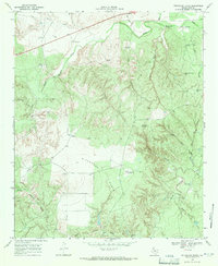
USGS Historical Quadrangle in GeoPDF.
Types: Citation;
Tags: 7.5 x 7.5 minute,
Downloadable Data,
GeoPDF,
GeoTIFF,
Historical Topographic Maps,
In May 2013, the Grand Canyon Monitoring and Research Center (GCMRC) of the U.S. Geological Survey’s (USGS) Southwest Biological Science Center (SBSC) acquired airborne multispectral high resolution data for the Colorado River in Grand Canyon in Arizona, USA. The imagery data consist of four bands (blue, green, red and near infrared) with a ground resolution of 20 centimeters (cm). These data are available to the public as 16-bit geotiff files. They are projected in the State Plane (SP) map projection using the central Arizona zone (202) and the North American Datum of 1983 (NAD83). The assessed accuracy for these data is based on 91 Ground Control Points (GCPs), and is reported at 95% confidence as 0.64 meters...
Surveys of the bathymetry and backscatter intensity of the sea floor of the Historic Area Remediation Site (HARS), offshore of New York and New Jersey, were carried out in 1996, 1998, and 2000 using a Simrad EM1000 multibeam echosounder mounted on the Canadian Coast Guard ship Frederick G. Creed. The objective of the multiple echosounder surveys was to map the bathymetry and surficial sediments over time as dredged material was placed in the HARS to remediate contaminated sediments. Maps derived from the multibeam surveys show sea-floor bathymetry, shaded-relief bathymetry, and backscatter intensity (a measure of sea-floor texture and roughness) at a spatial resolution of 3 meters. The area was mapped by the U.S....
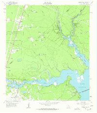
USGS Historical Quadrangle in GeoPDF.
Types: Citation;
Tags: 7.5 x 7.5 minute,
Downloadable Data,
GeoPDF,
GeoTIFF,
Historical Topographic Maps,
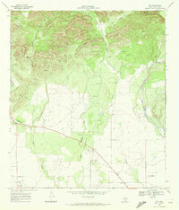
USGS Historical Quadrangle in GeoPDF.
Types: Citation;
Tags: 7.5 x 7.5 minute,
Downloadable Data,
GeoPDF,
GeoTIFF,
Historical Topographic Maps,
|

|
