Filters
Date Types (for Date Range)
Contacts
Tag Types
Tag Schemes
|

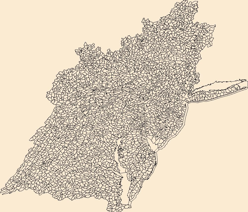
The Watershed Boundary Dataset (WBD) is a comprehensive aggregated collection of hydrologic unit data consistent with the national criteria for delineation and resolution. It defines the areal extent of surface water drainage to a point except in coastal or lake front areas where there could be multiple outlets as stated by the "Federal Standards and Procedures for the National Watershed Boundary Dataset (WBD)" "Standard" (https://pubs.usgs.gov/tm/11/a3/). Watershed boundaries are determined solely upon science-based hydrologic principles, not favoring any administrative boundaries or special projects, nor particular program or agency. This dataset represents the hydrologic unit boundaries to the 12-digit (6th level)...
Tags: 10-digit,
12-digit,
14-digit,
16-digit,
2-digit, All tags...
4-digit,
6-digit,
8-digit,
Accomack,
Adams,
Albany,
Albemarle,
Alexandria,
Allegany,
Alleghany,
Amelia,
Amherst,
Anne Arundel,
Appomattox,
Arlington,
Atlantic,
Augusta,
Baltimore,
Basin,
Bath,
Bedford,
Bennington,
Bergen,
Berkeley,
Berks,
Berkshire,
Blair,
Botetourt,
Bradford,
Bronx,
Broome,
Buckingham,
Bucks,
Buena Vista,
Burlington,
CT,
Calvert,
Cambria,
Camden,
Cameron,
Campbell,
Cape May,
Carbon,
Caroline,
Carroll,
Cecil,
Centre,
Charles,
Charles City,
Charlotte,
Charlottesville,
Chemung,
Chenango,
Chesapeake,
Chester,
Chesterfield,
Clarke,
Clearfield,
Clinton,
Colonial Heights,
Columbia,
Connecticut,
Cortland,
Covington,
Craig,
Culpeper,
Cumberland,
DC,
DE,
Dauphin,
Delaware,
Delaware,
Dinwiddie,
District of Columbia,
District of Columbia,
Dorchester,
Downloadable Data,
Dutchess,
Elk,
Esri File GeoDatabase 10,
Essex,
Fairfax,
Falls Church,
Fauquier,
FileGDB,
Fluvanna,
Franklin,
Frederick,
Fredericksburg,
Fulton,
Garrett,
Giles,
Gloucester,
Goochland,
Grant,
Greater Bridgeport,
Greenbrier,
Greene,
HU-2,
HU-2 Region,
HU2_02,
HUC,
Hamilton,
Hampshire,
Hampton,
Hanover,
Hardy,
Harford,
Harrisonburg,
Henrico,
Herkimer,
Highland,
Hopewell,
Howard,
Hudson,
Hunterdon,
Huntingdon,
Hydrography,
Hydrologic Unit Code,
Hydrologic Units,
Indiana,
Isle of Wight,
James City,
Jefferson,
Juniata,
Kent,
King George,
King William,
King and Queen,
Kings,
Lackawanna,
Lancaster,
Lebanon,
Lehigh,
Lewis,
Lexington,
Livingston,
Loudoun,
Louisa,
Lower Connecticut River Valley,
Lunenburg,
Luzerne,
Lycoming,
Lynchburg,
MA,
MD,
Madison,
Manassas,
Manassas Park,
Maryland,
Massachusetts,
Mathews,
McKean,
Mercer,
Middlesex,
Mifflin,
Mineral,
Monmouth,
Monroe,
Montgomery,
Montour,
Morgan,
Morris,
NJ,
NY,
Nassau,
National Watershed Boundary Dataset (WBD),
National Watershed Boundary Dataset (WBD),
Nelson,
New Castle,
New Jersey,
New Kent,
New York,
New York,
Newport News,
Norfolk,
Northampton,
Northumberland,
Nottoway,
Ocean,
Oneida,
Onondaga,
Ontario,
Orange,
Otsego,
PA,
Page,
Passaic,
Pendleton,
Pennsylvania,
Perry,
Petersburg,
Philadelphia,
Pike,
Pocahontas,
Poquoson,
Portsmouth,
Potter,
Powhatan,
Preston,
Prince Edward,
Prince George,
Prince George's,
Prince William,
Putnam,
Queen Anne's,
Queens,
RI,
Randolph,
Rappahannock,
Region,
Rensselaer,
Rhode Island,
Richmond,
Roanoke,
Rockbridge,
Rockingham,
Rockland,
Rutland,
Salem,
Saratoga,
Schenectady,
Schoharie,
Schuyler,
Schuylkill,
Shenandoah,
Snyder,
Somerset,
South Central Connecticut,
Southeastern Connecticut,
Spotsylvania,
St. Mary's,
Stafford,
Staunton,
Steuben,
Sub-basin,
Sub-region,
Subwatershed,
Suffolk,
Sullivan,
Surry,
Susquehanna,
Sussex,
Talbot,
Tioga,
Tompkins,
Tucker,
US,
Ulster,
Union,
United States,
VA,
VT,
Vermont,
Virginia,
Virginia Beach,
WBD,
WV,
Warren,
Washington,
Watershed,
Watershed Boundary Dataset,
Wayne,
Waynesboro,
West Virginia,
Westchester,
Western Connecticut,
Westmoreland,
Wicomico,
Williamsburg,
Winchester,
Windham,
Worcester,
Wyoming,
Yates,
York,
inlandWaters, Fewer tags

The Watershed Boundary Dataset (WBD) is a comprehensive aggregated collection of hydrologic unit data consistent with the national criteria for delineation and resolution. It defines the areal extent of surface water drainage to a point except in coastal or lake front areas where there could be multiple outlets as stated by the "Federal Standards and Procedures for the National Watershed Boundary Dataset (WBD)" "Standard" (https://pubs.usgs.gov/tm/11/a3/). Watershed boundaries are determined solely upon science-based hydrologic principles, not favoring any administrative boundaries or special projects, nor particular program or agency. This dataset represents the hydrologic unit boundaries to the 12-digit (6th level)...
Tags: 10-digit,
12-digit,
14-digit,
16-digit,
2-digit, All tags...
4-digit,
6-digit,
8-digit,
Accomack,
Adams,
Albany,
Albemarle,
Alexandria,
Allegany,
Alleghany,
Amelia,
Amherst,
Anne Arundel,
Appomattox,
Arlington,
Atlantic,
Augusta,
Baltimore,
Basin,
Bath,
Bedford,
Bennington,
Bergen,
Berkeley,
Berks,
Berkshire,
Blair,
Botetourt,
Bradford,
Bronx,
Broome,
Buckingham,
Bucks,
Buena Vista,
Burlington,
CT,
Calvert,
Cambria,
Camden,
Cameron,
Campbell,
Cape May,
Carbon,
Caroline,
Carroll,
Cecil,
Centre,
Charles,
Charles City,
Charlotte,
Charlottesville,
Chemung,
Chenango,
Chesapeake,
Chester,
Chesterfield,
Clarke,
Clearfield,
Clinton,
Colonial Heights,
Columbia,
Connecticut,
Cortland,
Covington,
Craig,
Culpeper,
Cumberland,
DC,
DE,
Dauphin,
Delaware,
Delaware,
Dinwiddie,
District of Columbia,
District of Columbia,
Dorchester,
Downloadable Data,
Dutchess,
Elk,
Essex,
Fairfax,
Falls Church,
Fauquier,
Fluvanna,
Franklin,
Frederick,
Fredericksburg,
Fulton,
Garrett,
GeoPackage,
Giles,
Gloucester,
Goochland,
Grant,
Greater Bridgeport,
Greenbrier,
Greene,
HU-2,
HU-2 Region,
HU2_02,
HUC,
Hamilton,
Hampshire,
Hampton,
Hanover,
Hardy,
Harford,
Harrisonburg,
Henrico,
Herkimer,
Highland,
Hopewell,
Howard,
Hudson,
Hunterdon,
Huntingdon,
Hydrography,
Hydrologic Unit Code,
Hydrologic Units,
Indiana,
Isle of Wight,
James City,
Jefferson,
Juniata,
Kent,
King George,
King William,
King and Queen,
Kings,
Lackawanna,
Lancaster,
Lebanon,
Lehigh,
Lewis,
Lexington,
Livingston,
Loudoun,
Louisa,
Lower Connecticut River Valley,
Lunenburg,
Luzerne,
Lycoming,
Lynchburg,
MA,
MD,
Madison,
Manassas,
Manassas Park,
Maryland,
Massachusetts,
Mathews,
McKean,
Mercer,
Middlesex,
Mifflin,
Mineral,
Monmouth,
Monroe,
Montgomery,
Montour,
Morgan,
Morris,
NJ,
NY,
Nassau,
National Watershed Boundary Dataset (WBD),
National Watershed Boundary Dataset (WBD),
Nelson,
New Castle,
New Jersey,
New Kent,
New York,
New York,
Newport News,
Norfolk,
Northampton,
Northumberland,
Nottoway,
Ocean,
Oneida,
Onondaga,
Ontario,
Open Geospatial Consortium GeoPackage 1.2,
Orange,
Otsego,
PA,
Page,
Passaic,
Pendleton,
Pennsylvania,
Perry,
Petersburg,
Philadelphia,
Pike,
Pocahontas,
Poquoson,
Portsmouth,
Potter,
Powhatan,
Preston,
Prince Edward,
Prince George,
Prince George's,
Prince William,
Putnam,
Queen Anne's,
Queens,
RI,
Randolph,
Rappahannock,
Region,
Rensselaer,
Rhode Island,
Richmond,
Roanoke,
Rockbridge,
Rockingham,
Rockland,
Rutland,
Salem,
Saratoga,
Schenectady,
Schoharie,
Schuyler,
Schuylkill,
Shenandoah,
Snyder,
Somerset,
South Central Connecticut,
Southeastern Connecticut,
Spotsylvania,
St. Mary's,
Stafford,
Staunton,
Steuben,
Sub-basin,
Sub-region,
Subwatershed,
Suffolk,
Sullivan,
Surry,
Susquehanna,
Sussex,
Talbot,
Tioga,
Tompkins,
Tucker,
US,
Ulster,
Union,
United States,
VA,
VT,
Vermont,
Virginia,
Virginia Beach,
WBD,
WV,
Warren,
Washington,
Watershed,
Watershed Boundary Dataset,
Wayne,
Waynesboro,
West Virginia,
Westchester,
Western Connecticut,
Westmoreland,
Wicomico,
Williamsburg,
Winchester,
Windham,
Worcester,
Wyoming,
Yates,
York,
inlandWaters, Fewer tags
The Watershed Boundary Dataset (WBD) is a comprehensive aggregated collection of hydrologic unit data consistent with the national criteria for delineation and resolution. It defines the areal extent of surface water drainage to a point except in coastal or lake front areas where there could be multiple outlets as stated by the "Federal Standards and Procedures for the National Watershed Boundary Dataset (WBD)" "Standard" (https://pubs.usgs.gov/tm/11/a3/). Watershed boundaries are determined solely upon science-based hydrologic principles, not favoring any administrative boundaries or special projects, nor particular program or agency. This dataset represents the hydrologic unit boundaries to the 12-digit (6th level)...
Tags: 10-digit,
12-digit,
14-digit,
16-digit,
2-digit, All tags...
4-digit,
6-digit,
8-digit,
Accomack,
Adams,
Albany,
Albemarle,
Alexandria,
Allegany,
Alleghany,
Amelia,
Amherst,
Anne Arundel,
Appomattox,
Arlington,
Atlantic,
Augusta,
Baltimore,
Basin,
Bath,
Bedford,
Bennington,
Bergen,
Berkeley,
Berks,
Berkshire,
Blair,
Botetourt,
Bradford,
Bronx,
Broome,
Buckingham,
Bucks,
Buena Vista,
Burlington,
CT,
Calvert,
Cambria,
Camden,
Cameron,
Campbell,
Cape May,
Carbon,
Caroline,
Carroll,
Cecil,
Centre,
Charles,
Charles City,
Charlotte,
Charlottesville,
Chemung,
Chenango,
Chesapeake,
Chester,
Chesterfield,
Clarke,
Clearfield,
Clinton,
Colonial Heights,
Columbia,
Connecticut,
Cortland,
Covington,
Craig,
Culpeper,
Cumberland,
DC,
DE,
Dauphin,
Delaware,
Delaware,
Dinwiddie,
District of Columbia,
District of Columbia,
Dorchester,
Downloadable Data,
Dutchess,
Elk,
Esri Shapefile nan,
Essex,
Fairfax,
Falls Church,
Fauquier,
Fluvanna,
Franklin,
Frederick,
Fredericksburg,
Fulton,
Garrett,
Giles,
Gloucester,
Goochland,
Grant,
Greater Bridgeport,
Greenbrier,
Greene,
HU-2,
HU-2 Region,
HU2_02,
HUC,
Hamilton,
Hampshire,
Hampton,
Hanover,
Hardy,
Harford,
Harrisonburg,
Henrico,
Herkimer,
Highland,
Hopewell,
Howard,
Hudson,
Hunterdon,
Huntingdon,
Hydrography,
Hydrologic Unit Code,
Hydrologic Units,
Indiana,
Isle of Wight,
James City,
Jefferson,
Juniata,
Kent,
King George,
King William,
King and Queen,
Kings,
Lackawanna,
Lancaster,
Lebanon,
Lehigh,
Lewis,
Lexington,
Livingston,
Loudoun,
Louisa,
Lower Connecticut River Valley,
Lunenburg,
Luzerne,
Lycoming,
Lynchburg,
MA,
MD,
Madison,
Manassas,
Manassas Park,
Maryland,
Massachusetts,
Mathews,
McKean,
Mercer,
Middlesex,
Mifflin,
Mineral,
Monmouth,
Monroe,
Montgomery,
Montour,
Morgan,
Morris,
NJ,
NY,
Nassau,
National Watershed Boundary Dataset (WBD),
National Watershed Boundary Dataset (WBD),
Nelson,
New Castle,
New Jersey,
New Kent,
New York,
New York,
Newport News,
Norfolk,
Northampton,
Northumberland,
Nottoway,
Ocean,
Oneida,
Onondaga,
Ontario,
Orange,
Otsego,
PA,
Page,
Passaic,
Pendleton,
Pennsylvania,
Perry,
Petersburg,
Philadelphia,
Pike,
Pocahontas,
Poquoson,
Portsmouth,
Potter,
Powhatan,
Preston,
Prince Edward,
Prince George,
Prince George's,
Prince William,
Putnam,
Queen Anne's,
Queens,
RI,
Randolph,
Rappahannock,
Region,
Rensselaer,
Rhode Island,
Richmond,
Roanoke,
Rockbridge,
Rockingham,
Rockland,
Rutland,
Salem,
Saratoga,
Schenectady,
Schoharie,
Schuyler,
Schuylkill,
Shapefile,
Shenandoah,
Snyder,
Somerset,
South Central Connecticut,
Southeastern Connecticut,
Spotsylvania,
St. Mary's,
Stafford,
Staunton,
Steuben,
Sub-basin,
Sub-region,
Subwatershed,
Suffolk,
Sullivan,
Surry,
Susquehanna,
Sussex,
Talbot,
Tioga,
Tompkins,
Tucker,
US,
Ulster,
Union,
United States,
VA,
VT,
Vermont,
Virginia,
Virginia Beach,
WBD,
WV,
Warren,
Washington,
Watershed,
Watershed Boundary Dataset,
Wayne,
Waynesboro,
West Virginia,
Westchester,
Western Connecticut,
Westmoreland,
Wicomico,
Williamsburg,
Winchester,
Windham,
Worcester,
Wyoming,
Yates,
York,
inlandWaters, Fewer tags
|
|

