Filters
Date Range
Types
Contacts
Categories
Tag Types
Tag Schemes
|

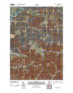
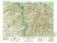
USGS Historical Quadrangle in GeoPDF.
Tags: 15 x 15 minute,
Downloadable Data,
GeoPDF,
GeoTIFF,
Historical Topographic Maps, All tags...
Historical Topographic Maps 15 x 15 Minute Map Series,
La Crosse,
Map,
WI,
imageryBaseMapsEarthCover, Fewer tags
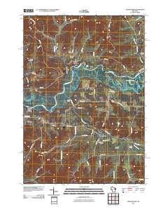
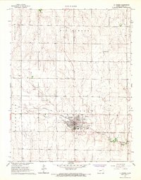
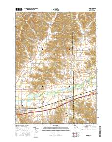
Layered GeoPDF 7.5 Minute Quadrangle Map. Layers of geospatial data include orthoimagery, roads, grids, geographic names, elevation contours, hydrography, and other selected map features.
Tags: 7.5 x 7.5 minute,
Downloadable Data,
EarthCover,
GeoPDF,
Imagery and Base Maps, All tags...
La Crosse,
Map,
Onalaska, WI,
Public Land Survey System,
U.S. National Grid,
US,
US Topo,
US Topo Historical,
United States,
Wisconsin,
boundary,
contour,
geographic names,
hydrography,
imageryBaseMapsEarthCover,
orthoimage,
structures,
topographic,
transportation,
woodland, Fewer tags
Layered GeoPDF 7.5 Minute Quadrangle Map. Layers of geospatial data include orthoimagery, roads, grids, geographic names, elevation contours, hydrography, and other selected map features.
Tags: 7.5 x 7.5 minute,
Downloadable Data,
EarthCover,
GeoPDF,
Imagery and Base Maps, All tags...
La Crosse,
Map,
Stevenstown, WI,
Trempealeau,
U.S. National Grid,
US,
US Topo,
US Topo Historical,
United States,
Wisconsin,
contour,
geographic names,
hydrography,
imageryBaseMapsEarthCover,
orthoimage,
topographic,
transportation, Fewer tags
Layered GeoPDF 7.5 Minute Quadrangle Map. Layers of geospatial data include orthoimagery, roads, grids, geographic names, elevation contours, hydrography, and other selected map features.
Tags: 7.5 x 7.5 minute,
Downloadable Data,
EarthCover,
GeoPDF,
Imagery and Base Maps, All tags...
La Crosse,
Map,
Middle Ridge, WI,
Monroe,
Public Land Survey System,
U.S. National Grid,
US,
US Topo,
US Topo Historical,
United States,
Wisconsin,
boundary,
contour,
geographic names,
hydrography,
imageryBaseMapsEarthCover,
orthoimage,
structures,
topographic,
transportation,
woodland, Fewer tags
Layered GeoPDF 7.5 Minute Quadrangle Map. Layers of geospatial data include orthoimagery, roads, grids, geographic names, elevation contours, hydrography, and other selected map features.
Tags: 7.5 x 7.5 minute,
Downloadable Data,
EarthCover,
GeoPDF,
Imagery and Base Maps, All tags...
La Crosse,
Map,
Minnesota,
Pickwick, MN-WI,
Public Land Survey System,
Trempealeau,
U.S. National Grid,
US,
US Topo,
US Topo Historical,
United States,
Winona,
Wisconsin,
boundary,
contour,
geographic names,
hydrography,
imageryBaseMapsEarthCover,
orthoimage,
structures,
topographic,
transportation,
woodland, Fewer tags
Layered GeoPDF 7.5 Minute Quadrangle Map. Layers of geospatial data include orthoimagery, roads, grids, geographic names, elevation contours, hydrography, and other selected map features.
Tags: 7.5 x 7.5 minute,
Downloadable Data,
EarthCover,
Four Corners, WI,
GeoPDF, All tags...
Imagery and Base Maps,
La Crosse,
Map,
Monroe,
U.S. National Grid,
US,
US Topo,
US Topo Historical,
United States,
Wisconsin,
contour,
geographic names,
hydrography,
imageryBaseMapsEarthCover,
orthoimage,
topographic,
transportation, Fewer tags
USGS Historical Quadrangle in GeoPDF.
Tags: 15 x 15 minute,
Downloadable Data,
GeoPDF,
GeoTIFF,
Historical Topographic Maps, All tags...
Historical Topographic Maps 15 x 15 Minute Map Series,
La Crosse,
Map,
WA,
imageryBaseMapsEarthCover, Fewer tags
USGS Historical Quadrangle in GeoPDF.
Tags: 7.5 x 7.5 minute,
Downloadable Data,
GeoPDF,
GeoTIFF,
Historical Topographic Maps, All tags...
Historical Topographic Maps 7.5 x 7.5 Minute Map Series,
KS,
La Crosse,
Map,
imageryBaseMapsEarthCover, Fewer tags
USGS Historical Quadrangle in GeoPDF.
Tags: 7.5 x 7.5 minute,
Downloadable Data,
GeoPDF,
GeoTIFF,
Historical Topographic Maps, All tags...
Historical Topographic Maps 7.5 x 7.5 Minute Map Series,
IN,
La Crosse,
Map,
imageryBaseMapsEarthCover, Fewer tags
USGS Historical Quadrangle in GeoPDF.
Tags: 1 x 2 degree,
Downloadable Data,
GeoPDF,
GeoTIFF,
Historical Topographic Maps, All tags...
Historical Topographic Maps 1 x 2 Degree Map Series,
La Crosse,
Map,
WI,
imageryBaseMapsEarthCover, Fewer tags
Geospatial data includes structures and other selected map features.
Tags: Adams,
Ashland,
Barron,
Bayfield,
Brown, All tags...
Buffalo,
Burnett,
Calumet,
Campground,
Chippewa,
Clark,
College / University,
Columbia,
Courthouse,
Crawford,
Dane,
Dodge,
Door,
Douglas,
Downloadable Data,
Dunn,
Eau Claire,
Esri Shapefile nan,
Fire Station/ EMS Station,
Florence,
Fond du Lac,
Forest,
Grant,
Green,
Green Lake,
Hospital/Medical Center,
Information Center,
Iowa,
Iron,
Jackson,
Jefferson,
Juneau,
Kenosha,
Kewaunee,
La Crosse,
Lafayette,
Langlade,
Law Enforcement,
Lincoln,
Manitowoc,
Marathon,
Marinette,
Marquette,
Menominee,
Milwaukee,
Monroe,
National Structures Dataset (NSD),
National Structures Dataset (NSD),
Oconto,
Oneida,
Outagamie,
Ozaukee,
Pepin,
Pierce,
Polk,
Portage,
Post Office,
Price,
Prison/ Correctional Facility,
Racine,
Richland,
Rock,
Rusk,
Sauk,
Sawyer,
School,
School:Elementary,
School:High School,
School:Middle School,
Shapefile,
Shawano,
Sheboygan,
St. Croix,
State,
State,
State Capitol,
Structures,
Taylor,
Technical School,
Town Hall,
Trade School,
Trailhead,
Trempealeau,
US,
United States,
Vernon,
Vilas,
Visitor Center,
WI,
Walworth,
Washburn,
Washington,
Waukesha,
Waupaca,
Waushara,
Winnebago,
Wisconsin,
Wood,
structure, Fewer tags
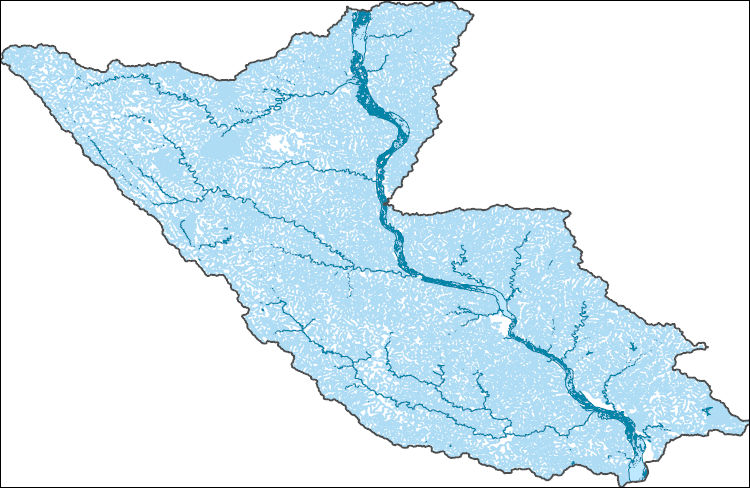
The National Hydrography Dataset (NHD) is a feature-based database that interconnects and uniquely identifies the stream segments or reaches that make up the nation's surface water drainage system. NHD data was originally developed at 1:100,000-scale and exists at that scale for the whole country. This high-resolution NHD, generally developed at 1:24,000/1:12,000 scale, adds detail to the original 1:100,000-scale NHD. (Data for Alaska, Puerto Rico and the Virgin Islands was developed at high-resolution, not 1:100,000 scale.) Local resolution NHD is being developed where partners and data exist. The NHD contains reach codes for networked features, flow direction, names, and centerline representations for areal water...
Tags: Administrative watershed units,
Administrative watershed units,
Allamakee,
Area of Complex Channels,
Area to be submerged, All tags...
Basin,
Basin,
Bay/Inlet,
Boundaries,
Boundary,
Bridge,
Buchanan,
Canal/Ditch,
Carroll,
Chickasaw,
Clayton,
Clinton,
Coastline,
Connector,
Crawford,
Dam/Weir,
Delaware,
Downloadable Data,
Drainage areas for surface water,
Drainageway,
Dubuque,
Esri Shapefile nan,
Estuary,
Fayette,
Fillmore,
Flow direction network,
Flume,
ForeShore,
Gaging Station,
Gate,
Grant,
HU-4,
HU-4 Subregion,
HU10,
HU12,
HU14,
HU16,
HU2,
HU4,
HU4_0706,
HU6,
HU8,
HUC,
Hazard Zone,
Houston,
Howard,
Hydrographic,
Hydrography,
Hydrography,
Hydrography,
Hydrologic Unit Code,
Hydrologic Units,
IA,
IL,
Ice mass,
Illinois,
Inundation Area,
Iowa,
Iowa,
Jackson,
Jo Daviess,
Jones,
La Crosse,
Lafayette,
Levee,
Line,
Linn,
Lock Chamber,
MN,
Marsh,
Minnesota,
Mitchell,
Monroe,
Mower,
National Hydrography Dataset (NHD),
National Hydrography Dataset (NHD) Best Resolution,
National Hydrography Dataset (NHD) Best Resolution,
Nonearthen Shore,
Orthoimage,
Playa,
Point,
PointEvent,
Pond,
Rapids,
Rapids,
Reach,
Reach code,
Reef,
Region,
Reservoir,
Rock,
Sea/Ocean,
Shapefile,
Sink/Rise,
Sounding Datum Line,
Special Use Zone,
Special Use Zone Limit,
Spillway,
Stephenson,
Stream,
Stream/River,
Sub-basin,
Sub-region,
Subbasin,
Submerged Stream,
Subregion,
Subwatershed,
Surface water systems,
Swamp,
Topographic,
Tunnel,
US,
Underground Conduit,
United States,
Vernon,
WBD,
WBD,
WI,
Wall,
Wash,
Water Intake Outflow,
Waterfall,
Watershed,
Watershed Boundaries,
Watershed Boundary Dataset,
Watershed Boundary Dataset,
Well,
Whiteside,
Winneshiek,
Wisconsin,
artificial path,
boundaries,
dams,
drainage systems and characteristics,
inlandWaters,
lakes,
ngda,
rivers, Fewer tags

The 1:100,000-scale geologic map database of the South Boston 30' × 60' quadrangle, Virginia and North Carolina, provides geologic information for the Piedmont along the I-85 and U.S. Route 58 corridors and in the Roanoke River watershed, which includes the John H. Kerr Reservoir and Lake Gaston. The Raleigh terrane (located on the eastern side of the map) contains Neoproterozoic to early Paleozoic(?) polydeformed, amphibolite-facies gneisses and schists. The Carolina slate belt of the Carolina terrane (located in the central part of the map) contains Neoproterozoic metavolcanic and metasedimentary rocks at greenschist facies. Although locally complicated, the slate-belt structure mapped across the South Boston...
Tags: 30 x 60 minute,
Aaron Formation,
Aarons Creek,
Alkaline basalt,
Allen Creek, All tags...
Alluvium,
Amphibolite,
Argillite,
Armistead Branch,
Ashcake Creek,
Augen gneiss,
Averett,
Bagleys Mills,
Banister Lake,
Banister River,
Barnes Junction,
Basalt,
Baskerville,
Bears Element Creek,
Beaver Pond,
Beaver Pond Creek,
Beech Creek,
Bethel Hill,
Big Hounds Creek,
Big Juniper Creek,
Biotite gneiss,
Birch Creek,
Bishops Corner,
Black Walnut Creek,
Blackridge,
Blackstone Creek,
Blanes Millpond,
Bluestone Creek,
Bluestone Otter Creek,
Bluewing Creek,
Bowes Branch,
Boydton,
Bracey,
Brodnax,
Brunswick County,
Buckham Creek,
Buckhorn Creek,
Buckskin Creek,
Buffalo Creek,
Buffalo Junction,
Buffalo Springs,
Buggs Island,
Burton Branch,
Butcher Creek,
Cambrian,
Cargills Creek,
Carolina slate belt,
Carolina terrane,
Castle Creek,
Castle Heights,
Cataclasite,
Catawba Creek,
Cedar Creek,
Cenozoic,
Charlotte County,
Chase City,
Christie,
Clarksville,
Clarkton,
Clays Mill,
Clover,
Clover Creek,
Cluster Springs,
Coleman Creek,
Colluvium,
Conglomerate,
Connor Lake,
Cotton Creek,
Couches Creek,
Country Line complex,
Cox Creek,
Crooked Creek,
Crupper Run,
Crystal Hill,
Cub Creek,
Cunningham complex,
Dacite,
Dan River,
Devils Branch,
Devonian,
Diabase,
Difficult Creek,
Diorite,
Dixon Millpond,
Dockery Creek,
Drakes Branch,
Dryburg,
Dudley,
Dundas,
Ellis Creek,
Esnon,
Evans Creek,
Farmers Branch,
Felsic gneiss,
Finchley,
Finnewood Creek,
Finneywood,
Flat Creek,
Flat Rock Creek,
Forksville,
Formosa,
Fort Mitchell,
Gabbro,
Gibson Creek,
Gilliams Branch,
Gneiss,
Goodell Creek,
Granite,
Granitic gneiss,
Granodiorite,
Granville County,
Grassy Creek,
Great Creek,
Greenschist,
Gregory Corner,
Hagood Creek,
Halifax,
Halifax County,
Harmony,
Hawtree Creek,
Hitesburg,
Holocene,
Horsepen Creek,
Horseshoe Lake,
Hughs Lake,
Hunting Creek,
Hyco Formation,
Hyco River,
Island Creek,
Island Creek Reservoir,
Jeffress,
Johnson Creek,
Jurassic,
Kenbridge,
Kerr Reservoir,
Kettle Creek,
Kettlesticks Creek,
Kits Creek,
La Crosse,
Lake Gaston,
Lake Gordon,
Langford Pond,
Lawsons Creek,
Layton Creek,
Lennig,
Little Genito Creek,
Little Horsepen Creek,
Little Johnson Creek,
Little Juniper Creek,
Little Temble Creek,
Long Branch,
Lunenburg,
Lunenburg County,
Lyle Creek,
Marengo,
Mason Creek,
Mayo,
Mayo Creek,
Mayo Reservoir,
Mecklenburg County,
Mesozoic,
Metabasalt,
Metamorphic rock,
Metamorphic suite of South Hill,
Metasedimentary rock,
Metavolcanic rock,
Middle Meherrin River,
Mikes Creek,
Miles Creek,
Mill Branch,
Milton terrane,
Mines Creek,
Miocene,
Miry Creek,
Mississippian,
Mitchell Creek,
Monzodiorite,
Monzonite,
Moody Creek,
Mossingford,
Mount Laurel,
Mountain Creek,
Mylonite,
Nathalie,
Nelson,
Neogene,
Neoproterozoic,
North Carolina,
North Meherrin River,
North View,
Nutbush Creek,
Nutbush Creek mylonite zone,
Omega,
Ontario,
Ordovician,
Orthogneiss,
Otter Creek,
Paleozoic,
Palmer Crossroads,
Palmer Springs,
Panhandle Creek,
Parham Creek,
Pennsylvanian,
Permian,
Person County,
Peter Creek,
Philbeck Crossroads,
Phyllonite,
Piney Creek,
Piney Grove,
Plantersville,
Pleistocene,
Pliocene,
Poplar Creek,
Public Fork,
Quartz diorite,
Quartz monzonite,
Quartzite,
Quaternary,
Rabat,
Raleigh terrane,
Randolph,
Ready Creek,
Red Bank,
Red Oak,
Redlawn,
Reedy Creek,
Reeses Creek,
Rehoboth,
Reynolds Creek,
Rhyolite,
Riverdale,
Roanoke Creek,
Roanoke River,
Rocky Branch,
Sand,
Sandy Creek,
Saxe,
Schist,
Scotts Crossroad,
Scottsburg,
Seay Creek,
Shiny Rock,
Siddon,
Siltstone,
Silurian,
Sinai,
Skipwith,
Smith Creek,
South Boston,
South Hill,
South Meherrin River,
Spanish Grove,
Stokes Creek,
Stony Creek,
Taylors Creek,
Temble Creek,
Terrace,
The Ridge,
Tonalite,
Triassic,
Tungsten,
Twittys Creek,
USGS Science Data Catalog (SDC),
Union Level,
Vance County,
Vance pluton,
Victoria,
Virgilina,
Virgilina Formation,
Virginia,
Wallace Branch,
Warren County,
Wightman,
Winn Creek,
Wolf Trap Creek,
Wylliesburg,
abandoned mines and quarries,
bedrock geologic units,
copper,
earth sciences,
folding (geologic),
foliation (geologic),
fracture (geologic),
geologic contacts,
geologic maps,
geologic processes,
geologic structure,
geologic time periods,
geologic time scales,
geology,
geoscientificInformation,
geospatial datasets,
information product types,
inlandWaters,
lithology,
maps and atlases,
metamorphic rocks,
metamorphism (geological),
mining and quarrying,
place,
sedimentary rocks,
sedimentation,
society,
stratum,
structural geology,
structure,
surficial geologic units,
unconsolidated deposits,
utilitiesCommunication, Fewer tags

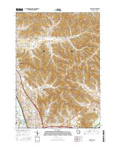
Layered GeoPDF 7.5 Minute Quadrangle Map. Layers of geospatial data include orthoimagery, roads, grids, geographic names, elevation contours, hydrography, and other selected map features.
Tags: 7.5 x 7.5 minute,
Coon Valley, WI,
Downloadable Data,
EarthCover,
GeoPDF, All tags...
Imagery and Base Maps,
La Crosse,
Map,
U.S. National Grid,
US,
US Topo,
US Topo Historical,
United States,
Vernon,
Wisconsin,
contour,
geographic names,
hydrography,
imageryBaseMapsEarthCover,
orthoimage,
topographic,
transportation, Fewer tags
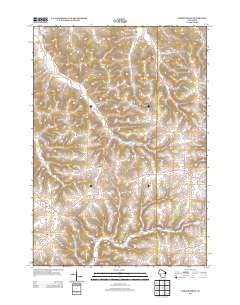
Layered GeoPDF 7.5 Minute Quadrangle Map. Layers of geospatial data include orthoimagery, roads, grids, geographic names, elevation contours, hydrography, and other selected map features.
Tags: 7.5 x 7.5 minute,
Downloadable Data,
EarthCover,
GeoPDF,
Imagery and Base Maps, All tags...
Jackson,
La Crosse,
Map,
North Bend, WI,
Public Land Survey System,
U.S. National Grid,
US,
US Topo,
US Topo Historical,
United States,
Wisconsin,
boundary,
contour,
geographic names,
hydrography,
imageryBaseMapsEarthCover,
orthoimage,
structures,
topographic,
transportation,
woodland, Fewer tags
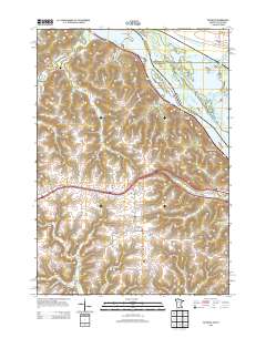
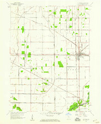
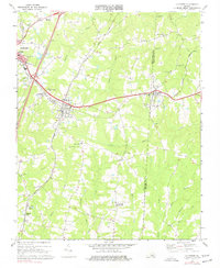
Layered geospatial PDF Map. Layers of geospatial data include orthoimagery, roads, grids, geographic names, elevation contours, hydrography, and other selected map features.
Tags: 7.5 x 7.5 minute,
Bangor, WI,
Downloadable Data,
EarthCover,
GeoPDF, All tags...
Imagery and Base Maps,
La Crosse,
Map,
Monroe,
Public Land Survey System,
U.S. National Grid,
US,
US Topo,
US Topo Historical,
United States,
Wisconsin,
boundary,
contour,
geographic names,
hydrography,
imageryBaseMapsEarthCover,
orthoimage,
structures,
topographic,
transportation,
woodland, Fewer tags
The Geographic Names Information System (GNIS) is the Federal standard for geographic nomenclature. The U.S. Geological Survey developed the GNIS for the U.S. Board on Geographic Names, a Federal inter-agency body chartered by public law to maintain uniform feature name usage throughout the Government and to promulgate standard names to the public. The GNIS is the official repository of domestic geographic names data; the official vehicle for geographic names use by all departments of the Federal Government; and the source for applying geographic names to Federal electronic and printed products of all types.
Tags: Adams,
Antarctica,
Antarctica,
Ashland,
BGN, All tags...
Barron,
Bayfield,
Board on Geographic Names,
Borough,
Brown,
Buffalo,
Burnett,
Calumet,
Census Area,
Chippewa,
Clark,
Columbia,
Commonwealth,
County,
Crawford,
Dane,
District,
Dodge,
Door,
Douglas,
Downloadable Data,
Dunn,
Eau Claire,
Esri File GeoDatabase 10,
Feature class,
Feature coordinates,
Feature county,
Feature description,
Feature designation,
Feature history,
Feature indentification,
Feature name,
Feature state,
FileGDB,
Florence,
Fond du Lac,
Forest,
GNIS,
Geographic Names,
Geographic Names Full Model,
Geographic Names Information System,
Geographic feature,
Geographic name,
Geographical feature,
Geographical name,
Grant,
Green,
Green Lake,
Iowa,
Iron,
Jackson,
Jefferson,
Juneau,
Kenosha,
Kewaunee,
La Crosse,
Lafayette,
Langlade,
Lincoln,
Manitowoc,
Marathon,
Marinette,
Marquette,
Menominee,
Milwaukee,
Monroe,
Municipio,
National Geographic Names Information System (GNIS),
National Geographic Names Information System (GNIS),
Oconto,
Official feature name,
Oneida,
Outagamie,
Outlying Area,
Ozaukee,
Parish,
Pepin,
Pierce,
Place name,
Polk,
Populated Place,
Portage,
Price,
Racine,
Richland,
Rock,
Rusk,
Sauk,
Sawyer,
Shawano,
Sheboygan,
St. Croix,
State,
Taylor,
Territories,
Territory,
Topographic Map,
Trempealeau,
U.S. Board on Geographic Names,
U.S. Geological Survey,
US,
USA,
USBGN,
USGS,
United States,
United States,
United States,
Variant name,
Vernon,
Vilas,
WI,
Walworth,
Washburn,
Washington,
Waukesha,
Waupaca,
Waushara,
Winnebago,
Wisconsin,
Wood,
antarctic,
database,
economy,
environment,
feature,
gazetteer,
geographic,
geographic names,
geographical,
geography,
geospatial,
imageryBaseMapsEarthCover,
inlandWaters,
location,
map,
name,
place,
placename,
society,
structure,
topographic map,
toponymy, Fewer tags
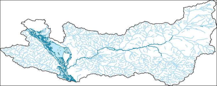
The National Hydrography Dataset (NHD) is a feature-based database that interconnects and uniquely identifies the stream segments or reaches that make up the nation's surface water drainage system. NHD data was originally developed at 1:100,000-scale and exists at that scale for the whole country. This high-resolution NHD, generally developed at 1:24,000/1:12,000 scale, adds detail to the original 1:100,000-scale NHD. (Data for Alaska, Puerto Rico and the Virgin Islands was developed at high-resolution, not 1:100,000 scale.) Local resolution NHD is being developed where partners and data exist. The NHD contains reach codes for networked features, flow direction, names, and centerline representations for areal water...
Tags: Administrative watershed units,
Administrative watershed units,
Area of Complex Channels,
Area to be submerged,
Basin, All tags...
Basin,
Bay/Inlet,
Boundaries,
Boundary,
Bridge,
Canal/Ditch,
Coastline,
Connector,
Dam/Weir,
Downloadable Data,
Drainage areas for surface water,
Drainageway,
Estuary,
Flow direction network,
Flume,
ForeShore,
Gaging Station,
Gate,
GeoPackage,
HU-8,
HU-8 Subbasin,
HU10,
HU12,
HU14,
HU16,
HU2,
HU4,
HU6,
HU8,
HU8_07040006,
HUC,
Hazard Zone,
Houston,
Hydrographic,
Hydrography,
Hydrography,
Hydrography,
Hydrologic Unit Code,
Hydrologic Units,
Ice mass,
Inundation Area,
La Crosse,
Levee,
Line,
Lock Chamber,
MN,
Marsh,
Minnesota,
Monroe,
National Hydrography Dataset (NHD),
National Hydrography Dataset (NHD) Best Resolution,
National Hydrography Dataset (NHD) Best Resolution,
Nonearthen Shore,
Open Geospatial Consortium GeoPackage 1.2,
Orthoimage,
Playa,
Point,
PointEvent,
Pond,
Rapids,
Rapids,
Reach,
Reach code,
Reef,
Region,
Reservoir,
Rock,
Sea/Ocean,
Sink/Rise,
Sounding Datum Line,
Special Use Zone,
Special Use Zone Limit,
Spillway,
Stream,
Stream/River,
Sub-basin,
Sub-region,
Subbasin,
Submerged Stream,
Subregion,
Subwatershed,
Surface water systems,
Swamp,
Topographic,
Trempealeau,
Tunnel,
US,
Underground Conduit,
United States,
WBD,
WBD,
WI,
Wall,
Wash,
Water Intake Outflow,
Waterfall,
Watershed,
Watershed Boundaries,
Watershed Boundary Dataset,
Watershed Boundary Dataset,
Well,
Winona,
Wisconsin,
artificial path,
boundaries,
dams,
drainage systems and characteristics,
inlandWaters,
lakes,
ngda,
rivers, Fewer tags
USGS Historical Quadrangle in GeoPDF.
Tags: 7.5 x 7.5 minute,
Downloadable Data,
GeoPDF,
GeoTIFF,
Historical Topographic Maps, All tags...
Historical Topographic Maps 7.5 x 7.5 Minute Map Series,
La Crosse,
Map,
VA,
imageryBaseMapsEarthCover, Fewer tags

USGS Historical Quadrangle in GeoPDF.
Tags: 15 x 15 minute,
Downloadable Data,
GeoPDF,
GeoTIFF,
Historical Topographic Maps, All tags...
Historical Topographic Maps 15 x 15 Minute Map Series,
La Crosse,
Map,
WA,
imageryBaseMapsEarthCover, Fewer tags
|
|

