Filters: Tags: Lake (X)
2,232 results (121ms)|
Filters
Date Range
Extensions (Less)
Types (Less)
Contacts (Less)
Categories (Less) Tag Types
|

Description of Work U.S. Geological Survey (USGS) is identifying the types and locations of emerging and legacy toxic contaminants in the water and sediments at 59 major tributaries to the Great Lakes (including many Area of Concern sites). This information is needed to help prioritize watersheds for restoration, develop strategies to reduce contaminants, and measure the success of those efforts in meeting restoration goals. The USGS contaminant and virus tributary monitoring network follows the National Monitoring Network for Coastal Waters design. The monitoring effort includes collecting emerging contaminant samples at 17 sites, a subset of the 30 nutrient monitoring sites; and for human viruses and other waterborne...
Categories: Project;
Types: Map Service,
OGC WFS Layer,
OGC WMS Layer,
OGC WMS Service;
Tags: Emerging contaminants,
GLRI,
Great Lakes Restoration Initiative,
Great Lakes Restoration Initiative,
Great Lakes Tributaries,

Description of Work Benthos (benthic invertebrate) and plankton (phytoplankton/zooplankton) communities in Wisconsin's four Lake Michigan Areas of Concern (AOCs; Menominee River, Lower Green Bay and Fox River, Sheboygan River, and Milwaukee Estuary) and six non-AOCs will be quantified. The inclusion of non-AOC sites will allow comparison of AOC sites to relatively-unimpacted or less-impacted control sites with natural physical and chemical characteristics that are as close as possible to that of the AOCs. The community data within and between the AOCs and non-AOCs will be analyzed. This project is a cooperative agreement between the Wisconsin Department of Natural Resources (WDNR) and the US Geological Survey (USGS)....
Categories: Project;
Types: Map Service,
OGC WFS Layer,
OGC WMS Layer,
OGC WMS Service;
Tags: AOC,
Areas of concern,
Beneficial use impairment,
Ecosystem health,
Fox River,

Description of Work USGS will conduct seasonal sampling of benthic invertebrates, zooplankton, prey fish, and their diets to complement the seasonal lower trophic level sampling by EPA. A point of emphasis is describing the vertical distribution of planktivores and their zooplankton prey, to fill a knowledge gap on these predator/prey interactions. These data will provide a more holistic understanding of how invasive-driven, food-web changes could be altering energy available to sport fishes in the Great Lakes and used to build bioenergetics models that can evaluate whether zooplankton dynamics are being driven by limited resources or excessive predation. Understanding the key drivers of zooplankton will provide...
Categories: Project;
Types: Map Service,
OGC WFS Layer,
OGC WMS Layer,
OGC WMS Service;
Tags: Accountability,
CSMI,
Ecosystem health,
Energy transfer,
Fish production,
These data are high-resolution bathymetry (lake bottom elevation) in a gridded XYZ format, generated from hydrographic surveys of Morse and Geist Reservoirs in April and May of 2016. Hydrographic data were collected using a multibeam echo-sounder (MBES) with integrated inertial navigation solution (INS) mounted on a marine survey vessel. Data were collected as the vessel traversed the lake along survey lines distributed throughout the area. Data collection software integrated and stored the depth data from the multibeam sonar and the horizontal and vertical position and attitude data of the vessel from the INS in real time. In the shallow areas, additional data were collected with an acoustic Doppler current profiler...
These data are high-resolution bathymetry (lake bottom elevation) in a gridded XYZ format, generated from hydrographic surveys of Morse Reservoir in May 2016. Hydrographic data were collected using a multibeam echo-sounder (MBES) with integrated inertial navigation solution (INS) mounted on a marine survey vessel. Data were collected as the vessel traversed the lake along survey lines distributed throughout the area. Data collection software integrated and stored the depth data from the multibeam sonar and the horizontal and vertical position and attitude data of the vessel from the INS in real time. In the shallow areas, additional data were collected with an acoustic Doppler current profiler (ADCP) and a real-time...
Categories: Data;
Tags: Hamilton County,
Indiana,
Morse Reservoir,
Noblesville,
United States of America,
The National Hydrography Dataset (NHD) is a feature-based database that interconnects and uniquely identifies the stream segments or reaches that make up the nation's surface water drainage system. NHD data was originally developed at 1:100,000-scale and exists at that scale for the whole country. This high-resolution NHD, generally developed at 1:24,000/1:12,000 scale, adds detail to the original 1:100,000-scale NHD. (Data for Alaska, Puerto Rico and the Virgin Islands was developed at high-resolution, not 1:100,000 scale.) Local resolution NHD is being developed where partners and data exist. The NHD contains reach codes for networked features, flow direction, names, and centerline representations for areal water...
The NHDPlus Version 1.0 is an integrated suite of application-ready geospatial data sets that incorporate many of the best features of the National Hydrography Dataset (NHD) and the National Elevation Dataset (NED). The NHDPlus includes a stream network (based on the 1:100,000-scale NHD), improved networking, naming, and "value-added attributes" (VAA's). NHDPlus also includes elevation-derived catchments (drainage areas) produced using a drainage enforcement technique first broadly applied in New England, and thus dubbed "The New-England Method". This technique involves "burning-in" the 1:100,000-scale NHD and when available building "walls" using the national Watershed Boundary Dataset (WBD). The resulting modified...
The National Hydrography Dataset (NHD) is a feature-based database that interconnects and uniquely identifies the stream segments or reaches that make up the nation's surface water drainage system. NHD data was originally developed at 1:100,000-scale and exists at that scale for the whole country. This high-resolution NHD, generally developed at 1:24,000/1:12,000 scale, adds detail to the original 1:100,000-scale NHD. (Data for Alaska, Puerto Rico and the Virgin Islands was developed at high-resolution, not 1:100,000 scale.) Local resolution NHD is being developed where partners and data exist. The NHD contains reach codes for networked features, flow direction, names, and centerline representations for areal water...
The National Hydrography Dataset (NHD) is a feature-based database that interconnects and uniquely identifies the stream segments or reaches that make up the nation's surface water drainage system. NHD data was originally developed at 1:100,000-scale and exists at that scale for the whole country. This high-resolution NHD, generally developed at 1:24,000/1:12,000 scale, adds detail to the original 1:100,000-scale NHD. (Data for Alaska, Puerto Rico and the Virgin Islands was developed at high-resolution, not 1:100,000 scale.) Local resolution NHD is being developed where partners and data exist. The NHD contains reach codes for networked features, flow direction, names, and centerline representations for areal water...
The National Hydrography Dataset (NHD) is a feature-based database that interconnects and uniquely identifies the stream segments or reaches that make up the nation's surface water drainage system. NHD data was originally developed at 1:100,000-scale and exists at that scale for the whole country. This high-resolution NHD, generally developed at 1:24,000/1:12,000 scale, adds detail to the original 1:100,000-scale NHD. (Data for Alaska, Puerto Rico and the Virgin Islands was developed at high-resolution, not 1:100,000 scale.) Local resolution NHD is being developed where partners and data exist. The NHD contains reach codes for networked features, flow direction, names, and centerline representations for areal water...
The National Hydrography Dataset (NHD) is a feature-based database that interconnects and uniquely identifies the stream segments or reaches that make up the nation's surface water drainage system. NHD data was originally developed at 1:100,000-scale and exists at that scale for the whole country. This high-resolution NHD, generally developed at 1:24,000/1:12,000 scale, adds detail to the original 1:100,000-scale NHD. (Data for Alaska, Puerto Rico and the Virgin Islands was developed at high-resolution, not 1:100,000 scale.) Local resolution NHD is being developed where partners and data exist. The NHD contains reach codes for networked features, flow direction, names, and centerline representations for areal water...
Layers of geospatial data include contours, boundaries, land cover, hydrography, roads, transportation, geographic names, structures, and other selected map features.
Layers of geospatial data include contours, boundaries, land cover, hydrography, roads, transportation, geographic names, structures, and other selected map features.
Types: Citation;
Tags: 7.5 x 7.5 minute,
7_5_Min,
Combined Vector,
Combined Vector,
Combined Vector,

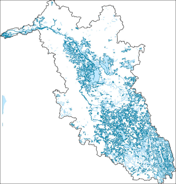
The Watershed Boundary Dataset (WBD) is a comprehensive aggregated collection of hydrologic unit data consistent with the national criteria for delineation and resolution. It defines the areal extent of surface water drainage to a point except in coastal or lake front areas where there could be multiple outlets as stated by the "Federal Standards and Procedures for the National Watershed Boundary Dataset (WBD)" "Standard" (https://pubs.usgs.gov/tm/11/a3/). Watershed boundaries are determined solely upon science-based hydrologic principles, not favoring any administrative boundaries or special projects, nor particular program or agency. This dataset represents the hydrologic unit boundaries to the 12-digit (6th level)...
This dataset is part of the U.S. Geological Survey (USGS) Great Lakes Coastal Wetland Restoration Assessment (GLCWRA) initiative. These data represent the flowline network in the Green Bay Restoration Assessment (GBRA). It is attributed with the number of disconnections (e.g., road crossings) between the reach and Lake Ontario. The more road crossings on a flowline the more disconnected that area is from the lake and the less suitable it will be for restoration. These data help identify the condition of hydrologic separation between potential restoration areas and Lake Ontario. Low numbers represent fewer disconnections, such as culverts, between the reach and the water body requiring no flow network modification...
Geospatial data is comprised of government boundaries.

Geospatial data is comprised of government boundaries.
Geospatial data includes structures and other selected map features.
|

|
