Filters: Tags: Liberty Island (X)
31 results (57ms)|
Filters
Date Range
Types Contacts
Categories Tag Types Tag Schemes |
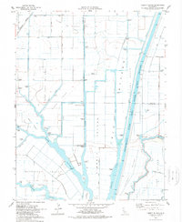
USGS Historical Quadrangle in GeoPDF.
Real-time, high frequency (1-second sample interval) GPS location, water quality, and water isotope (δ2H, δ18O) data was collected in the Cache Slough Complex (CSC), located in the northern San Francisco Bay Delta (SFBD). Data was collected on 10/01/2014 for an approximate 4-hour period (10:30 – 14:30 h PST) while underway on the R/V Mary Landsteiner, a 26-foot USGS vessel. Sample water was pumped continuously through a pickup tube, passed through a 178 micron pre-filter, a de-bubbler, and diverted through a 0.2 micron filter and an unfiltered flow path to water quality instrumentation. The real-time data were recorded using a Campbell Scientific CR-6 data logger. Water isotopes (δ2H, δ18O) were logged to a separate...
Categories: Data;
Types: Citation,
Map Service,
OGC WFS Layer,
OGC WMS Layer,
OGC WMS Service;
Tags: Aquatic Biology,
Cache Slough,
Ecology,
Geochemistry,
Hydrogeology,
Data was collected in the Cache Slough Complex located in the northern San Francisco Estuary to characterize water quality parameters at high spatial resolution. Data collection was conducted on three separate occasions: October 2017, May 2018, and October 2018. Data set includes nitrate, ammonium, ortho-phosphate, dissolved organic carbon, temperature, conductivity, dissolved oxygen, turbidity, chlorophyll, stable isotopes including water isotopes. Measurements were used to calculate evaporation to inflow ratios and water residence time.
This portion of the data release presents a topographic point cloud of the Liberty Island Conservation Bank Wildlands restoration site in the Sacramento-San Joaquin Delta, derived from structure-from-motion (SfM) processing of aerial imagery collected with an Unmanned Aerial System (UAS) on 2018-10-23. The point cloud contains 380,296,568 points at an approximate point density of 323 point per square-meter. Each point contains an explicit horizontal and vertical coordinate, color, intensity, and classification. The point cloud is tiled into 500 x 500-meter tiles to reduce file size. The raw imagery used to create this point cloud was acquired using two UAS fitted with Ricoh GR II digital cameras global shutters....
Grain size distribution and bulk density are reported for sediment samples from two flooded agricultural tracts, Little Holland Tract and Liberty Island, in the Sacramento-San Joaquin Delta, California. Samples were repeatedly collected at 8 sites using a Ponar grab or push core samplers during 19 visits to the study area from 2015 to 2019. The long-term time series data collection stations (sites LWA, HVB, HWC, and LVB) were sampled on almost every field survey, and the remaining sites were sampled 6 or times or fewer, some only once. All samples were analyzed for grain size distribution, and some were analyzed for bulk density. These data provide insight into how particle size distributions varied spatially and...
Categories: Data;
Tags: CMGP,
Coastal and Marine Geology Program,
Liberty Island,
Little Holland Tract,
Oceans,
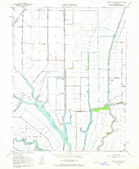
USGS Historical Quadrangle in GeoPDF.

Water depth, turbidity, and current velocity time-series data were collected in Little Holland Tract in 2016. Depth (from pressure) and velocity were measured in high-frequency (8 Hz) bursts. Burst means represent tidal stage and currents, and burst data can be used to determine wave height, period, direction, and wave-orbital velocity. The turbidity sensors were calibrated to suspended-sediment concentration measured in water samples collected on site. The calibration and fit parameters for all of the turbidity sensors used in the study are tabulated and provided with the data. Data were sequentially added to this data release as they were collected and post-processed. Typically, each zip folder for a deployment...

Grain size distribution and bulk density are reported for sediment push cores from two flooded agricultural tracts, Little Holland Tract and Liberty Island, in the Sacramento-San Joaquin Delta, California. Push core samples were collected from 17 sites by the U.S. Geological Survey in June 2016. Each core was analyzed at multiple depths to investigate variations in particle sizes with depth below the sediment surface. The same sites were sampled previously in 2014 (https://www.sciencebase.gov/catalog/item/5a73a58fe4b0a9a2e9e172cf). These data provide insight into the variation of particle size distributions in space, bed depth, and time.
Categories: Data;
Tags: CMGP,
Coastal and Marine Geology Program,
Liberty Island,
Little Holland Tract,
Oceans,
This data release documents the spatial and temporal variability of nutrients and related water quality parameters at high spatial resolution in the North Delta in the Sacramento-San Joaquin River Delta of California, USA. The data set includes nitrate, ammonium, phosphate, dissolved organic carbon, temperature, conductivity, dissolved oxygen, turbidity, and chlorophyll . Data-collection cruises were conducted under three different environmental/flow conditions in August, September, and October 2018 that coincided with conditions prior to, during, and following a directed flow action or pulse of agricultural return water organized by the California Department of Water Resources and California Natural Resources Agency...
Categories: Data;
Types: Map Service,
OGC WFS Layer,
OGC WMS Layer,
OGC WMS Service;
Tags: California,
Central Valley,
Directed Flow Action,
Liberty Island,
Sacramento River,

Water depth and turbidity time-series data were collected in Little Holland Tract (LHT) from 2015 to 2017. Depth (from pressure) was measured in high-frequency (6 or 8 Hz) bursts. Burst means represent tidal stage, and burst data can be used to determine wave height and period. The turbidity sensors were calibrated to suspended-sediment concentration measured in water samples collected on site. The calibration and fit parameters for all of the turbidity sensors used in the study are tabulated and provided with the data. Data were sequentially added to this data release as they were collected and post-processed. Typically, each zip folder for a deployment period contains one file from an optical backscatter sensor...

Water depth, turbidity, and current velocity time-series data were collected in Little Holland Tract in 2016. Depth (from pressure) and velocity were measured in high-frequency (8 Hz) bursts. Burst means represent tidal stage and currents, and burst data can be used to determine wave height, period, and direction, and wave-orbital velocity. The turbidity sensors were calibrated to suspended-sediment concentration measured in water samples collected on site. The calibration and fit parameters for all of the turbidity sensors used in the study are tabulated and provided with the data. Data were sequentially added to this data release as they were collected and post-processed. Typically, each zip folder for...
|

|
