Filters
Date Types (for Date Range)
Contacts
Tag Types
Tag Schemes
|
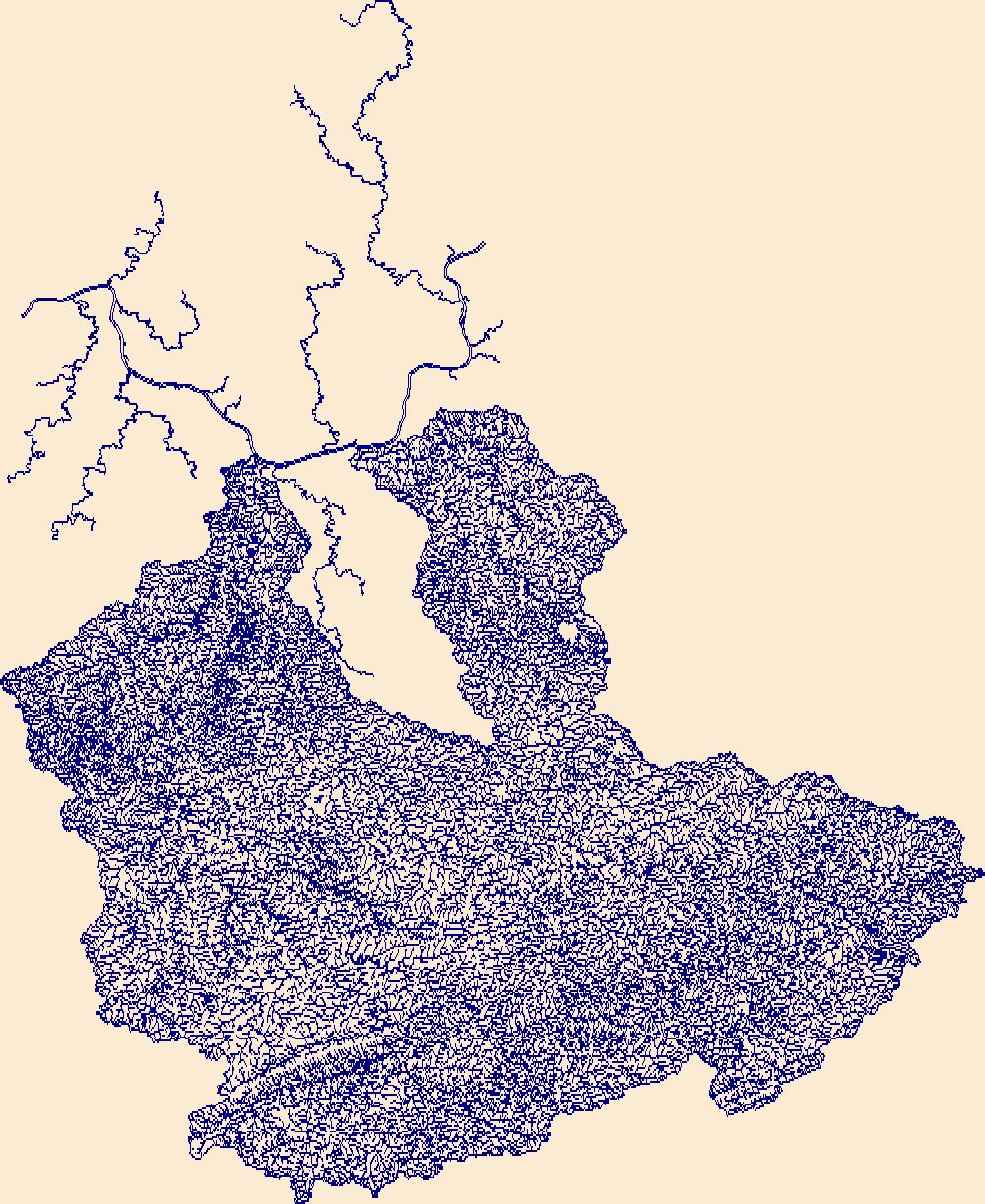
The High Resolution National Hydrography Dataset Plus (NHDPlus HR) is an integrated set of geospatial data layers, including the best available National Hydrography Dataset (NHD), the 10-meter 3D Elevation Program Digital Elevation Model (3DEP DEM), and the National Watershed Boundary Dataset (WBD). The NHDPlus HR combines the NHD, 3DEP DEMs, and WBD to create a stream network with linear referencing, feature naming, "value added attributes" (VAAs), elevation-derived catchments, and other features for hydrologic data analysis. The stream network with linear referencing is a system of data relationships applied to hydrographic systems so that one stream reach "flows" into another and "events" can be tied to and traced...
Tags: Boone County,
Boyd County,
Buchanan County,
Cabell County,
Dickenson County, All tags...
Downloadable Data,
Elliott County,
FileGDB,
FileGDB 10.1,
Floyd County,
HU-4 Subregion,
HU-4 Subregion,
HU4_0507,
Hydrography,
Johnson County,
KY,
Kanawha County,
Kentucky,
Knott County,
Lawrence County,
Letcher County,
Lincoln County,
Logan County,
Magoffin County,
Martin County,
Mason County,
McDowell County,
Mercer County,
Mingo County,
Morgan County,
NHDPlus HR Rasters,
NHDPlus High Resolution (NHDPlus HR),
National Hydrography Dataset (NHD),
National Hydrography Dataset Plus High Resolution (NHDPlus HR),
National Hydrography Dataset Plus High Resolution (NHDPlus HR) Current,
Pike County,
Putnam County,
Raleigh County,
Russell County,
Tazewell County,
US,
United States,
VA,
Virginia,
WV,
Wayne County,
West Virginia,
Wise County,
Wyoming County,
base maps,
cartography,
catchments,
channels,
digital elevation models,
drainage basins,
earth sciences,
elevation,
environment,
geographic information systems,
geoscientific,
geospatial analysis,
hydrographic datasets,
hydrographic features,
hydrology,
imagery,
inland waters,
lakes,
land surface characteristics,
reservoirs,
river reaches,
rivers,
streamflow,
streamflow data,
streams,
topography,
water bodies,
water quality,
water resources,
watersheds, Fewer tags

The High Resolution National Hydrography Dataset Plus (NHDPlus HR) is an integrated set of geospatial data layers, including the best available National Hydrography Dataset (NHD), the 10-meter 3D Elevation Program Digital Elevation Model (3DEP DEM), and the National Watershed Boundary Dataset (WBD). The NHDPlus HR combines the NHD, 3DEP DEMs, and WBD to create a stream network with linear referencing, feature naming, "value added attributes" (VAAs), elevation-derived catchments, and other features for hydrologic data analysis. The stream network with linear referencing is a system of data relationships applied to hydrographic systems so that one stream reach "flows" into another and "events" can be tied to and traced...
Tags: Adams County,
Athens County,
Boone County,
Boyd County,
Bracken County, All tags...
Brown County,
Butler County,
Cabell County,
Campbell County,
Carroll County,
Carter County,
Clark County,
Clermont County,
Clinton County,
Dearborn County,
Decatur County,
Downloadable Data,
Elliott County,
Fayette County,
FileGDB,
FileGDB 10.1,
Fleming County,
Franklin County,
Gallatin County,
Gallia County,
Grant County,
Greene County,
Greenup County,
HU-4 Subregion,
HU-4 Subregion,
HU4_0509,
Hamilton County,
Highland County,
Hocking County,
Hydrography,
IN,
Indiana,
Jackson County,
KY,
Kenton County,
Kentucky,
Lawrence County,
Lawrence County,
Lewis County,
Lincoln County,
Logan County,
Madison County,
Mason County,
Mason County,
Meigs County,
Mingo County,
Montgomery County,
Morgan County,
NHDPlus HR Rasters,
NHDPlus High Resolution (NHDPlus HR),
National Hydrography Dataset (NHD),
National Hydrography Dataset Plus High Resolution (NHDPlus HR),
National Hydrography Dataset Plus High Resolution (NHDPlus HR) Current,
OH,
Ohio,
Ohio County,
Pendleton County,
Pike County,
Putnam County,
Ripley County,
Ross County,
Rowan County,
Scioto County,
Switzerland County,
US,
United States,
Vinton County,
WV,
Warren County,
Wayne County,
West Virginia,
base maps,
cartography,
catchments,
channels,
digital elevation models,
drainage basins,
earth sciences,
elevation,
environment,
geographic information systems,
geoscientific,
geospatial analysis,
hydrographic datasets,
hydrographic features,
hydrology,
imagery,
inland waters,
lakes,
land surface characteristics,
reservoirs,
river reaches,
rivers,
streamflow,
streamflow data,
streams,
topography,
water bodies,
water quality,
water resources,
watersheds, Fewer tags
|
|

