Filters
Date Types (for Date Range)
Extensions
Types
Contacts
Categories
Tag Types
Tag Schemes
|
Geospatial data includes structures and other selected map features.
Tags: Adams,
Alcorn,
Amite,
Attala,
Benton, All tags...
Bolivar,
Calhoun,
Campground,
Carroll,
Chickasaw,
Choctaw,
Claiborne,
Clarke,
Clay,
Coahoma,
College / University,
Copiah,
Courthouse,
Covington,
DeSoto,
Downloadable Data,
Fire Station/ EMS Station,
Forrest,
Franklin,
GeoPackage,
George,
Greene,
Grenada,
Hancock,
Harrison,
Hinds,
Holmes,
Hospital/Medical Center,
Humphreys,
Information Center,
Issaquena,
Itawamba,
Jackson,
Jasper,
Jefferson,
Jefferson Davis,
Jones,
Kemper,
Lafayette,
Lamar,
Lauderdale,
Law Enforcement,
Lawrence,
Leake,
Lee,
Leflore,
Lincoln,
Lowndes,
MS,
Madison,
Marion,
Marshall,
Mississippi,
Monroe,
Montgomery,
National Structures Dataset (NSD),
National Structures Dataset (NSD),
Neshoba,
Newton,
Noxubee,
Oktibbeha,
Open Geospatial Consortium GeoPackage 1.2,
Panola,
Pearl River,
Perry,
Pike,
Pontotoc,
Post Office,
Prentiss,
Prison/ Correctional Facility,
Quitman,
Rankin,
School,
School:Elementary,
School:High School,
School:Middle School,
Scott,
Sharkey,
Simpson,
Smith,
State,
State,
State Capitol,
Stone,
Structures,
Sunflower,
Tallahatchie,
Tate,
Technical School,
Tippah,
Tishomingo,
Town Hall,
Trade School,
Trailhead,
Tunica,
US,
Union,
United States,
Visitor Center,
Walthall,
Warren,
Washington,
Wayne,
Webster,
Wilkinson,
Winston,
Yalobusha,
Yazoo,
structure, Fewer tags

This dataset includes a modified subset of polygon features that describe U.S. Geological Survey's defined geologic provinces of the World. Each province has a set of geologic characteristics that distinguish it from surrounding provinces. These characteristics may include dominant lithologies, the age of the strata, and/or structural type. Each province is assigned a unique numeric code and may fall within two or more countries or assessment regions.
Categories: Data,
pre-SM502.8;
Types: Downloadable,
Map Service,
OGC WFS Layer,
OGC WMS Layer,
Shapefile;
Tags: AG,
AI,
AN,
AW,
Anguilla, All tags...
Antigua and Barbuda,
Aruba,
Aves Ridge (6109),
BB,
BS,
BZ,
Bahama Platform (6119),
Bahamas,
Barbados,
Barbados Accretionary Complex (6127),
Barinas-Apure Basin (6097),
Beata Ridge (6111),
Belize,
Bonaire Basin (6101),
British Virgin Islands,
CO,
CR,
CU,
Cariaco Basin (6102),
Caribbean,
Cayman Islands,
Cayman Ridge (6121),
Cayman Trough (6120),
Cesar Basin (6094),
Chiapas Massif-Nuclear Central America (6122),
Choco Pacific Basin (6087),
Colombia,
Colombian Basin (6112),
Costa Rica,
Cuba,
DM,
DO,
Dominica,
Dominican Republic,
Earth Science,
East Venezuela Basin (6098),
Economic geology,
El Salvador,
Falcon Basin (6100),
Florida Peninsula (5050),
GD,
GP,
GT,
GY,
Gas province,
Gas resource assessment,
Geologic province,
Geology,
Greater Antilles Deformed Belt (6117),
Grenada,
Grenada Back-Arc Basin (6126),
Guadeloupe,
Guajira Basin (6095),
Guatemala,
Gulf Cenozoic OCS (5097),
Gulf Cenozoic OCS (5098),
Guyana,
Guyana Shield (6002),
Guyana-Suriname Basin (6021),
HN,
HT,
Haiti,
Honduras,
JM,
Jamaica,
KN,
KY,
LC,
Lesser Antilles Deformed Belt (6107),
Llanos Basin (6096),
Lower Magdelena (6091),
MQ,
MS,
MX,
Macuspana Basin (5306),
Maracaibo Basin (6099),
Martinique,
Maya Mountains (6125),
Mexico,
Middle America Province (6113),
Middle Magdelena (6090),
Monserrat,
NI,
Natural Gas,
Natural gas liquids resource assessment,
Natural gas resources,
Neogene Volcanic Belt (6108),
Netherlands Antilles,
Nicaragua,
North Caribbean Deformed Belt (6116),
North Nicaraguan Rise (6114),
Ocean (0),
Ocean (1),
Oil and gas province,
Oil and gas resource assessment,
Oil province,
Oil resource assessment,
Oil resources,
PA,
PR,
Pacific Offshore Basin (6088),
Panama,
Perjira-Venezuela-Coastal Ranges (6093),
Petroleum,
Puerto Rico,
Puerto Rico Trench (6118),
Resource Assessment,
SV,
Saline-Comalcalco Basin (5304),
Sierra Madre de Chiapas-Peten Foldbelt (5310),
Sierra Nevada de Santa Marta (6105),
South Caribbean Accretionary Prism (6104),
South Nicaraguan Rise (6115),
St. Kitts and Nevis,
St. Lucia,
St. Vincent and the Grenadines,
TC,
TT,
Tobago Trough (6103),
Trinidad and Tobago,
Turks and Caicas Islands,
U.S. Geological Survey,
US,
USGS,
USGS Science Data Catalog (SDC),
United States,
VC,
VE,
VI,
VQ,
Venezuela,
Venezuelan Basin (6110),
Villahermosa Uplift (5305),
Virgin Islands,
West-Central Cordillera (6106),
Yucatan Basin (6123),
Yucatan Platform (5308),
caribbean,
economy,
environment,
geoscientificInformation,
oilgas,
wep,
worldgeologicmaps, Fewer tags

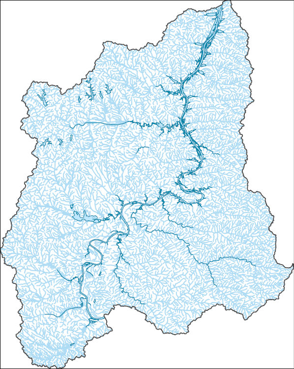
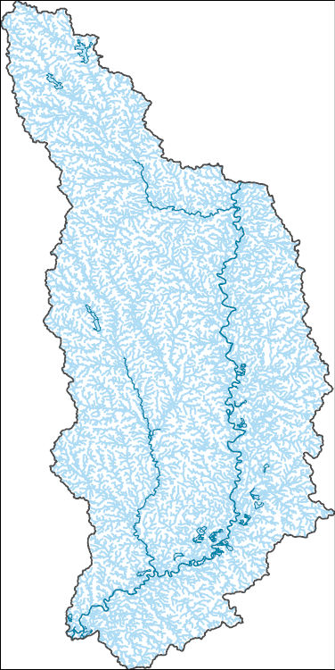
The High Resolution National Hydrography Dataset Plus (NHDPlus HR) is an integrated set of geospatial data layers, including the best available National Hydrography Dataset (NHD), the 10-meter 3D Elevation Program Digital Elevation Model (3DEP DEM), and the National Watershed Boundary Dataset (WBD). The NHDPlus HR combines the NHD, 3DEP DEMs, and WBD to create a stream network with linear referencing, feature naming, "value added attributes" (VAAs), elevation-derived catchments, and other features for hydrologic data analysis. The stream network with linear referencing is a system of data relationships applied to hydrographic systems so that one stream reach "flows" into another and "events" can be tied to and traced...
Tags: Adams County,
Amite County,
Attala County,
Carroll County,
Choctaw County, All tags...
Claiborne County,
Concordia County,
Copiah County,
Downloadable Data,
FileGDB,
FileGDB 10.1,
Franklin County,
HU-4 Subregion,
HU-4 Subregion,
HU4_0806,
Hinds County,
Holmes County,
Hydrography,
Jefferson County,
LA,
Leake County,
Lincoln County,
Louisiana,
MS,
Madison County,
Madison County,
Mississippi,
Montgomery County,
NHDPlus HR Rasters,
NHDPlus High Resolution (NHDPlus HR),
National Hydrography Dataset (NHD),
National Hydrography Dataset Plus High Resolution (NHDPlus HR),
National Hydrography Dataset Plus High Resolution (NHDPlus HR) Current,
Oktibbeha County,
Tensas County,
US,
United States,
Warren County,
Webster County,
West Feliciana County,
Wilkinson County,
Yazoo County,
base maps,
cartography,
catchments,
channels,
digital elevation models,
drainage basins,
earth sciences,
elevation,
environment,
geographic information systems,
geoscientific,
geospatial analysis,
hydrographic datasets,
hydrographic features,
hydrology,
imagery,
inland waters,
lakes,
land surface characteristics,
reservoirs,
river reaches,
rivers,
streamflow,
streamflow data,
streams,
topography,
water bodies,
water quality,
water resources,
watersheds, Fewer tags

Lake temperature is an important environmental metric for understanding habitat suitability for many freshwater species and is especially useful when temperatures are predicted throughout the water column (known as temperature profiles). In this data release, multiple modeling approaches were used to generate predictions of daily temperature profiles for thousands of lakes in the Midwest. Predictions were generated using two modeling frameworks: a machine learning model (specifically an entity-aware long short-term memory or EA-LSTM model; Kratzert et al., 2019) and a process-based model (specifically the General Lake Model or GLM; Hipsey et al., 2019). Both the EA-LSTM and GLM frameworks were used to generate...
Categories: Data;
Tags: AR,
Arkansas,
IA,
IL,
IN, All tags...
Illinois,
Indiana,
Iowa,
KS,
KY,
Kansas,
Kentucky,
LA,
Louisiana,
MI,
MN,
MO,
MS,
MT,
Michigan,
Minnesota,
Mississippi,
Missouri,
Montana,
ND,
NE,
Nebraska,
North Dakota,
OH,
OK,
Ohio,
Oklahoma,
SD,
South Dakota,
TN,
TX,
Tennessee,
Texas,
US,
USGS Science Data Catalog (SDC),
United States,
WI,
WY,
Wisconsin,
Wyoming,
climate change,
deep learning,
environment,
inlandWaters,
lakes,
machine learning,
modeling,
reservoirs,
temperate lakes,
temperature,
thermal profiles,
water,
water resources, Fewer tags
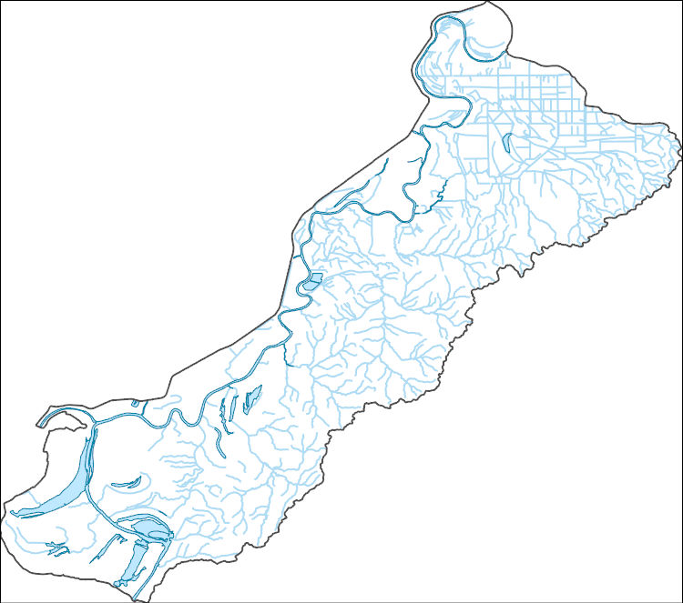
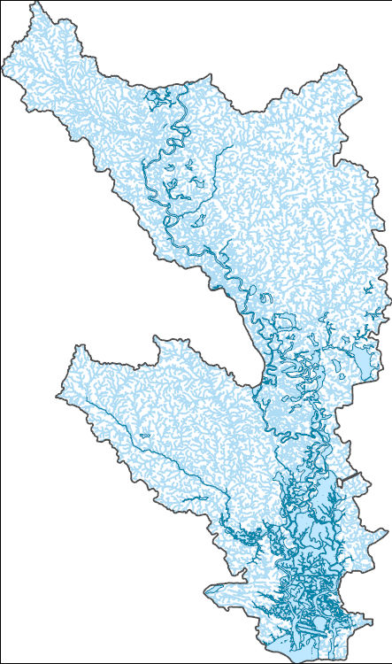
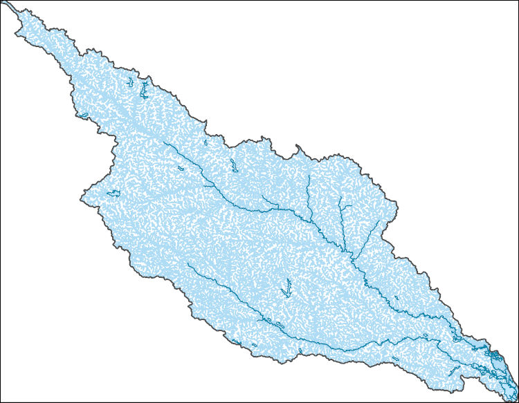
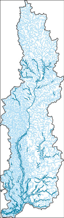
The National Hydrography Dataset (NHD) is a feature-based database that interconnects and uniquely identifies the stream segments or reaches that make up the nation's surface water drainage system. NHD data was originally developed at 1:100,000-scale and exists at that scale for the whole country. This high-resolution NHD, generally developed at 1:24,000/1:12,000 scale, adds detail to the original 1:100,000-scale NHD. (Data for Alaska, Puerto Rico and the Virgin Islands was developed at high-resolution, not 1:100,000 scale.) Local resolution NHD is being developed where partners and data exist. The NHD contains reach codes for networked features, flow direction, names, and centerline representations for areal water...
Tags: Adams,
Administrative watershed units,
Administrative watershed units,
Amite,
Area of Complex Channels, All tags...
Area to be submerged,
Basin,
Basin,
Bay/Inlet,
Boundaries,
Boundary,
Bridge,
Canal/Ditch,
Coastline,
Connector,
Copiah,
Dam/Weir,
Downloadable Data,
Drainage areas for surface water,
Drainageway,
Esri File GeoDatabase 10,
Estuary,
FileGDB,
Flow direction network,
Flume,
ForeShore,
Franklin,
Gaging Station,
Gate,
HU-8,
HU-8 Subbasin,
HU10,
HU12,
HU14,
HU16,
HU2,
HU4,
HU6,
HU8,
HU8_08060205,
HUC,
Hazard Zone,
Hydrographic,
Hydrography,
Hydrography,
Hydrography,
Hydrologic Unit Code,
Hydrologic Units,
Ice mass,
Inundation Area,
Jefferson,
Levee,
Lincoln,
Line,
Lock Chamber,
MS,
Marsh,
Mississippi,
National Hydrography Dataset (NHD),
National Hydrography Dataset (NHD) Best Resolution,
National Hydrography Dataset (NHD) Best Resolution,
Nonearthen Shore,
Orthoimage,
Playa,
Point,
PointEvent,
Pond,
Rapids,
Rapids,
Reach,
Reach code,
Reef,
Region,
Reservoir,
Rock,
Sea/Ocean,
Sink/Rise,
Sounding Datum Line,
Special Use Zone,
Special Use Zone Limit,
Spillway,
Stream,
Stream/River,
Sub-basin,
Sub-region,
Subbasin,
Submerged Stream,
Subregion,
Subwatershed,
Surface water systems,
Swamp,
Topographic,
Tunnel,
US,
Underground Conduit,
United States,
WBD,
WBD,
Wall,
Wash,
Water Intake Outflow,
Waterfall,
Watershed,
Watershed Boundaries,
Watershed Boundary Dataset,
Watershed Boundary Dataset,
Well,
Wilkinson,
artificial path,
boundaries,
dams,
drainage systems and characteristics,
inlandWaters,
lakes,
ngda,
rivers, Fewer tags
The National Hydrography Dataset (NHD) is a feature-based database that interconnects and uniquely identifies the stream segments or reaches that make up the nation's surface water drainage system. NHD data was originally developed at 1:100,000-scale and exists at that scale for the whole country. This high-resolution NHD, generally developed at 1:24,000/1:12,000 scale, adds detail to the original 1:100,000-scale NHD. (Data for Alaska, Puerto Rico and the Virgin Islands was developed at high-resolution, not 1:100,000 scale.) Local resolution NHD is being developed where partners and data exist. The NHD contains reach codes for networked features, flow direction, names, and centerline representations for areal water...
Tags: Administrative watershed units,
Administrative watershed units,
Area of Complex Channels,
Area to be submerged,
Basin, All tags...
Basin,
Bay/Inlet,
Boundaries,
Boundary,
Bridge,
Canal/Ditch,
Coastline,
Connector,
Dam/Weir,
Downloadable Data,
Drainage areas for surface water,
Drainageway,
Estuary,
Flow direction network,
Flume,
ForeShore,
Gaging Station,
Gate,
GeoPackage,
HU-8,
HU-8 Subbasin,
HU10,
HU12,
HU14,
HU16,
HU2,
HU4,
HU6,
HU8,
HU8_08090203,
HUC,
Harrison,
Hazard Zone,
Hydrographic,
Hydrography,
Hydrography,
Hydrography,
Hydrologic Unit Code,
Hydrologic Units,
Ice mass,
Inundation Area,
Jefferson,
LA,
Levee,
Line,
Lock Chamber,
Louisiana,
MS,
Marsh,
Mississippi,
National Hydrography Dataset (NHD),
National Hydrography Dataset (NHD) Best Resolution,
National Hydrography Dataset (NHD) Best Resolution,
Nonearthen Shore,
Open Geospatial Consortium GeoPackage 1.2,
Orleans,
Orthoimage,
Plaquemines,
Playa,
Point,
PointEvent,
Pond,
Rapids,
Rapids,
Reach,
Reach code,
Reef,
Region,
Reservoir,
Rock,
Sea/Ocean,
Sink/Rise,
Sounding Datum Line,
Special Use Zone,
Special Use Zone Limit,
Spillway,
St. Bernard,
St. Charles,
St. Tammany,
Stream,
Stream/River,
Sub-basin,
Sub-region,
Subbasin,
Submerged Stream,
Subregion,
Subwatershed,
Surface water systems,
Swamp,
Topographic,
Tunnel,
US,
Underground Conduit,
United States,
WBD,
WBD,
Wall,
Wash,
Water Intake Outflow,
Waterfall,
Watershed,
Watershed Boundaries,
Watershed Boundary Dataset,
Watershed Boundary Dataset,
Well,
artificial path,
boundaries,
dams,
drainage systems and characteristics,
inlandWaters,
lakes,
ngda,
rivers, Fewer tags
The National Hydrography Dataset (NHD) is a feature-based database that interconnects and uniquely identifies the stream segments or reaches that make up the nation's surface water drainage system. NHD data was originally developed at 1:100,000-scale and exists at that scale for the whole country. This high-resolution NHD, generally developed at 1:24,000/1:12,000 scale, adds detail to the original 1:100,000-scale NHD. (Data for Alaska, Puerto Rico and the Virgin Islands was developed at high-resolution, not 1:100,000 scale.) Local resolution NHD is being developed where partners and data exist. The NHD contains reach codes for networked features, flow direction, names, and centerline representations for areal water...
Tags: Administrative watershed units,
Administrative watershed units,
Area of Complex Channels,
Area to be submerged,
Attala, All tags...
Basin,
Basin,
Bay/Inlet,
Boundaries,
Boundary,
Bridge,
Canal/Ditch,
Claiborne,
Coastline,
Connector,
Dam/Weir,
Downloadable Data,
Drainage areas for surface water,
Drainageway,
Estuary,
Flow direction network,
Flume,
ForeShore,
Gaging Station,
Gate,
GeoPackage,
HU-8,
HU-8 Subbasin,
HU10,
HU12,
HU14,
HU16,
HU2,
HU4,
HU6,
HU8,
HU8_08060202,
HUC,
Hazard Zone,
Hinds,
Holmes,
Hydrographic,
Hydrography,
Hydrography,
Hydrography,
Hydrologic Unit Code,
Hydrologic Units,
Ice mass,
Inundation Area,
Levee,
Line,
Lock Chamber,
MS,
Madison,
Marsh,
Mississippi,
National Hydrography Dataset (NHD),
National Hydrography Dataset (NHD) Best Resolution,
National Hydrography Dataset (NHD) Best Resolution,
Nonearthen Shore,
Open Geospatial Consortium GeoPackage 1.2,
Orthoimage,
Playa,
Point,
PointEvent,
Pond,
Rapids,
Rapids,
Reach,
Reach code,
Reef,
Region,
Reservoir,
Rock,
Sea/Ocean,
Sink/Rise,
Sounding Datum Line,
Special Use Zone,
Special Use Zone Limit,
Spillway,
Stream,
Stream/River,
Sub-basin,
Sub-region,
Subbasin,
Submerged Stream,
Subregion,
Subwatershed,
Surface water systems,
Swamp,
Topographic,
Tunnel,
US,
Underground Conduit,
United States,
WBD,
WBD,
Wall,
Warren,
Wash,
Water Intake Outflow,
Waterfall,
Watershed,
Watershed Boundaries,
Watershed Boundary Dataset,
Watershed Boundary Dataset,
Well,
Yazoo,
artificial path,
boundaries,
dams,
drainage systems and characteristics,
inlandWaters,
lakes,
ngda,
rivers, Fewer tags
The National Hydrography Dataset (NHD) is a feature-based database that interconnects and uniquely identifies the stream segments or reaches that make up the nation's surface water drainage system. NHD data was originally developed at 1:100,000-scale and exists at that scale for the whole country. This high-resolution NHD, generally developed at 1:24,000/1:12,000 scale, adds detail to the original 1:100,000-scale NHD. (Data for Alaska, Puerto Rico and the Virgin Islands was developed at high-resolution, not 1:100,000 scale.) Local resolution NHD is being developed where partners and data exist. The NHD contains reach codes for networked features, flow direction, names, and centerline representations for areal water...
Tags: Administrative watershed units,
Administrative watershed units,
Alcorn,
Area of Complex Channels,
Area to be submerged, All tags...
Basin,
Basin,
Bay/Inlet,
Benton,
Boundaries,
Boundary,
Bridge,
Canal/Ditch,
Carroll,
Chester,
Coastline,
Connector,
Dam/Weir,
Decatur,
Downloadable Data,
Drainage areas for surface water,
Drainageway,
Esri File GeoDatabase 10,
Estuary,
FileGDB,
Flow direction network,
Flume,
ForeShore,
Gaging Station,
Gate,
HU-8,
HU-8 Subbasin,
HU10,
HU12,
HU14,
HU16,
HU2,
HU4,
HU6,
HU8,
HU8_06040001,
HUC,
Hardin,
Hazard Zone,
Henderson,
Humphreys,
Hydrographic,
Hydrography,
Hydrography,
Hydrography,
Hydrologic Unit Code,
Hydrologic Units,
Ice mass,
Inundation Area,
Levee,
Line,
Lock Chamber,
MS,
Marsh,
McNairy,
Mississippi,
National Hydrography Dataset (NHD),
National Hydrography Dataset (NHD) Best Resolution,
National Hydrography Dataset (NHD) Best Resolution,
Nonearthen Shore,
Orthoimage,
Perry,
Playa,
Point,
PointEvent,
Pond,
Rapids,
Rapids,
Reach,
Reach code,
Reef,
Region,
Reservoir,
Rock,
Sea/Ocean,
Sink/Rise,
Sounding Datum Line,
Special Use Zone,
Special Use Zone Limit,
Spillway,
Stream,
Stream/River,
Sub-basin,
Sub-region,
Subbasin,
Submerged Stream,
Subregion,
Subwatershed,
Surface water systems,
Swamp,
TN,
Tennessee,
Tishomingo,
Topographic,
Tunnel,
US,
Underground Conduit,
United States,
WBD,
WBD,
Wall,
Wash,
Water Intake Outflow,
Waterfall,
Watershed,
Watershed Boundaries,
Watershed Boundary Dataset,
Watershed Boundary Dataset,
Wayne,
Well,
artificial path,
boundaries,
dams,
drainage systems and characteristics,
inlandWaters,
lakes,
ngda,
rivers, Fewer tags

The National Hydrography Dataset (NHD) is a feature-based database that interconnects and uniquely identifies the stream segments or reaches that make up the nation's surface water drainage system. NHD data was originally developed at 1:100,000-scale and exists at that scale for the whole country. This high-resolution NHD, generally developed at 1:24,000/1:12,000 scale, adds detail to the original 1:100,000-scale NHD. (Data for Alaska, Puerto Rico and the Virgin Islands was developed at high-resolution, not 1:100,000 scale.) Local resolution NHD is being developed where partners and data exist. The NHD contains reach codes for networked features, flow direction, names, and centerline representations for areal water...
Tags: Administrative watershed units,
Administrative watershed units,
Alcorn,
Area of Complex Channels,
Area to be submerged, All tags...
Basin,
Basin,
Bay/Inlet,
Benton,
Boundaries,
Boundary,
Bridge,
Canal/Ditch,
Carroll,
Chester,
Coastline,
Connector,
Dam/Weir,
Decatur,
Downloadable Data,
Drainage areas for surface water,
Drainageway,
Esri Shapefile nan,
Estuary,
Flow direction network,
Flume,
ForeShore,
Gaging Station,
Gate,
HU-8,
HU-8 Subbasin,
HU10,
HU12,
HU14,
HU16,
HU2,
HU4,
HU6,
HU8,
HU8_06040001,
HUC,
Hardin,
Hazard Zone,
Henderson,
Humphreys,
Hydrographic,
Hydrography,
Hydrography,
Hydrography,
Hydrologic Unit Code,
Hydrologic Units,
Ice mass,
Inundation Area,
Levee,
Line,
Lock Chamber,
MS,
Marsh,
McNairy,
Mississippi,
National Hydrography Dataset (NHD),
National Hydrography Dataset (NHD) Best Resolution,
National Hydrography Dataset (NHD) Best Resolution,
Nonearthen Shore,
Orthoimage,
Perry,
Playa,
Point,
PointEvent,
Pond,
Rapids,
Rapids,
Reach,
Reach code,
Reef,
Region,
Reservoir,
Rock,
Sea/Ocean,
Shapefile,
Sink/Rise,
Sounding Datum Line,
Special Use Zone,
Special Use Zone Limit,
Spillway,
Stream,
Stream/River,
Sub-basin,
Sub-region,
Subbasin,
Submerged Stream,
Subregion,
Subwatershed,
Surface water systems,
Swamp,
TN,
Tennessee,
Tishomingo,
Topographic,
Tunnel,
US,
Underground Conduit,
United States,
WBD,
WBD,
Wall,
Wash,
Water Intake Outflow,
Waterfall,
Watershed,
Watershed Boundaries,
Watershed Boundary Dataset,
Watershed Boundary Dataset,
Wayne,
Well,
artificial path,
boundaries,
dams,
drainage systems and characteristics,
inlandWaters,
lakes,
ngda,
rivers, Fewer tags
The National Hydrography Dataset (NHD) is a feature-based database that interconnects and uniquely identifies the stream segments or reaches that make up the nation's surface water drainage system. NHD data was originally developed at 1:100,000-scale and exists at that scale for the whole country. This high-resolution NHD, generally developed at 1:24,000/1:12,000 scale, adds detail to the original 1:100,000-scale NHD. (Data for Alaska, Puerto Rico and the Virgin Islands was developed at high-resolution, not 1:100,000 scale.) Local resolution NHD is being developed where partners and data exist. The NHD contains reach codes for networked features, flow direction, names, and centerline representations for areal water...
Tags: Administrative watershed units,
Administrative watershed units,
Area of Complex Channels,
Area to be submerged,
Basin, All tags...
Basin,
Bay/Inlet,
Boundaries,
Boundary,
Bridge,
Canal/Ditch,
Coastline,
Connector,
Dam/Weir,
Downloadable Data,
Drainage areas for surface water,
Drainageway,
Esri File GeoDatabase 10,
Estuary,
FileGDB,
Flow direction network,
Flume,
ForeShore,
Gaging Station,
Gate,
HU-8,
HU-8 Subbasin,
HU10,
HU12,
HU14,
HU16,
HU2,
HU4,
HU6,
HU8,
HU8_08030208,
HUC,
Hazard Zone,
Hydrographic,
Hydrography,
Hydrography,
Hydrography,
Hydrologic Unit Code,
Hydrologic Units,
Ice mass,
Inundation Area,
Issaquena,
LA,
Levee,
Line,
Lock Chamber,
Louisiana,
MS,
Madison,
Marsh,
Mississippi,
National Hydrography Dataset (NHD),
National Hydrography Dataset (NHD) Best Resolution,
National Hydrography Dataset (NHD) Best Resolution,
Nonearthen Shore,
Orthoimage,
Playa,
Point,
PointEvent,
Pond,
Rapids,
Rapids,
Reach,
Reach code,
Reef,
Region,
Reservoir,
Rock,
Sea/Ocean,
Sharkey,
Sink/Rise,
Sounding Datum Line,
Special Use Zone,
Special Use Zone Limit,
Spillway,
Stream,
Stream/River,
Sub-basin,
Sub-region,
Subbasin,
Submerged Stream,
Subregion,
Subwatershed,
Surface water systems,
Swamp,
Topographic,
Tunnel,
US,
Underground Conduit,
United States,
WBD,
WBD,
Wall,
Warren,
Wash,
Water Intake Outflow,
Waterfall,
Watershed,
Watershed Boundaries,
Watershed Boundary Dataset,
Watershed Boundary Dataset,
Well,
Yazoo,
artificial path,
boundaries,
dams,
drainage systems and characteristics,
inlandWaters,
lakes,
ngda,
rivers, Fewer tags
The National Hydrography Dataset (NHD) is a feature-based database that interconnects and uniquely identifies the stream segments or reaches that make up the nation's surface water drainage system. NHD data was originally developed at 1:100,000-scale and exists at that scale for the whole country. This high-resolution NHD, generally developed at 1:24,000/1:12,000 scale, adds detail to the original 1:100,000-scale NHD. (Data for Alaska, Puerto Rico and the Virgin Islands was developed at high-resolution, not 1:100,000 scale.) Local resolution NHD is being developed where partners and data exist. The NHD contains reach codes for networked features, flow direction, names, and centerline representations for areal water...
Tags: Administrative watershed units,
Administrative watershed units,
Area of Complex Channels,
Area to be submerged,
Basin, All tags...
Basin,
Bay/Inlet,
Boundaries,
Boundary,
Bridge,
Canal/Ditch,
Coastline,
Connector,
Dam/Weir,
Downloadable Data,
Drainage areas for surface water,
Drainageway,
Esri File GeoDatabase 10,
Estuary,
FileGDB,
Flow direction network,
Flume,
ForeShore,
Gaging Station,
Gate,
George,
Greene,
HU-8,
HU-8 Subbasin,
HU10,
HU12,
HU14,
HU16,
HU2,
HU4,
HU6,
HU8,
HU8_03170006,
HUC,
Hazard Zone,
Hydrographic,
Hydrography,
Hydrography,
Hydrography,
Hydrologic Unit Code,
Hydrologic Units,
Ice mass,
Inundation Area,
Jackson,
Levee,
Line,
Lock Chamber,
MS,
Marsh,
Mississippi,
National Hydrography Dataset (NHD),
National Hydrography Dataset (NHD) Best Resolution,
National Hydrography Dataset (NHD) Best Resolution,
Nonearthen Shore,
Orthoimage,
Perry,
Playa,
Point,
PointEvent,
Pond,
Rapids,
Rapids,
Reach,
Reach code,
Reef,
Region,
Reservoir,
Rock,
Sea/Ocean,
Sink/Rise,
Sounding Datum Line,
Special Use Zone,
Special Use Zone Limit,
Spillway,
Stream,
Stream/River,
Sub-basin,
Sub-region,
Subbasin,
Submerged Stream,
Subregion,
Subwatershed,
Surface water systems,
Swamp,
Topographic,
Tunnel,
US,
Underground Conduit,
United States,
WBD,
WBD,
Wall,
Wash,
Water Intake Outflow,
Waterfall,
Watershed,
Watershed Boundaries,
Watershed Boundary Dataset,
Watershed Boundary Dataset,
Well,
artificial path,
boundaries,
dams,
drainage systems and characteristics,
inlandWaters,
lakes,
ngda,
rivers, Fewer tags
The National Hydrography Dataset (NHD) is a feature-based database that interconnects and uniquely identifies the stream segments or reaches that make up the nation's surface water drainage system. NHD data was originally developed at 1:100,000-scale and exists at that scale for the whole country. This high-resolution NHD, generally developed at 1:24,000/1:12,000 scale, adds detail to the original 1:100,000-scale NHD. (Data for Alaska, Puerto Rico and the Virgin Islands was developed at high-resolution, not 1:100,000 scale.) Local resolution NHD is being developed where partners and data exist. The NHD contains reach codes for networked features, flow direction, names, and centerline representations for areal water...
Tags: Administrative watershed units,
Administrative watershed units,
Area of Complex Channels,
Area to be submerged,
Basin, All tags...
Basin,
Bay/Inlet,
Boundaries,
Boundary,
Bridge,
Canal/Ditch,
Coastline,
Connector,
Dam/Weir,
Downloadable Data,
Drainage areas for surface water,
Drainageway,
Estuary,
Flow direction network,
Flume,
ForeShore,
Forrest,
Gaging Station,
Gate,
GeoPackage,
George,
HU-8,
HU-8 Subbasin,
HU10,
HU12,
HU14,
HU16,
HU2,
HU4,
HU6,
HU8,
HU8_03170007,
HUC,
Hazard Zone,
Hydrographic,
Hydrography,
Hydrography,
Hydrography,
Hydrologic Unit Code,
Hydrologic Units,
Ice mass,
Inundation Area,
Jackson,
Jefferson Davis,
Lamar,
Levee,
Line,
Lock Chamber,
MS,
Marion,
Marsh,
Mississippi,
National Hydrography Dataset (NHD),
National Hydrography Dataset (NHD) Best Resolution,
National Hydrography Dataset (NHD) Best Resolution,
Nonearthen Shore,
Open Geospatial Consortium GeoPackage 1.2,
Orthoimage,
Pearl River,
Perry,
Playa,
Point,
PointEvent,
Pond,
Rapids,
Rapids,
Reach,
Reach code,
Reef,
Region,
Reservoir,
Rock,
Sea/Ocean,
Sink/Rise,
Sounding Datum Line,
Special Use Zone,
Special Use Zone Limit,
Spillway,
Stone,
Stream,
Stream/River,
Sub-basin,
Sub-region,
Subbasin,
Submerged Stream,
Subregion,
Subwatershed,
Surface water systems,
Swamp,
Topographic,
Tunnel,
US,
Underground Conduit,
United States,
WBD,
WBD,
Wall,
Wash,
Water Intake Outflow,
Waterfall,
Watershed,
Watershed Boundaries,
Watershed Boundary Dataset,
Watershed Boundary Dataset,
Well,
artificial path,
boundaries,
dams,
drainage systems and characteristics,
inlandWaters,
lakes,
ngda,
rivers, Fewer tags
The National Hydrography Dataset (NHD) is a feature-based database that interconnects and uniquely identifies the stream segments or reaches that make up the nation's surface water drainage system. NHD data was originally developed at 1:100,000-scale and exists at that scale for the whole country. This high-resolution NHD, generally developed at 1:24,000/1:12,000 scale, adds detail to the original 1:100,000-scale NHD. (Data for Alaska, Puerto Rico and the Virgin Islands was developed at high-resolution, not 1:100,000 scale.) Local resolution NHD is being developed where partners and data exist. The NHD contains reach codes for networked features, flow direction, names, and centerline representations for areal water...
Tags: AL,
Administrative watershed units,
Administrative watershed units,
Alabama,
Area of Complex Channels, All tags...
Area to be submerged,
Basin,
Basin,
Bay/Inlet,
Boundaries,
Boundary,
Bridge,
Canal/Ditch,
Coastline,
Connector,
Dam/Weir,
Downloadable Data,
Drainage areas for surface water,
Drainageway,
Estuary,
Flow direction network,
Flume,
ForeShore,
Gaging Station,
Gate,
GeoPackage,
George,
Greene,
HU-8,
HU-8 Subbasin,
HU10,
HU12,
HU14,
HU16,
HU2,
HU4,
HU6,
HU8,
HU8_03170003,
HUC,
Hazard Zone,
Hydrographic,
Hydrography,
Hydrography,
Hydrography,
Hydrologic Unit Code,
Hydrologic Units,
Ice mass,
Inundation Area,
Levee,
Line,
Lock Chamber,
MS,
Marsh,
Mississippi,
National Hydrography Dataset (NHD),
National Hydrography Dataset (NHD) Best Resolution,
National Hydrography Dataset (NHD) Best Resolution,
Nonearthen Shore,
Open Geospatial Consortium GeoPackage 1.2,
Orthoimage,
Playa,
Point,
PointEvent,
Pond,
Rapids,
Rapids,
Reach,
Reach code,
Reef,
Region,
Reservoir,
Rock,
Sea/Ocean,
Sink/Rise,
Sounding Datum Line,
Special Use Zone,
Special Use Zone Limit,
Spillway,
Stream,
Stream/River,
Sub-basin,
Sub-region,
Subbasin,
Submerged Stream,
Subregion,
Subwatershed,
Surface water systems,
Swamp,
Topographic,
Tunnel,
US,
Underground Conduit,
United States,
WBD,
WBD,
Wall,
Wash,
Washington,
Water Intake Outflow,
Waterfall,
Watershed,
Watershed Boundaries,
Watershed Boundary Dataset,
Watershed Boundary Dataset,
Wayne,
Well,
artificial path,
boundaries,
dams,
drainage systems and characteristics,
inlandWaters,
lakes,
ngda,
rivers, Fewer tags
The National Hydrography Dataset (NHD) is a feature-based database that interconnects and uniquely identifies the stream segments or reaches that make up the nation's surface water drainage system. NHD data was originally developed at 1:100,000-scale and exists at that scale for the whole country. This high-resolution NHD, generally developed at 1:24,000/1:12,000 scale, adds detail to the original 1:100,000-scale NHD. (Data for Alaska, Puerto Rico and the Virgin Islands was developed at high-resolution, not 1:100,000 scale.) Local resolution NHD is being developed where partners and data exist. The NHD contains reach codes for networked features, flow direction, names, and centerline representations for areal water...
Tags: AL,
Administrative watershed units,
Administrative watershed units,
Alabama,
Area of Complex Channels, All tags...
Area to be submerged,
Basin,
Basin,
Bay/Inlet,
Boundaries,
Boundary,
Bridge,
Canal/Ditch,
Coastline,
Connector,
Dam/Weir,
Downloadable Data,
Drainage areas for surface water,
Drainageway,
Estuary,
Flow direction network,
Flume,
ForeShore,
Gaging Station,
Gate,
GeoPackage,
George,
Greene,
HU-8,
HU-8 Subbasin,
HU10,
HU12,
HU14,
HU16,
HU2,
HU4,
HU6,
HU8,
HU8_03170008,
HUC,
Hazard Zone,
Hydrographic,
Hydrography,
Hydrography,
Hydrography,
Hydrologic Unit Code,
Hydrologic Units,
Ice mass,
Inundation Area,
Jackson,
Levee,
Line,
Lock Chamber,
MS,
Marsh,
Mississippi,
Mobile,
National Hydrography Dataset (NHD),
National Hydrography Dataset (NHD) Best Resolution,
National Hydrography Dataset (NHD) Best Resolution,
Nonearthen Shore,
Open Geospatial Consortium GeoPackage 1.2,
Orthoimage,
Playa,
Point,
PointEvent,
Pond,
Rapids,
Rapids,
Reach,
Reach code,
Reef,
Region,
Reservoir,
Rock,
Sea/Ocean,
Sink/Rise,
Sounding Datum Line,
Special Use Zone,
Special Use Zone Limit,
Spillway,
Stream,
Stream/River,
Sub-basin,
Sub-region,
Subbasin,
Submerged Stream,
Subregion,
Subwatershed,
Surface water systems,
Swamp,
Topographic,
Tunnel,
US,
Underground Conduit,
United States,
WBD,
WBD,
Wall,
Wash,
Washington,
Water Intake Outflow,
Waterfall,
Watershed,
Watershed Boundaries,
Watershed Boundary Dataset,
Watershed Boundary Dataset,
Wayne,
Well,
artificial path,
boundaries,
dams,
drainage systems and characteristics,
inlandWaters,
lakes,
ngda,
rivers, Fewer tags

Geospatial data includes structures and other selected map features.
Tags: AK,
AL,
AR,
AS,
AZ, All tags...
Alabama,
Alaska,
American Samoa,
Arizona,
Arkansas,
CA,
CO,
CT,
California,
Campground,
College / University,
Colorado,
Connecticut,
Courthouse,
DC,
DE,
Delaware,
District of Columbia,
Downloadable Data,
Esri File GeoDatabase 10,
FL,
FileGDB,
Fire Station/ EMS Station,
Florida,
GA,
GU,
Georgia,
Guam,
HI,
Hawaii,
Hospital/Medical Center,
IA,
ID,
IL,
IN,
Idaho,
Illinois,
Indiana,
Information Center,
Iowa,
KS,
KY,
Kansas,
Kentucky,
LA,
Law Enforcement,
Louisiana,
MA,
MD,
ME,
MI,
MN,
MO,
MP,
MS,
MT,
Maine,
Maryland,
Massachusetts,
Michigan,
Minnesota,
Mississippi,
Missouri,
Montana,
NC,
ND,
NE,
NH,
NJ,
NM,
NV,
NY,
National,
National,
National Structures Dataset (NSD),
National Structures Dataset (NSD),
Nebraska,
Nevada,
New Hampshire,
New Jersey,
New Mexico,
New York,
North Carolina,
North Dakota,
Northern Mariana Islands,
OH,
OK,
OR,
Ohio,
Oklahoma,
Oregon,
PA,
PR,
Pennsylvania,
Post Office,
Prison/ Correctional Facility,
Puerto Rico,
RI,
Rhode Island,
SC,
SD,
School,
School:Elementary,
School:High School,
School:Middle School,
South Carolina,
South Dakota,
State Capitol,
Structures,
TN,
TX,
Technical School,
Tennessee,
Texas,
Town Hall,
Trade School,
Trailhead,
US,
UT,
United States,
Utah,
VA,
VI,
VT,
Vermont,
Virgin Islands,
Virginia,
Visitor Center,
WA,
WI,
WV,
WY,
Washington,
West Virginia,
Wisconsin,
Wyoming,
structure, Fewer tags

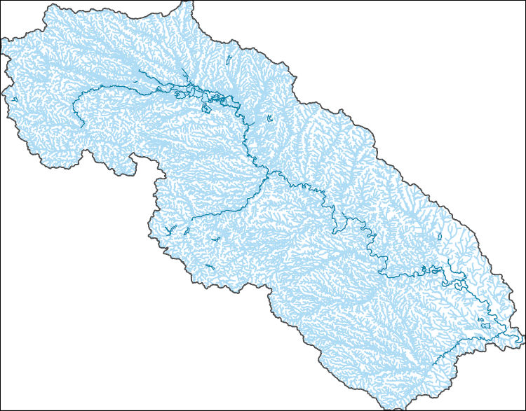
The National Hydrography Dataset (NHD) is a feature-based database that interconnects and uniquely identifies the stream segments or reaches that make up the nation's surface water drainage system. NHD data was originally developed at 1:100,000-scale and exists at that scale for the whole country. This high-resolution NHD, generally developed at 1:24,000/1:12,000 scale, adds detail to the original 1:100,000-scale NHD. (Data for Alaska, Puerto Rico and the Virgin Islands was developed at high-resolution, not 1:100,000 scale.) Local resolution NHD is being developed where partners and data exist. The NHD contains reach codes for networked features, flow direction, names, and centerline representations for areal water...
Tags: Administrative watershed units,
Administrative watershed units,
Area of Complex Channels,
Area to be submerged,
Basin, All tags...
Basin,
Bay/Inlet,
Boundaries,
Boundary,
Bridge,
Canal/Ditch,
Coastline,
Connector,
Dam/Weir,
Downloadable Data,
Drainage areas for surface water,
Drainageway,
Esri Shapefile nan,
Estuary,
Flow direction network,
Flume,
ForeShore,
Gaging Station,
Gate,
HU-8,
HU-8 Subbasin,
HU10,
HU12,
HU14,
HU16,
HU2,
HU4,
HU6,
HU8,
HU8_08090203,
HUC,
Harrison,
Hazard Zone,
Hydrographic,
Hydrography,
Hydrography,
Hydrography,
Hydrologic Unit Code,
Hydrologic Units,
Ice mass,
Inundation Area,
Jefferson,
LA,
Levee,
Line,
Lock Chamber,
Louisiana,
MS,
Marsh,
Mississippi,
National Hydrography Dataset (NHD),
National Hydrography Dataset (NHD) Best Resolution,
National Hydrography Dataset (NHD) Best Resolution,
Nonearthen Shore,
Orleans,
Orthoimage,
Plaquemines,
Playa,
Point,
PointEvent,
Pond,
Rapids,
Rapids,
Reach,
Reach code,
Reef,
Region,
Reservoir,
Rock,
Sea/Ocean,
Shapefile,
Sink/Rise,
Sounding Datum Line,
Special Use Zone,
Special Use Zone Limit,
Spillway,
St. Bernard,
St. Charles,
St. Tammany,
Stream,
Stream/River,
Sub-basin,
Sub-region,
Subbasin,
Submerged Stream,
Subregion,
Subwatershed,
Surface water systems,
Swamp,
Topographic,
Tunnel,
US,
Underground Conduit,
United States,
WBD,
WBD,
Wall,
Wash,
Water Intake Outflow,
Waterfall,
Watershed,
Watershed Boundaries,
Watershed Boundary Dataset,
Watershed Boundary Dataset,
Well,
artificial path,
boundaries,
dams,
drainage systems and characteristics,
inlandWaters,
lakes,
ngda,
rivers, Fewer tags
The National Hydrography Dataset (NHD) is a feature-based database that interconnects and uniquely identifies the stream segments or reaches that make up the nation's surface water drainage system. NHD data was originally developed at 1:100,000-scale and exists at that scale for the whole country. This high-resolution NHD, generally developed at 1:24,000/1:12,000 scale, adds detail to the original 1:100,000-scale NHD. (Data for Alaska, Puerto Rico and the Virgin Islands was developed at high-resolution, not 1:100,000 scale.) Local resolution NHD is being developed where partners and data exist. The NHD contains reach codes for networked features, flow direction, names, and centerline representations for areal water...
Tags: AL,
Administrative watershed units,
Administrative watershed units,
Alabama,
Area of Complex Channels, All tags...
Area to be submerged,
Basin,
Basin,
Bay/Inlet,
Boundaries,
Boundary,
Bridge,
Canal/Ditch,
Choctaw,
Coastline,
Connector,
Dam/Weir,
Downloadable Data,
Drainage areas for surface water,
Drainageway,
Esri File GeoDatabase 10,
Estuary,
FileGDB,
Flow direction network,
Flume,
ForeShore,
Gaging Station,
Gate,
HU-8,
HU-8 Subbasin,
HU10,
HU12,
HU14,
HU16,
HU2,
HU4,
HU6,
HU8,
HU8_03160108,
HUC,
Hazard Zone,
Hydrographic,
Hydrography,
Hydrography,
Hydrography,
Hydrologic Unit Code,
Hydrologic Units,
Ice mass,
Inundation Area,
Kemper,
Levee,
Line,
Lock Chamber,
Lowndes,
MS,
Marsh,
Mississippi,
National Hydrography Dataset (NHD),
National Hydrography Dataset (NHD) Best Resolution,
National Hydrography Dataset (NHD) Best Resolution,
Nonearthen Shore,
Noxubee,
Oktibbeha,
Orthoimage,
Pickens,
Playa,
Point,
PointEvent,
Pond,
Rapids,
Rapids,
Reach,
Reach code,
Reef,
Region,
Reservoir,
Rock,
Sea/Ocean,
Sink/Rise,
Sounding Datum Line,
Special Use Zone,
Special Use Zone Limit,
Spillway,
Stream,
Stream/River,
Sub-basin,
Sub-region,
Subbasin,
Submerged Stream,
Subregion,
Subwatershed,
Sumter,
Surface water systems,
Swamp,
Topographic,
Tunnel,
US,
Underground Conduit,
United States,
WBD,
WBD,
Wall,
Wash,
Water Intake Outflow,
Waterfall,
Watershed,
Watershed Boundaries,
Watershed Boundary Dataset,
Watershed Boundary Dataset,
Well,
Winston,
artificial path,
boundaries,
dams,
drainage systems and characteristics,
inlandWaters,
lakes,
ngda,
rivers, Fewer tags
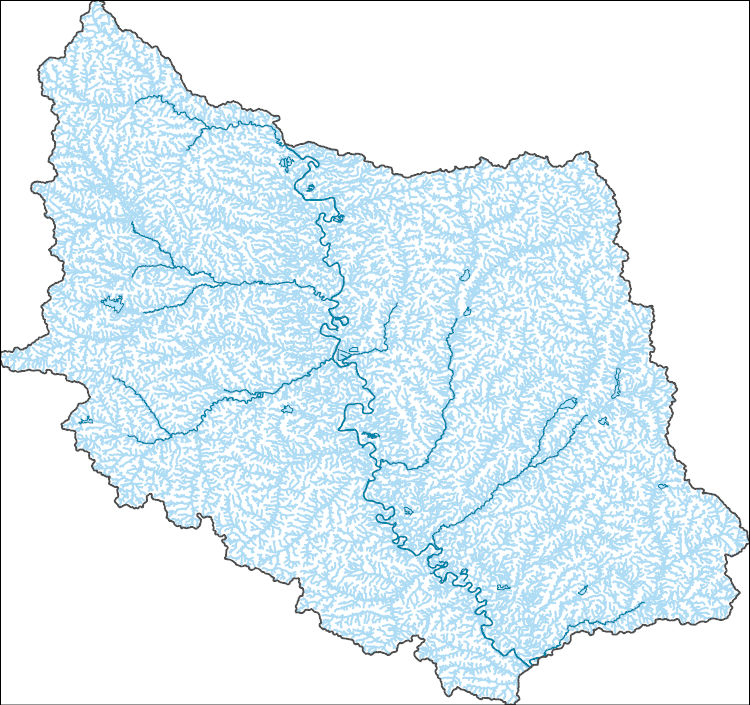
The National Hydrography Dataset (NHD) is a feature-based database that interconnects and uniquely identifies the stream segments or reaches that make up the nation's surface water drainage system. NHD data was originally developed at 1:100,000-scale and exists at that scale for the whole country. This high-resolution NHD, generally developed at 1:24,000/1:12,000 scale, adds detail to the original 1:100,000-scale NHD. (Data for Alaska, Puerto Rico and the Virgin Islands was developed at high-resolution, not 1:100,000 scale.) Local resolution NHD is being developed where partners and data exist. The NHD contains reach codes for networked features, flow direction, names, and centerline representations for areal water...
Tags: Administrative watershed units,
Administrative watershed units,
Area of Complex Channels,
Area to be submerged,
Basin, All tags...
Basin,
Bay/Inlet,
Boundaries,
Boundary,
Bridge,
Canal/Ditch,
Coastline,
Connector,
Copiah,
Dam/Weir,
Downloadable Data,
Drainage areas for surface water,
Drainageway,
Esri Shapefile nan,
Estuary,
Flow direction network,
Flume,
ForeShore,
Gaging Station,
Gate,
HU-8,
HU-8 Subbasin,
HU10,
HU12,
HU14,
HU16,
HU2,
HU4,
HU6,
HU8,
HU8_03180003,
HUC,
Hazard Zone,
Hydrographic,
Hydrography,
Hydrography,
Hydrography,
Hydrologic Unit Code,
Hydrologic Units,
Ice mass,
Inundation Area,
Jefferson Davis,
Lawrence,
Levee,
Lincoln,
Line,
Lock Chamber,
MS,
Marion,
Marsh,
Mississippi,
National Hydrography Dataset (NHD),
National Hydrography Dataset (NHD) Best Resolution,
National Hydrography Dataset (NHD) Best Resolution,
Nonearthen Shore,
Orthoimage,
Playa,
Point,
PointEvent,
Pond,
Rapids,
Rapids,
Reach,
Reach code,
Reef,
Region,
Reservoir,
Rock,
Sea/Ocean,
Shapefile,
Simpson,
Sink/Rise,
Sounding Datum Line,
Special Use Zone,
Special Use Zone Limit,
Spillway,
Stream,
Stream/River,
Sub-basin,
Sub-region,
Subbasin,
Submerged Stream,
Subregion,
Subwatershed,
Surface water systems,
Swamp,
Topographic,
Tunnel,
US,
Underground Conduit,
United States,
WBD,
WBD,
Wall,
Walthall,
Wash,
Water Intake Outflow,
Waterfall,
Watershed,
Watershed Boundaries,
Watershed Boundary Dataset,
Watershed Boundary Dataset,
Well,
artificial path,
boundaries,
dams,
drainage systems and characteristics,
inlandWaters,
lakes,
ngda,
rivers, Fewer tags
The National Hydrography Dataset (NHD) is a feature-based database that interconnects and uniquely identifies the stream segments or reaches that make up the nation's surface water drainage system. NHD data was originally developed at 1:100,000-scale and exists at that scale for the whole country. This high-resolution NHD, generally developed at 1:24,000/1:12,000 scale, adds detail to the original 1:100,000-scale NHD. (Data for Alaska, Puerto Rico and the Virgin Islands was developed at high-resolution, not 1:100,000 scale.) Local resolution NHD is being developed where partners and data exist. The NHD contains reach codes for networked features, flow direction, names, and centerline representations for areal water...
Tags: Administrative watershed units,
Administrative watershed units,
Area of Complex Channels,
Area to be submerged,
Basin, All tags...
Basin,
Bay/Inlet,
Boundaries,
Boundary,
Bridge,
Canal/Ditch,
Coastline,
Connector,
Copiah,
Dam/Weir,
Downloadable Data,
Drainage areas for surface water,
Drainageway,
Estuary,
Flow direction network,
Flume,
ForeShore,
Gaging Station,
Gate,
GeoPackage,
HU-8,
HU-8 Subbasin,
HU10,
HU12,
HU14,
HU16,
HU2,
HU4,
HU6,
HU8,
HU8_03180002,
HUC,
Hazard Zone,
Hinds,
Hydrographic,
Hydrography,
Hydrography,
Hydrography,
Hydrologic Unit Code,
Hydrologic Units,
Ice mass,
Inundation Area,
Leake,
Levee,
Line,
Lock Chamber,
MS,
Madison,
Marsh,
Mississippi,
National Hydrography Dataset (NHD),
National Hydrography Dataset (NHD) Best Resolution,
National Hydrography Dataset (NHD) Best Resolution,
Nonearthen Shore,
Open Geospatial Consortium GeoPackage 1.2,
Orthoimage,
Playa,
Point,
PointEvent,
Pond,
Rankin,
Rapids,
Rapids,
Reach,
Reach code,
Reef,
Region,
Reservoir,
Rock,
Scott,
Sea/Ocean,
Simpson,
Sink/Rise,
Smith,
Sounding Datum Line,
Special Use Zone,
Special Use Zone Limit,
Spillway,
Stream,
Stream/River,
Sub-basin,
Sub-region,
Subbasin,
Submerged Stream,
Subregion,
Subwatershed,
Surface water systems,
Swamp,
Topographic,
Tunnel,
US,
Underground Conduit,
United States,
WBD,
WBD,
Wall,
Wash,
Water Intake Outflow,
Waterfall,
Watershed,
Watershed Boundaries,
Watershed Boundary Dataset,
Watershed Boundary Dataset,
Well,
artificial path,
boundaries,
dams,
drainage systems and characteristics,
inlandWaters,
lakes,
ngda,
rivers, Fewer tags
The National Hydrography Dataset (NHD) is a feature-based database that interconnects and uniquely identifies the stream segments or reaches that make up the nation's surface water drainage system. NHD data was originally developed at 1:100,000-scale and exists at that scale for the whole country. This high-resolution NHD, generally developed at 1:24,000/1:12,000 scale, adds detail to the original 1:100,000-scale NHD. (Data for Alaska, Puerto Rico and the Virgin Islands was developed at high-resolution, not 1:100,000 scale.) Local resolution NHD is being developed where partners and data exist. The NHD contains reach codes for networked features, flow direction, names, and centerline representations for areal water...
Tags: AR,
Administrative watershed units,
Administrative watershed units,
Area of Complex Channels,
Area to be submerged, All tags...
Arkansas,
Arkansas,
Basin,
Basin,
Bay/Inlet,
Bolivar,
Bollinger,
Boundaries,
Boundary,
Bridge,
Butler,
Canal/Ditch,
Cape Girardeau,
Clay,
Coahoma,
Coastline,
Connector,
Craighead,
Crittenden,
Cross,
Dam/Weir,
DeSoto,
Desha,
Downloadable Data,
Drainage areas for surface water,
Drainageway,
Dunklin,
Estuary,
Faulkner,
Flow direction network,
Flume,
ForeShore,
Gaging Station,
Gate,
GeoPackage,
Greene,
HU-4,
HU-4 Subregion,
HU10,
HU12,
HU14,
HU16,
HU2,
HU4,
HU4_0802,
HU6,
HU8,
HUC,
Hazard Zone,
Hydrographic,
Hydrography,
Hydrography,
Hydrography,
Hydrologic Unit Code,
Hydrologic Units,
Ice mass,
Inundation Area,
Iron,
Jackson,
Jefferson,
Lawrence,
Lee,
Levee,
Lincoln,
Line,
Lock Chamber,
Lonoke,
MO,
MS,
Madison,
Marsh,
Mississippi,
Mississippi,
Missouri,
Monroe,
National Hydrography Dataset (NHD),
National Hydrography Dataset (NHD) Best Resolution,
National Hydrography Dataset (NHD) Best Resolution,
New Madrid,
Nonearthen Shore,
Open Geospatial Consortium GeoPackage 1.2,
Orthoimage,
Pemiscot,
Phillips,
Playa,
Poinsett,
Point,
PointEvent,
Pond,
Prairie,
Pulaski,
Randolph,
Rapids,
Rapids,
Reach,
Reach code,
Reef,
Region,
Reservoir,
Reynolds,
Rock,
Scott,
Sea/Ocean,
Sink/Rise,
Sounding Datum Line,
Special Use Zone,
Special Use Zone Limit,
Spillway,
St. Francis,
St. Francois,
Ste. Genevieve,
Stoddard,
Stream,
Stream/River,
Sub-basin,
Sub-region,
Subbasin,
Submerged Stream,
Subregion,
Subwatershed,
Surface water systems,
Swamp,
Topographic,
Tunica,
Tunnel,
US,
Underground Conduit,
United States,
WBD,
WBD,
Wall,
Wash,
Washington,
Water Intake Outflow,
Waterfall,
Watershed,
Watershed Boundaries,
Watershed Boundary Dataset,
Watershed Boundary Dataset,
Wayne,
Well,
White,
Woodruff,
artificial path,
boundaries,
dams,
drainage systems and characteristics,
inlandWaters,
lakes,
ngda,
rivers, Fewer tags
|
|

