|
|

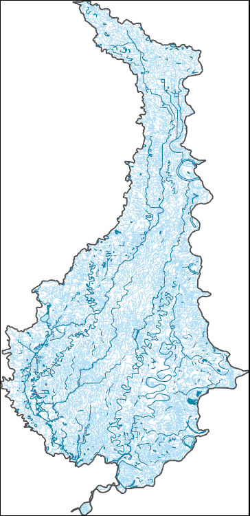
The High Resolution National Hydrography Dataset Plus (NHDPlus HR) is an integrated set of geospatial data layers, including the best available National Hydrography Dataset (NHD), the 10-meter 3D Elevation Program Digital Elevation Model (3DEP DEM), and the National Watershed Boundary Dataset (WBD). The NHDPlus HR combines the NHD, 3DEP DEMs, and WBD to create a stream network with linear referencing, feature naming, "value added attributes" (VAAs), elevation-derived catchments, and other features for hydrologic data analysis. The stream network with linear referencing is a system of data relationships applied to hydrographic systems so that one stream reach "flows" into another and "events" can be tied to and traced...
Tags: AR,
Arkansas,
Arkansas County,
Bolivar County,
Bollinger County, All tags...
Butler County,
Cape Girardeau County,
Clay County,
Coahoma County,
Craighead County,
Crittenden County,
Cross County,
DeSoto County,
Desha County,
Downloadable Data,
Dunklin County,
Faulkner County,
FileGDB,
FileGDB 10.1,
Greene County,
HU-4 Subregion,
HU-4 Subregion,
HU4_0802,
Hydrography,
Iron County,
Jackson County,
Jefferson County,
Lawrence County,
Lee County,
Lincoln County,
Lonoke County,
MO,
MS,
Madison County,
Mississippi,
Mississippi County,
Missouri,
Monroe County,
NHDPlus HR Rasters,
NHDPlus High Resolution (NHDPlus HR),
National Hydrography Dataset (NHD),
National Hydrography Dataset Plus High Resolution (NHDPlus HR),
National Hydrography Dataset Plus High Resolution (NHDPlus HR) Current,
New Madrid County,
Pemiscot County,
Phillips County,
Poinsett County,
Prairie County,
Pulaski County,
Randolph County,
Reynolds County,
Scott County,
St. Francis County,
St. Francois County,
Ste. Genevieve County,
Stoddard County,
Tunica County,
US,
United States,
Washington County,
Wayne County,
White County,
Woodruff County,
base maps,
cartography,
catchments,
channels,
digital elevation models,
drainage basins,
earth sciences,
elevation,
environment,
geographic information systems,
geoscientific,
geospatial analysis,
hydrographic datasets,
hydrographic features,
hydrology,
imagery,
inland waters,
lakes,
land surface characteristics,
reservoirs,
river reaches,
rivers,
streamflow,
streamflow data,
streams,
topography,
water bodies,
water quality,
water resources,
watersheds, Fewer tags

The High Resolution National Hydrography Dataset Plus (NHDPlus HR) is an integrated set of geospatial data layers, including the National Hydrography Dataset (NHD), National Watershed Boundary Dataset (WBD), and 3D Elevation Program Digital Elevation Model (3DEP DEM). The NHDPlus HR combines the NHD, 3DEP DEMs, and WBD to a data suite that includes the NHD stream network with linear referencing functionality, the WBD hydrologic units, elevation-derived catchment areas for each stream segment, "value added attributes" (VAAs), and other features that enhance hydrologic data analysis and routing.
Tags: 4-digit hydrologic unit,
Accomack County,
Albemarle County,
Alleghany County,
Amelia County, All tags...
Amherst County,
Appomattox County,
Augusta County,
Bath County,
Bedford County,
Botetourt County,
Buckingham County,
Buena Vista County,
Campbell County,
Caroline County,
Charles City County,
Charlotte County,
Charlottesville County,
Chesapeake County,
Chesterfield County,
Colonial Heights County,
Covington County,
Craig County,
Culpeper County,
Cumberland County,
DE,
Delaware,
Dinwiddie County,
Dorchester County,
Downloadable Data,
Essex County,
Fauquier County,
FileGDB,
Fluvanna County,
Fredericksburg County,
Giles County,
Gloucester County,
Goochland County,
Greenbrier County,
Greene County,
HU-4 Subregion,
HU4,
HU4_0208,
Hampton County,
Hanover County,
Henrico County,
Highland County,
Hopewell County,
Hydrography,
Isle of Wight County,
James City County,
Kent County,
King George County,
King William County,
King and Queen County,
Lancaster County,
Lexington County,
Louisa County,
Lunenburg County,
Lynchburg County,
MD,
Madison County,
Maryland,
Mathews County,
Middlesex County,
Monroe County,
Montgomery County,
NHDPlus HR Rasters,
NHDPlus High Resolution (NHDPlus HR),
National Hydrography Dataset (NHD),
National Hydrography Dataset Plus High Resolution (NHDPlus HR),
National Hydrography Dataset Plus High Resolution (NHDPlus HR) Current,
Nelson County,
New Kent County,
Newport News County,
Norfolk County,
Northampton County,
Northumberland County,
Nottoway County,
Orange County,
Page County,
Pendleton County,
Petersburg County,
Pocahontas County,
Poquoson County,
Portsmouth County,
Powhatan County,
Prince Edward County,
Prince George County,
Rappahannock County,
Richmond County,
Roanoke County,
Rockbridge County,
Rockingham County,
Somerset County,
Spotsylvania County,
St. Mary's County,
Stafford County,
Suffolk County,
Surry County,
Sussex County,
US,
United States,
VA,
Virginia,
Virginia Beach County,
WV,
Warren County,
West Virginia,
Westmoreland County,
Wicomico County,
Williamsburg County,
Worcester County,
York County,
base maps,
cartography,
catchments,
channels,
digital elevation models,
drainage basins,
earthsciences,
environment,
geographic information systems,
geoscientificInformation,
geospatial analysis,
hydrographic datasets,
hydrographic features,
hydrology,
inlandWaters,
lakes,
land surface characteristics,
reservoirs,
river reaches,
rivers,
streamflow,
streamflow data,
streams,
surface water quality,
topography,
water resources,
waterbodies,
watersheds, Fewer tags

The High Resolution National Hydrography Dataset Plus (NHDPlus HR) is an integrated set of geospatial data layers, including the best available National Hydrography Dataset (NHD), the 10-meter 3D Elevation Program Digital Elevation Model (3DEP DEM), and the National Watershed Boundary Dataset (WBD). The NHDPlus HR combines the NHD, 3DEP DEMs, and WBD to create a stream network with linear referencing, feature naming, "value added attributes" (VAAs), elevation-derived catchments, and other features for hydrologic data analysis. The stream network with linear referencing is a system of data relationships applied to hydrographic systems so that one stream reach "flows" into another and "events" can be tied to and traced...
Tags: Adams County,
Amite County,
Attala County,
Carroll County,
Choctaw County, All tags...
Claiborne County,
Concordia County,
Copiah County,
Downloadable Data,
FileGDB,
FileGDB 10.1,
Franklin County,
HU-4 Subregion,
HU-4 Subregion,
HU4_0806,
Hinds County,
Holmes County,
Hydrography,
Jefferson County,
LA,
Leake County,
Lincoln County,
Louisiana,
MS,
Madison County,
Madison County,
Mississippi,
Montgomery County,
NHDPlus HR Rasters,
NHDPlus High Resolution (NHDPlus HR),
National Hydrography Dataset (NHD),
National Hydrography Dataset Plus High Resolution (NHDPlus HR),
National Hydrography Dataset Plus High Resolution (NHDPlus HR) Current,
Oktibbeha County,
Tensas County,
US,
United States,
Warren County,
Webster County,
West Feliciana County,
Wilkinson County,
Yazoo County,
base maps,
cartography,
catchments,
channels,
digital elevation models,
drainage basins,
earth sciences,
elevation,
environment,
geographic information systems,
geoscientific,
geospatial analysis,
hydrographic datasets,
hydrographic features,
hydrology,
imagery,
inland waters,
lakes,
land surface characteristics,
reservoirs,
river reaches,
rivers,
streamflow,
streamflow data,
streams,
topography,
water bodies,
water quality,
water resources,
watersheds, Fewer tags

The High Resolution National Hydrography Dataset Plus (NHDPlus HR) is an integrated set of geospatial data layers, including the National Hydrography Dataset (NHD), National Watershed Boundary Dataset (WBD), and 3D Elevation Program Digital Elevation Model (3DEP DEM). The NHDPlus HR combines the NHD, 3DEP DEMs, and WBD to a data suite that includes the NHD stream network with linear referencing functionality, the WBD hydrologic units, elevation-derived catchment areas for each stream segment, "value added attributes" (VAAs), and other features that enhance hydrologic data analysis and routing.
Tags: 4-digit hydrologic unit,
Accomack County,
Adams County,
Albemarle County,
Alexandria County, All tags...
Allegany County,
Arlington County,
Augusta County,
Bedford County,
Berkeley County,
Carroll County,
Charles County,
Clarke County,
Cumberland County,
DC,
District of Columbia,
District of Columbia County,
Downloadable Data,
Fairfax County,
Falls Church County,
Fauquier County,
FileGDB,
Franklin County,
Frederick County,
Fulton County,
Garrett County,
Grant County,
Greene County,
HU-4 Subregion,
HU4,
HU4_0207,
Hampshire County,
Hardy County,
Harrisonburg County,
Highland County,
Huntingdon County,
Hydrography,
Jefferson County,
King George County,
Loudoun County,
MD,
Madison County,
Manassas County,
Manassas Park County,
Maryland,
Mineral County,
Montgomery County,
Morgan County,
NHDPlus HR Rasters,
NHDPlus High Resolution (NHDPlus HR),
National Hydrography Dataset (NHD),
National Hydrography Dataset Plus High Resolution (NHDPlus HR),
National Hydrography Dataset Plus High Resolution (NHDPlus HR) Current,
Nelson County,
Northumberland County,
PA,
Page County,
Pendleton County,
Pennsylvania,
Perry County,
Pocahontas County,
Preston County,
Prince George's County,
Prince William County,
Randolph County,
Rappahannock County,
Richmond County,
Rockingham County,
Shenandoah County,
Somerset County,
St. Mary's County,
Stafford County,
Staunton County,
Tucker County,
US,
United States,
VA,
Virginia,
WV,
Warren County,
Washington County,
Waynesboro County,
West Virginia,
Westmoreland County,
Winchester County,
base maps,
cartography,
catchments,
channels,
digital elevation models,
drainage basins,
earthsciences,
environment,
geographic information systems,
geoscientificInformation,
geospatial analysis,
hydrographic datasets,
hydrographic features,
hydrology,
inlandWaters,
lakes,
land surface characteristics,
reservoirs,
river reaches,
rivers,
streamflow,
streamflow data,
streams,
surface water quality,
topography,
water resources,
waterbodies,
watersheds, Fewer tags

The High Resolution National Hydrography Dataset Plus (NHDPlus HR) is an integrated set of geospatial data layers, including the best available National Hydrography Dataset (NHD), the 10-meter 3D Elevation Program Digital Elevation Model (3DEP DEM), and the National Watershed Boundary Dataset (WBD). The NHDPlus HR combines the NHD, 3DEP DEMs, and WBD to create a stream network with linear referencing, feature naming, "value added attributes" (VAAs), elevation-derived catchments, and other features for hydrologic data analysis. The stream network with linear referencing is a system of data relationships applied to hydrographic systems so that one stream reach "flows" into another and "events" can be tied to and traced...
Tags: Attala County,
Choctaw County,
Copiah County,
Downloadable Data,
FileGDB, All tags...
FileGDB 10.1,
HU-4 Subregion,
HU-4 Subregion,
HU4_0318,
Hancock County,
Hinds County,
Hydrography,
Jefferson Davis County,
Kemper County,
LA,
Lamar County,
Lawrence County,
Leake County,
Lincoln County,
Louisiana,
MS,
Madison County,
Marion County,
Mississippi,
NHDPlus HR Rasters,
NHDPlus High Resolution (NHDPlus HR),
National Hydrography Dataset (NHD),
National Hydrography Dataset Plus High Resolution (NHDPlus HR),
National Hydrography Dataset Plus High Resolution (NHDPlus HR) Current,
Neshoba County,
Newton County,
Noxubee County,
Pearl River County,
Pike County,
Rankin County,
Scott County,
Simpson County,
Smith County,
St. Tammany County,
Tangipahoa County,
US,
United States,
Walthall County,
Washington County,
Winston County,
base maps,
cartography,
catchments,
channels,
digital elevation models,
drainage basins,
earth sciences,
elevation,
environment,
geographic information systems,
geoscientific,
geospatial analysis,
hydrographic datasets,
hydrographic features,
hydrology,
imagery,
inland waters,
lakes,
land surface characteristics,
reservoirs,
river reaches,
rivers,
streamflow,
streamflow data,
streams,
topography,
water bodies,
water quality,
water resources,
watersheds, Fewer tags

The High Resolution National Hydrography Dataset Plus (NHDPlus HR) is an integrated set of geospatial data layers, including the National Hydrography Dataset (NHD), National Watershed Boundary Dataset (WBD), and 3D Elevation Program Digital Elevation Model (3DEP DEM). The NHDPlus HR combines the NHD, 3DEP DEMs, and WBD to a data suite that includes the NHD stream network with linear referencing functionality, the WBD hydrologic units, elevation-derived catchment areas for each stream segment, "value added attributes" (VAAs), and other features that enhance hydrologic data analysis and routing.
Tags: 4-digit hydrologic unit,
Albany County,
Bennington County,
Berkshire County,
Columbia County, All tags...
Delaware County,
Downloadable Data,
Dutchess County,
Essex County,
FileGDB,
Fulton County,
Greene County,
HU-4 Subregion,
HU4,
HU4_0202,
Hamilton County,
Herkimer County,
Hydrography,
Lewis County,
MA,
Madison County,
Massachusetts,
Montgomery County,
Morris County,
NHDPlus HR Rasters,
NHDPlus High Resolution (NHDPlus HR),
NJ,
NY,
National Hydrography Dataset (NHD),
National Hydrography Dataset Plus High Resolution (NHDPlus HR),
National Hydrography Dataset Plus High Resolution (NHDPlus HR) Current,
New Jersey,
New York,
Oneida County,
Orange County,
Otsego County,
Passaic County,
Putnam County,
Rensselaer County,
Rockland County,
Rutland County,
Saratoga County,
Schenectady County,
Schoharie County,
Sullivan County,
Sussex County,
US,
Ulster County,
United States,
VT,
Vermont,
Warren County,
Washington County,
Westchester County,
Windham County,
base maps,
cartography,
catchments,
channels,
digital elevation models,
drainage basins,
earthsciences,
environment,
geographic information systems,
geoscientificInformation,
geospatial analysis,
hydrographic datasets,
hydrographic features,
hydrology,
inlandWaters,
lakes,
land surface characteristics,
reservoirs,
river reaches,
rivers,
streamflow,
streamflow data,
streams,
surface water quality,
topography,
water resources,
waterbodies,
watersheds, Fewer tags

The High Resolution National Hydrography Dataset Plus (NHDPlus HR) is an integrated set of geospatial data layers, including the best available National Hydrography Dataset (NHD), the 10-meter 3D Elevation Program Digital Elevation Model (3DEP DEM), and the National Watershed Boundary Dataset (WBD). The NHDPlus HR combines the NHD, 3DEP DEMs, and WBD to create a stream network with linear referencing, feature naming, "value added attributes" (VAAs), elevation-derived catchments, and other features for hydrologic data analysis. The stream network with linear referencing is a system of data relationships applied to hydrographic systems so that one stream reach "flows" into another and "events" can be tied to and traced...
Tags: AR,
Arkansas,
Benton County,
Bolivar County,
Calhoun County, All tags...
Carroll County,
Chickasaw County,
Chicot County,
Coahoma County,
DeSoto County,
Desha County,
Downloadable Data,
East Carroll County,
FileGDB,
FileGDB 10.1,
Grenada County,
HU-4 Subregion,
HU-4 Subregion,
HU4_0803,
Holmes County,
Humphreys County,
Hydrography,
Issaquena County,
LA,
Lafayette County,
Leflore County,
Louisiana,
MS,
Madison County,
Marshall County,
Mississippi,
Montgomery County,
NHDPlus HR Rasters,
NHDPlus High Resolution (NHDPlus HR),
National Hydrography Dataset (NHD),
National Hydrography Dataset Plus High Resolution (NHDPlus HR),
National Hydrography Dataset Plus High Resolution (NHDPlus HR) Current,
Panola County,
Pontotoc County,
Quitman County,
Sharkey County,
Shelby County,
Sunflower County,
TN,
Tallahatchie County,
Tate County,
Tennessee,
Tippah County,
Tunica County,
US,
Union County,
United States,
Warren County,
Washington County,
Webster County,
Yalobusha County,
Yazoo County,
base maps,
cartography,
catchments,
channels,
digital elevation models,
drainage basins,
earth sciences,
elevation,
environment,
geographic information systems,
geoscientific,
geospatial analysis,
hydrographic datasets,
hydrographic features,
hydrology,
imagery,
inland waters,
lakes,
land surface characteristics,
reservoirs,
river reaches,
rivers,
streamflow,
streamflow data,
streams,
topography,
water bodies,
water quality,
water resources,
watersheds, Fewer tags
The High Resolution National Hydrography Dataset Plus (NHDPlus HR) is an integrated set of geospatial data layers, including the best available National Hydrography Dataset (NHD), the 10-meter 3D Elevation Program Digital Elevation Model (3DEP DEM), and the National Watershed Boundary Dataset (WBD). The NHDPlus HR combines the NHD, 3DEP DEMs, and WBD to create a stream network with linear referencing, feature naming, "value added attributes" (VAAs), elevation-derived catchments, and other features for hydrologic data analysis. The stream network with linear referencing is a system of data relationships applied to hydrographic systems so that one stream reach "flows" into another and "events" can be tied to and traced...
Tags: AR,
Arkansas,
Ashley County,
Caldwell County,
Catahoula County, All tags...
Chicot County,
Concordia County,
Desha County,
Downloadable Data,
Drew County,
East Carroll County,
FileGDB,
FileGDB 10.1,
Franklin County,
HU-4 Subregion,
HU-4 Subregion,
HU4_0805,
Hydrography,
Jefferson County,
LA,
Lincoln County,
Louisiana,
Madison County,
Morehouse County,
NHDPlus HR Rasters,
NHDPlus High Resolution (NHDPlus HR),
National Hydrography Dataset (NHD),
National Hydrography Dataset Plus High Resolution (NHDPlus HR),
National Hydrography Dataset Plus High Resolution (NHDPlus HR) Current,
Ouachita County,
Richland County,
Tensas County,
US,
United States,
West Carroll County,
base maps,
cartography,
catchments,
channels,
digital elevation models,
drainage basins,
earth sciences,
elevation,
environment,
geographic information systems,
geoscientific,
geospatial analysis,
hydrographic datasets,
hydrographic features,
hydrology,
imagery,
inland waters,
lakes,
land surface characteristics,
reservoirs,
river reaches,
rivers,
streamflow,
streamflow data,
streams,
topography,
water bodies,
water quality,
water resources,
watersheds, Fewer tags

The High Resolution National Hydrography Dataset Plus (NHDPlus HR) is an integrated set of geospatial data layers, including the best available National Hydrography Dataset (NHD), the 10-meter 3D Elevation Program Digital Elevation Model (3DEP DEM), and the National Watershed Boundary Dataset (WBD). The NHDPlus HR combines the NHD, 3DEP DEMs, and WBD to create a stream network with linear referencing, feature naming, "value added attributes" (VAAs), elevation-derived catchments, and other features for hydrologic data analysis. The stream network with linear referencing is a system of data relationships applied to hydrographic systems so that one stream reach "flows" into another and "events" can be tied to and traced...
Tags: AR,
Alcorn County,
Alexander County,
Arkansas,
Ballard County, All tags...
Benton County,
Calloway County,
Carlisle County,
Carroll County,
Chester County,
Crittenden County,
Crockett County,
DeSoto County,
Downloadable Data,
Dyer County,
Fayette County,
FileGDB,
FileGDB 10.1,
Fulton County,
Gibson County,
Graves County,
HU-4 Subregion,
HU-4 Subregion,
HU4_0801,
Hardeman County,
Haywood County,
Henderson County,
Henry County,
Hickman County,
Hydrography,
IL,
Illinois,
KY,
Kentucky,
Lake County,
Lauderdale County,
MO,
MS,
Madison County,
Marshall County,
McCracken County,
McNairy County,
Mississippi,
Mississippi County,
Mississippi County,
Missouri,
NHDPlus HR Rasters,
NHDPlus High Resolution (NHDPlus HR),
National Hydrography Dataset (NHD),
National Hydrography Dataset Plus High Resolution (NHDPlus HR),
National Hydrography Dataset Plus High Resolution (NHDPlus HR) Current,
New Madrid County,
Obion County,
Pemiscot County,
Prentiss County,
Scott County,
Shelby County,
TN,
Tennessee,
Tippah County,
Tipton County,
US,
Union County,
United States,
Weakley County,
base maps,
cartography,
catchments,
channels,
digital elevation models,
drainage basins,
earth sciences,
elevation,
environment,
geographic information systems,
geoscientific,
geospatial analysis,
hydrographic datasets,
hydrographic features,
hydrology,
imagery,
inland waters,
lakes,
land surface characteristics,
reservoirs,
river reaches,
rivers,
streamflow,
streamflow data,
streams,
topography,
water bodies,
water quality,
water resources,
watersheds, Fewer tags

The High Resolution National Hydrography Dataset Plus (NHDPlus HR) is an integrated set of geospatial data layers, including the National Hydrography Dataset (NHD), National Watershed Boundary Dataset (WBD), and 3D Elevation Program Digital Elevation Model (3DEP DEM). The NHDPlus HR combines the NHD, 3DEP DEMs, and WBD to a data suite that includes the NHD stream network with linear referencing functionality, the WBD hydrologic units, elevation-derived catchment areas for each stream segment, "value added attributes" (VAAs), and other features that enhance hydrologic data analysis and routing.
Tags: 4-digit hydrologic unit,
Adams County,
Allegany County,
Baltimore County,
Bedford County, All tags...
Berks County,
Blair County,
Bradford County,
Broome County,
Cambria County,
Cameron County,
Carbon County,
Carroll County,
Cecil County,
Centre County,
Chemung County,
Chenango County,
Chester County,
Clearfield County,
Clinton County,
Columbia County,
Cortland County,
Cumberland County,
Dauphin County,
Delaware County,
Downloadable Data,
Elk County,
FileGDB,
Franklin County,
Fulton County,
HU-4 Subregion,
HU4,
HU4_0205,
Harford County,
Herkimer County,
Huntingdon County,
Hydrography,
Indiana County,
Jefferson County,
Juniata County,
Lackawanna County,
Lancaster County,
Lebanon County,
Livingston County,
Luzerne County,
Lycoming County,
MD,
Madison County,
Maryland,
McKean County,
Mifflin County,
Montgomery County,
Montour County,
NHDPlus HR Rasters,
NHDPlus High Resolution (NHDPlus HR),
NY,
National Hydrography Dataset (NHD),
National Hydrography Dataset Plus High Resolution (NHDPlus HR),
National Hydrography Dataset Plus High Resolution (NHDPlus HR) Current,
New York,
Northumberland County,
Oneida County,
Onondaga County,
Ontario County,
Otsego County,
PA,
Pennsylvania,
Perry County,
Potter County,
Schoharie County,
Schuyler County,
Schuylkill County,
Snyder County,
Somerset County,
Steuben County,
Sullivan County,
Susquehanna County,
Tioga County,
Tompkins County,
US,
Union County,
United States,
Wayne County,
Wyoming County,
Yates County,
York County,
base maps,
cartography,
catchments,
channels,
digital elevation models,
drainage basins,
earthsciences,
environment,
geographic information systems,
geoscientificInformation,
geospatial analysis,
hydrographic datasets,
hydrographic features,
hydrology,
inlandWaters,
lakes,
land surface characteristics,
reservoirs,
river reaches,
rivers,
streamflow,
streamflow data,
streams,
surface water quality,
topography,
water resources,
waterbodies,
watersheds, Fewer tags
|
|

